By Lou Melini — A ride around the Uinta mountain range has been on my bucket list of short tours for over a decade. What attracted me to the route is the multitude of roads keeping a bike traveler off of US Highway 40 from Duchesne to Vernal. To the north of the Uinta Mountain range are numerous gravel roads south and west of Fort Bridger, Wyoming, that will take one away from I-80. I also like that I could do this trip from my house without needing a bus, train or car.
In addition to the route, there are ample resupply options along the way that limit the need to carry food no more than 2 days.
I did the trip with 2 “youngsters” that have gone on several overnight rides with me. Patrick and Dave were gracious enough to carry all of the food and spare water over the final 4 days along with being frequently at the front of our small pace line when we encountered headwinds. At 69, I welcomed the assistance.
The route we took is 470 miles with nearly 25,500 feet of elevation gain and of course, elevation loss. During the 7 days of riding, we averaged about 11.4 miles/hour. There were 3 long days of 80-82 miles, over 7 hours of saddle time, and lots of chamois cream.
The first of those days included riding over Wolf Creek Summit, another had 6,400 feet of elevation gain, and the 3rd long day included 46 miles of gravel roads. The one full rest day in Vernal was very welcome for my tired legs.
Planning for the trip during the coronavirus pandemic
Being anxious during the planning phase due to the uncertainty of sudden campground closures is an understatement. On the other hand, news reports of crowded state parks and other campgrounds had me worried about being turned away. Another concern was the ability to socially isolate in a packed campground. A small bottle of hand sanitizer is on my bike tour checklist, but a mask is new to the list. Then there was the nightmare “what-if” such as one of us waking up at night with a fever and a cough.
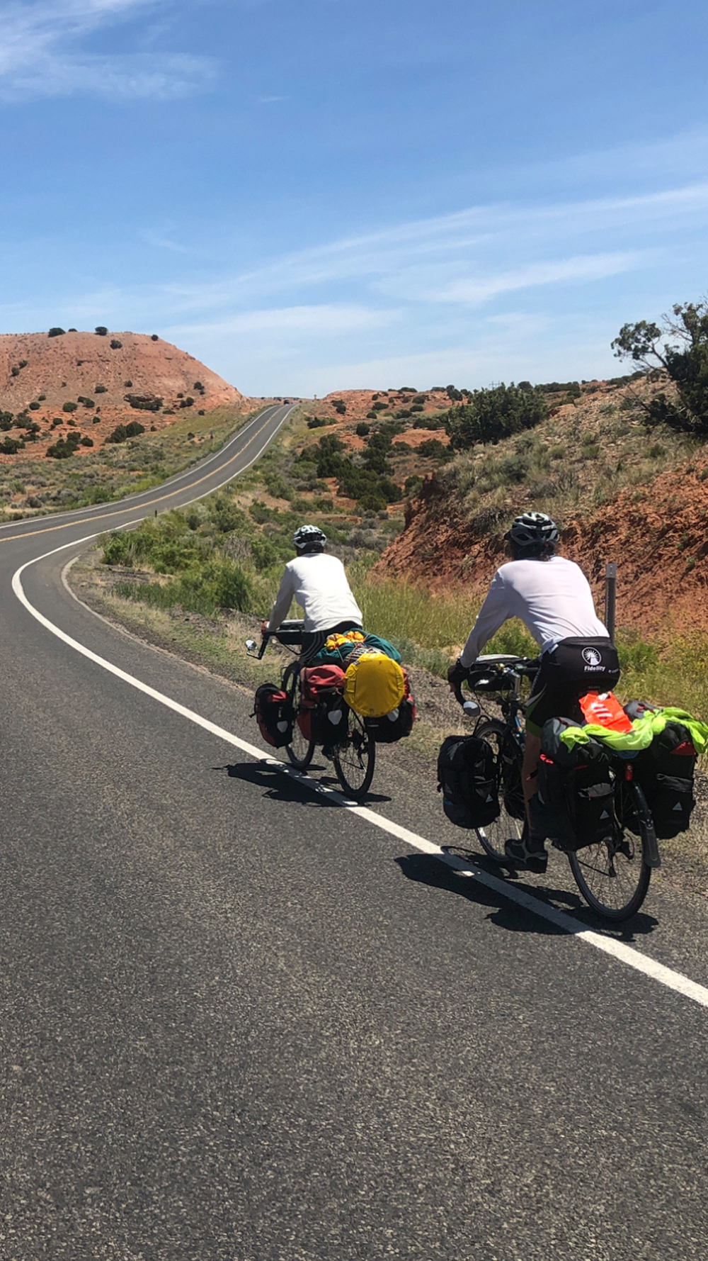
We made reservations at 3 campgrounds, a number that equals the number of campground reservations that I have made in over 22,000 lifetime miles of bike travel. It turned out that we could have rolled into any of the 3 campgrounds without a reservation, as none were full, but all were busy with campers. There was plenty of room for social distancing. Fortunately, we did not encounter any mechanical or other issues that might have delayed us from honoring our reservations. We only “stealth” camped once as the campground was closed for reasons unrelated to the coronavirus.
[Author’s Note: On a subsequent trip, all of the campgrounds that I encountered were full on the weekend and many were full during weekdays so plan accordingly.]
In order to limit our exposure to other people, we decided to do group meals that reduced our shopping exposure to one person with a shopping list for breakfast, lunch, dinner and snacks. The plan for meals worked well with the additional benefit of camaraderie within the group.
The Ride
Days 1 and 2
Day one was a meandering route through Park City after climbing to Parley’s Summit on I-80, ending south of Kamas. I’ve done this ride numerous times. Logistical options were limited with the closure of the campground at Rock Cliff recreation area
We started day 2 with just under 10 miles of relatively flat, low-traffic riding before we starting going up. The climb to the top of Wolf Creek summit is long and steep, longer and steeper than I remember in my younger days. The road has one switchback to reach the summit at 9,500 feet. The US Forest Service campground at the summit provided plenty of rocks to sit on for a much-needed rest. The next 47 miles that took us almost to Duchesne were downhill with a tailwind. For lunch, we cruised into Tabiona to the City Park, which had a great view of the southern Uinta Mountains.
We averaged over 20 miles/hour on this 47-mile section of the ride, ending the 80-mile day with a short steep climb to Starvation State Park. We immediately changed our reservation to the campground that had much needed showers. The neighboring campers brought over beer and Pepsi that we could choose from, which was a nice experience, accompanied by beautiful views and a nice sandy place that was nearly surrounded by grass to pitch our tents.
At 11:00 PM we found out why the grass was so nice as we were awoken by the sprinkler system going off. No one put the fly on their tent as it was warm, and the stargazing was nice, but due to the wind, we were getting sprayed. There was quite a bit of shouting as we pulled up stakes and moved our tents away from the water. We quickly got everything under control at the cost of a small tear in 2 tents, plus I cut my finger pulling out a tent stake.
Days 3 and 4
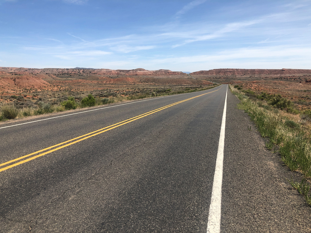
The ride to Vernal from Starvation State Park was a proverbial walk-in-the-park. Relatively flat roads, a nice tail wind and except for a short section near Roosevelt and the approach to Vernal, we had roads devoid of traffic for the 65-mile day. Vernal had all we needed. The KOA campground was very clean, and well-stocked with nice people to make our stay pleasant. In addition, we had a small pool to relax in and an outdoor stovetop so we could save our fuel. As I mentioned earlier, we took a rest day here for the anxiously anticipated 80-miles and 6400 feet of climbing to Manila. In a fit of panic, I considered hiring a shuttle to take me part way. Fortunately, a cooler head prevailed when I realized that the road is open year-round and has a fair amount of truck traffic, which meant the grade of the road is fairly reasonable.
Days 5 and 6
We had an early 6:30 AM start for Day 5 out of Vernal. As we approached mile ten there was a sign stating that there were 10 switchbacks and “only” 5-8% grades in the next 4 miles. With a couple of stops for scenic views, the group spun up US Highway 191 only to come to even more beautiful scenery at the summit, where we rode through a Ponderosa pine forest south and west of Flaming Gorge National Recreation Area.
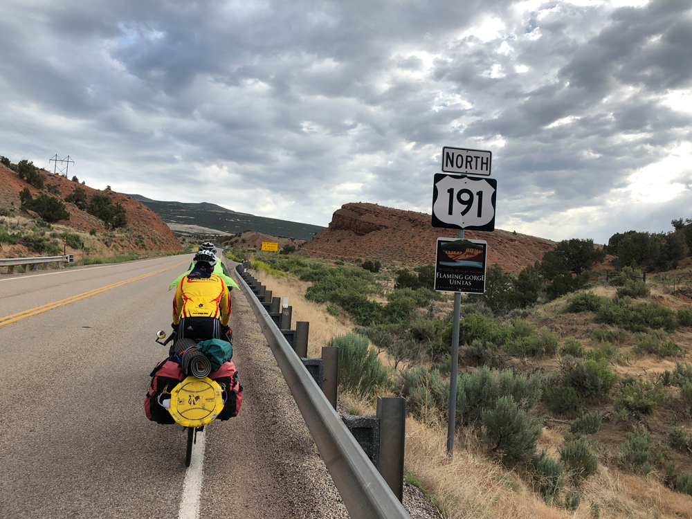
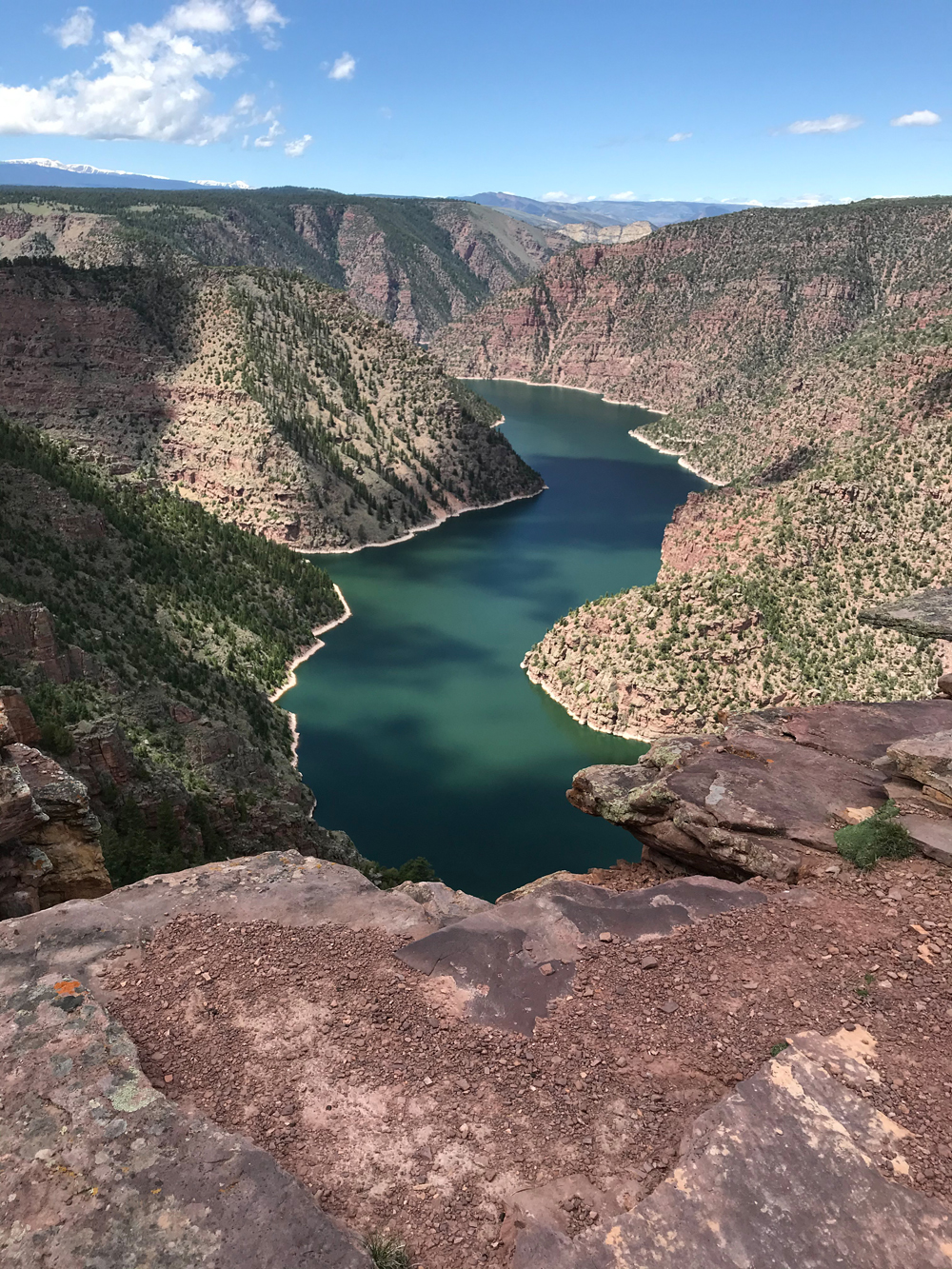
We decided the beautiful road we rode wasn’t enough, so we took a detour for lunch at Red Canyon overlook, a picture-perfect spot. In fact, it looked exactly like the postcard I purchased at the KOA in Vernal. In addition to the views, there are several small Forest Service campgrounds, a café and a visitor center that is to be included as a lodging stop on a return visit. I seem to collect ideas for more trips whenever I go on tour.
We ended the day losing quite a bit of the elevation we gained just prior to Manila. Despite the extensive climbing, we had to carry food on this leg, knowing that Manila did not have a grocery store.
On day 6, we stopped In Mountain View, Wyoming where there is a grocery store but no camping. We had a late lunch and picked up supplies before moving on to Fort Bridger, which has camping, but no grocery. This is part of the logistics of small-town travel that I have frequently encountered. The ride on day 6 was high rangeland once out of Flaming Gorge National Monument, with little climbing, sparse traffic, and views from the north of the Uinta Mountains.
Morning Coffee on day 7
On this day we had about 2,000 feet of net elevation loss but it was still a tough day. We rode 82 miles, including 46 miles of gravel road. When we got to Chalk Creek Road, pavement, and an expected downhill, we faced a stiff uphill draft which slowed our efforts.
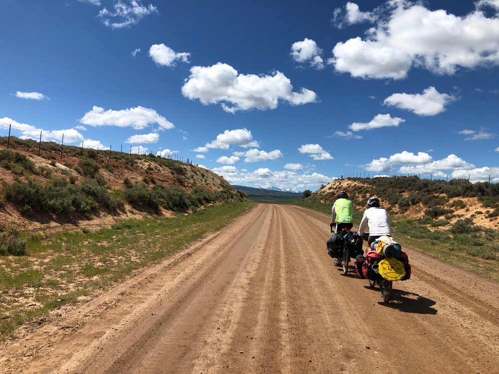
The gravel road from Fort Bridger to Utah Highway 150 (Mirror Lake Scenic Highway) was a highlight. The area is primarily rangeland, with the historical attraction of the original route of the Mormon trek into Utah.
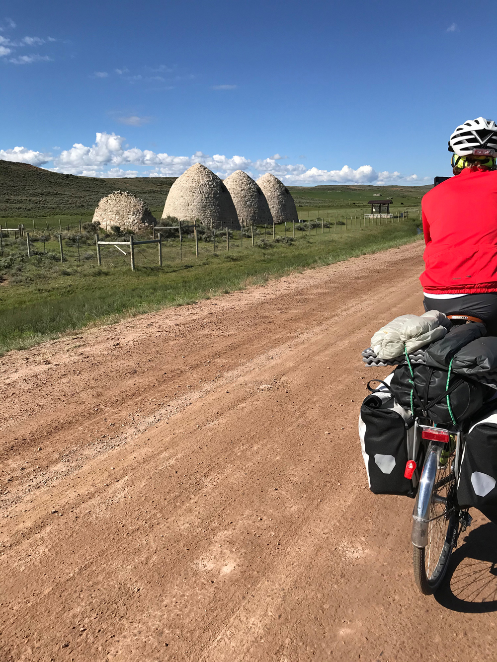
There was the obvious contrast of traditional sheepherders in a pasture shared with large wind turbines. We stopped at the Piedmont charcoal kilns, a formerly prosperous town 150 years ago but now only the kilns remain. There was a lot of wildlife along the way, though we had seen deer, antelope, eagles, osprey, and numerous small mammals and other birds throughout the ride.
When we arrived at the Coalville campground, we had dinner “catered” by Patrick’s wife, Joy. I was beat; beat up tired after the ride. I took a shower then wandered to the office in the slim chance of having coffee, as I didn’t feel like firing up my stove and having instant coffee. As with every tour, a story emerges.
There were 2 employees when I entered the office. I asked the young girl behind the counter about coffee. She was about to direct me to the back when the guy stocking shelves spoke up and said; “The coffee is back there, pointing to the back of the office. I made it fresh this morning.”
I looked at him and said, “It’s 4 o’clock! Fresh this morning?”
He said it was in the special carafe that kept it fresh and warm adding that I could try it before I bought it. So, I tried it, then filled my camp mug and added enough sugar to make it OK.
When I approached the cashier, I asked; “So how much is this morning’s coffee?”
The guy interjected and said $1.50. As I slid 2 $1 bills across the counter, the cashier sheepishly slid one back and said; “That’s plenty for morning coffee”.
Dinner was absolutely fantastic. I am still saying thank you to Patrick and Joy for the meal. I turned in early for a good night’s sleep.
Day 8
Dave suggested that we return to Salt Lake City via Henefer and East Canyon, a wise choice as we avoided Park City traffic and the duplication of a route we took on day one. I was home by early afternoon and already looking forward to riding the loop again.
History along the tour
There is a lot of history along the route of this tour. The most notable history is between the old trading post and now city of Fort Bridger and the former city and current ghost town of Piedmont, both located in Wyoming.
In 1842 or 1843, depending on source, Jim Bridger and his partner Louis Vasquez established Fort Bridger to trade with Native Americans and service emigrant traffic along the Overland Trail.
Later emigrants on the Oregon, California, and Mormon trails used Fort Bridger to obtain supplies. Though now famous, Fort Bridger at the time was not as well outfitted as the more “luxurious” Fort Laramie on the eastern Wyoming plains. Fort Bridger also serviced the Pony Express, the Transcontinental Railroad and the Lincoln Highway. When I-80 was built, Fort Bridger was bypassed along with the towns of Lyman, Urie, and Mountain View that now only see traffic as part of a historic byway.
Brigham Young and the Mormon pioneers took control of Fort Bridger in 1853 or 1855 depending on source, to service emigrants on the Mormon trail. In 1857 Fort Bridger became an Army post for most of the next several decades, ending their control of Fort Bridger in 1890.
In 1928 the Fort was sold to the Wyoming Historic Landmark Commission. In 1933 the original 38-acre site became a Wyoming Historical Landmark and Museum.
After leaving Fort Bridger, we stopped in Piedmont, a once thriving town established in 1867 to provide railroad ties for the Union Pacific Railroad. Kilns were built to provide charcoal for the railroad and the Salt Lake City steel industry.
In 1940 the town ceased to exist following the rerouting of the railroad a couple of decades earlier. The name Piedmont was derived from an area in Italy where 2 of the early residents came from. Three of the 5 kilns are still present and were listed on the National Register of Historic Places in 1971.
Near Piedmont are historical markers and encampments where the original route of Mormon pioneers passed through. Small iron rail monuments are also present as reminders of the original transcontinental railroad.
Tour Summary
We left Salt Lake City on June 13, arriving home on June 20. The high temperature for the 8 days was just over 80. There were 3 mornings that we woke up with lows of 39-40 (Kamas, Manila and Fort Bridger). Doing the ride a couple of weeks earlier may insure more comfortable temperatures, but the week we rode was a bit cooler than the previous week, so we got lucky with the weather. We only used the flies on our tents when cooler morning temperatures were expected. The only precipitation we experienced was a brief hailstorm as we approached the Daggett County line north of Vernal, the summit of our climb that day.
Tire sizes ranged from 700Cx32- to 38-mm on our bikes. No one struggled on the gravel roads, though the ride was bumpy at times. We had one flat tire for the entire tour from a small piece of wire imbedded in the tread. Each of us had a low gear in the range of 20-21 gear inches (24 tooth chain ring/32 tooth cassette ring), which was adequate for Wolf Creek and East Canyon summits.
We stayed in 4 commercial campgrounds, one state park, and one location that I will leave as undisclosed. We had a shower at the end of each day save one, a luxury that we all preferred at the end of long days in the saddle. Forest Service land is available at some of the higher elevations near Wolf Creek summit and Flaming Gorge if one wants to stealth camp or stay in forest service campgrounds.
We traveled mostly on low-traffic roads. Shoulders on roadways were generally narrow. Except for one thrown beer can near Tabiona, traffic was friendly and polite. Not once did I feel like I was on the wrong road. We used a combination of DeLorme maps (provided by me, the old guy) and GPS navigation from the young guys, go figure. Both worked well, though the GPS gave better detail on the gravel roads.
We had redundancy with tools, kitchen items (stoves and pots), and water filters. We ended up only needing the water filters one night. The redundancy helped as one filter clogged and couldn’t be fixed.
For me, traveling on my bike is the most enjoyable and memorable aspect of cycling. This particular tour was outstanding. Scenery, nice accommodations and two great riding partners made this a memorable bucket list tour that I hope to someday repeat. I just hope my aging body and confidence cooperates.





thanks for sharing this! I just came back from the Ride the Rockies (supported) tour in Colorado, and would like to explore the Uintas more. I wonder if you would need a gravel bike for this ride. I currently don’t own one.. (just a road bike 25-mm tires)
Comments are closed.