By Tom Diegel — With the exploding popularity of backcountry bikepacking there are zillions of routes to choose from these days. However, there are only a few in the West that stretch for many-hundreds of miles, and most of those are on gravel roads. There are, however, two that sport a majority of miles on challenging singletrack: the Colorado Trail and the Arizona Trail. The Colorado Trail is high and therefore has a fairly narrow weather window of summertime; but the Arizona trail conveniently hugs the shoulder seasons that make it convenient for the coveted shoulder season adventurers, and only the Arizona Trail has its own Trail Angels!
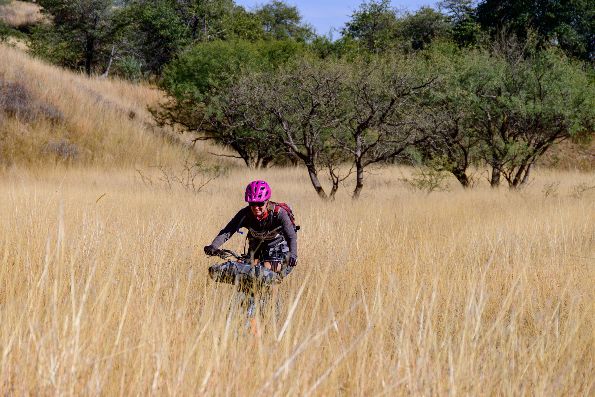
The AZT – as it’s known – stretches over 800 miles from the Mexico border to the Utah border and has become an early/late season staple for through-hikers as an alternative to the much-longer Appalachian and Pacific Crest trails and the higher elevation John Muir and Colorado trails. Unlike the first three that don’t allow bikes on any sections, the AZT not only allows bikes on the non-Wilderness sections but it’s also quite rideable, albeit over lots of rugged desert singletrack and which distinguishes it from the Great Divide, which is mostly gravel roads.
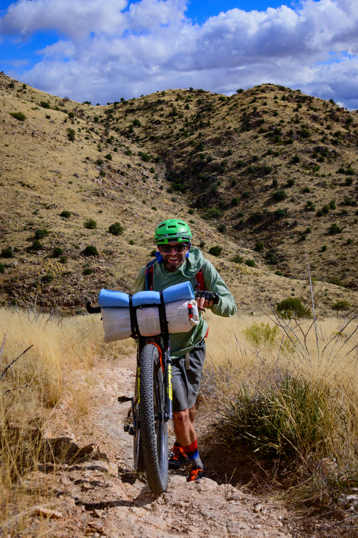
Our early November trip was initiated by our great adventurer/photographer friend Benj Wadsworth, and he knew that an invite to my wife Ashley and I wouldn’t be turned down, especially when he and Ashley’s old pal Dave Cook was keen to join. A solid foursome meant that we could be pretty efficient at gettin’ er done.
That said, “gettin’ er done” for us meant only the southern “half” (slightly less). A November start meant that the high plateaus of northern Arizona would be too cold already with some early snow, and we were keen for both a fairly leisurely trip and the opportunity to ride through desert that was quite different from the southern Utah desert we were accustomed to. So our trip was to begin at the southern border and go north to the Picketpost Trailhead near Superior, AZ, about an hour east of Phoenix in the Superstition Mountains. Our planned route roughly followed the unofficial route of the unofficial 300-mile AZT Race
While the 300-mile AZT Race is done as fast as 60 hours, we planned a fun week without the races’s excruciating saddle sores and fatigue-induced hallucinations, which meant that we were shooting for a challenging but very reasonable 40+ miles/day of mostly singletrack. Though we weren’t racing, we connected with the AZT Race director John Schilling, who is as enthusiastic about anyone doing adventure rides in his home state as he is about his racers. John provided us with a ton of excellent information, including a key note that Arizona had a prolific and much-appreciated monsoon season last summer that had the side-effect of encouraging the growth of “Cat’s Claw”.
Cat’s Claw (Dolichandra unguis-cati for the botanically inclined) is a gnarly little bush that we – fortunately – don’t have in Utah, because it loves to grab and tear at skin and clothes. There was a challenging section of trail near the southern start that was rumored to be unusually rife with this pernicious bush, so we did the first 30-odd miles on adjacent gravel roads as a gear/bike/people shakedown. This detour gave us the opportunity to hang out in the infamous desert zone of illegal immigration, and we saw plenty of both official and unofficial folks scanning the desert for signs of furtive movement of people negotiating very unforgiving terrain to get into the US.
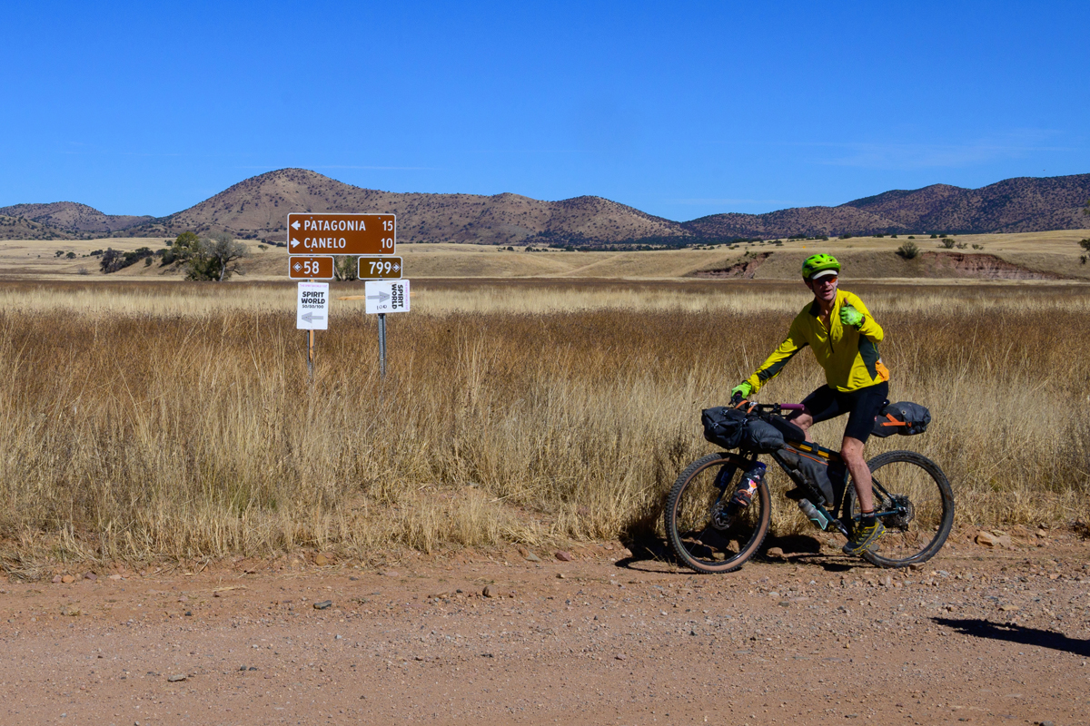
A short day of riding got us to the unlikely Parker Lake (the arroyo going into the lake was bone dry, as was the arroyo exiting the lake), and another short day got us to the quaint little town of Patagonia. We became aware that “quaint” is a pretty new adjective for Patagonia. It seems that in the past it’s been more “dusty” and “bleak”. Recently, there’s been an influx of tourism – turbocharged by a young couple who apparently made their fortune as bike touring guides and ambitiously turned an abandoned old west store into the Patagonia Lumber Company (patagonialumberco.com), a food, wine, coffee, beer, and entertainment hub of the town. They even got the attention of a guy who had owned bike shops in Missoula and Helena but decided that Patagonia was his next stop, and he had opened his shop in a shack out back just six weeks prior. The day prior to our arrival was the Spirit World 100; a gravel race that is wildly popular and was a definite infusion of money and enthusiasm to the town.
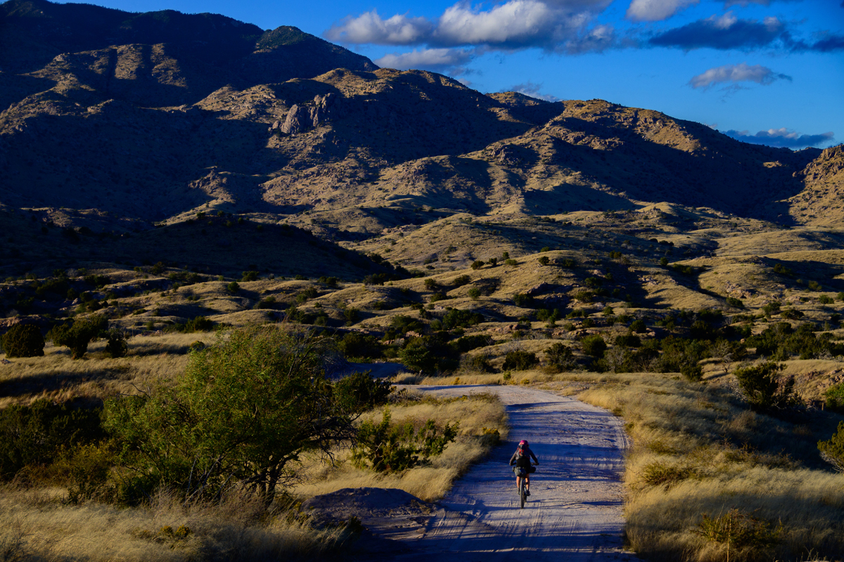
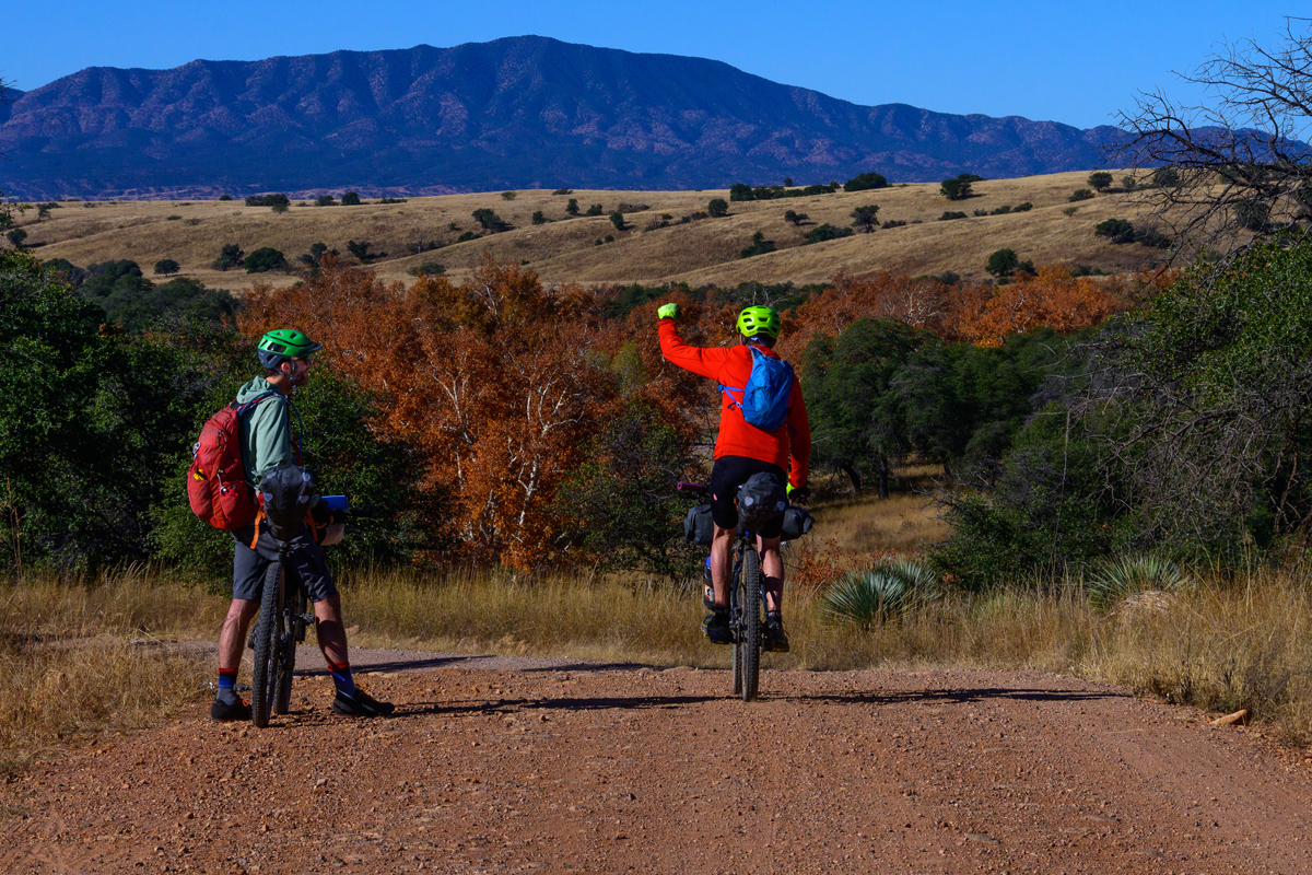
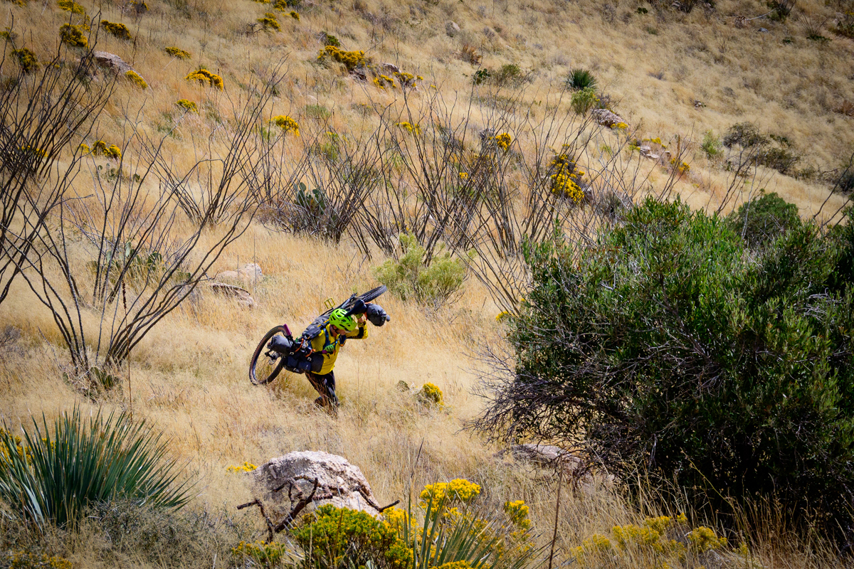
Leaving Patagonia we finally hit the Arizona Trail proper a few miles outside of town. We were pleased to find that indeed the trail was not only rideable, but was great. It was fairly challenging and had a few short hike-a-bikes up steep climbs, but for the most part we rode on through. And while there were certainly some Cat’s Claw and other spiky vegetation (yucca, agave, cholla, prickly pear, and the goofy-looking, anthropomorphic saguaro cactuses), we didn’t get too shredded as long as we weren’t staring at the menacing vegetation alongside the trail, and instead focused on where we wanted to be. Benj did provide a good example of what happens when your mind and/or vision wanders when he went slightly off trail and pretty much quilled himself in the ass! (no picture, fortunately!).
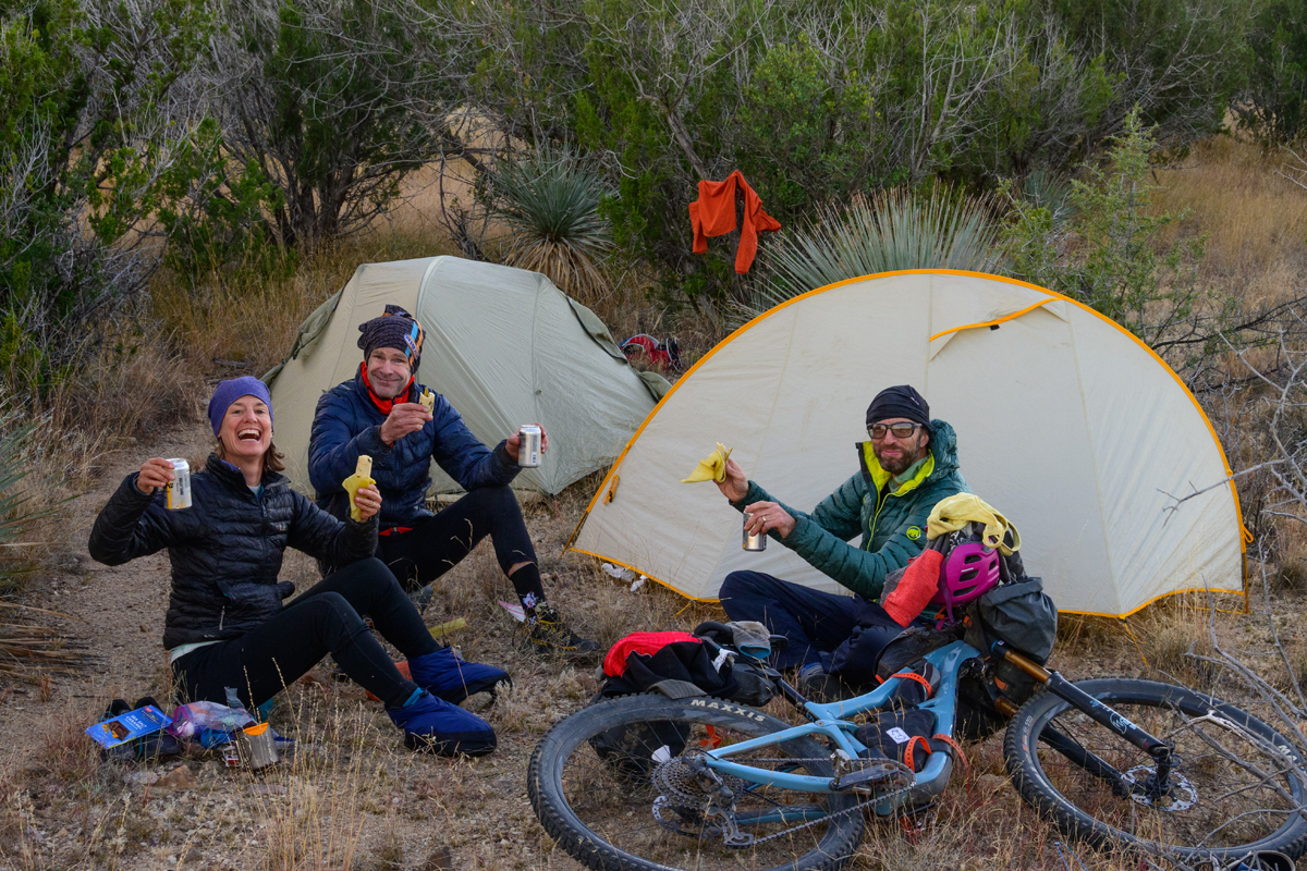
There is a bit of periodic civilization on the route. In addition to Patagonia there is Kentucky Camp, an old mine that is now a backcountry museum with seasonal (winter; which is “the season” in southern Arizona) volunteers. For about ten days each spring and fall Phoenix residents Jim and Marilyn set up “Magic Camp” at a spot they can drive to where they have tent sites for through-hikers and cyclists and serve up burgers at night and pancakes in the morning. Jim and Marilyn are great examples of the enthusiasm that Arizonans have about their AZT. They are examples of the well-known and well-loved “trail angels” who will come out from nearby towns to pick you up and bring you into town to re-provision and the businesses along the way provide goodies and bennies to trail users. It very much feels like a community of Arizona Trail lovers.
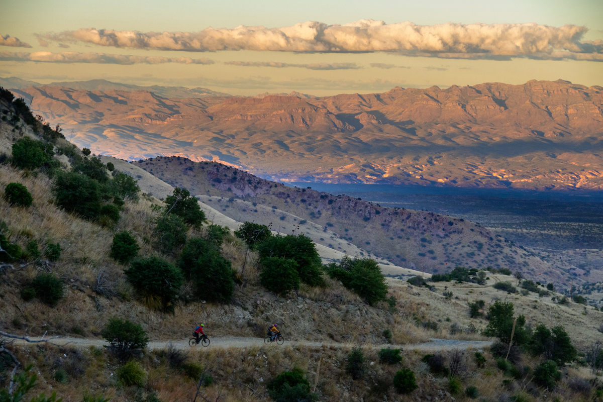
While the hikers and bikers generally share much of the route, a significant point where the AZT bike and hiking trails diverge is Mount Lemmon. Lemmon is a 9000 foot peak outside of Tucson that is a cool respite for overheated Tucsonians in the summer and actually has a viable ski resort as well. There is an iconic MTB trail on it called – appropriately enough – Lemmon Drop, and though it’s not designated as such it’s very much a downhill trail. The northbound AZT route goes 18 miles up the Mt. Lemmon highway, which is not busy and is arguably one of the best and nicest paved climbs in the country that takes hours to climb as it is. Climbing for that length of time invariably leads to elevation gain, and in the shoulder seasons it’s important to understand that the pleasant warmth of the near-sea level southern Arizona gives way to frigid temps on Lemmon. When we got to the idyllic little village of Summerhaven, we headed straight for the pizza, coffee/tea, and huge cookie place there to warm up. After, we dropped 4000’ down the rough north-side doubletrack called the “Control Road” (which was the original road up Lemmon) to avoid camping in the frigid temps up high (we had met some through hikers who had “camped” in pretty much a pig-pile in the tiny and always-open post office some days prior).
A nice aspect of not racing a bikepacking route is that you can do fun diversions. We found a beautiful slickrock canyon that offered beautiful waterfalls and swimmable pools to clean off the accumulated trail dirt, and later we sort of veered off the route and into a working ranch deep in a desert valley, and when we saw the ranch manager he not only told us to ignore the many ominous no trespassing signs (“those aren’t for cyclists!”) but also offered us use of his tap and a nearby campsite. Again, AZT trail angels are great!
We rode many, many miles of amazing singletrack. Most of it is pretty slow and challenging trail, and much of it is remote; we kept wondering about the countless hours of work that was put in to link together literally hundreds of miles of trail in barren, desiccated, and hardscrabble terrain miles from any trailhead, and it’s nearly all at rideable grades despite pretty severe terrain. And about the time that you feel like wow, there’s no water and no place to resupply, you pop out into little towns like Oracle, which has a lovely little cafe with a nice little store and scrumptious baked goods.
On the way to Superior and the end of the AZT 300 we also hooked into part of the Queen’s Ransom route, another John Schilling special that is a 227 mile route in the same ‘hood. The Queen’s Ransom has a bit more double track and gravel road, but can be combined with the AZT as an additional route that adds more riding closer to Phoenix, thus adding more adventure to your trip without adding much more shuttle distance. We actually used it as a nice conduit out to the sprawling Phoenix valley to get an Uber back to Tucson to retrieve our car.
Our tour ended less than halfway “up” the Arizona Trail, but it’s clear to us that if the northern bit of the AZT is anything like the southern, we’ll head back again soon to continue heading north to — and through? — the Grand Canyon (true AZT-ers carry their bikes across the Canyon! Not sure if we’ll do that…). It’s an incredible ride through an unusual desert landscape, with the added bonus of being looked after by actual angels!
If you go:
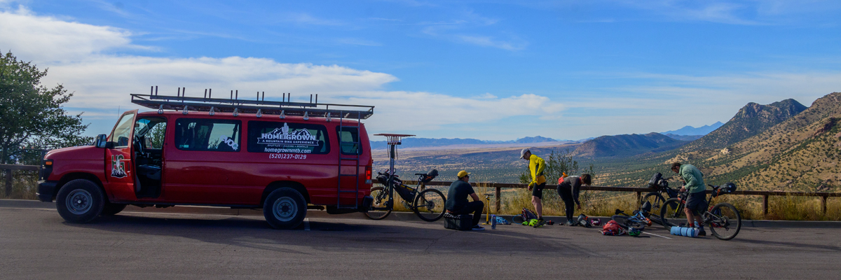
- Homegrown Shuttles runs people and bikes from Tucson to anywhere on the AZT. (homegrownmtb.com)
- Bikes – the AZT is not Cutthroat friendly! It’s a real mountain bike ride. Full suspension or at least big squishy tires with real treads, reinforced sidewalls (for the sharp rocks) and tubeless goo (for the thorns) and likely standard mtb handlebars are all pretty important.
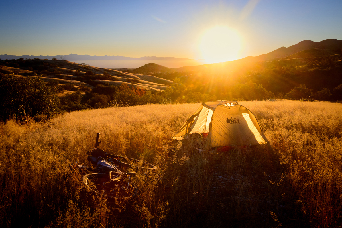
- Go light! It’s challenging riding and there’s not much water in the Sonoran Desert so you might be carrying more than you normally would, so use all your lightweight gear tricks.
Trip Details:
- Start – Montezuma Pass, AZ
- End – Picketpost Trailhead, Superior AZ
- 310 miles
- 7 days