By Lou Melini — The Caribou Loop Trail is a 200-mile collection of gravel roads, both US Forest Service and county, along the Idaho and Wyoming borders. To the north is Alpine, Wyoming and near the southern end is Afton, Wyoming. The route is primarily an ATV loop, though I was told that about 20% of the users are bicycles. Julie and I saw no other bikes. The trail is named the Caribou Loop Trail as there is a Caribou Trail in Idaho.
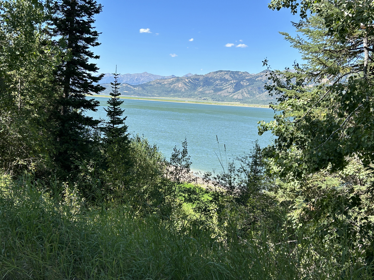
With the combination of Forest Service and county roads, the scenery is a varied as one can imagine here in the West. Forested roads, wide rivers adjacent to the roads plus many not-so-wide rivers, fenced ranch land, active mining activity, wide scenic valley, and in one brief section, an LDS ward house with scattered nearby homes. At night, the stars shone bright.
I was told about the route from a friend that did the Idaho section of the trail. If you have never heard of the Caribou Loop trail, I am not surprised. When Julie and I were asked what we were doing from local people we met, we said we were riding the Caribou Loop Trail. After a blank stare, we learned to name the roads which were known, just not the loop name. I assume that someone cobbled together the route with the intention of creating tourism among the ATV crowd but needs to get the word out.
The Caribou Loop trail is fairly well marked, though not as well as touted. The website (cariboulooptrail.com) has a map that you can download. Julie and I could not download the map even with the help of one of our sons. Neither could my friend even after speaking with a person responsible for the website. I ended up using the Wyoming and Idaho Road and Recreation Atlas from Benchmark maps. The route was clearly shown in the atlas, just not called the Caribou Loop trail.
[Editor’s Note: you can download GPX and KMZ files and a useless pdf]
Leaving Alpine
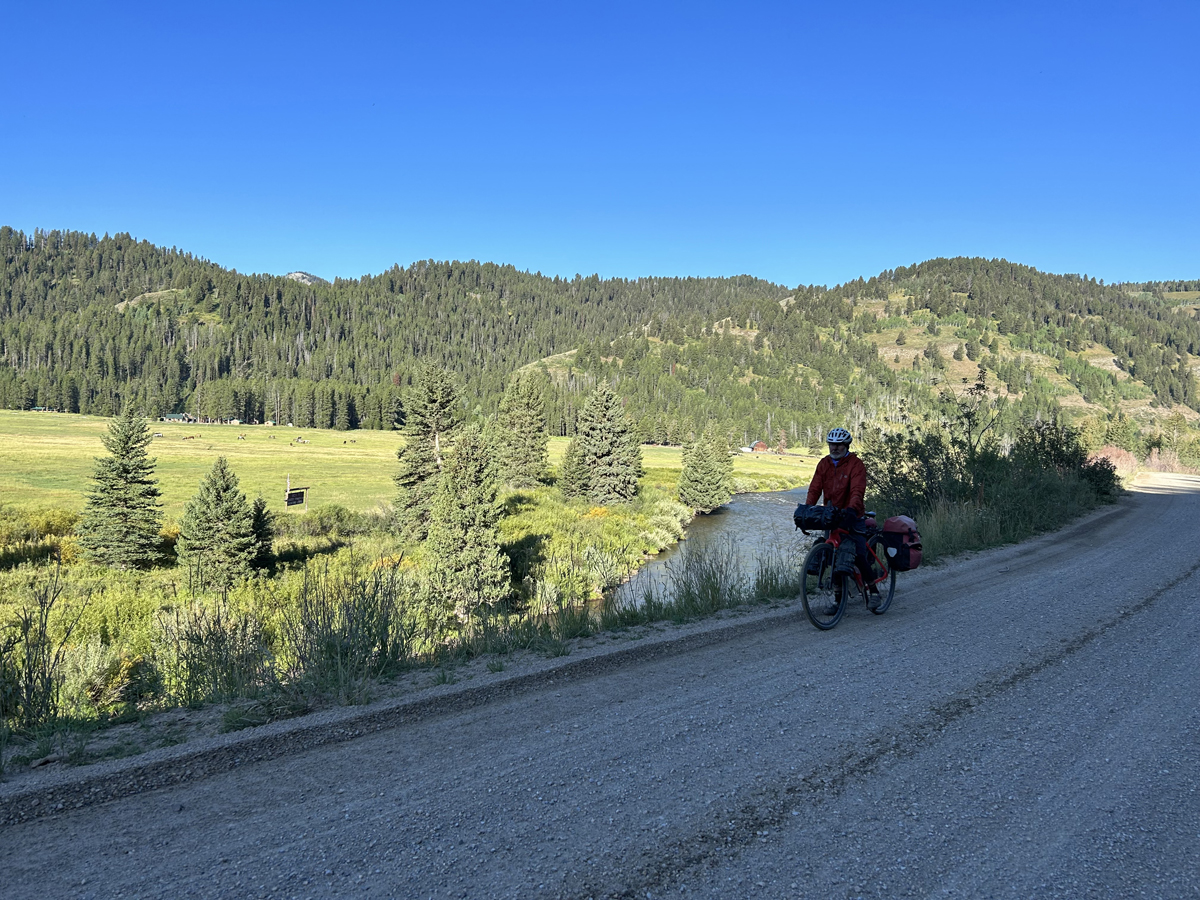
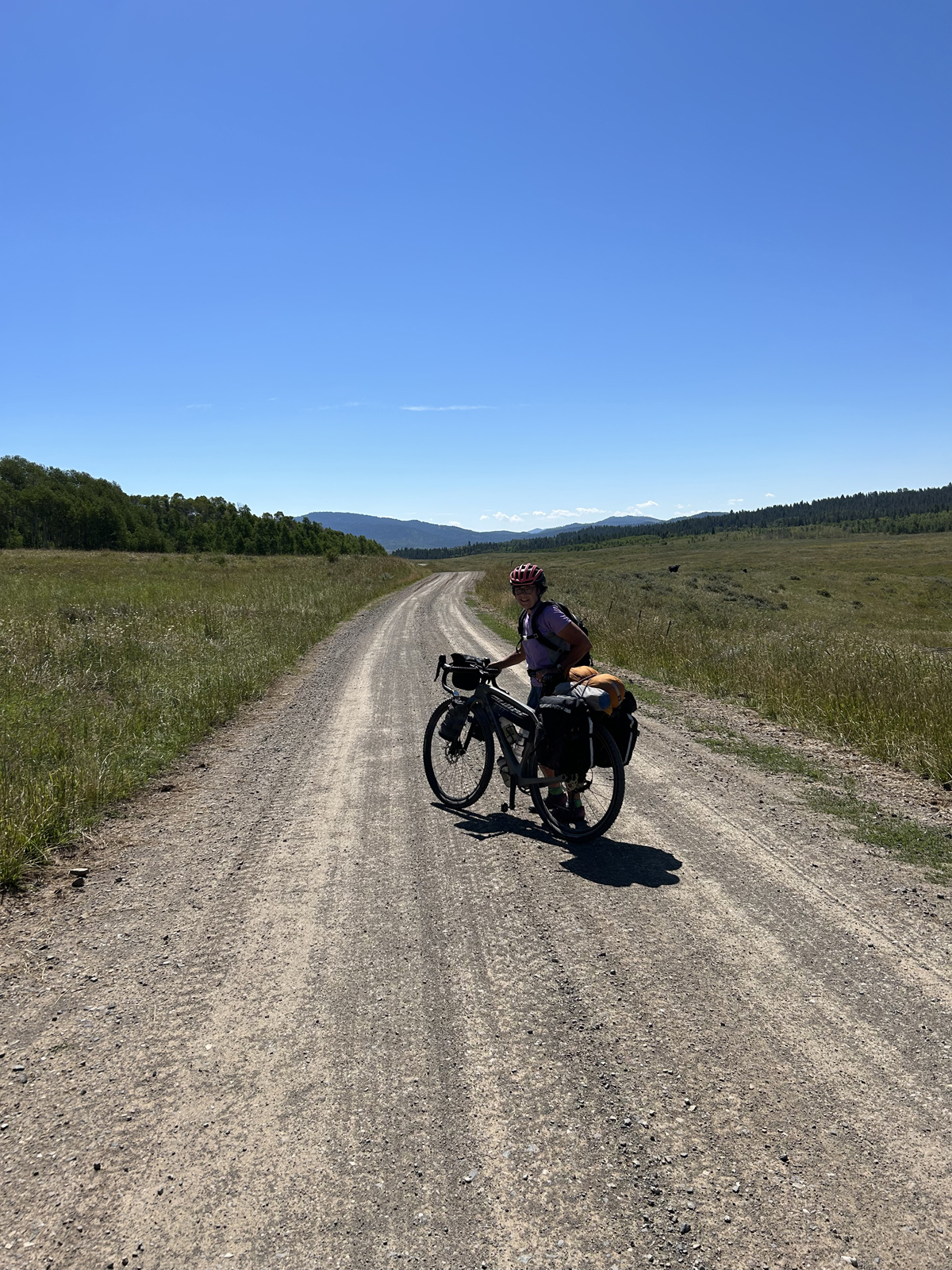
I arranged with the city of Alpine to leave our car at the Don Wood Civic Center. We left town on a Friday at 3:15 with the goal to ride 2 hours. From Alpine we traveled south on highway 89 about 3 miles to McCoy Creek FS Road. We rode north then west for another 16 miles before stopping to camp. We topped off our water supply at McCoy Creek FS campground in case we were not able to access McCoy creek when we camped. The gravel road was in good shape, some potholes, some up and down with only one hill that put us in our lower gears. There were few vehicles. There were plenty of camping options, though many were taken. It was a nice scenic ride through the forest.
Riding South
The morning of Day 2 was chilly and damp, the only morning that required my knee warmers and a couple of layers on top. The day soon became hot. We eventually camped after 48 miles of riding on relatively flat Grays Lake, Tincup, Lanes Creek, and Diamond Creek Roads. These are county gravel roads that are in great condition. Large cattle ranches bordered most of our ride. We found a bit of shaded open space to camp next to a creek that did not appear to traverse a cattle ranch.
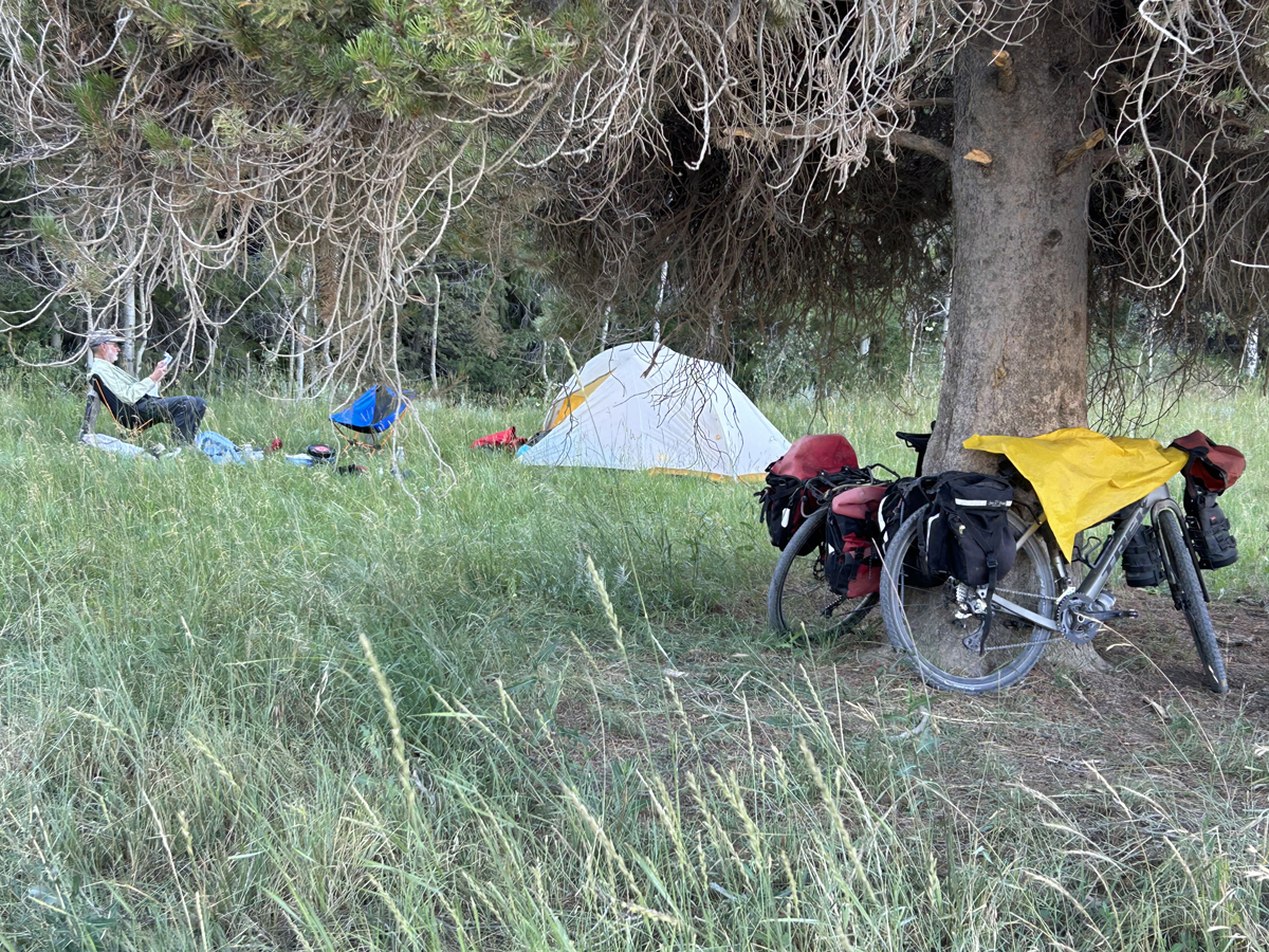
We woke on day three, prepared ride only to find Julie’s rear tire was at zero pressure. She lost sealant on day two from both tires but both sealed and held air for the rest of the day. (see product review of tires)
The first 5 miles of the day’s ride was great. Once past the Forest Service guard station the road started to go upward, enough that we walked our bikes for the final quarter of a mile to the top. Our legs were a bit fatigued from the past 2 days, our age was a factor and the need for lower gears on our bikes was apparent. There was a second hill that became more of the same, though perhaps a bit more walking.
After 16 miles we came to Wells Canyon Road, notorious for being a rough road. It was 4 miles of misery. The road should be renamed Hells Canyon Road. Julie walked the first 100 yards or so, a steep rutted downhill full of golf ball sized rocks. For the first mile we had frequent piles of small rock and ruts that had me hopping back and forth on the road to find hardpack. The road smoothed out a bit as we approached the Simplot mine until we hit more rocks and needed to walk up a short section of a hill then carefully and slowly weave our way downhill through more small rocks on the road. We were happy to leave that section of the Caribou trail. It took us 3 hours to travel the first 20 miles of day 3. When we turned onto Crow Creek Road, we were a bit beat up, hot, and hungry so we stopped at a bridge, filtered water, and had lunch. Crow Creek Road was, despite being gravel, a smooth fast ride into Riverview where we hit actual pavement. We tried “Campgrounds near me” but ended up at a mobile home park in Afton. Being a Sunday most of Afton is shut down, so when we spotted the Marriott two blocks away, so we took it.
Decisions/Indecisions
The Marriott stay was well needed. We arrived hot and tired. We rode 42 miles in 5 hours. Bike travel rules suggest food and fluids before discussions and making decisions when one is tired and grumpy, so we showered and went out to eat.
We wanted to complete the Caribou trail, but the narrative for the next day would have put us climbing the 9300-foot Commissary Ridge, a landmark that I could not find on the map on Smith’s Fork Road. I did not know if the ridge existed, but I also did not want to ignore the Caribou website narrative. We envisioned pushing our bikes more than we wanted to do. We decided to alter our ride by riding Highway 89 back to Alpine. After a night of rest, we would ride up Grays River Road. The first 35 miles of this road is reportedly the most scenic section of the entire Caribou loop.
On my return home I researched Smith’s Fork Road more. My concerns of steep elevation gain were unfounded. The Smith Fork trailhead is 14 miles south of Afton (7.5 miles south of Smoot). The Smith’s Fork Road is about 42 miles and has 2821 feet of elevation gain. Perhaps for the next trip.
Alpine and Grays River Road
Upon arrival in Alpine, we picked up our car and went a quarter mile to Grays River Cove RV Park, a campground I have stayed at on 4 previous bike trips going back to 2005. The fee is $20/person. Since 2005 the facilities have been upgraded with 5-star restrooms and showers. The owner is a couple of years older than I, comparably grumpy, but overall nice and accommodating. We planned on camping for the night (Monday), leaving our car the next day (Tuesday) so that we could ride up Grays River Road for about 36 miles to a Forest Service campground. We would return on Wednesday to buy showers and then head home.
We asked the owner about the condition of Grays River Road for bike travel. He suggested we talk to a local that was very knowledgeable about the road. It was 2 PM and we realized the local road expert, after one sentence, had a few too many whiskey and water drinks. However, there was one coherent moment when he mentioned road construction about 16 miles up Grays River Road.
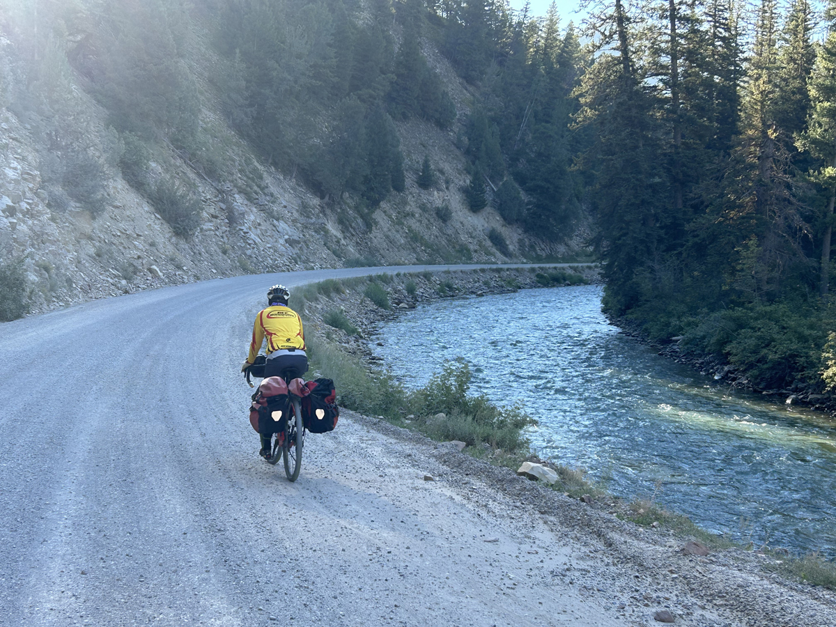
Our legs were rested, and we were excited to ride. Grays River Road was as spectacular as advertised. A wide river flowing through a wide valley of forest and meadows. Unfortunately, the road construction we heard about was a resurfacing of the gravel road. We endured a large number of gravel trucks hauling their load up and down the road, along with tourist traffic. Dust and noise from the gravel trucks and other vehicles diminished our day. The speed limit of 35 mph was more of a suggestion. On one curve in the road a cowboy on his horse, with his dog, was moving 4 stray cattle while an ATV was passing him. They were met by a gravel truck coming down the road. Julie and I were surprised all went well.
In addition, we had to deal with large sections of the road that had loose sand and marble sized rocks, tire deep in some places. I put 45 mm Pirelli tires on Julie’s bike to improve her stability on such a surface. She did well. (see product reviews) After 20 miles we passed the construction area and had the road to ourselves for the remaining 16 miles to the campground. My Senior Pass for National Parks and Federal lands allowed me to acquire a campsite for $5. It was nice to have a picnic table and vault toilets for the night.
As planned, we returned to our car at the campground, had lunch, showers, and then drove home. On our tour we rode about 170 miles on gravel roads and another 50 on pavement for this trip. We learned much about what we like and don’t like in off-pavement travel. Other than Wells Canyon Road, the degree of difficulty of this loop trail that we rode was good for us. We would like to ride Grays River Road again sometime in the future when the road construction is completed, and the surface rock is mostly gone. We shall see. Overall, the Caribou Loop Trail is a worthwhile trip for others that would be interested in this bike packing route as well as on the many other gravel roads in that area.
And now for something completely different
The Ace hardware stores in Alpine and Afton have camping supplies. I know because for the first time after well over 2 years of cumulative backpacking and bike travel going back to 1975, I had 2 cold dinners due to a lack of fuel. In the process of transferring gear from one set of panniers to another before leaving for the trip, I didn’t transfer the fuel for my stove. Soaking our dinners for 20 minutes made the meals eatable, but I wouldn’t recommend it. I drew the line at cold morning coffee. Ace is the place for canister fuel for your stove.
Nuts and Bolts
- At 200 miles, the Caribou Loop Trail can be completed in 4-6 days by most bikepackers. In the northern Idaho and Wyoming section of the loop the roads are relatively flat. Smith’s Fork and the southern section of Diamond Creek Road (county road 102) have elevation gain that will challenge the average person. This route could be ridden from the time snow melts in the spring until snow falls in the fall.
- Given that there is a mine, a church and some homes on the Idaho section, there may be opportunity to ride (day rides) year-round though cold weather will probably be prohibitive. I assume snowmobiles use the roads in winter so fat tire bikes may also be a winter option for day rides.
- Julie and I obtained water from streams and forest service campgrounds limiting what we needed to carry. We tried to obtain water at a faucet from an LDS ward house on Grays Lake Road, but the water seemed foul. Perhaps we needed to let the water run for more time.
- Food stores are available in the towns of Alpine and Afton.
- There is a lot of private land and ranches but camping along the road or in Forest Service campgrounds were easy options.