By Martin Neunzert — On the first weekend of October 2024, I cycled a two-day interstate loop around Beaver Mountain, Utah. A huge number of MyTube videos and blogs describe ultimate bikepacking routes with low-carbon access via public transport, a wide variety of resupply points, consistently great weather, secluded wild camping spots, quiet roads without goathead stickers, hard-packed gravel, some singletrack adventure, epic climbs with stunning views, open vistas and yurts.
Of course, no such route exists, and if you paid for an app promising that, they took your money.
I had in mind an almost car-free world-class two-day G2 tour, without having to drive six hours and without feeling like I had to produce a Reb Dull suffer-fest video with drones and a rap-track.
Of course, many of you will look at my photos and conclude “You’re not a real bikepacker!” Since I’m not an influencer—and cannot be influenced—I learned long ago carrying all my water in small panniers gives me the freedom to go as slow as I want, turn around if I want, go out on any spur road I want and camp wherever I want totally unconstrained by water supply issues. Your app doesn’t tell you which streams are dry in late season (none of them in this case) and which are cow-polluted (all of them in this case).
I found almost what I went looking for and came back with a conclusion I hadn’t expected.
The keystone to any great tour is parking. That sets your times, and, therefore, your effort, regardless if the rest of your planning is any good.
I parked in a place I knew was free of NO OVERNIGHT PARKING signs. This constraint is becoming more common, and no app contains that information. I’m not going to tell you where that spot is because this is not a route guide. You can figure it out because you have access to all the same information I did. Would it help to know it was near where I started a backpacking trip to Mount Magog one August with an umbrella because of chucking down rain?

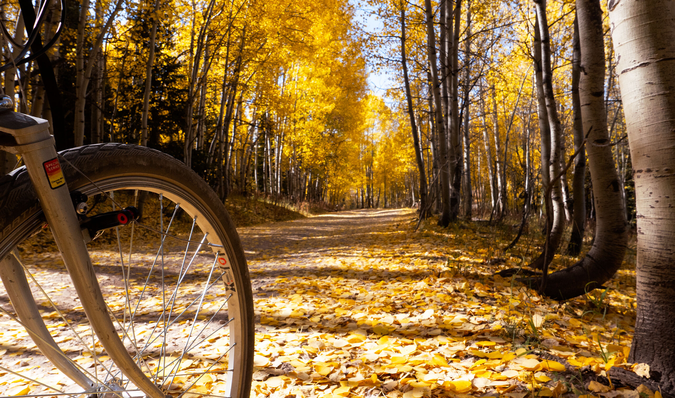
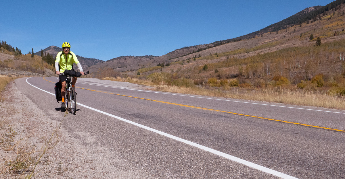
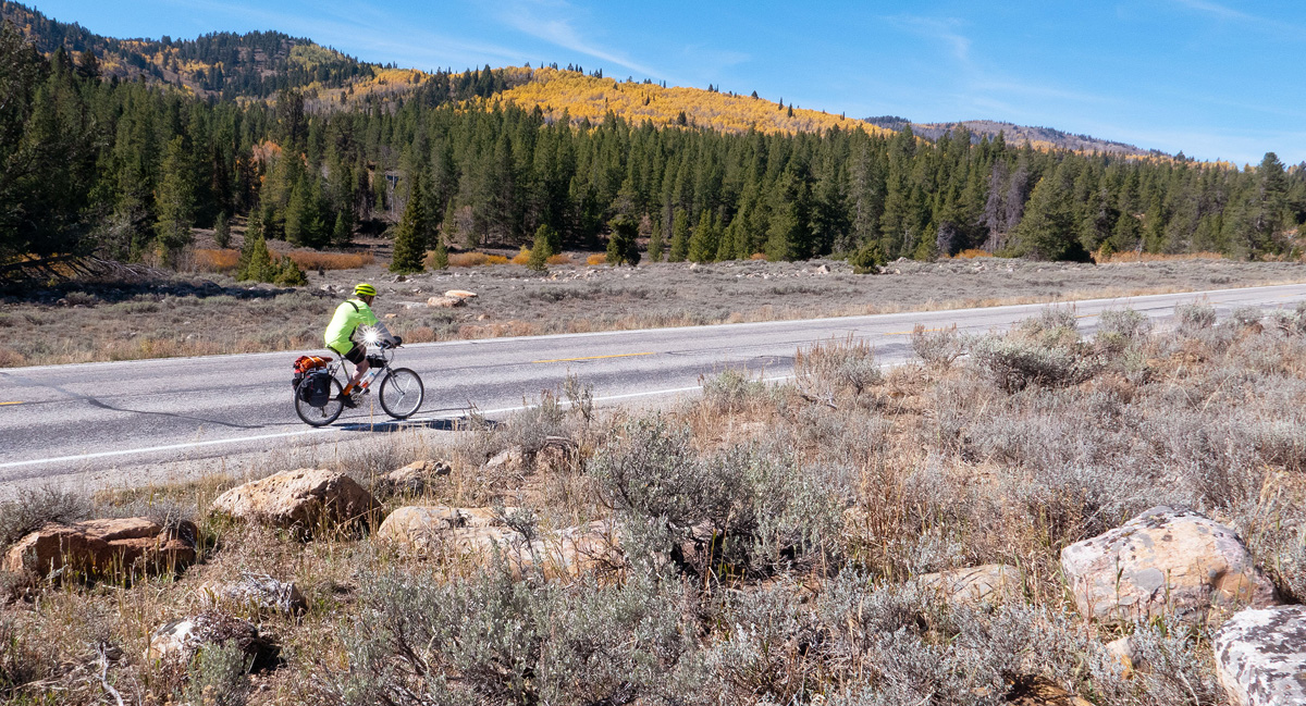
I had to ride on the highway for a few miles because the phrase “mixed surface” is still trending. Or whatever. Churro balls got me through.
Along the way, I caught just a brief glimpse of an unnamed 9,000+-foot point west of Steam Mill Peak where I passed some sinkholes while on a ski tour. There are a shedload of alpine caves in that area.
I could see the ridge east of Beaver Mountain where I talked a couple friends into skiing ridiculous breakable crust. Curiously, no one was injured.
Steam Mill Peak is an obvious landmark, where I once biked to clear some trees that had fallen on the trail (no chainsaw).
I saw a great panoramic view of Steam Mill Peak and Doubletop Mountain, bringing back memories of a two-day ski tour—too cold to snow.
I noticed where I started a day of mountain biking and trailwork in Steam Mill Canyon (no chainsaw).
I passed the spot where most people start to get to a yurt near Steam Mill Peak. I skied three days in that area once, only yurtless.
I remembered a time, long ago, where my wife and I did a ski tour in Sink Hollow to the Idaho border, untracked snow the whole way.
I’ll not forget taking my wife backpacking to the site of the steam-powered sawmill where we found steer’s head flowers (if you Joogle that, you’ll learn it was early season and muddy).
The cut logs you see along Shorty’s Cutoff Trail? Some of those are mine (no chainsaw).
Best corn skiing ever? Maybe, on a memorable April Fool’s Day ascent of Steam Mill Peak. Or maybe it was just all 142 types of snow.
I still haven’t figured out quite where we were when I pioneered a ski route east of Beaver Mountain and discovered the largest mountain mahogany forest in North America.
I was reminded of yet another two-day backcountry ski trip in Hells Kitchen, with an ascent of Steam Mill Peak—whipping wind all night.
Oh, and if you’re bored, try Joogling “Pat Hollow crash site.”
Two of my friends still talk about the best powder day ever in Long Hollow, not diminished by having to pole for three miles on a horrible beaten-out snowmobile track.
Like climbers on Chomolungma spanning crevasses, I once used an aluminum extension ladder to cross the upper Logan River for a quiet ski tour with friends.
I still have slides documenting ski touring in lower White Pine Creek with just my wife.
I still have slides documenting ski touring in lower White Pine Creek with five friends the next weekend.
Only I know where the “Lost Aspen Glades” are. Ski porn stuff, on the right day.
The point of all this? My most vivid trip memories were from human-powered adventures. This bikepack is certainly right up there. Someone will eventually create a Human Power Recreation Zone (HPRZ). Shouldn’t Beaver Mountain be the world’s first?