By John Summerson — The Diné Bikéyah (Navajo Nation) is the largest Native American reservation in the United States. Spanning parts of three states (Arizona, New Mexico and Utah), it comprises over 27,000 squares miles of desert scrub, towering sandstone cliffs and spires and, in places, tree covered mountains. Though it contains relatively few roads and is sparsely populated, cycling is starting to emerge there.
The long standing Diné (‘The People’ in Navajo) Bike Project is the driving force behind promoting bikes and community wellness on the reservation. Most of the riding is of the off-road variety but there is an annual road race in and around the impressive Chuska Mountains that ends with a solid climb.
The Chuska range is the longest on Navajo land. Straddling the border of Arizona and New Mexico, this is where the most challenging climbs are located. Hot starts in summer, they all end within the trees at altitude and one of them carries the steepest half mile in Arizona. Below are the three most difficult paved ascents on the reservation. This is isolated country so if heading out to tackle these hills or for any extended riding in the area, make sure you carry what you might need.
Buffalo Pass South
Length – 6.3 miles Average Grade – 6.0%
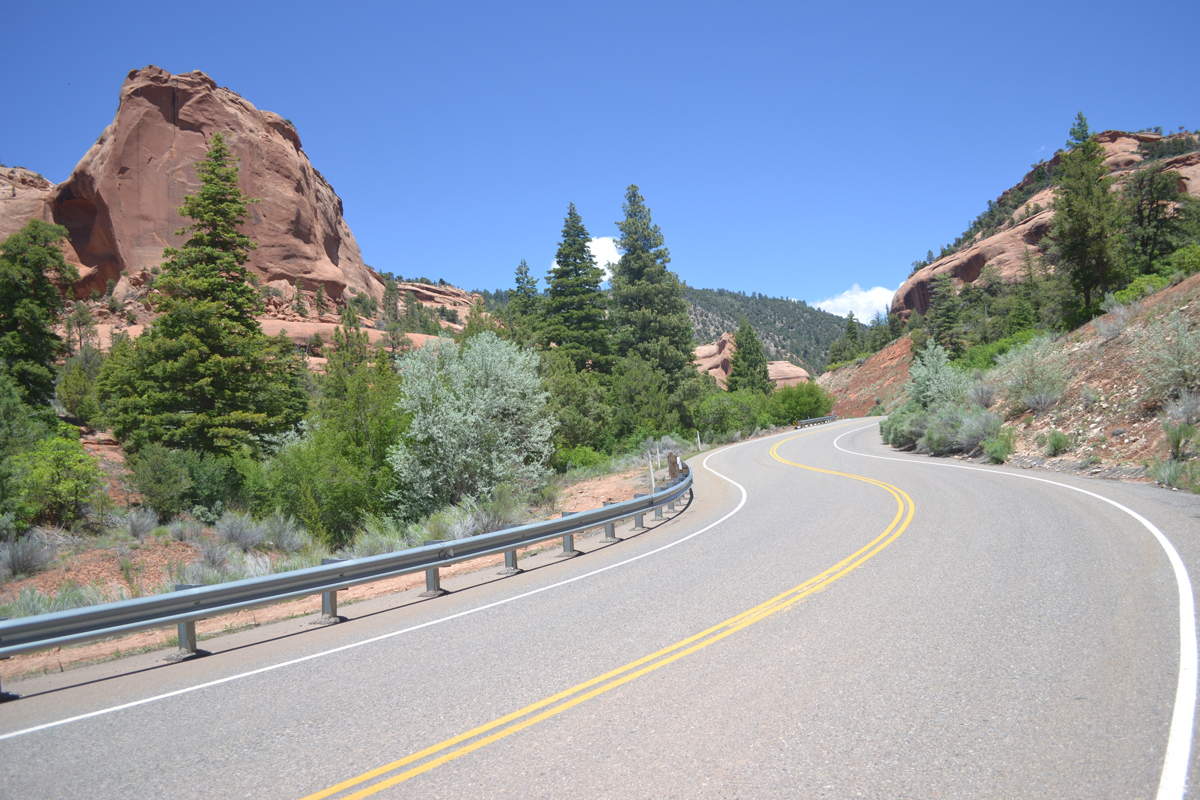
The south side of Buffalo Pass is an isolated and scenic climb in the northeast portion of the Grand Canyon State. A moderate grade greets you to begin the ascent as well as red rock views. Soon the road gets twisty and enters a canyon. Red rock soon recedes to pinyon pine views as well as increased grade. At mile 4.2 the route gets twisty and the grade ramps up to double digit and what is the most difficult half mile of paved climbing within Arizona follows. You will find the maximum grade on the hill here as well. The slope then eases a bit as trees close in as you gain altitude. Towards the top the pedaling gets easy and the climb ends at an unmarked but obvious pass among aspen trees.
Directions – In the small community of Lukachukai on the Navajo Indian Reservation in northeast Arizona, at the junction of Routes 14 and 13, take Route 13 (may be unmarked at junction but it is the main paved road that heads north) north for a few miles to the bridge over Totsoh Wash where the listed climb begins by continuing north on Route 13.
Buffalo Pass North
Length – 8.8 miles Average Grade – 5.1%
The north side of Buffalo Pass is longer but less steep than its south side, resulting in an almost identical ascent regarding difficulty. A shallow grade greets you on the narrow road, gradually getting steeper as you climb. Just over 4 miles in riders will definitely start to feel the slope as larger trees begin to appear. The grade then eases to almost flat before you hit the steepest quarter mile on the hill. From here the grade eases and you will encounter a short descent before moderate climbing resumes up to the unmarked top within trees. The north side of Buffalo Pass is a fun descent as well.
Directions – Approximately 7 miles south of Shiprock, NM on Route 491, head west on Route 13 for just over 20 miles to the Red Valley Chapter House, crossing into Arizona in the process. From the chapter house continue south on Route 13 for 4.2 miles to begin the listed climb where the pavement tilts upward.
Narbonna Pass East
Length – 10.4 miles Average Grade – 5.2%
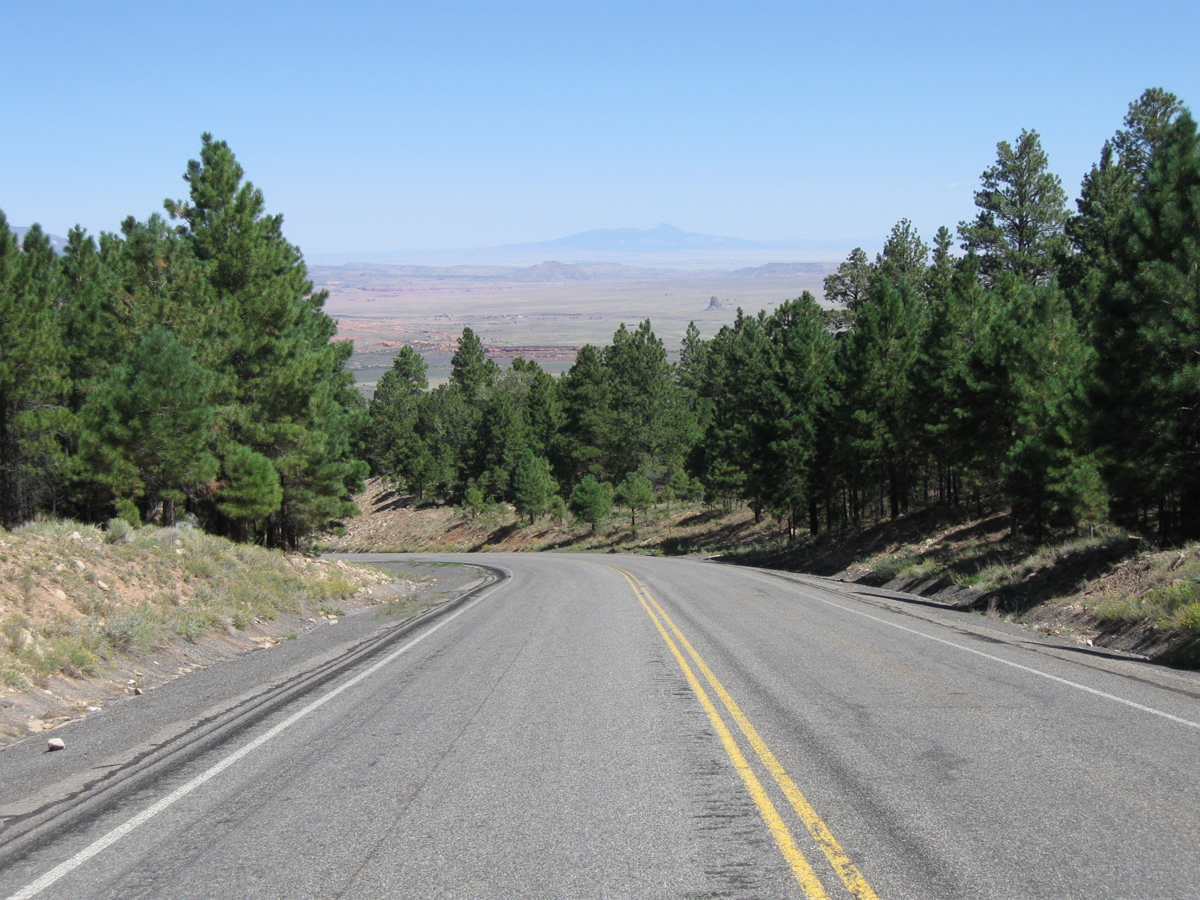
Once known as Washington Pass, the east side of Narbonna Pass on Route 134 is a very isolated category 1 climb located in western New Mexico close to the Arizona border. It begins as quite shallow (and has contained poor pavement in the past) but soon enters a drainage with increased grade just over one mile into the ascent. After this stretch the grade then tends to alternate between moderate and shallow (but there are no flats or descents on this hill) as you continue to ride west. Eventually a few small trees appear in places along the lightly travelled route. Toward the top a right turn introduces steeper grade and the last two miles are the stoutest of the climb. A few big trees appear with altitude as the road is contained within a canyon near the top. Just before the summit the grade eases and the climb ends at an unmarked but obvious top with a pullout on the left. The west side of Narbonna Pass is a much shorter climb.
Directions – From Interstate 40 in Gallup, NM head north on Route 491 for ~48 miles to tiny Sheep Springs and Route 134 on the left (may not be marked but it is the only paved road heading west). The listed climb begins at the junction by continuing west on Route 134.
Resources:
- Diné Bike Project: https://www.navajoyes.org/dine-bike-project/
- Tour de Rez Cup Series Bike Races (MTB and road): https://www.navajoyes.org/events/
- Navajo Nation Tourism information: https://farmingtonnm.org/listings/navajo-nation
- Navajo Reservation History: https://www.navajo-nsn.gov/history