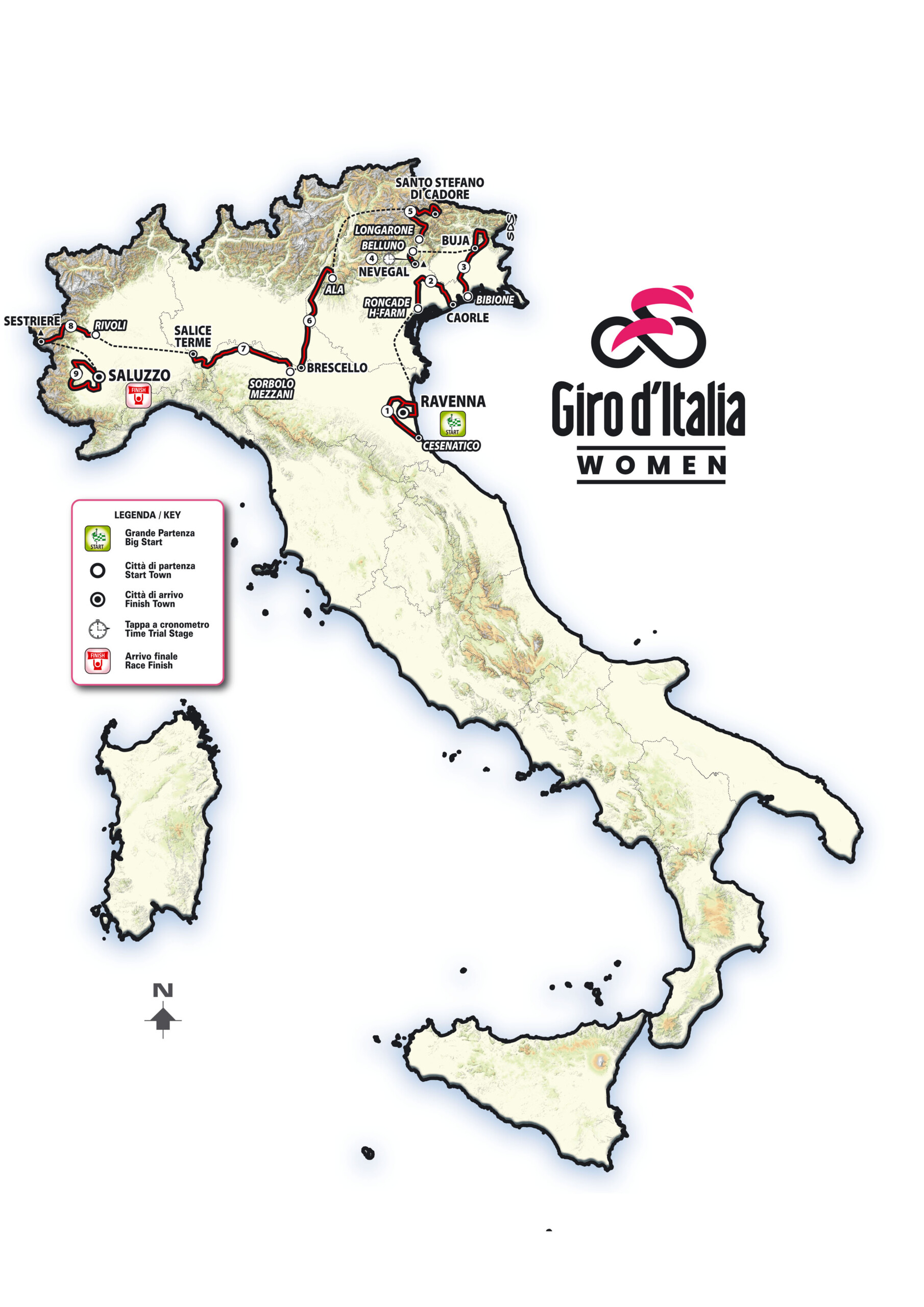
ROMA, Italy (1 December 2025) — The Giro d’Italia Women 2026 will start in Cesenatico on 30 May and finish in Saluzzo on 7 June. Organised for the third consecutive year by RCS Sports & Events, the nine-stage race will cover 1,153.7 km with a total elevation gain of 12,500 metres. Two summit finishes await riders: Nevegal and Sestriere, which will feature the Colle delle Finestre for the first time in race history. RTL 102.5 will serve as the official radio station.
“The race will start on 30 May in Cesenatico and conclude with a grand finale on Sunday 7 June in Saluzzo, after nine stages – one more than in the previous two editions – totalling 1,153.7 km and 12,500 metres of elevation gain,” organisers confirmed at the presentation in Rome’s Auditorium Parco della Musica Ennio Morricone.
The event featured hosts Pierluigi Pardo and Barbara Pedrotti, with interviews conducted by Paolo Pacchioni of RTL 102.5. Sporting and entertainment stars attended, including Simon Yates, Elisa Longo Borghini, and two-time Giro winner Vincenzo Nibali. “We are thrilled to welcome these champions and all the fans of women’s cycling to experience this exciting route,” organisers said.
Italian and international authorities joined the ceremony. A Bulgarian delegation attended in person, while Italian officials sent video messages. Alessandro Onorato, Councillor for Major Events, Sport, Tourism and Fashion of Roma Capitale, presided over the presentation. RCS Group executives Urbano Cairo, Paolo Bellino, Mauro Vegni, and Stefano Barigelli also participated.
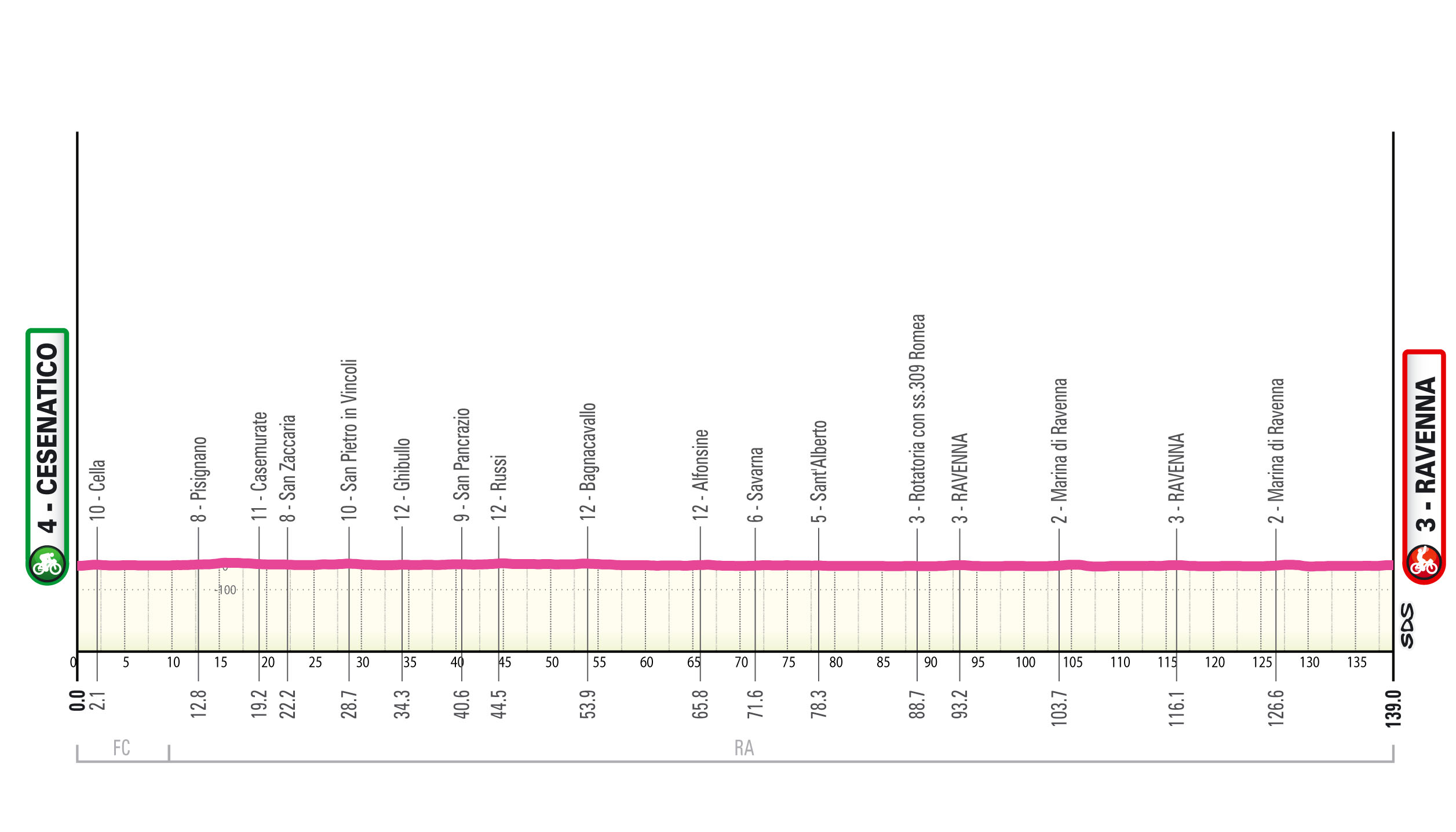
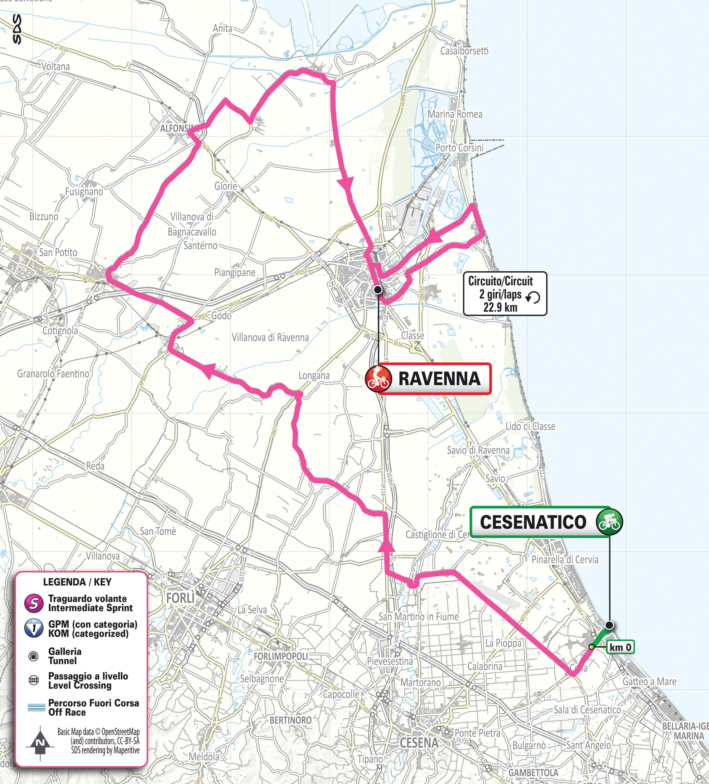
Stage 1: Cesenatico–Ravenna, 139 km
The Giro opens with a completely flat stage. Riders will start in Cesenatico, cross the Ravenna plain, skirt the Comacchio Valleys, and tackle two laps of a 23 km circuit before finishing in Ravenna.
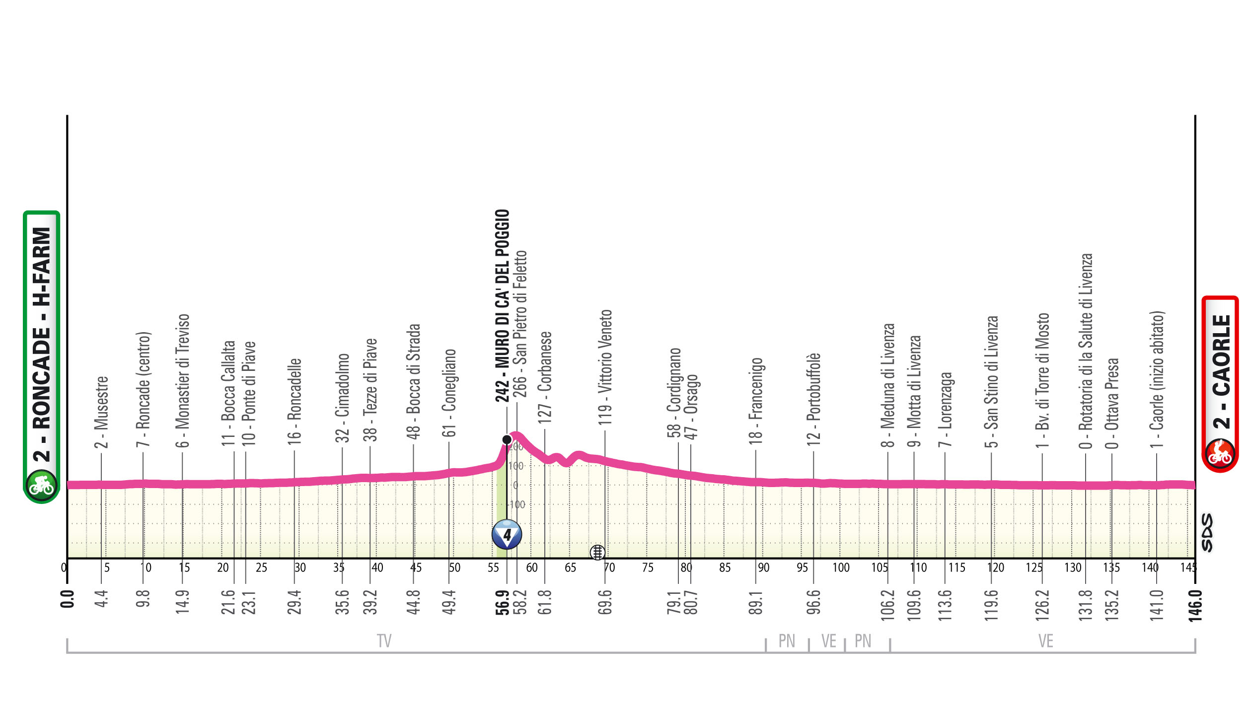
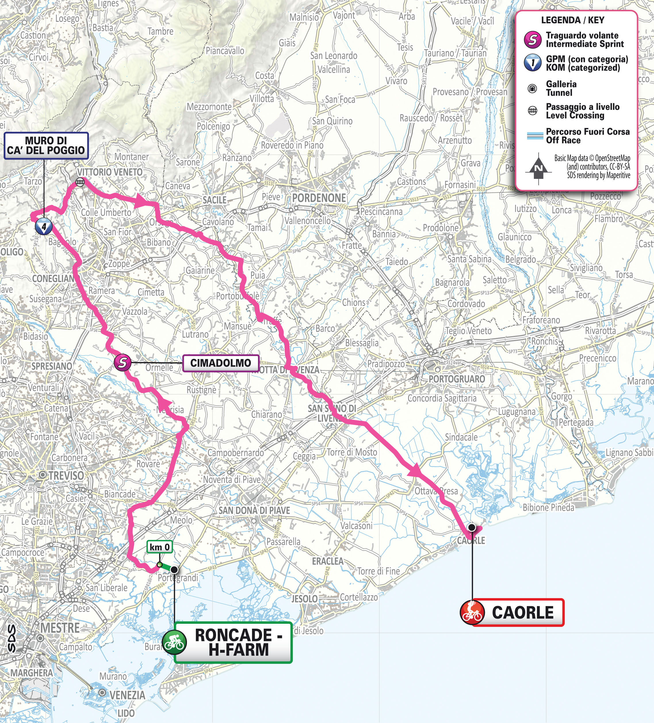
Stage 2: Roncade H-Farm–Caorle, 146 km
Stage 2 is almost entirely flat with a single intermediate climb. “The race starts from Roncade H-Farm, follows the Piave River, tackles the Muro di Ca’ del Poggio, then descends along the Livenza to the finish in Caorle,” organisers said. The profile will likely allow for a bunch sprint finish.
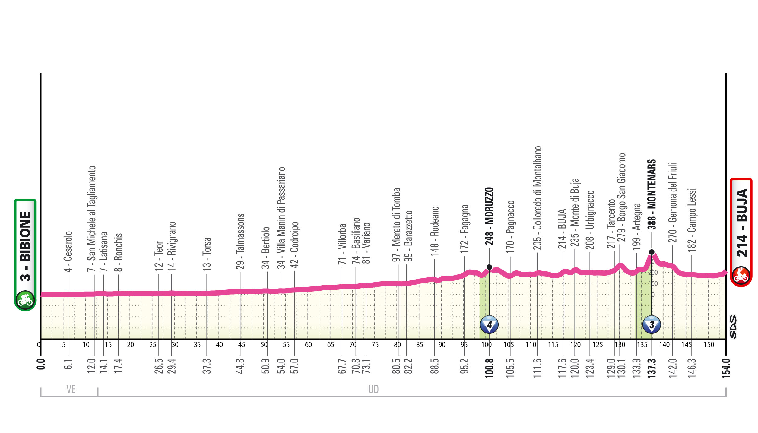
Stage 3: Bibione–Buja, 154 km
Riders face a flat start followed by a very undulating final circuit. The 36 km loop features several short, steep climbs, including Montenars, 18 km from the finish.

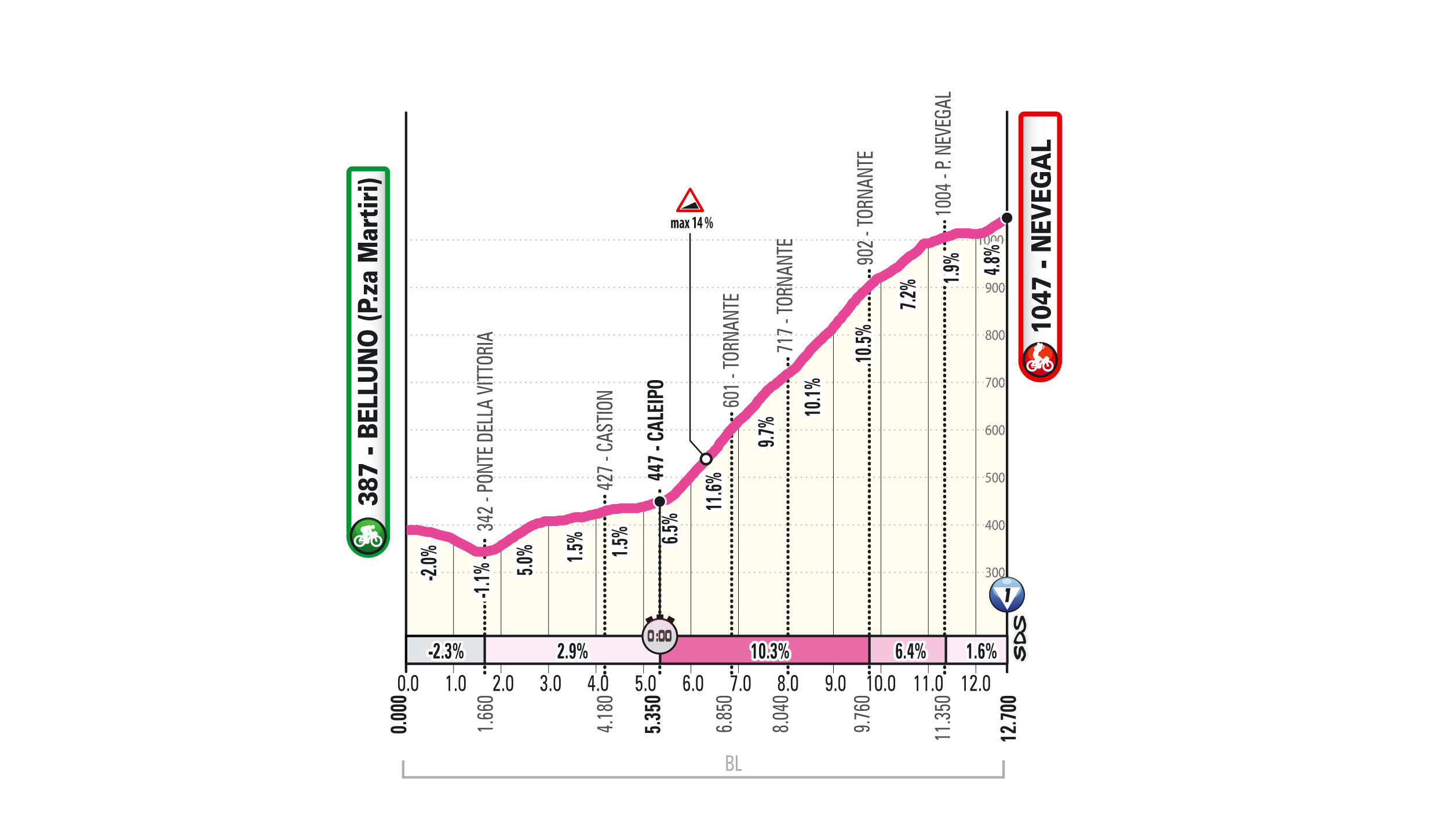
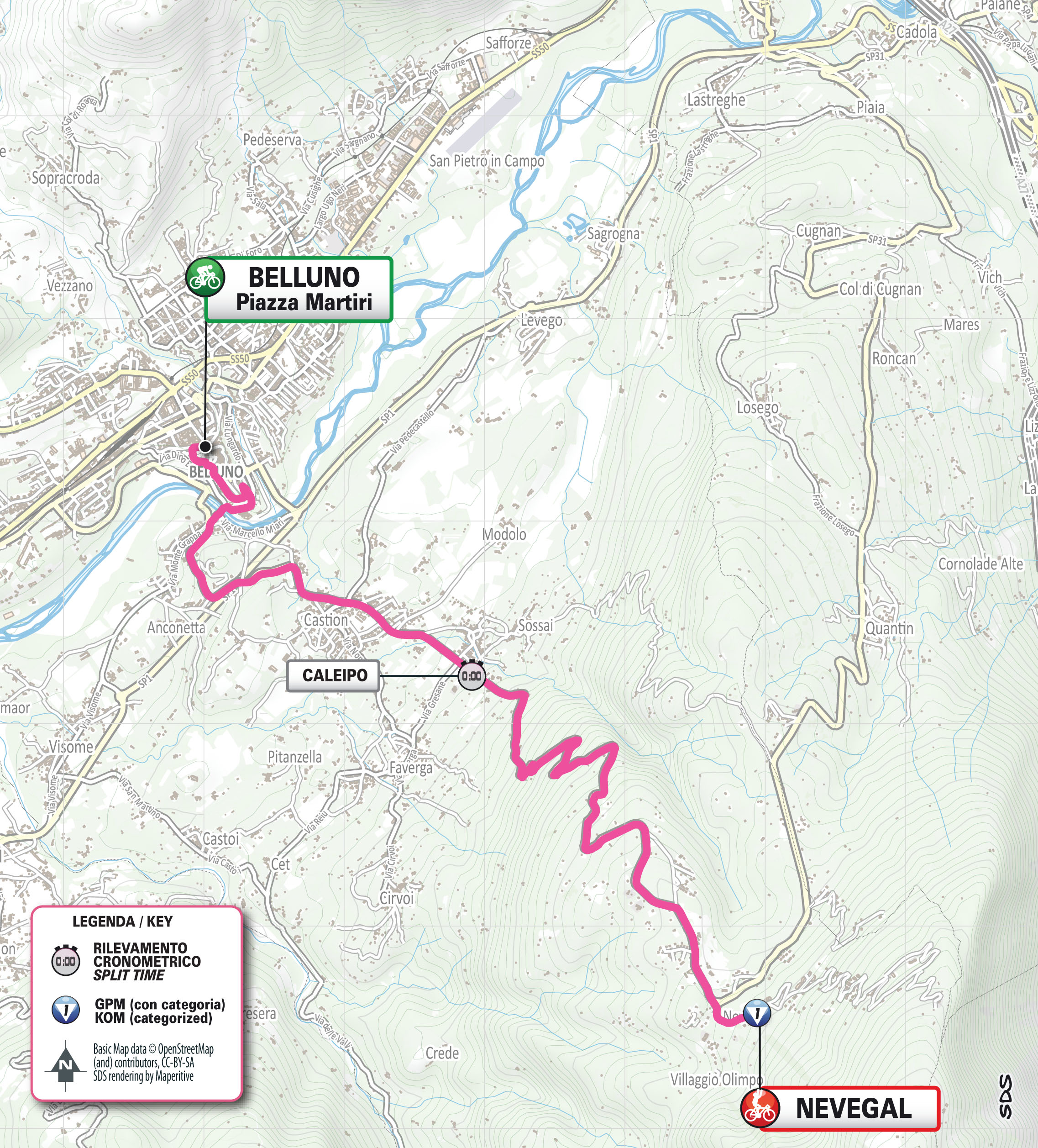
Stage 4: Belluno–Nevegal Tudor ITT, 12.7 km
Stage 4 presents a short, explosive mountain time trial. “A short descent leads out of Belluno, followed by a climb in three parts: about 3 km at 3% to the Caleipo intermediate split, then 4 km at over 10% with ramps up to 14%, and finally a less demanding 2 km section where full effort will be required to set a fast time,” organisers said. The route mirrors the 2011 Giro stage won by Alberto Contador.
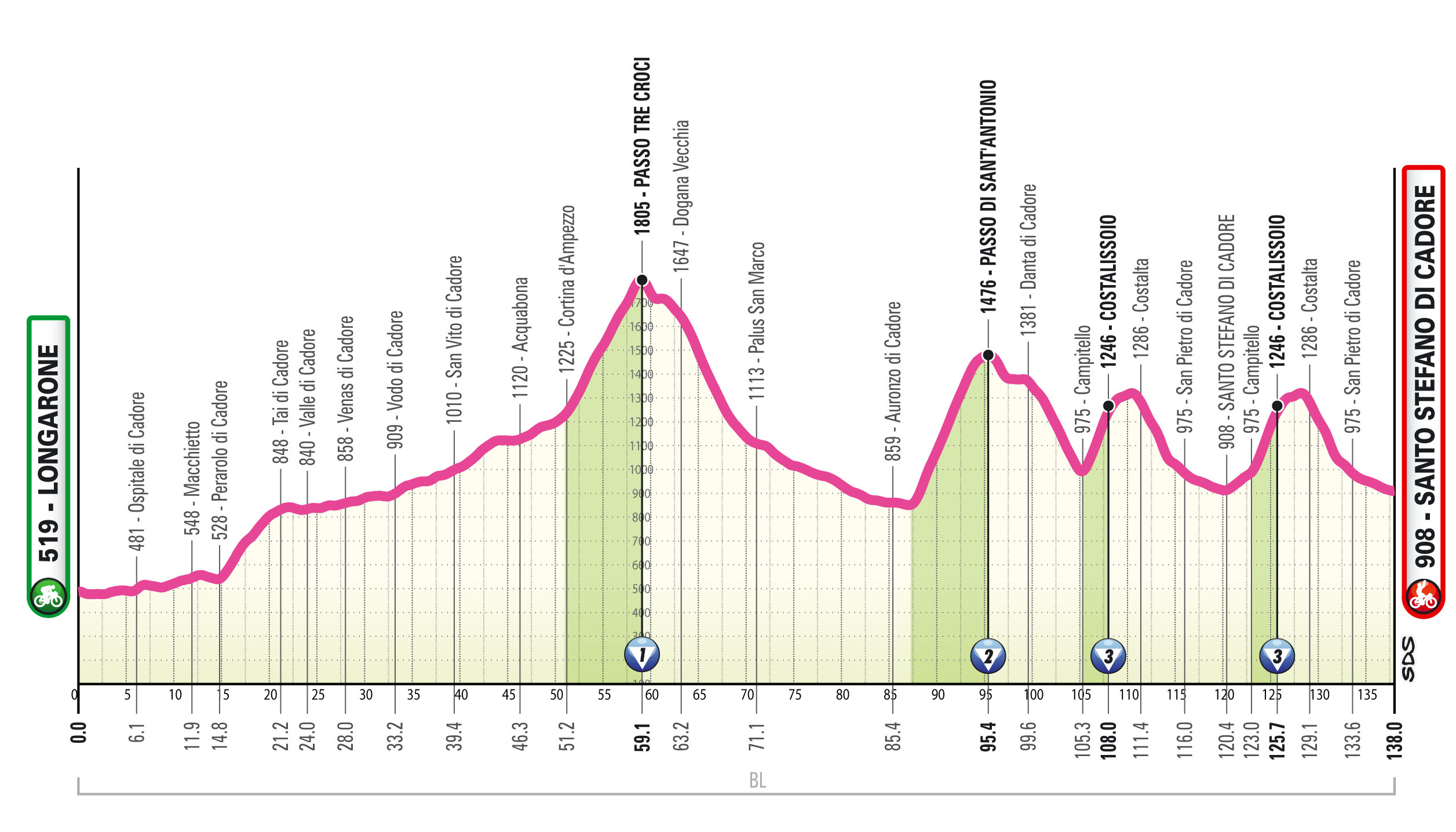
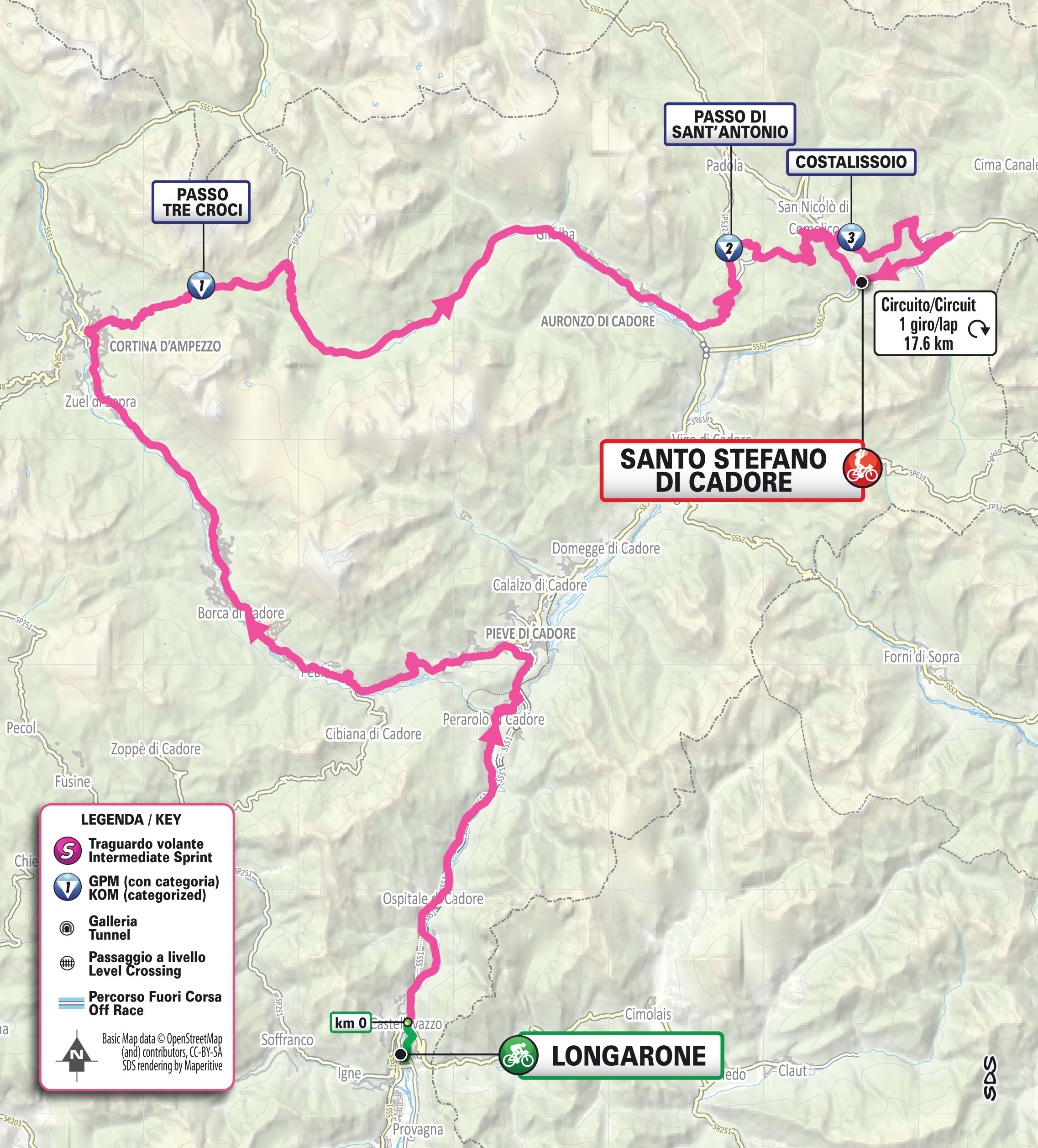
Stage 5: Longarone–Santo Stefano di Cadore, 138 km
Stage 5 takes riders into the Dolomites with four categorized climbs and no real recovery sections. “From Longarone the route climbs gently through the Piave Valley and the Boite Valley towards Cortina d’Ampezzo, then tackles the tough Passo Tre Croci and Passo di Sant’Antonio, which leads into the final circuit. Riders will climb Costalissoio, descend and pass under the finish line before climbing Costalissoio again to reach the finish,” organisers explained.
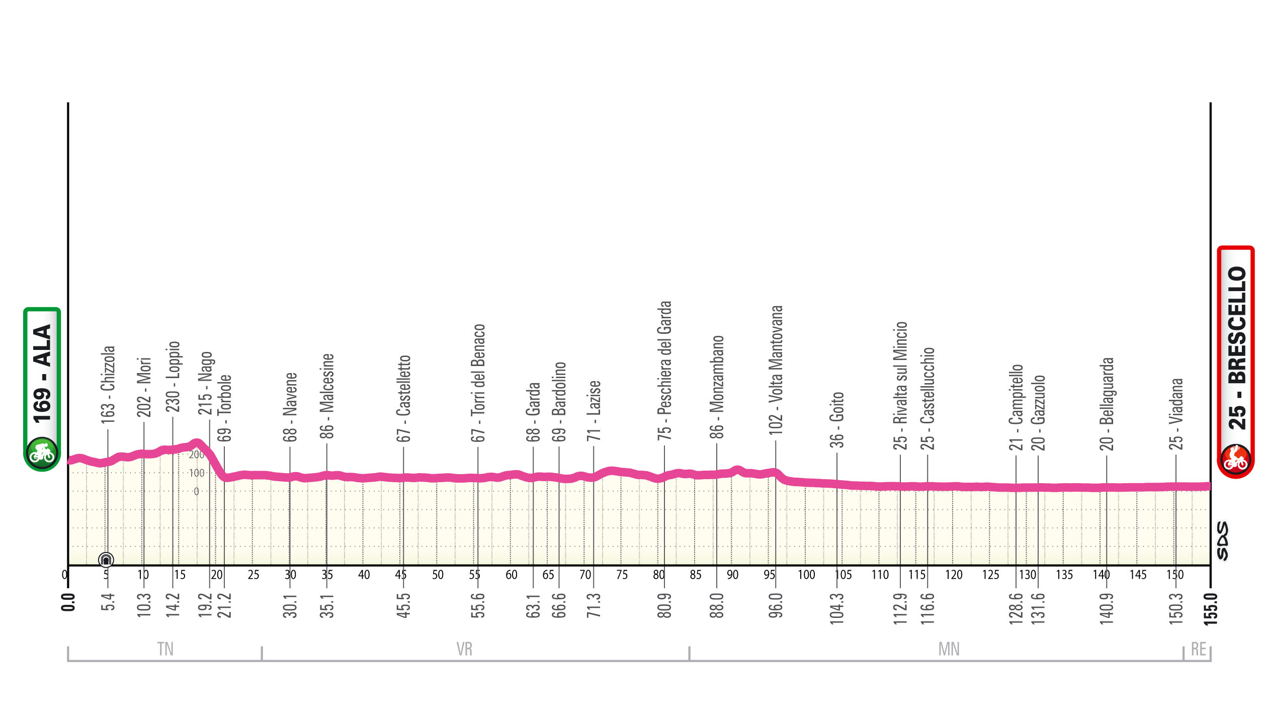
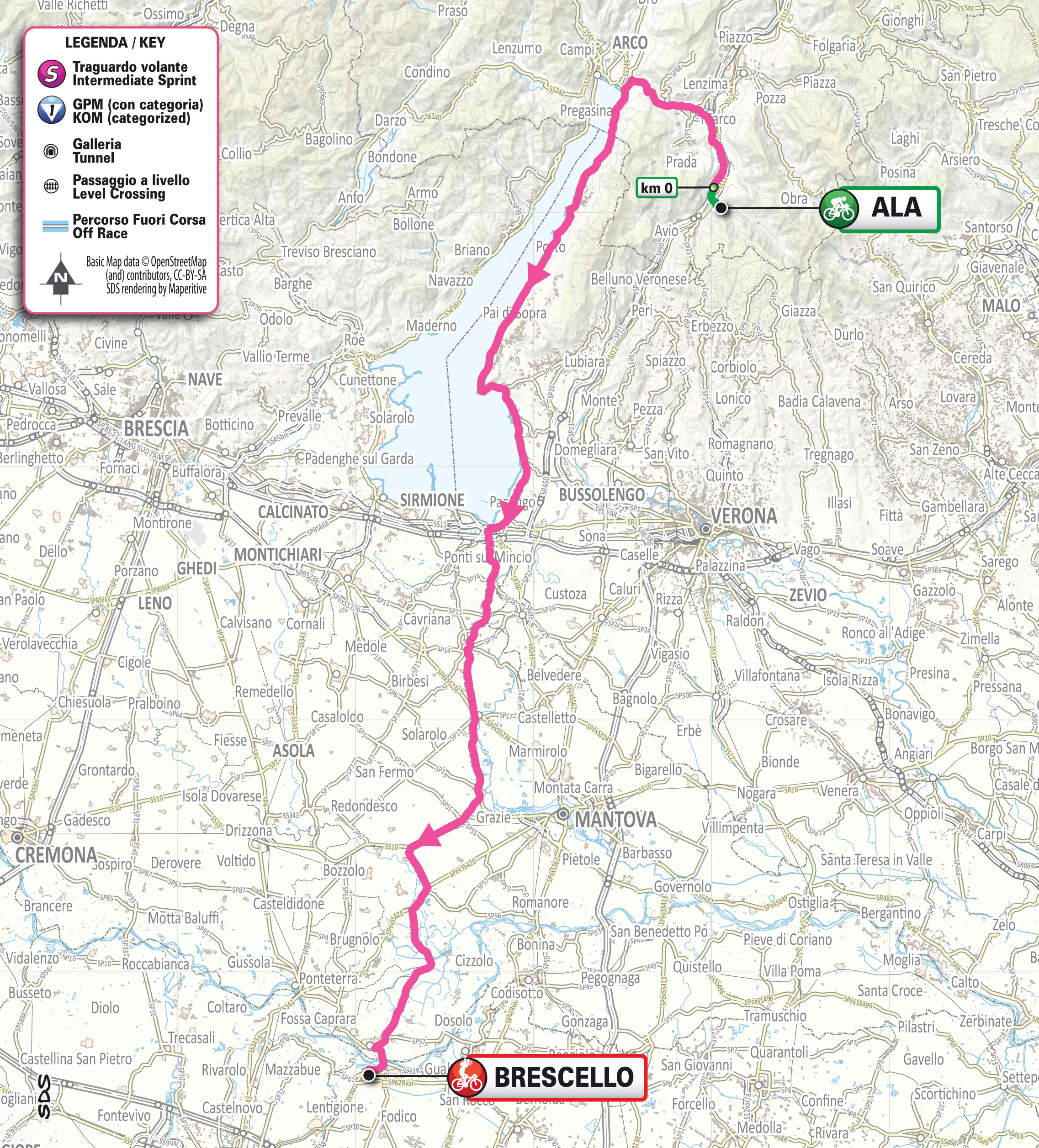
Stage 6: Ala–Brescello, 155 km
Stage 6 is likely to end in a bunch sprint. Riders will traverse the flat or slightly downhill section between the Adige River and Lake Garda, then cross the Verona and Mantua plains before crossing the Po shortly before the finish.
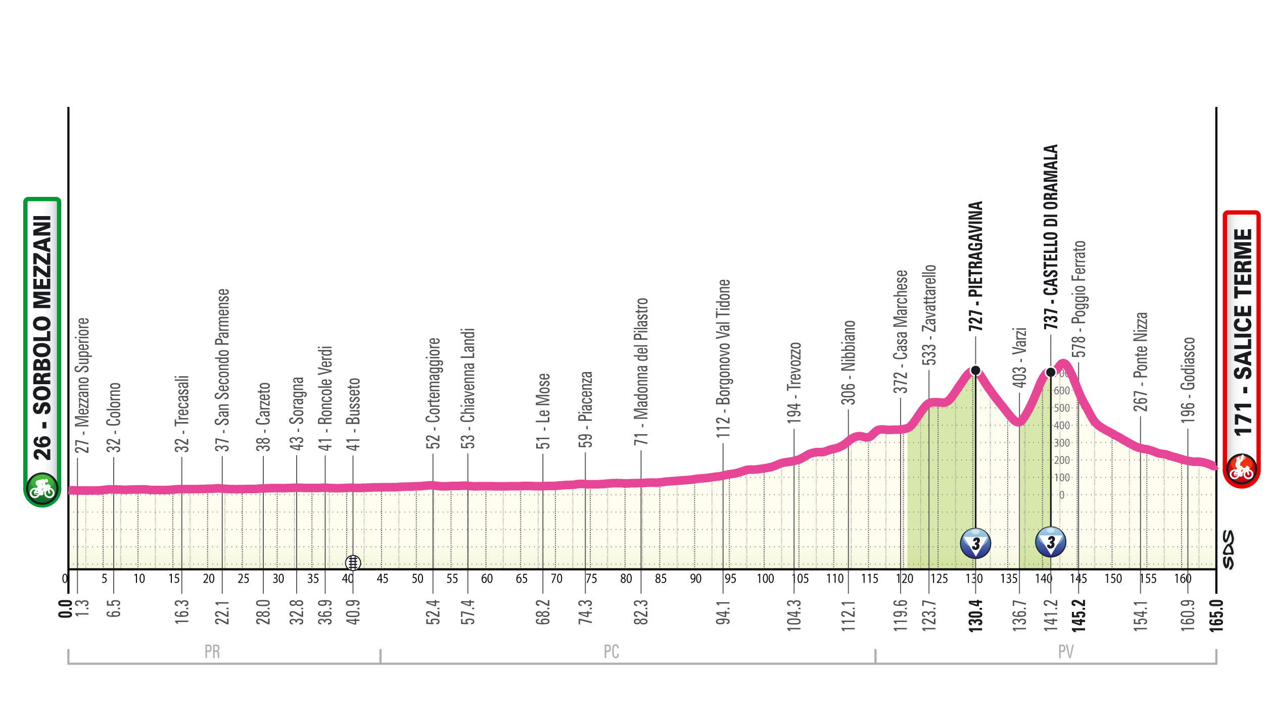
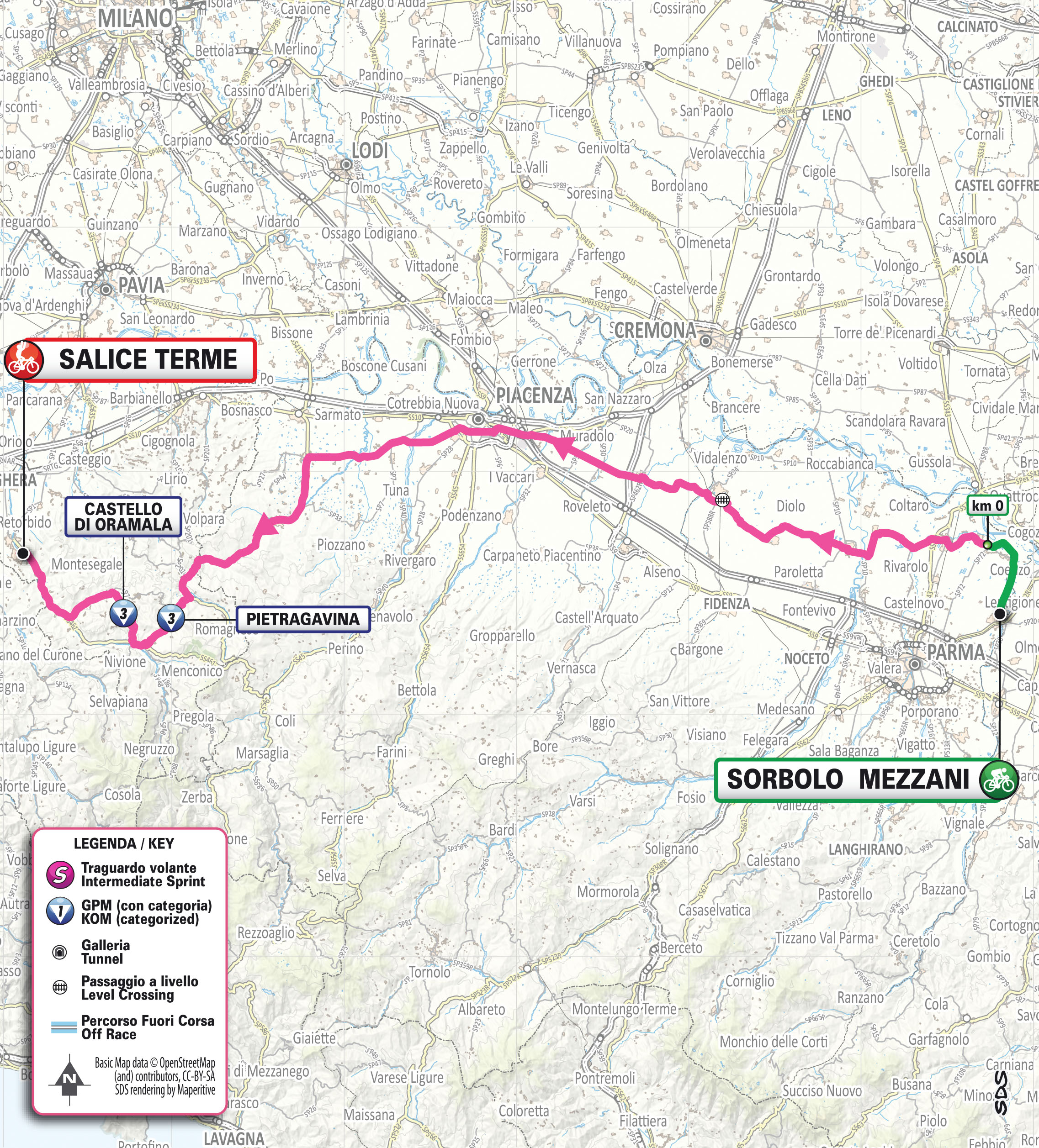
Stage 7: Sorbolo Mezzani–Salice Terme, 165 km
The longest stage of the Giro covers 165 km. Riders face a flat route up to Val Tidone, then tackle two short but steep climbs: Pietragavina and Castello di Oramala.
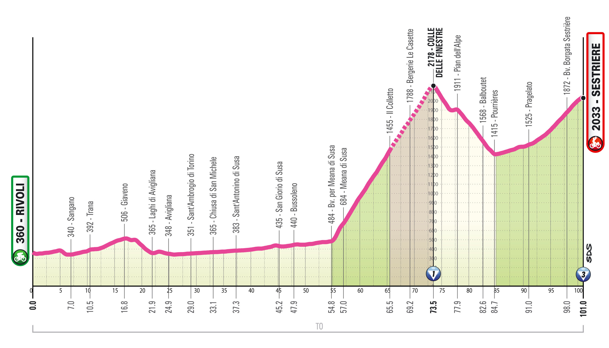
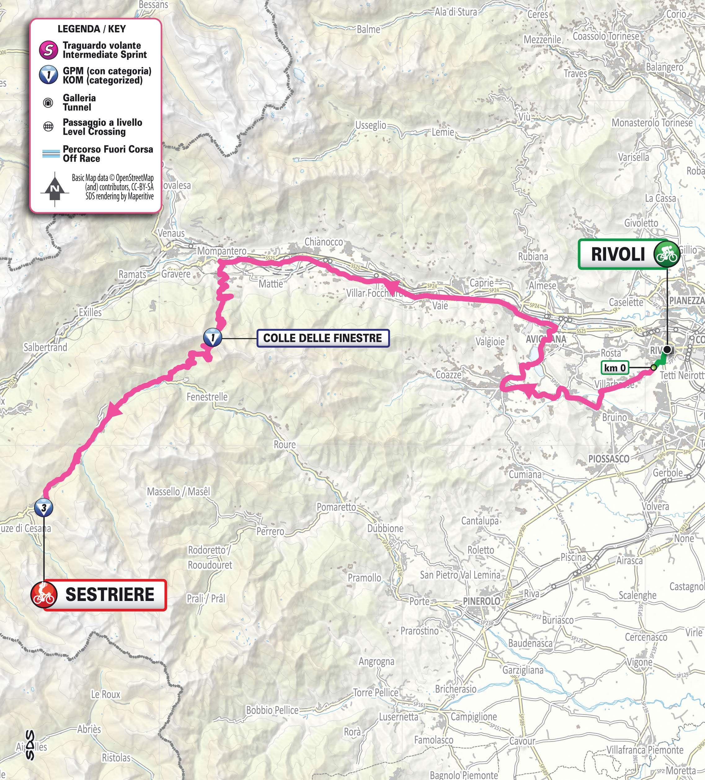
Stage 8: Rivoli–Sestriere, 101 km
The Queen Stage challenges riders with the Colle delle Finestre and the Colle del Sestriere. “The first 50 km are flat before the ascent: 18 km, half paved and half gravel, averaging around 9% with ramps up to 14% in the opening kilometres. A challenging descent follows, then the final climb, where all available power will be needed to make the difference,” organisers said.
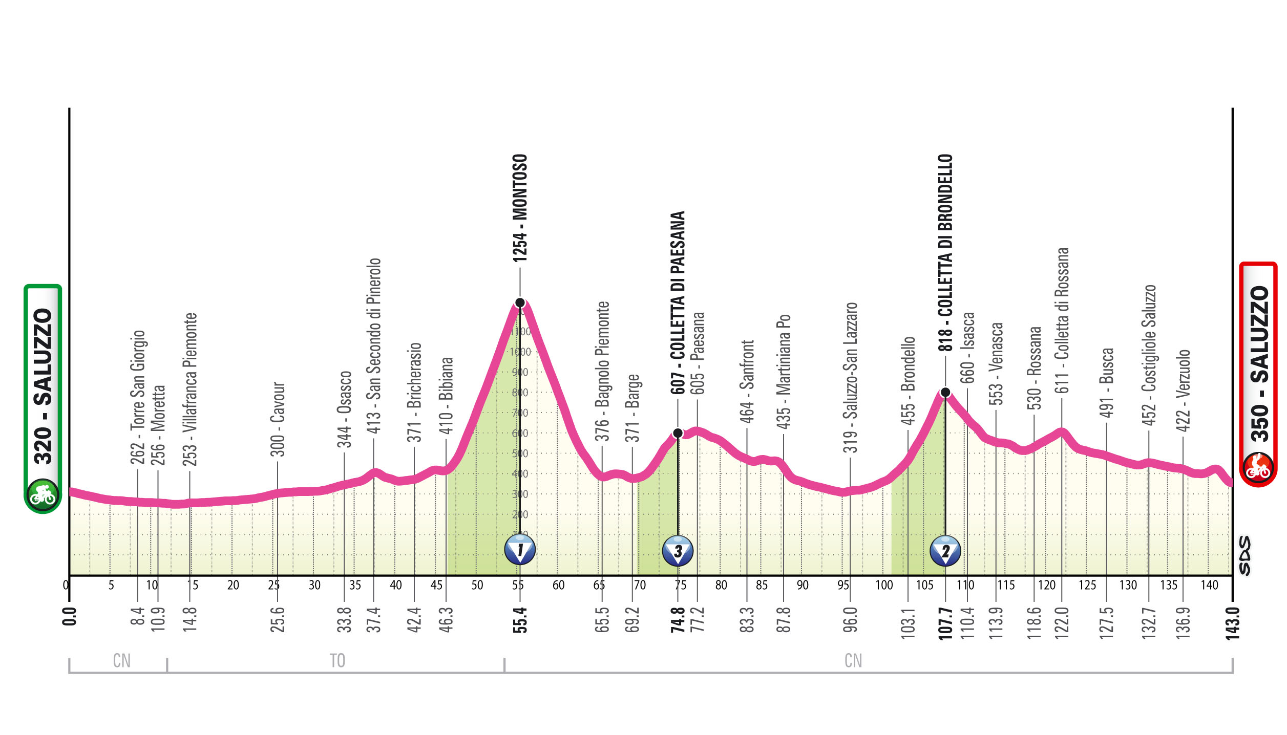
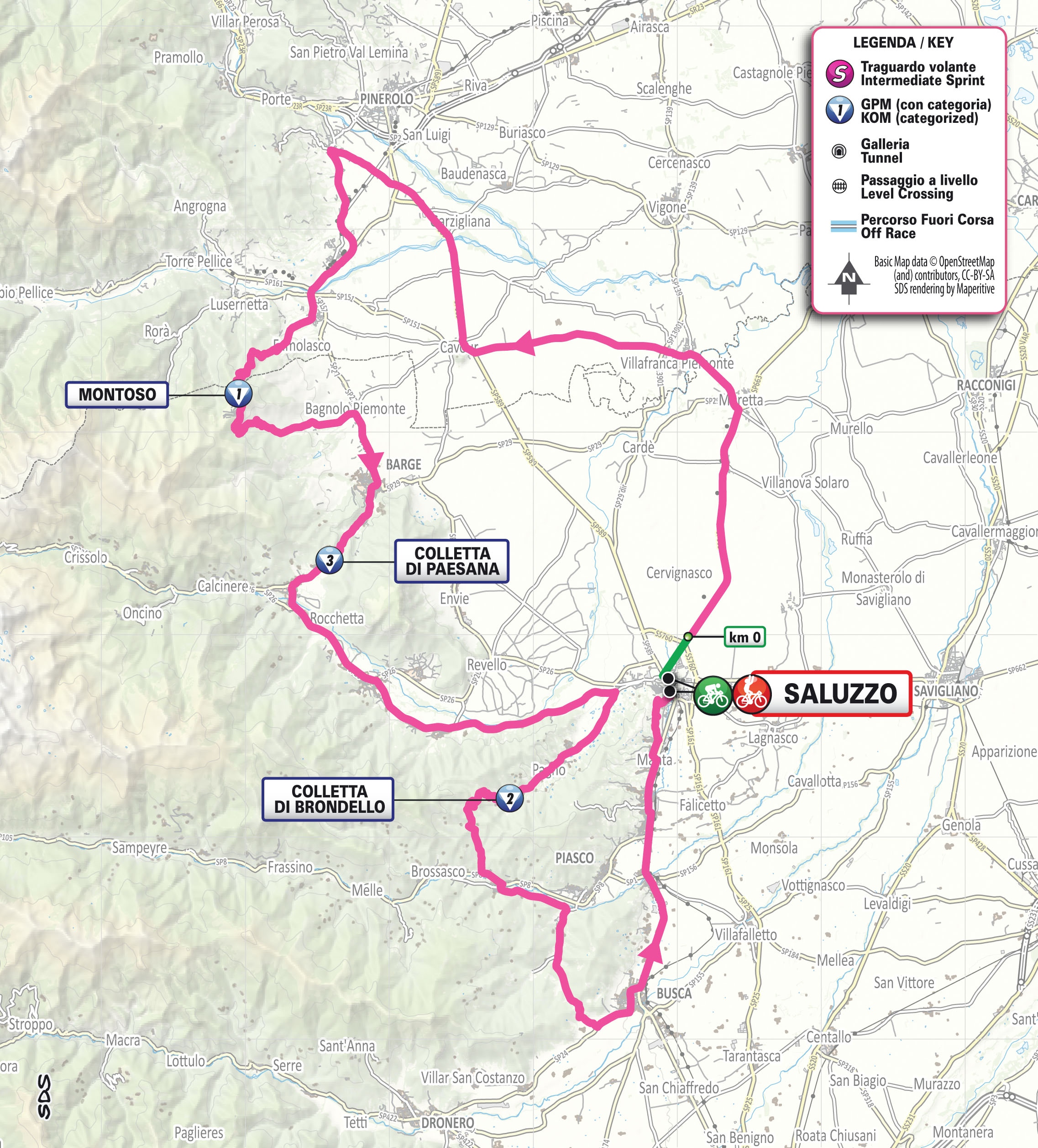
Stage 9: Saluzzo–Saluzzo, 143 km
The Giro concludes with a rolling stage. “The central section features three climbs in quick succession: Montoso, Colletta di Paesana and Colletta di Brondello. The finale is slightly downhill,” organisers noted.
#GirodItaliaWomen