
By Brian Berlin — Bike adventurers could experience rides of a lifetime this summer exploring a route that few have ridden and even fewer know about.
The 6,800-mile ADT passes through 15 states, 325+ communities, near the homes of 40 million people, seven capitals, through wilderness areas, state and national parks, from Point Reyes, California, to Cape Henlopen State Park in Delaware. If you’ve biked or hiked trails in one of these states, you might have been on the ADT and not known it.
On July 4, 2026, cyclists and hikers will kick off a cross-country relay that will traverse the American Discovery Trail (ADT) to celebrate our country’s 250th birthday. American Discovery 250 Relay supporters will carry batons containing a scroll of the Declaration of Independence inside. Several batons will bear engravings of the words “Life, Liberty, and the Pursuit of Happiness.”
The folks behind the ADT want to change that anonymity, and the American Discovery 250 Relay is intended to do just that.
“There are people who are biking many sections of it, but they are thinking that they’re biking on the Katy Trail,” said Eric Howard, Executive Director of the American Discovery Trail Society.
“Or they’re thinking they’re biking on the Chesapeake and Ohio Canal, or some other rail-trail. But they’re also on the American Discovery Trail. One of our challenges that we’re working on is making sure that people are aware that if they’re going on this trail, that they’re also on the Discovery Trail.” Putting up signage along the trail falls to the State Coordinators.
The relay begins July 1, 2026, from the western trailhead at Point Reyes, California, and will cross the Golden Gate Bridge in San Francisco July 4. The relay will end at Cape Henlopen State Park in Delaware on Thanksgiving, bookending traditional American holidays.
Given the number of days, weeks, and months allotted, hikers alone cannot complete the Relay.
“We’ve got to average about 40 miles a day,” Howard explained. “And you can’t do 40 miles on foot every day.”
The ADT is open to anyone: hikers, bikers, horseback riders, as well as a “wide variety of users who live near the route and benefit from the convenient location.” You can hike the entire trail. Ride horseback on certain segments and bike over most segments. Participation is free. Information about the trail and the Relay can be found at discoverytrail.org.
Origins of the American Discovery Trail
The history of the American Discovery Trail begins in 1980–81 when the American Hiking Society (AHS) organized a cross-country hike called HikaNation. Jim Kern, William Kemsley, Jr., Paul Pritchard, Glenn Seaborg, and others, all hikers and backpackers, organized the hiking adventure from Golden Gate Park in San Francisco to Cape Henlopen, in Delaware. The hike took 14 months and covered 4,286 miles.
In 1990, Ellen Dudley and Eric Seaborg hiked and biked the ADT to scout the route and memorialized their adventure in the book American Discoveries: Scouting the First Coast-to-Coast Recreational Trail.
“They stopped at various places along the way,” Howard added, “including the Oval Office in the White House and had an excellent adventure, and as a result of their adventure, not only did they write a book, they got married.”
AHS hired a national coordinator in 1991 to work with state coordinators to maintain and refine the trail. The American Discovery Trail Society formed five years later to steward the ADT.
Western Region ADT
This article will focus on the Western Region of the ADT, which spans California, Nevada, Utah, and Colorado. I wanted to highlight bikeable sections of the Western Region, so I met with the State Coordinators from each of these states to gain insight into the routes in their respective areas.
These State Coordinators were extremely helpful in “virtually” scouting the bikeable Relay routes they haven’t personally ridden. In the process, they introduced me to the concept of Bike Alternate routes, which go around areas where bikes aren’t allowed.
California
The California segment begins at Limantour Beach on the Pacific Coast July 1 and finishes at the Tahoe Rim Trail on the California-Nevada border July 14.
Cyclists can join the relay July 4 on the Marin County side of the Golden Gate for a short ride across the bridge, then ride along the Embarcadero to the Ferry Building. However, organizers expect a lot of hikers. John Mercurio, California ADT State Coordinator, cautioned that cyclists would have to ride at walking pace or push ahead.
“If you had a cohort that was interested in riding on July 4,” he emailed me, “I’d also be open to trying to coordinate with you on a special arrangement.”
For instance, the walkers will begin at 8 a.m. on July 4, but if cyclists departed at 10 a.m., they could easily roll into Pier 39 at 11 a.m. at the same time as the walkers, for the kick-off celebration. Perhaps a better bicycling strategy is to join the relay as it leaves the Bay Area, according to Mercurio.
“The Bay Area is unusual for the relay,” John continued. “In most places, cyclists are the favored group, because of the amount of miles we need to cover, and the flat terrain involved. In the Bay, though, distances favor walkers, and many of the trails are bike-restricted. July 8 is the day we really need the cyclists to turn out, getting us through the Delta.”
July 8 is a 70-mile jaunt in Contra Costa County starting at the Contra Loma Regional Park and following walking/biking trails and city streets to Sacramento. Expect hot weather as you approach Sacramento. You will also get to experience the Del Rio Trail, a new rail-trail that parallels Freeport Blvd. Riders can take any type of bike on this section — road, gravel, and touring, for instance.
John Mercurio said the Del Rio is a new addition to the ADT route.
“We just took it (the route) off the street and onto that trail, and I’ve been on it, and it’s beautiful. It’s a really good improvement that we just made.”
One note of caution: cyclists and pedestrians have called out the Antioch Bridge crossing as not for the faint of heart. It’s 13 stories high, there’s very little shoulder, and tons of traffic. Some have opted to Uber it or get a support ride.
From July 10 through July 14, the relay leaves Sacramento and climbs toward the eastern trailhead near Tahoe City. On July 11, cyclists can follow the paved Jedediah Smith Memorial Trail along the American River and into Folsom Lake State Recreation Area as far as Beek’s Bight. Beyond that point, the relay route does not permit bicycles.
On July 14, the relay departs Lewis Campground for Tahoe City, with portions of the route following the Tahoe Rim Trail, a favorite among mountain bikers. Riders should note, however, that the Desolation, Granite Chief, and Mount Rose wilderness areas prohibit bicycles, as does the 50-mile stretch of the Tahoe Rim Trail that overlaps with the Pacific Crest Trail, from Meiss Meadow to Twin Peaks.
If you’re not a mountain biker, consider joining the Relay at the Truckee River Bike Trail and pedaling into Tahoe City.
Where the ADT Relay follows established bike paths, riders of all types can participate. Other sections, like Auburn to Tahoe City, offer some mountain biking surfaces, but the ADT hasn’t officially scouted the off-road parts for rideability.
“I’ve been struggling with how to create a bicycle route (on the ADT) all the way across California,” Mercurio told me. “And so, the biggest and most challenging gap is basically from Auburn to the Nevada line.” Bike adventurers take note.
Nevada
The Nevada Relay segment starts on July 15 in Tahoe City, California, and finishes in Baker, Nevada, July 29.
“There are sections (where) we have created bike alternate routes,” said Samantha Szesciorka, Nevada State Coordinator. “So, we went ahead and laid out alternate routes specifically with bikes in mind. Can you do the entire trail on a bike? Yes. Will you love every mile of it? No. There are sections that are very difficult on a bicycle.”
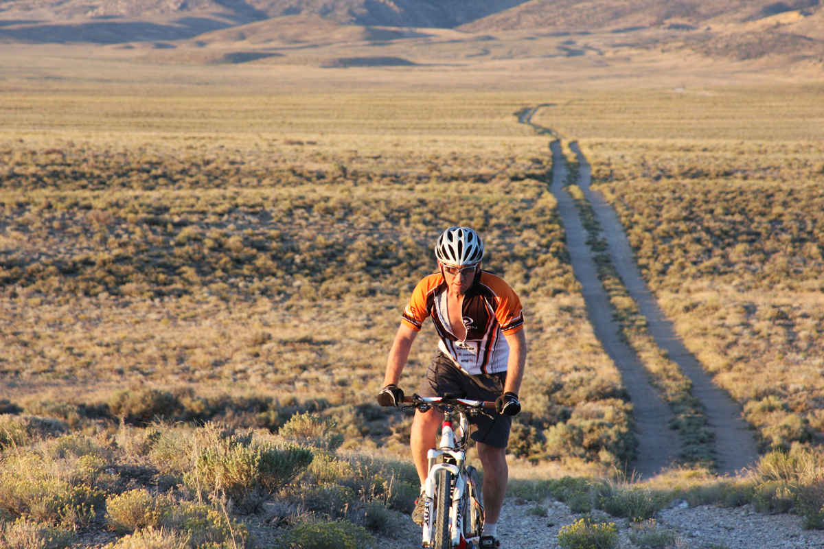
Trevor Oxborrow and his dad Tom rode the Nevada ADT on bikes in 2001. They also organized the Comstock Epic bikepacking race, which follows the ADT bicycle route. Tom Oxborrow preceded Samantha as Nevada State Coordinator and has worked with Samantha on the bike alternate routes.
Trevor shared his firsthand knowledge of the route via text. “I am partial to the east side of the state,” he wrote. “Baker to Lund is a fantastic adventure.”
The relay route runs west to east, so I asked him about the route in that direction and mentioned that the last segment covers Cave Lake to Baker.
“West-to-east, from Cave Lake State Park to Baker, is spectacular!” he texted. “Pavement ends just past the Cave Lake State Park boat ramp and dock, a gradual dirt road climb begins through Aspens, getting steeper as you switchback up to Cooper Summit where you are greeted with a spectacular view across Spring Valley of 13,000+ Wheeler Peak.”
The rest of the route to Baker includes chunky gravel, soft dirt that may force hike-a-bike, and paved highway the rest of the way to Baker.
Trevor urges preparedness. “For most cyclists, following the ADT through Nevada is very difficult. Route conditions, minimal water and food resupply typically necessitate a support vehicle.”
And it is going to be hot this time of year.
“The issue with the whole route is the lack of shade,” he texted me. “Most of the route is Sagebrush with minimal trees to protect a rider from the sun.”
He urges riders to bring their own support vehicle and driver. The second choice is to pre-position water caches and pre-confirm on-route natural water sources.
He added that heading east from Berlin-Ichthyosaur State Park (scheduled for July 22), all the valleys remain near or above 6,000 feet and rarely see temps above 100 degrees F, even in July and August.
Trevor recommends a mountain bike, either hardtail or full suspension. He prefers a hardtail to save on weight.
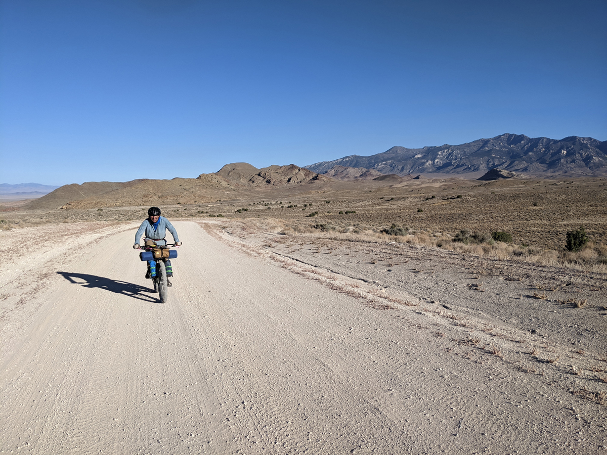
Despite the challenges, Kurstin Graham (https://bikepackingnv.blog/about/) thinks bicycling in Nevada is underrated, “You know, interestingly, for so many major trails that we have in the U.S. Nevada gets skipped.”
Kurstin is a Carson City-based bikepacker who has curated bikepacking routes in Northern Nevada and submitted them to Bikepacking Roots.
“And that’s always been a chip on my shoulder,” he continued, “a struggle that I have, because I am 100% Nevada. I love Nevada. I think we have so much to offer. I think we’re overlooked.”
“One thing unique about Nevada is the number of mountain ranges that we have,” Kurstin continued. “And our mountain ranges, for the most part, run north-south. So, when you’re looking east, you were looking at layers upon layers, you know, essentially just a corrugation of the Earth’s crust.”
Three long-distance bikeable sections appear on the calendar: July 20, Highway 95 at Fallon to Berlin, 105.8 miles; July 23, Big Smokey Valley to Martin Ranch, 87.6 miles; and July 26, Red Rock Summit to Preston, 81.7 miles.
Utah
The Utah ADT Relay segment begins in Baker, Nevada, July 31, and finishes in Moab, Utah, August 17.
Bob Palin, Utah ADT Coordinator, commented about the bikeable sections across the state during the Relay, “Well, yes, you can ride a bike. You can ride a bike the entire way using bike alternates.”
Two bike alternate Relay routes run along the Utah ADT: Beaver to Circleville, and Hell’s Backbone Road in the Dixie National Forest to Sandy Point.
The Beaver to Circleville bike alternate route leaves the main route and heads ESE through mountainous terrain.
The second bike alternate route heads south from the main trail and follows Highway 154, which Bob highlighted, “That’s a really great ride. It’s a good gravel road.”
There’s an overnight stop in Boulder.
“It’s actually a lot like Boulder, Colorado,” Bob pointed out. “(Only) much smaller, but the same vibe.” The “vibe” includes an annual visit by Zen Monks and a top-notch restaurant called Hell’s Backbone Grill and Farm.
Bob also noted that this bike alternate includes Boulder Mountain, the largest forested flat-top mountain in the U.S., 50,000 acres, all above 11,000 feet.
Heading ESE from Boulder, cyclists would enjoy a drop into a narrow canyon with tall red cliffs on both sides.
“(The route) goes for, like, 10 miles, and then opens up into a fantastic view of Capitol Reef and the Henry Mountains.”
Cyclists will encounter two notable viewpoints along this route.
“Overlook No. 2 is the one with big views of Capitol Reef and the Henry Mountains,” explained Bob. “Singing Canyon is like a slot canyon, and it has perfect acoustics… [There is] a little chamber orchestra that plays there once a year as well.”
Before turning north towards Capitol Reef, cyclists will ride the Burr Trail Road switchbacks that Bob raves about.
“They’re amazing, they’re absolutely incredible.”
Then comes a long road north to Capitol Reef National Park where the bike alternate route rejoins the main ADT relay trail.
“You’re riding along one side of the fold,” Bob explained, “and it’s called the Strike Valley. The Strike is the steep side of the fold, so you’re looking at these vertical cliffs all the way along there.”
Bob admits there are some daunting areas along the Utah ADT, which should appeal to bike adventurers seeking a challenge.
“You’re going to see every kind of scenery you can imagine,” he said. “The western part is really quite brutal. It goes through a place called the Wah Wah Valley, where the wind blows, it’s 110 degrees all the time, and the sand blows. But there’s some interesting geology out there to make up for it.”
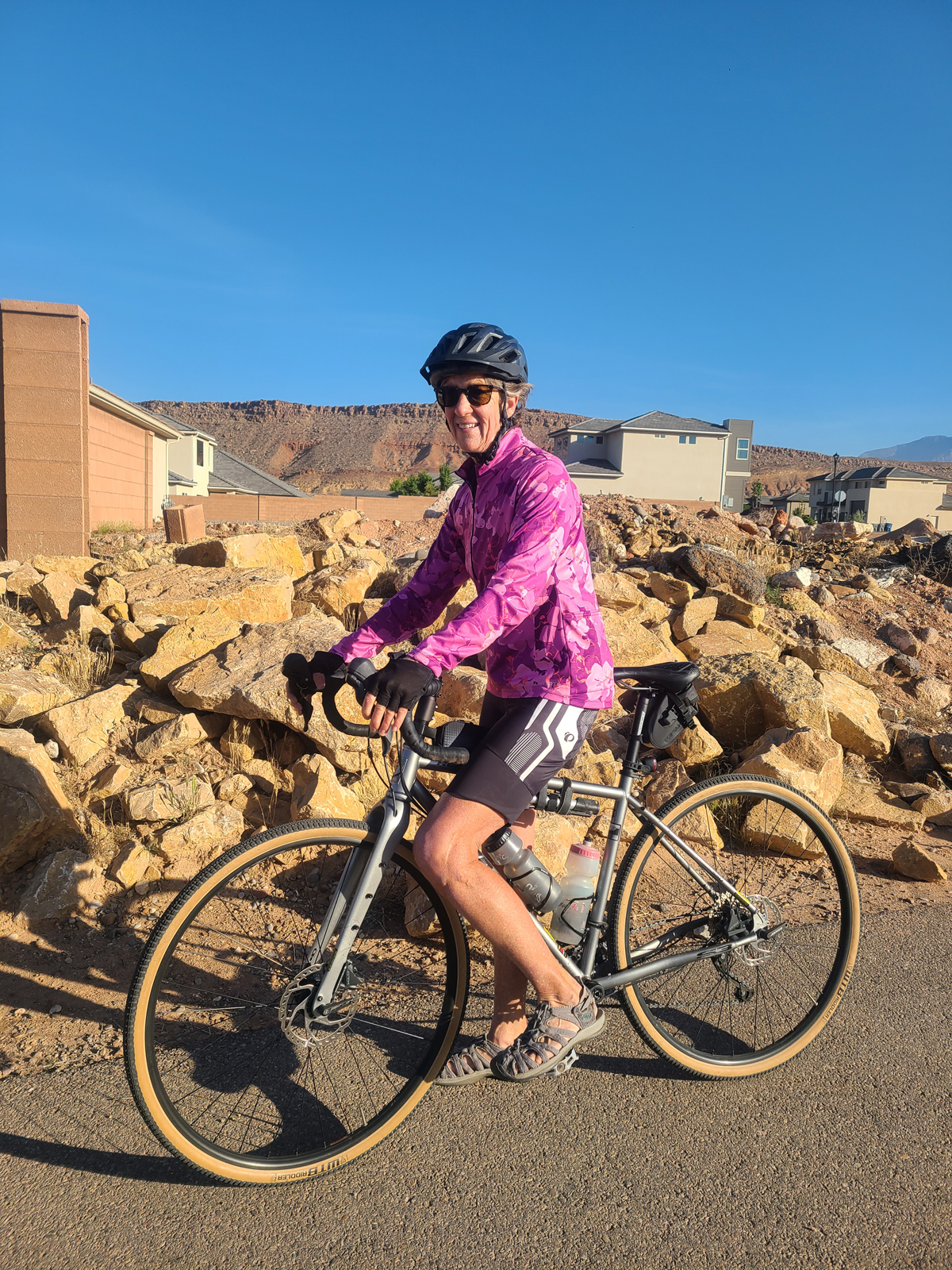
Janet Borg is a Utah cyclist and randonneur who has ridden the LoToJa, a 200+ mile, grueling race over three mountain passes from Logan, Utah, to Jackson, Wyoming.
She plans to ride the first Utah relay segment from Baker, Nevada, to Wah Wah Ranch, 73 miles, along the route that Bob Palin pointed out is very challenging. Interestingly, Bob Palin urged Janet to do the ride.
“So, he probably didn’t tell you, but he’s my husband,” Janet explained. “And it truly is phenomenal what he’s done to help promote the ADT in Utah and across the country. He’s been fabulous, and he’s so excited. I mean, you know, when you meet someone who’s so passionate about something and loves it so much, it’s hard not to get involved. So, he convinced me that I should ride this section.”
Cyclists should prepare for temperatures in the nineties, especially through Western Utah at this time of year. Janet Borg plans to start her ride at 4:00 a.m. for this reason. Bob Palin wrote me that every group of cyclists will carry an ADTS inReach Mini2. If there is phone service, riders can contact both Bob and Dave Whitson, Relay Coordinator, on their phones.
“Wherever I can, I will meet riders several times during the stage with supplies,” he wrote. “My trailer can carry 3 bikes in case somebody needs SAG help. We absolutely will not leave anybody stranded out there!”
“The temperature across Utah is pretty much directly related to altitude,” Bob added. “Each mountain range is cooler and each valley hotter.”
The average temperature during the day in Moab in Eastern Utah can reach the nineties. “Once you get down off the La Sal range in the east (northeast of Moab) it gets very hot on the Kokopelli,” Bob advised.
“The hottest place on the ADT in Utah is right at Lake Powell (Hite Bridge),” he continued. “It was 113 degrees Fahrenheit when I drove over the bridge a couple of years ago, but that was a particularly hot spell. I already have two riders for that part who will be on street bikes and starting early in the morning. I might ride with them, as it is all downhill.”
Bob recommends a mountain bike for the Utah ADT. He points out that the Wah Wah section that Janet Borg is riding on a gravel setup is mostly flat gravel. Most dirt roads are either sandy or rocky with climbs, though the route has few technical parts. Still, a mountain bike seems to be the best choice.
Colorado
The Colorado ADT Relay starts at Dewey Bridge, Utah, August 18, and reaches Sheridan, Colorado, September 3, where it splits into North and South routes. One baton travels on the Colorado North segment that ends near Julesburg on the Nebraska border, September 13. The other baton heads south to Lamar September 14. The split routes rejoin in Cincinnati, Ohio, in the fall.
You can bike a lot of the Colorado ADT, with a few exceptions noted Steve Hill, the State Coordinator.
“When you get into Grand Junction off the Kokopelli’s Trail,” Steve pointed out, “you have the Colorado National Monument right there, so the ADT does follow the trails through the monument. Now, the monument does not allow bikes on those trails, so cyclists have to ride the road through the monument.”
Farther east, the ADT passes near Camp Hale–Continental Divide National Monument, established in 2022 and associated with the World War II training grounds of the 10th Mountain Division.
“The Continental Divide National Monument was a new monument that President Biden signed into law just before he left office,” Steve told me. “So that’s a really cool place, because you’ve got the Camp Hale area that was World War II, training the soldiers, and up on Tennessee Pass, they also have a memorial to the Camp Hale soldiers as well.”
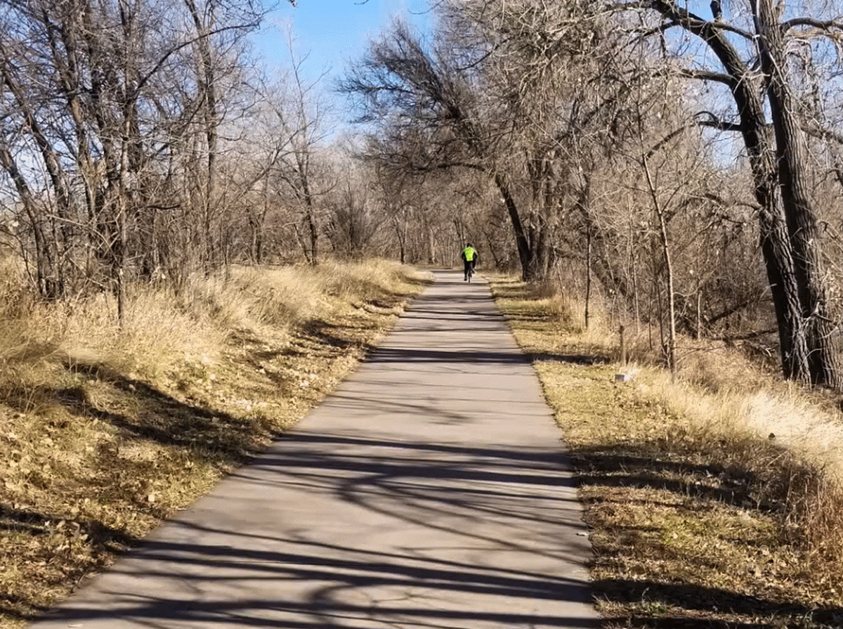
The Colorado North segment follows the paved South Platte River Trail up to East 136th Avenue, then picks up Riverdale Road. Surfaces look mostly paved on RidewithGPS, with a few unpaved county roads mixed in, fine for gravel or mountain bike. The grade is gradual, starting at 3,500 feet and reaching about 4,500 feet.
There’s a right turn at Greeley and you can pedal east to Fort Morgan where the road heads northeast to Sterling and near the border at Julesburg. This section looks totally bikeable on a gravel or mountain bike.
“Yes, it is, because it’s either gravel, dirt, or paved road,” confirmed Steve Hill. “As soon as you get off the 26-mile South Platte River Trail, the rest is all roadway going to Julesburg.”
The Colorado South segment leaves Sheridan with batons heading south and follows the Mary Carter Greenway Trail through Littleton. Travelers then pass through Chatfield State Park, through the Denver Audubon Park, and then follow the Colorado Trail, favored by mountain bikers and hikers, in Waterton Canyon for six miles.
Leaving the Colorado Trail, the route winds through Roxborough State Park and then along the Indian Creek Trail through the National Forest. After the National Forest, you’ll encounter the town of Larkspur and pedal through the Frink Creamery Open Space Trail, followed by the Greenland Open Space Trail. Riders should use mountain bikes on these mostly dirt surfaces.
You’ll continue through Palmer Lake, by the Monument on the New Santa Fe Trail, and then by the U.S. Air Force Academy up to the point where it merges with the Pikes Peak Greenway Trail.
The next stretch is notable for the Garden of the Gods, which attracts over a million visitors per year. Halfway down the Pikes Peak Greenway, the trail connects with Sinton Trail heading west. After Sinton Trail, you will enter Garden of the Gods from the Foothills Trail.
From the Garden of the Gods, participants enter the town of Manitou Springs, then head up Ute Pass through Green Mountain Falls to Woodland Park, which follows US 24 to US 67 and heads south to Cripple Creek. Ute Pass follows US 24 and is rideable on street, gravel, or mountain bike.
Shelf Road requires a mountain bike on the winding dirt road through a canyon that then becomes a paved highway from Cripple Creek to Cañon City. The route then follows the Arkansas River Corridor through Lake Pueblo State Park, all paved, and the city of Pueblo. From there the route is bikeable roadway through southeastern Colorado, ending in Lamar.
The Colorado ADT segment passes through two National Monuments, four state parks, five city parks, and 62 cities and towns. The highest point is Argentine Pass, 13,182 feet.
Notably, halfway through the state, you connect with the Colorado Trail/Continental Divide Trail after leaving Lake Ann Pass Trail, which you can mountain bike for 116 miles, minus two bike alternate routes around the Collegiate Peaks and Holy Cross wilderness areas.
According to the relay schedule, four 60+-mile rides suit cyclists: Dewey Bridge to Fruita, 75.7 miles; Trickle Park to Redstone, 73.6 miles; Englewood to Larkspur, 61.3 miles; Pueblo to La Junta, 78.1 miles.
Participants should expect hot weather crossing into Colorado from Utah. Temperatures can climb into the nineties during August in Grand Junction. Like Utah, temperatures depend on whether you’re biking in the mountains or the plains. As you pedal across Eastern Colorado, either on the North or South section, prepare for heat.
The North section passes through several towns where riders can replenish water and get food. Cyclists on the South segment should carry enough food and water to reach Larkspur, although water may be available at Roxborough and Foxborough Parks.
Something for Every Cyclist
The American Discovery Relay 250 has something for all types of cyclists: those who prefer a paved dedicated bike trail to those who seek challenging gravel routes, switchbacks, and climbs.
Janet Borg, the Utah cyclist, summarized why she’s riding the Relay, and potential bike participants should take note.
“Because it’s more than a new place to ride, and new places to ride feel like an adventure, and it’s fun to be part of a national celebration.”
“It’s also about personal growth and personal reflection,” offered Eric Howard. “And for some people, it’s very much about exercise and achieving a challenge.”
Resources
- Relay information and registration: discoverytrail.org/america-250-relay
- Daily relay schedule and calendar: discoverytrail.org/adt-relay-calendar
- State-by-state route maps: discoverytrail250.org/RelayStateMap.php
- Antioch Bridge crossing information: hikingamerica.com/antioch-bridge-crossing-american-discovery-trail
- GPX route data (free download through 2026): discoverytrailstore.org/collections/adt-data-books
- HikaNation history: hikanation.com
- American Discoveries (Dudley & Seaborg): https://www.amazon.com/American-Discoveries-Coast-Coast-Recreational/dp/0898864372
- Comstock Epic bikepacking race: comstockepic.com
- Camp Hale–Continental Divide National Monument: fs.usda.gov/r02/whiteriver/recreation/camp-hale-continental-divide-national-monument