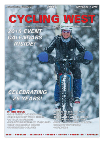
Cycling West and Cycling Utah Magazine’s Winter 2017 Issue is now available as a free download (9mb download), Pick up a copy at your favorite Utah, Idaho, Wyoming, Nevada, Montana, W. Colorado, N. Arizona bike shop or other location!
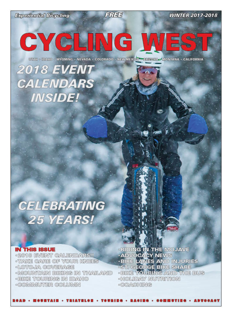
Cycling West Winter 2017-2018 Cover Photo: Niki Tichhauser on the Jolly Green Giants Trail at Grand Targhee Resort in Wyoming on January 21, 2017. Photo by Jeff Buydos, courtesy Grand Targhee Resort.
Contents
Keegan Swenson is Cycling Utah’s Rider of the Year – page – 3
Cycling West and Cycling Utah Celebrate 25 Years! – page – 3
Troy Adair Mixes Public Transit and Biking to Get to Work and to the Trail – page – 4
Book Review: You & A Bike & A Road – page – 6
Take Care of Your Knees for Happy Cycling – page – 7
Southern Accents – page – 8
Preparing Your Bike for Winter – page – 9
New Pathways and Trails Coming to Utah, Idaho, Montana, and Wyoming – page – 10
Book Review: Sue Knaup’s Bike Hunt: A Memoir Tells Stories of Giving Away Bikes – page – 10
Tarantula Ride…And More – page – 11
Mountain Biking in Thailand – page – 16
2018 Sedona Mountain Bike Festival Set for Fun and Trail Fundraising – page – 18
An Ode to Beer – page – 19
Applequist and Stevenson Show ‘Panache’ Winning LoToJa 2017 – page – 20
Push, But Not Too Hard – page – 22
New Regional Bike Friendly Communities Awarded page – 22
Healthy, Happy Holidays: A Nutrition Survival Guide for Endurance Athletes – page – 23
SLCBAC News for Winter 2017 – page – 23
Report: Bike Lanes Reduce Injuries – page – 30
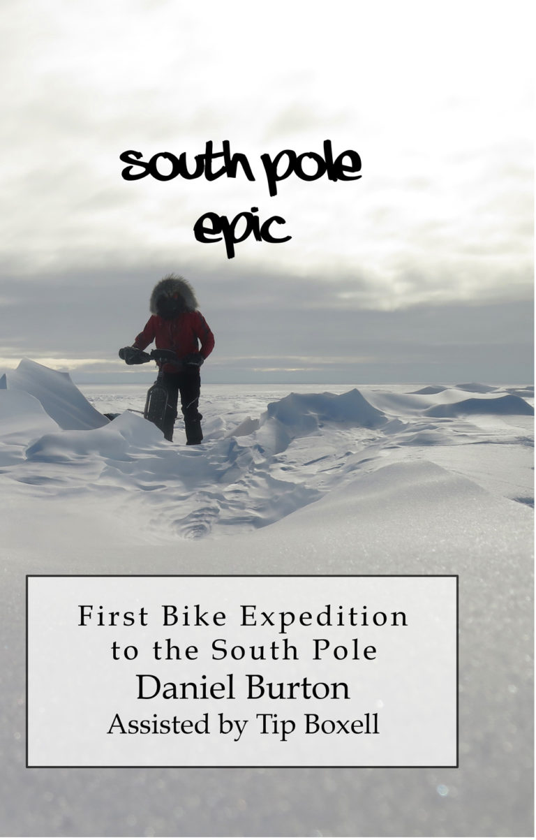
A Review of “South Pole Epic” by Daniel Burton – page – 30
Riding in the Mojave: Cibola Roll-a – page – 31
Fire, Water, and Summer: Bike Touring North Central Idaho – page – 32
Take the Bus; Go on a Bike Tour; Salt Lake Express, Your Bike Touring Buddy – page – 34
Bike Utah: Reflecting on 2017: Where we are and where we need to go – page – 35
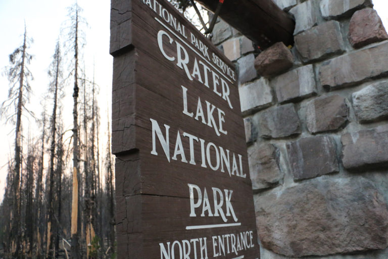
The entrance to Crater Lake National Park. How much will National Park fees rise under current plans? How will they affect bicycle touring cyclists. Photo by Dave Iltis
Guest Editorial by Lou Melini
Before my retirement, I received about $960 in total during 4 years I was able to take advantage of the Bicycle Commuter Act. In the Senate version of the tax bill, cyclists will see the meager $20/month Bicycle Commuter Tax break eliminated. Bus riders and car drivers will still see their $255 tax break remain intact. An article from the Washington Post quotes Ken McLeod, policy director at the League of American Bicyclists stated that cyclists are interpreting the purpose of pulling the tax break simply to send a discouraging message to cyclists. He further stated that the tax benefit costs the government about $5 million/year but is unsure how many cyclists the program benefits. CityLab summarized the Post article using the word “spite”. PeopleforBikes is also encouraging cyclists to contact their representative to restore the Bicycle Commuter Act.
Touring Cyclists will also see a boost in fees if they visit select National Parks during “peak season”. Yellowstone NP currently charges $15 for entering the park by bike (or foot). This fee will go up to $30 if the National Park Service (NPS) enacts the fee increase. Automobile entrance will also go up from the current $30 fee to $70 at Yellowstone. Personally I know the National Parks need the money. I sometimes think I should not use my senior pass that allows free entrance to the Park (that also includes my wife entering for free). I contribute to the National Parks Foundation (NPF) and to Yellowstone Forever as a way to help the Parks. (The NPF supports the fee increase according to the Washington Post)
National Park entrance fees are good for 7 days, so one could go to 2 national parks (Yellowstone and Teton for example) with one entrance fee. If 4 people are packed into a car, the per-person fee is actually quite small. Compare the Park fees with Disney World charges a minimum of $60/person per day with fees going upward to $130.
I am in favor of a fee increase but I would like the increase smaller and fairer to cyclists. Think about 4 people in a car paying $70 vs. 4 cyclists arriving and paying $120. This doesn’t seem right to me. Now if the NPS tells me that 80% of the cars coming to Yellowstone only have 1 or 2 passengers then I will back off with my complaint.
However I am a bike guy and I think the proposed bike fee for entering Yellowstone should be no higher than 25% of the car fee and that was my comment to the NPS. If you want to weigh in on the propose fee increase go to: https://www.nps.gov/orgs/1207/10-24-2017-fee-changes-proposal.htm
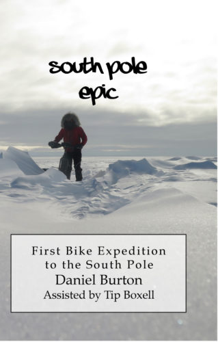
Anyone who knows me knows that I have done some epic things. But Mr. Burton has taken it to another level far beyond. Who decides to bike to the South Pole? With absolutely no experience camping in winter. At least he had the sense to do it in the southern summer. Still, I am absolutely amazed that through stubbornness and audacious tenacity he actually made it there. Kudos.
“Cold, uphill, 20-30 mph headwind in the snow. It was the definitely hardest day of my life, again.” I can’t help but laugh at the monstrosity of the man’s dream. He went from sea level to 9300 feet. Basically in the middle of winter, although it was “summer; down there. Carrying and pulling sleds with all his food and gear. Or mostly pushing it on foot at times.
A few anecdotes: “I think I have a sleeping disorder. Whenever I sit still for a few minutes I will fall asleep.” Sound familiar after a really long, hard ride?
And then his freehub went out, again. “I wired the cassette to the spokes…” In the middle of Antarctica. But he managed to fix it enough to keep going as long as he was careful with it. And he was in a personal race with Juan Granados, who claimed to be riding but Burton was following his ski tracks, not bike tracks.
After riding through everything, from Dec. 2, 2013 to Jan. 21, 2014, he made it. From his blog: “I’M AT THE SOUTH POLE!!!!” And “It is COLD here!”
The best part is that Daniel is one of us. He was a computer programmer for 23 years here in Utah, and after getting laid off he founded Epic Biking in Saratoga Springs on the west side of Utah Lake. Biking had gotten into his blood, like it does with a lot of us. And then he took a few thousands steps farther. Well done.
It is quite a read. Using a combination of notes from a journal and writing from remembrance, this tough trip comes through loud and clear. Well worth the time, and will bring back memories of long, hard rides of your own.
Thank you for the support that made it possible for us to publish for so long. We are honored to be part of the bike community.
Cycling West and Cycling Utah is proud to have completed 25 years of bringing you news and information on cycling in the Intermountain West. Founded in 1993 as Cycling Utah by David Ward and Bob Truelsen, the legacy of their creation continues. In 2016, we became Cycling West in the region, while keeping the name Cycling Utah in the Beehive State.
The Winter 2017 issue is our 199th edition. We have published 8 times a year, except in 2002 when due to the Olympics, we ran 7 issues.
Our mission with Cycling West is to grow, connect, and inform the cycling community by providing great content and resources for cyclists, athletes, and bike shops. Over the winter, and in the next year, look for more great coverage, new programs, new opportunities to contribute cycling news and stories, and new ways to sponsor and support Cycling West and Cycling Utah.
We look forward to being part of the community for another 25 years!
Find a copy of the latest issue in your favorite bike shop in Utah, Nevada, Wyoming, Idaho, Montana, W. Colorado, N. Arizona, and N. California.
Salt Lake City’s horrible air seen in contrast with the brand new 2015 bike lanes on Victory Road. Photo by Dave Iltis
Editorial by Dave Iltis
Originally Published 1-22-2014
As cyclists, we have a lot to lose by breathing dirty air. All the heavy breathing and oxygen processing we need to do to keep going means that we filter larger amounts of toxins than sedentary people. The more toxins in the air, the harder it is to take in oxygen, and the harder we have to breathe.
Utah’s air quality is often bad, especially in winter and in the heat of the July sun. In winter, temperature inversions form in Utah’s valleys – in particular the Salt Lake Valley, Cache Valley, and Utah Valley, and in many of the west’s basins. This is natural and would occur regardless of whether or not people live in those areas. What is not natural is the pollution that our society dumps into the air shed.
In summer, the main toxin is ground level ozone. This is formed when sunlight interacts with nitrous oxides and VOC’s (volatile organic compounds). Ozone is very reactive, and can damage lung tissue. See the above referenced article for more detail.
We cycle for many different reasons. We cycle for transportation, health, well being, the environment, happiness, mastery, competition, to push our limits, to get away, to feel the wind in our face and the speed of the descent, to be one with a machine, and most of all for fun. Air pollution takes this away from us – some days just a little, some red smoggy days completely. I’m tired of this, and I bet you are too.
It’s time for us as cyclists to do something about this.
First, we can educate ourselves on the different types of pollutants and the main sources of them. See the above links for a primer, and find out more at http://airquality.utah.gov .
The main sources of air pollution in the Salt Lake Valley are industry, automobiles, and point source (everything from restaurants to aerosol cans). Major industrial contributors to our poor air quality include Rio Tinto and the various oil refineries in the northern part of Salt Lake City. Utah recently granted permits to allow Rio Tinto and the oil refineries to expand and to ultimately increase the levels of pollution in the valley.
We need to use that knowledge to demand solutions from our politicians. It is no longer acceptable to trade our lungs for economic development. It’s no longer acceptable to let some profit while others pay the price.
Second, we need to ride. We need to encourage others to ride. And we need to lobby for better riding conditions. Better riding conditions, encouragement, more bike lanes, and safer riding lead to more people riding their bikes, which leads to safer riding conditions and even more people riding their bikes.
Automobiles and other vehicles are a leading cause of air pollution. Most of us use them. Save for a few dedicated souls, most of us are not likely to give up driving completely. But as cyclists, it’s easier for us to make the commitment to leave the car parked in the driveway more often. I went to the Utah Opera the other evening with a friend, and she and I were the only ones other than a few of the musicians who rode to the venue. The theater was packed – with over 1000 people in attendance (the Capitol Theatre holds 1876 people) – yet no one else rode their bikes.
The jury is still out on whether or not riding exposes you to more pollution than riding in a car, or less. This can depend on the ventilation of the car, traffic patterns, and the route you choose if you cycle (see City Cycling by Pucher and Buehler, ch. 5 and Van Kempen et al., 2010 http://www.rivm.nl/bibliotheek/rapporten/630053001.pdf ).
Additionally, take part in local bike advocacy. Please join Bike Utah, our state’s bike advocacy organization. http://bikeutah.org
Call your politicians and demand solutions. Gov. Gary Herbert’s number is 801-538-1000. Contact your state representative or senator – see http://le.utah.gov for contact information. Call them or email them and ask that they clean up our air. Many solutions are offered here: http://utah.sierraclub.org/content/utah-air-quality
In addition, Cycling Utah advocates for drastically increased funding for active transportation (biking and walking). This should be at least 2% or more of our transportation budget. Please let your representatives know.
First is Air Quality Amendments from Rep. Ed Redd (R-Logan). This would revive the ultra-low NOx water heater rule that the Air Quality Board passed this fall, which was then squashed by a legislative committee. Rep. Redd’s bill would undo this damage and let Utahn’s reap the benefits of cleaner burning water heaters.
Then, we’ve got a trio of bills to incentivize solar. One bill would legalize a type of solar lease called a Power Purchase Agreement. This is a popular model used by companies like Vivint Solar and Solar City which could make solar more affordable to a wider range of customers.
A second bill, by Rep. Lowry Snow (R-St. George), would prevent Home Owner Associations from barring rooftop solar installation. The third bill would exempt rooftop solar owners and leasers from paying property and sales taxes on their installations, an incentive 15 other states have. If passed, this trifecta could be a major boon to solar development in the state – especially important given Rocky Mountain Power’s efforts to yank us in the other direction.
Also, HEAL supports HB121 from Fred Cox (R-West Valley City), which would upgrade the state’s building codes to a 2015 standard. This would make new homes 15-20% more efficient than our current (2006) codes. Finally!
Next, Rep. Steve Handy (R-Layton) is also running HB87, which would extend our current state tax credits for electric, hybrid and natural vehicles and sets up a fund for folks who convert their vehicles to cleaner burning technology.
Finally is “Income Tax Contribution for Clean Air” from Rep. Patrice Arent (D-Millcreek) which creates a dedicated source of air quality funding through a simple tax check off. Since we currently do NOT have any dedicated yearly funding for air quality this could lead to an important revenue source for an underfunded division.
But this session is of course not without a few bad apples. Here’s the bills that endanger our efforts to support clean air and clean energy which HEAL will be fighting:
First up, is Building Code Review and Adoption Amendments from Rep. Brad Wilson (R-Kaysville). This bill delays how often we update our building code, which includes important energy efficiency measures. This means increased energy costs and more emissions. A true lose, lose.
Next is a bill from Rocky Mountain Power. STEP, or the Sustainable Transportation and Energy Plan, is being billed by the company as big push toward a more sustainable energy policy in Utah, but don’t be fooled. Buried in the bill are regulatory changes that would ultimately net Rocky Mountain Power (and cost ratepayers) millions. Plus it would bypass the regulatory panel that sometimes keeps them in check, the Public Service Commission. And while the bill has a few clean air carrots, other pieces would harm environmental interests. You’ll hear a lot more about this as the session moves forward.
Finally, no list of bad bills would be complete without an appearance from Rep. Ken Ivory (R-West Jordan). He’s pitching the “Ratepayer Protection Act,” which would stop (or at least slow down) Utah’s implementation of the Clean Power Plan, President Obama’s program to reduce the carbon output of our electricity sector. Lovely.
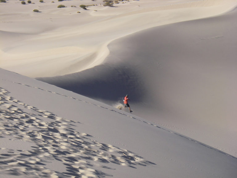
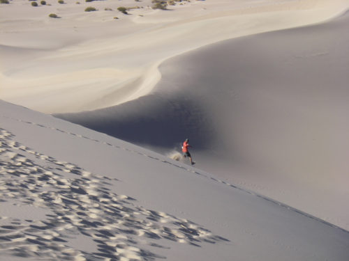
Tom Deigel runs down Sand Dunes in Death Valley National Park.
By Tom Diegel
Published in Cycling Utah – Fall/Winter 2014
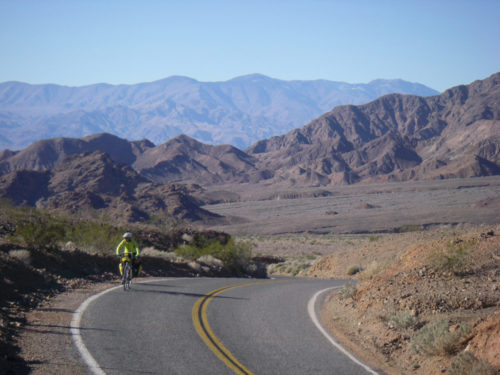
It’s the heart of winter the trails are under snow, the roads are covered with salty slush and snowplow detritus, the inversion is never-ending, and you are jonesing to get out for a big bike ride. But Moab’s also too cold, you’ve been to St George a lot, don’t feel like dealing with Las Vegas, and taking your bike on a plane to Santa Barbara is too expensive and problematic, so……where to go? To find warmer temps and great riding, what better place to go than the hottest place on earth? Death Valley is the place, and its only 6 hours away from the Wasatch Front.
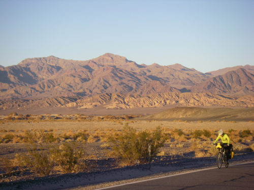
Death Valley is – of course – most famous for its lowest-point in the US status and its summertime heat (it got to 129 degrees in June 2013), but it’s also surprisingly large (the national park is the same size as Connecticut), has several big mountain ranges (a couple with 12,000 feet of relief to the valley floor!), and is quite wild with over 90% of it being wilderness. However, it is crisscrossed with a wide array of beautiful paved and gravel roads, and since the region gets a grand total of two inches of rain per year so the odds of getting rained on are fairly low. Add in very mild wintertime temperatures sublimely austere and beautiful desert scenery with a rich history and you have a pretty fascinating area.
The town of Shoshone – with a café, motel, hot springs, and 10 residents – is the most proximal Death Valley gateway for Salt Lakers, and is only an hour from Vegas. From there it’s a 55-75 mile (depending on your route) ride to Furnace Creek, which is the hub of Death Valley. Two of the routes are paved, and another is gravel and ‘cross-bike worthy, and all three go over 3-4000 foot passes and have little to no traffic. On your way you can make the side trip up to the 5500-foot Dante’s view, with spectacular views up and down the valley. If you make the grind up there, you get a remarkable 16 mile descent to the below-sea level oasis of Furnace Creek, where the ruggedness of the surrounding terrain is somewhat strangely offset by the typical national park amenities such as restaurants, a visitor center, grocery store, campgrounds, and lodging. Yes, everything is a bit overpriced, partly due to the National Park concessionaire markup, but also because at that point it feels like you are pretty far out there, and if it wasn’t for the spring/creek of Furnace Creek that provides the water for that area, there would truly be nothing for hundreds of miles.
Near Furnace Creek are a good handful of side trips: The Harmony Borax mine is what started civilizing Death Valley in 1881 and the mildly-interesting ruins of it are just outside of ‘town”, nearby Golden Canyon has a couple of canyon hikes and is famous for its sunset photos, and Artist’s Drive is a paved one way side-loop with a 1-2000’ climb, and both sport spectacular and colorful rock formations that even jaded Utah desert rats will find impressive. And of course there’s Badwater, the innocuous spot a few miles away that is formally the lowest spot in North America at 282 feet below sea, but is somewhat anticlimatic since it’s only a few feet lower than anywhere else and is typically full of tourists wandering around on a playa trying to figure out they should do with themselves besides take cheesy selfies.
North of Furnace Creek there are a couple of options; it’s about 25 flat, paved miles to the other notable outpost of Stovepipe Wells. Nearby are the sand dunes made famous in a bunch of the Star Wars desert scenes that are worthy of an hour’s worth of romping around, and to the west/south the road goes over the Panamint mountains to Panamint Valley, or you can stay in Death Valley proper going northward. Another fun loop option is to veer northeast over 4000+ foot Daylight Pass through the Amargosa range towards the Nevada border and then cut back up again on a gravel – but very ‘cross-able -road through the mountains over the aptly named Red (rock) Pass, then plunges and twists ever-downward on what is best described as a slot canyon with a one-way road through it! Going back and forth over 4000 foot passes doesn’t seem like much to people who live at 4000 feet, but when you start below sea level, they feel like real climbs! After a final plunge back down to the valley floor, it’s not far to loop back on the pavement to Stovepipe Wells, or you can climb gradually northward towards Scotty’s Castle.
Though bordering on the cheesy side of touristy, Scotty’s Castle is worthy of a visit and the $15 tour. It was built by a wealthy Chicagoan around the turn of the century who was captivated by tales of vast untapped natural resources and adventure to be had in Death Valley by a bigger-than-life local named Scotty. While the lucrative extraction didn’t transpire, the adventure associated with early life in Death Valley resonated with the financier, and he had a remarkable castle built that ultimately bore the name of his charlatan – but charming – buddy instead of his own (and indeed, “Albert’s Castle” probably sounded a bit stuffy for the wildness of Death Valley). The National Park Rangers dress up in “period” clothing to be the tour guides and clearly love the place and the story, so if you have the right attitude, it’s a fun way to spend an hour or two, knowing that there’s a fun descent awaiting to dive back down into the valley.
Not far from Scotty’s castle is Ubehebe Crater, another nice side attraction. It’s the remnant of an old volcano with a couple of impressively deep craters, and geologically-speaking they were formed practically yesterday, without any other effect in Death Valley. These are on the beginning of the 28 mile long gravel road to the Devil’s Racetrack, where rocks have mysteriously moved (literally) in the dry playa, leaving long tracks in their wake (a mystery that was just solved this past year; google it). There’s more to see past the Devil’s Racetrack, but given the distance, ruggedness of road, and lack of water out there it may not be as bike-friendly, though that means there’s plenty of opportunities for adventure.
Ashley enjoys the beautiful scenery in Death Valley National Park.
The mountains of Death Valley start off the valley floor in long, low angle scree fields that finally end in huge escarpments that have canyons carving through them, and not surprisingly this is where many of the hikes are. But “low angle” is a relative term, and the ride/hike combo typically starts with a pretty healthy grind straight up a thousand feet in a couple/few miles to get to the hikes, but they are worthy. Mosaic Canyon, Grotto Canyon, and Natural Bridge Canyons are some classics.
Death Valley is well-suited both for bike touring and day rides, with the limiting factor being water. Stovepipe Wells, Furnace Creek, and Panamint Springs all have (simple, and a little bleak) campgrounds and lodging, (so a credit card tour is very viable) and Mesquite Spring Campground near Scotty’s Castle has water as well.
For Utahns who grow weary of winter’s snows and cold inversions and think they’ve seen a lot of desert scenery Death Valley is a fascinating and different kind of desert. The combination of austere wildness with paved and gravel roads with little traffic, big climbs, long flats, mild temps, and interesting history makes for at least a week’s-worth of excellent riding and adventuring.
For Death Valley National Park information, see nps.gov/DEVA/planyourvisit/index.htm
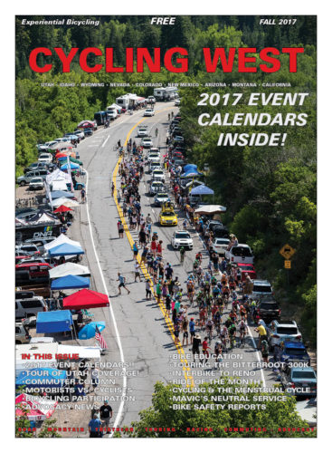
Cycling West and Cycling Utah Magazine’s Fall 2017 Issue is now available as a free download (10 mb download), Pick up a copy at your favorite Utah, Idaho, Wyoming, Nevada, Montana, W. Colorado, N. Arizona bike shop or other location!
Cycling West Cycling Utah Fall 2017 Cover Photo: Tanner’s Flat in Little Cottonwood Canyon is the place to be during the Queen Stage of the Tour of Utah. Photo by Jason Porter, jasonporterphoto.com
Contents
Britton Wins 2017 Larry H. Miller Tour of Utah – page – 3
Ty Magner Sprints to the Win At Stage 1 of Tour of Utah page – 3
Kenny Freestone Tackles a 38-mile Commute with a Pedal-Assist Electric Bike – page – 4
Why I Ride – page – 6
It’s Time to Upgrade Your Bike Parts! – page – 7
Puncturevine Pull Nets 855 Pounds of the Noxious Weed page – 7
Connors and Swenson Victorious at Park City Point to Point – page – 8
Remembering LOTOJA 2005 – page – 9
Mavic’s Neutral Service – In the Tour of Utah Peloton – page – 10
Cycling through the Menstrual Cycle – page – 11
Tittensor & Lindine Win the Intermountain Cup Finale at Powder Mountain – page – 13
Motorists vs. Cyclists – Let’s Remember to Look in the Mirror – page – 15
Stage 2: Bookwalter Wins First Mountain Top Finish of 2017 Tour of Utah at Snowbasin Resort page – 17
Rob Britton Moves into Overall Race Lead with Stage 3 Individual Time Trial Win at Tour of Utah page – 17
Tour of Utah Photo Gallery – A Few of Our Favorite Shots! – page – 18
American Murphy Wins Wild West Sprint at Stage 4 of 2017 Tour of Utah page – 20
Tour of Utah Photo Gallery – A Few of Our Favorite Shots! – page – 22
American McCabe Rockets To Win at Stage 5 of 2017 Tour of Utah page – 24
Stage 6: Italian Ciccone Completes Solo Summit of Snowbird to Conquer “Queen Stage” at Tour of Utah page – 25
Canadian Britton Defends Overall Lead to Win 2017 Larry H. Miller Tour of Utah; Canola Takes Last Stage Win page – 26
Report Looks at Causes and Patterns in Bicycle Crashes page – 31
Giving Up – page – 32
Americans Went for 2.4 Billion Recreational Rides in 2016 – New Reports Look at Bicycling Participation and Economy – page – 33
Interbike Relocates to Reno for 2018 page – 33
Governors’ Report Looks at Bicycle Safety – page – 33
Utah’s Charleston to Wallsburg via Deer Creek Ride is Scenic! – page – 34
10th Annual Moose Cross Cyclocross Festival to be Held October 7-8, 2017 in Victor, Idaho – page – 35
SLCBAC News – Chip Seal, LCC Intersection, Latina Bike Initiative, and Youth Education – page – 35
A Tour of Idaho’s Bitterroot 300K Trail – page – 36
3,053 Kids Participate in the First Year of Bike Utah’s Youth Bicycle Education Program – page – 39
Every day I am asked questions about specifics in sport nutrition, and we end up discussing the basics such as carbohydrates, electrolytes, and supplements. The science and research is all there, and my job is to guide athletes to use the information for their individual needs for training and/or racing. Luckily, most athletes are disciplined and want to improve, so adhere to their nutrition needs. But it is important to recognize that life, schedules, family, and work can all create challenges on eating perfectly. I receive a lot of inquiries about how to stay healthy and make the right food choices when traveling, going out to eat, and riding or racing out of state. So the focus of this article is to step back from all the science of sport nutrition and offer tips and tricks that will help make the best choices when you have to deviate from your normal food patterns.
Dining Out
Let’s face it, with our hectic schedules we are eating out more often. It’s fine to indulge once in a while when dining out, but if you are eating out more than once a week the “empty” calories can add up quickly. It’s easy to eat a whole day’s worth of calories in just one meal out. The good news is there are plenty of healthy ways to order that allow you to indulge responsibly.
Know your portions. Weigh and measure your food once in a while at home so you get a good idea of appropriate portions. This also helps you control portions when eating out.
Take half to go, ask the server to wrap up half your entrée before it reaches your table.
Avoid any dishes that have the words fried, batter dipped, creamy, cream sauce, scalloped, au gratin, butter sauce, cheesy, or alfredo. These words generally indicate the meal is higher in fat and calories.
Order a side salad and/or veggies as a side when available. Always request salad dressing on the side and to have your veggies steamed, sans butter or sauce. You can usually replace a heavy side with vegetables or greens – don’t be shy to ask for what you want!
Mexican Restaurant Tips
Go easy on the cheese, sour cream, and fried tortilla chips.
Make your burrito into a salad by dumping the inside over a bed of greens and use salsa as dressing!
Add plenty of salsa – it’s low in calories, high in flavor, and counts as a vegetable serving. Plus, the capsaicin in peppers stimulates fat burning, so there’s extra incentive.
Guacamole is a great healthy fat, containing a high concentration of omega-3 fatty acids, which are nature’s anti-inflammatory. But, use a small portion, as avocado is really high in calories.
Sub or Deli Sandwich Restaurant Tips
Choose whole grain or whole wheat breads or buns when offered. Whole grains are packed with nutrients and are a good source of fiber.
Choose lower calorie meats such as turkey, grilled chicken, or a vegetarian option.
Add extra vegetables for toppings.
Go light on the cheese, ask for just one slice.
Hold the mayo! Use vinegar, mustard, or a little olive oil to add flavor. Hummus and avocado can be great flavor enhancers too!
Pizza Restaurant Tips
Choose lower calorie pizza toppings such as: vegetables, pineapple, chicken.
Choose a red, tomato-based pizza sauce instead of a cream or ranch sauce.
Ask for your pizza to be “easy on the cheese”; this can cut your calories by up to 100 per slice.
Order thin crust. Less crust equals fewer calories.
Choose the smallest slices. You won’t notice the size difference, yet save 50-100 calories per slice.
Have a salad with plenty of veggies and a light dressing, so you get color and quality in the meal too!
Fast Food Restaurant Tips
Choose a side salad or fruit as a side when available. These are lower in calories and rich in antioxidants, vitamins and fiber.
If eating with a friend, split a small order of fries as a side to help satisfy your craving without adding too many calories.
Hold the mayo. 1 Tbsp. of mayonnaise adds 100 calories, and 11 grams of fat. Many sandwiches will use over 2 Tbsp. of mayonnaise.
Opt for grilled chicken or fish (instead of fried) on sandwiches, wraps and salads.
Steer yourself towards a low calorie, healthy side such as baked potato, fruit (apple slices), or side salad with low fat dressing.
Order water, as calories from soda add up quickly. A 32 oz. soda contains about 375 empty calories.
Don’t be shy to try the vegetarian option, like a veggie or bean burger. They can be very yummy and much healthier, low in fat, and count as another veggie serving in your day!
Dessert Tip! Split one dessert between the table. Just make sure to take a bite or two and pass it on. Then you can enjoy a little treat, feel satisfied, and be proud that you made a healthy choice.
Off-the-Bike Nutrition
Whether you are en route to a race, overcoming the end of season nutrition changes, or simply trying to improve your every day eating habits, the above tips and tricks will hopefully help you make the best choices for you. Another tip to always keep in mind is to pay attention to your hydration status. Sometimes when we munch or mindlessly over-eat, we could simply need a drink of water. Keeping fluids with you at all times can help with satiety and often calm hunger cravings. Unsweetened tea, flavored sparkling water, and kombucha are all great hydrators without any calorie guilt. Remember, these tips and trick are to help with ideas for healthy eating separate from training and racing! Refer to past articles on nutrition on cyclingwest.com on proper fueling of carbohydrates, fats, proteins, and hydration on the bike and other fitness needs. Always put the gas in your body tank that is appropriate for your individual needs.
Breanne Nalder, MS, RDN has a Master’s degree in nutrition with an emphasis in sports dietetics at the University of Utah. She is a Registered Dietitian, the nutrition coach at PLAN7 Endurance Coaching, and races for the DNA Cycling p/b K4 Racing team.
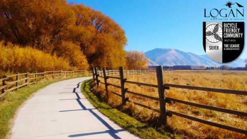
Logan, UT named a Silver Bicycle Friendly Community by the League of American Bicyclists
November 30, 2017 – Press Release – Logan, Utah –
With over 15 miles of trails, 5 miles of bike lanes, and a bike park and bike share system on the way, and much more, Logan is recognized as one of the best towns in Utah for cycling.
Today, the League of American Bicyclists recognized Logan with a Silver Bicycle Friendly CommunitySM (BFCSM) award, joining over 400 visionary communities from across the country.
With the announcement of 65 new and renewing BFCs today, Logan joins a leading group of communities, in all 50 states, that are transforming our neighborhoods. This national recognition puts Logan alongside Salt Lake City, Moab, Park City and Provo as the top ranked bicycle friendly communities in Utah.
“We applaud these communities for making bicycling a safe and convenient option for transportation and recreation,” said Bill Nesper, Executive Director at the League of American Bicyclists. “We are encouraged by the growing number of leaders who see bicycling as a way to build more vibrant, healthy, sustainable and connected communities and be a part of the solution to many complex challenges faced at both the community and national levels. We look forward to continuing to work with these communities as we move closer to our mission of creating a Bicycle Friendly America for everyone.”
Logan, Utah was awarded a silver level Bike Friendly City Award in 2017. Photo courtesy Logan City.
The BFC program is revolutionizing the way communities evaluate their quality of life, sustainability and transportation networks, while allowing them to benchmark their progress toward improving the ease of navigating by bicycle. With this impressive round, there are now over 400 BFCs in all 50 states. The Silver BFC award recognizes Logan’s commitment to improving conditions for bicycling through investment in bicycling promotion, education programs, infrastructure and pro-bicycling policies.
“A bike ride or a walk on a beautiful street or trail while gazing across our beautiful valley is a key part of what makes living in Logan great. As we grow, we’re committed to celebrating that part of valley life by making sure that bicycling stays as safe, healthy, and as fun for us and our children as it has been for our grandparents. This recognition by the League of American Cyclists is a true feather in the cap of the city, and has been won thanks to quality leadership and hard work by Logan’s leadership, staff, and her community members.”
– Craig Petersen, Logan City Mayor
“Bike lanes and trails may seem trivial to some, but creating opportunities for everyone in this community to improve their health, explore our beautiful parks and public lands, and take one more car off our crowded streets is of great value to Logan. People move here, and stay here for the quality of life, and I’m proud in the part I’ve played in helping Logan become nationally recognized as a bicycle friendly community.”
– Russ Holley, Logan City Senior Planner
The application which led to this award was assembled as a joint effort between Logan City staff, elected officials, and the CMPO Bicycle & Pedestrian Advisory Committee. For more information, contact Cache County Trails and Active Transportation Planner, Dayton Crites – [email protected]
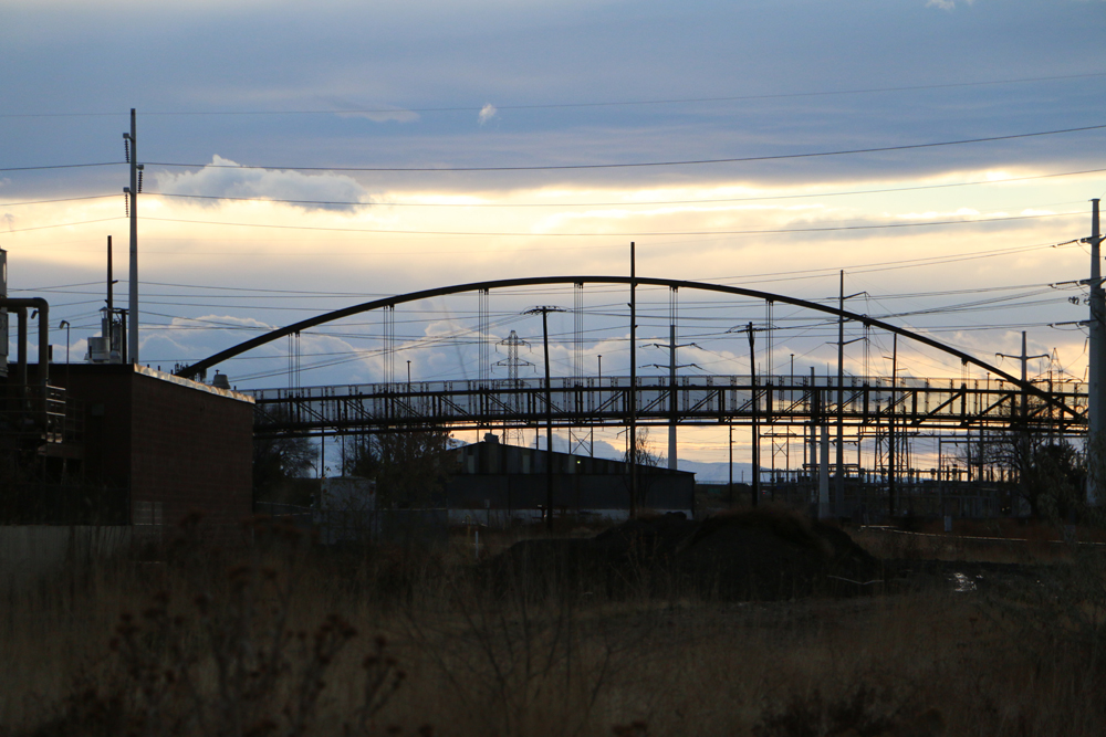
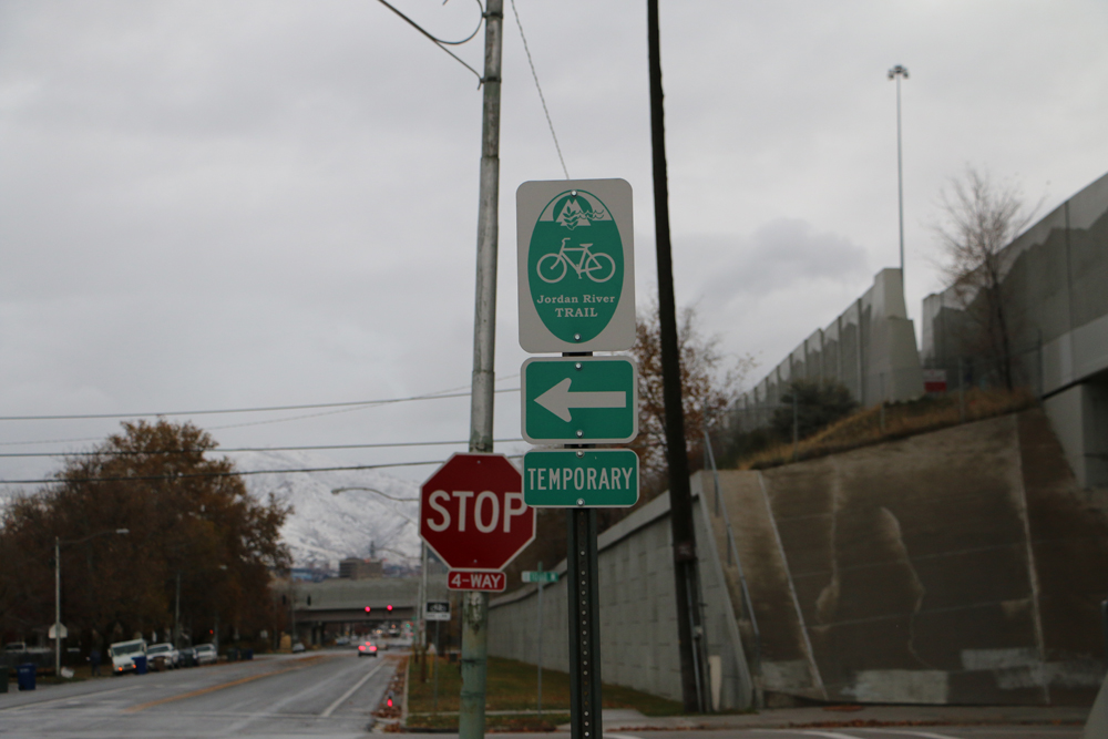
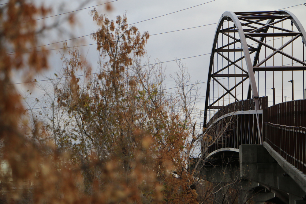
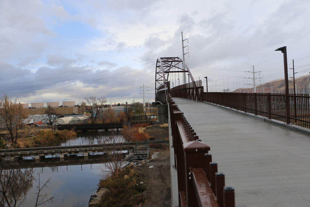
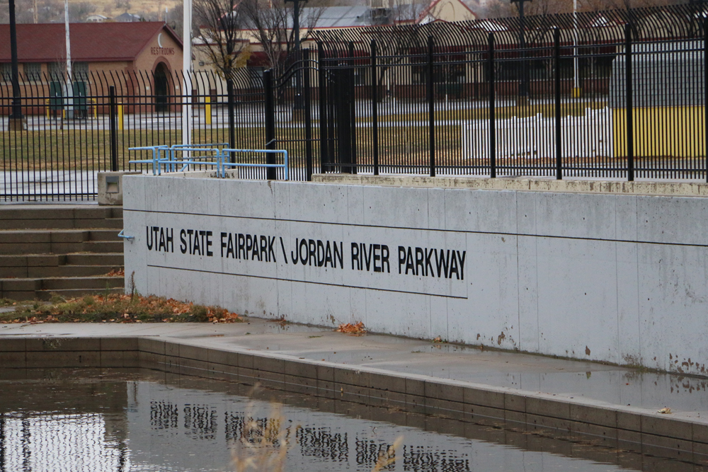
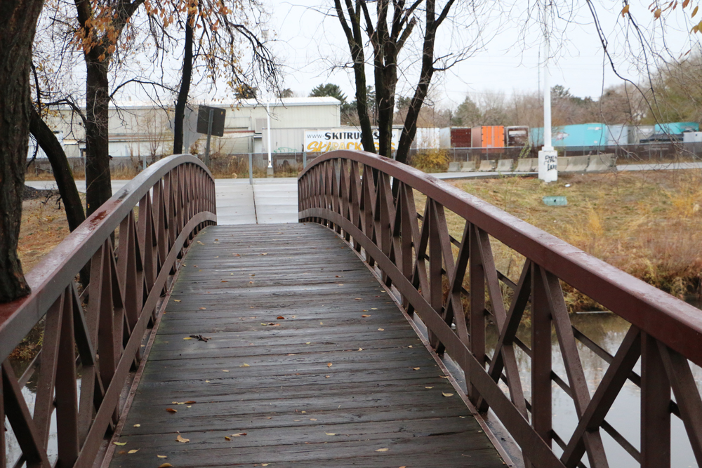
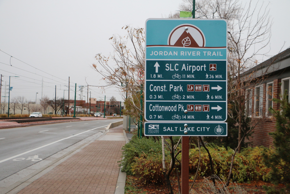
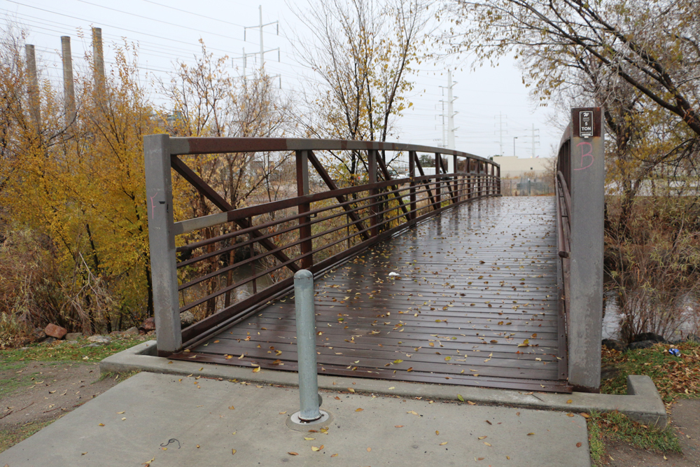
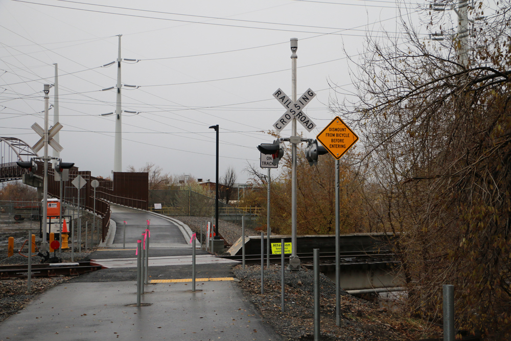
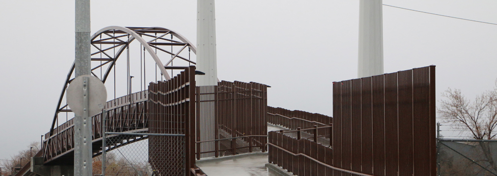
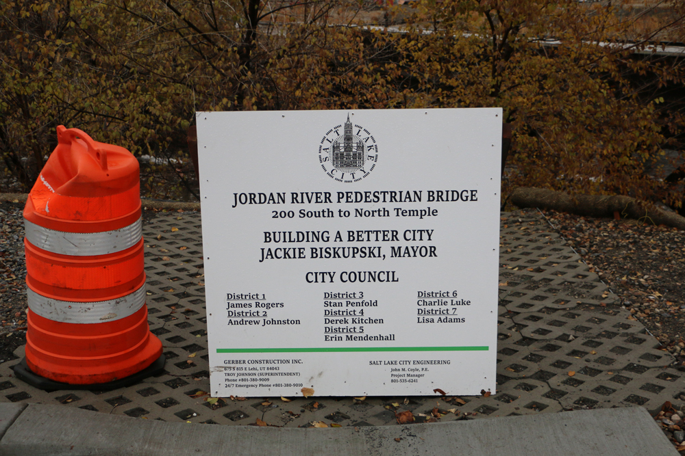
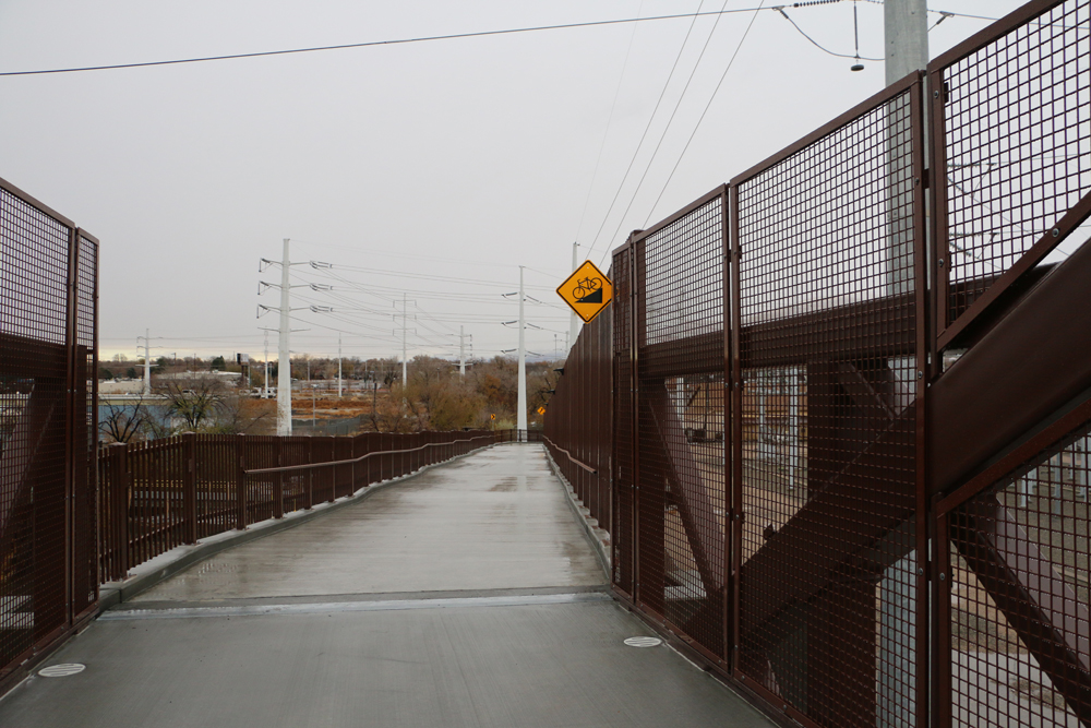
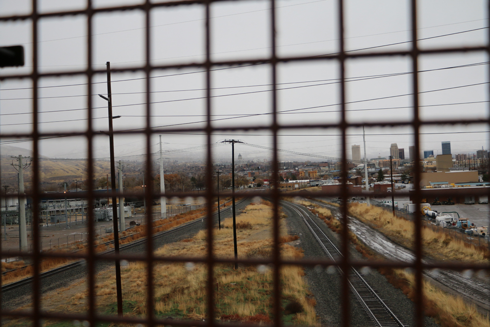
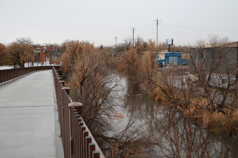
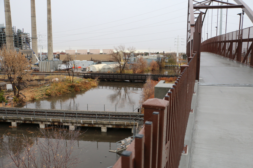
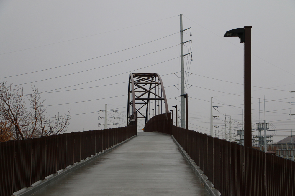
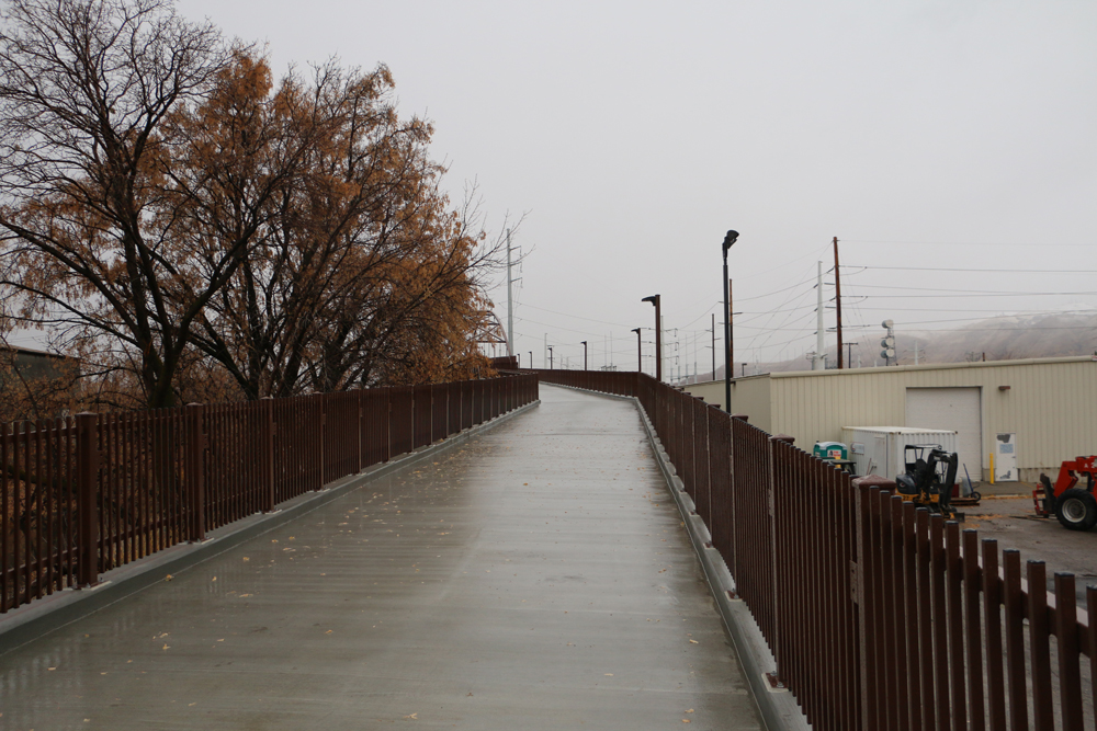
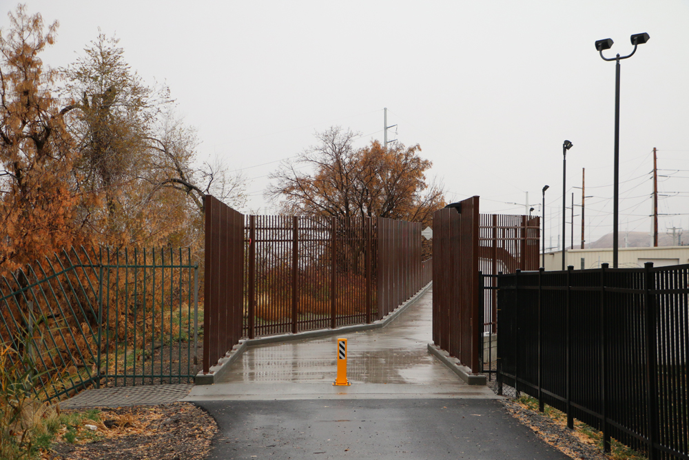
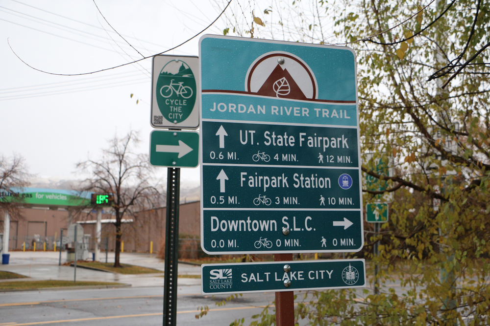
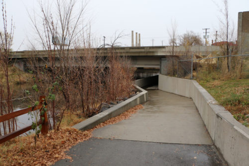
Salt Lake City, Utah – November 18, 2017 – The brand new Jordan River Parkway Bridge over the Union Pacific Railway between 200 S and N. Temple opens today for bicyclists and pedestrians. The addition of the bridge and new section completes the Jordan River Parkway Trail!
The new Jordan River Parkway Bridge, as seen from the east, over the railyard between 200 S and N. Temple is open for bikes and pedestrians. Photo by Dave Iltis
Salt Lake City has been working hard to complete this section. A press release stated:
The completion of the Jordan River Parkway Trail has been a major initiative of Salt Lake City, Salt Lake County, the State of Utah and the entire Jordan River community. One of the most challenging projects has been the completion of the trail over the active railroad lines between North Temple and 200 South. Through a partnership between Salt Lake City, Salt Lake County, the State of Utah, the Jordan River Commission, Rocky Mountain Power, Utah State Fair Park, Union Pacific Railroad, and Salt Lake Garfield and Western Railway, this last section of the trail has been completed.
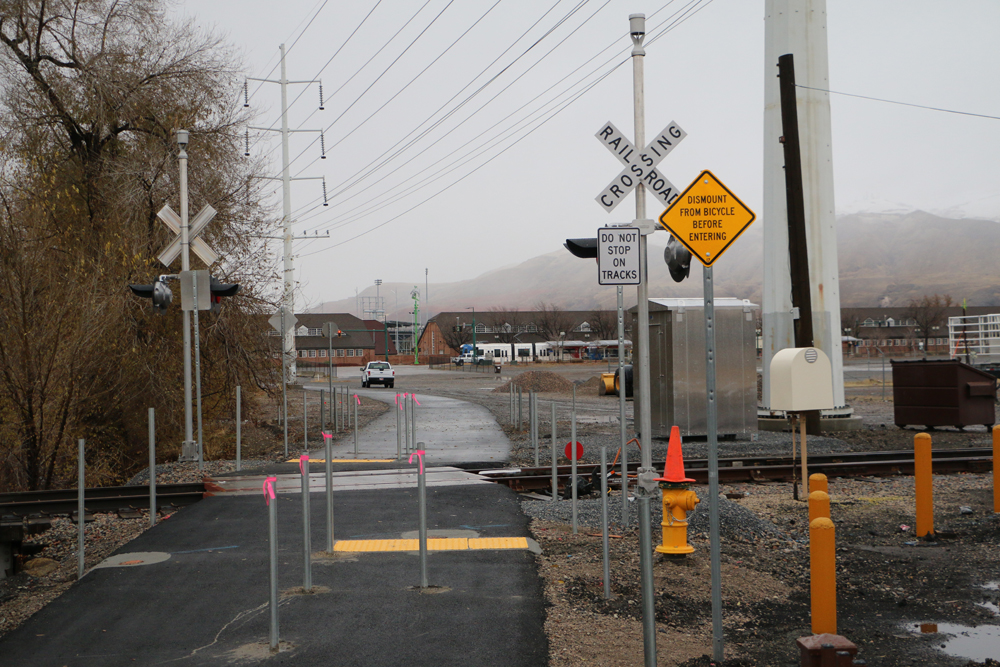
The new Jordan River Trail section consists of an arch bridge to span three mainline railroad tracks, connecting ramps and connecting asphalt trail sections. There is also one at-grade rail crossing of a lightly used, railyard track. Safety features at this at-grade crossing will include bedstead barriers, flashing-light signals and bells
Total clear span length of the bridge is about 270 feet, total length of the bridge with ramps is about 1,200 feet.
The Jordan River Trail has been planned since the 1970s. Now that it’s complete, the trail, along with its connections to the Legacy trail on the north and the Murdock Canal Trail on the south, provide over 100 miles of continuous off-street paved trail. This trail system is an asset to the community, promoting alternative transportation modes, healthy lifestyles and allows residents to experience nature within their city.
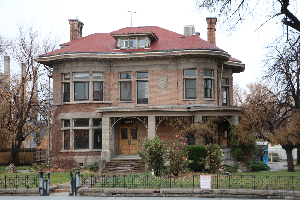
A grand opening celebration will take place on November 18, 2017 with a 5K fun run and ribbon cutting at the Fisher Mansion.
RACE START, 9 am: 17th South River Park (1150 W 1700 S, SLC, UT 84104)
RACE END: Fisher Mansion (1206 W 200 S, SLC, UT 84104)
Cycling Utah took a trip to the bridge. We present this photo gallery below of this great new addition to cycling in Salt Lake City.
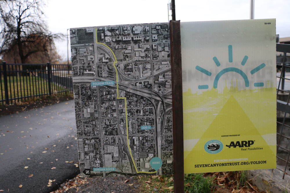
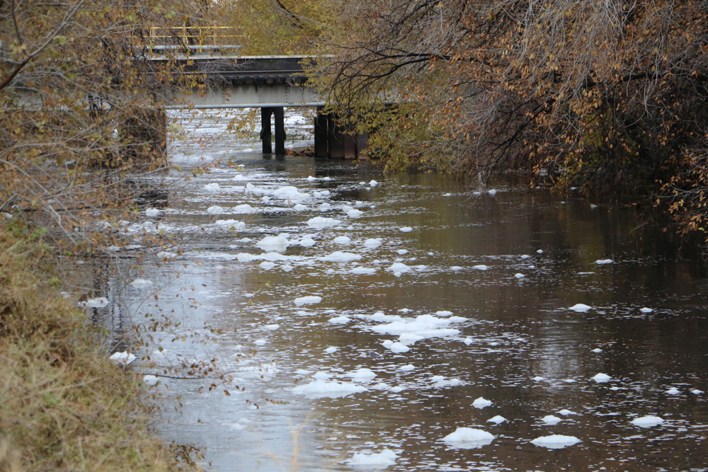
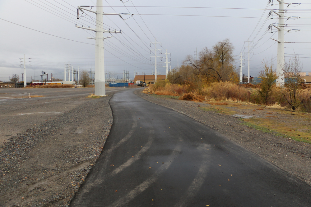
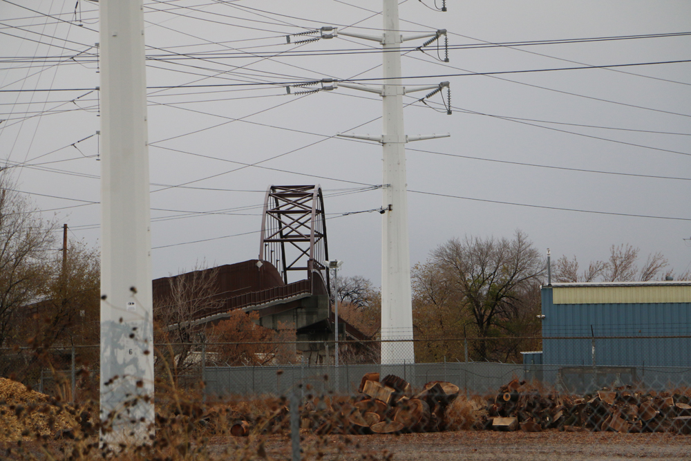
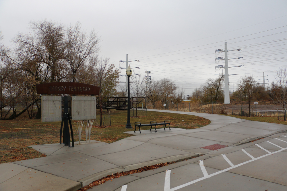
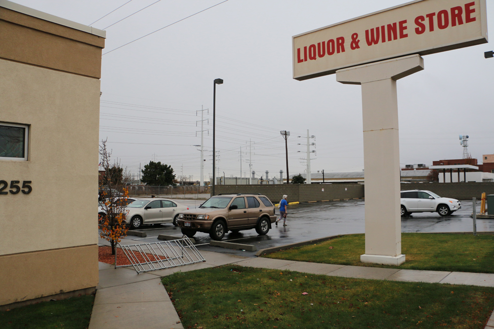
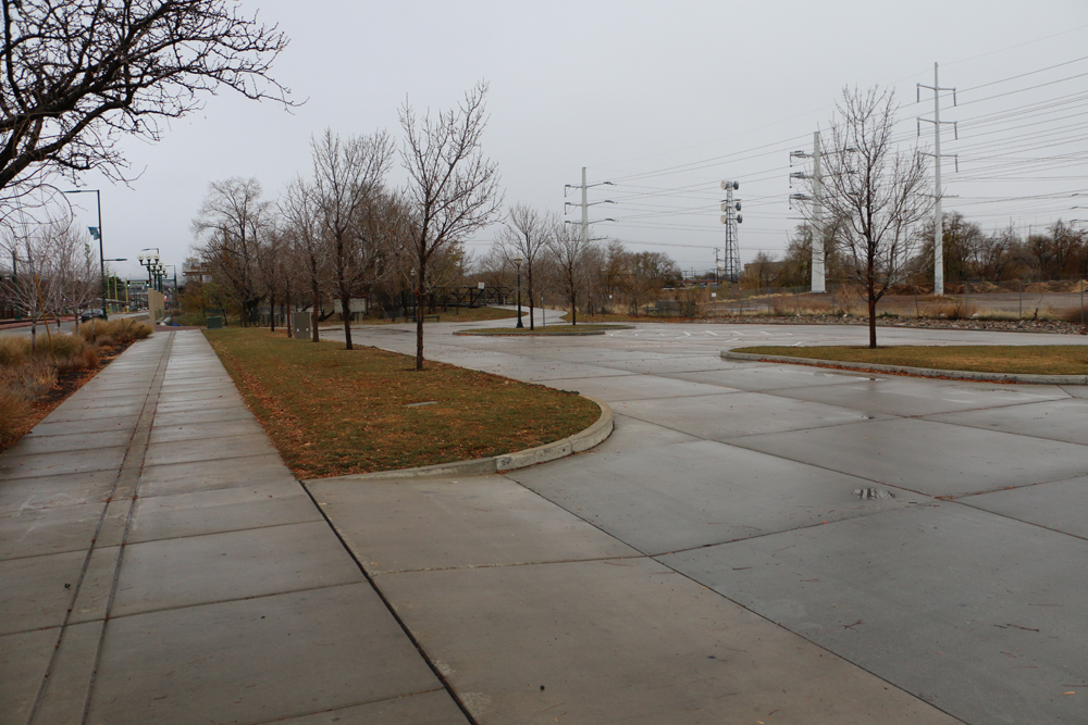
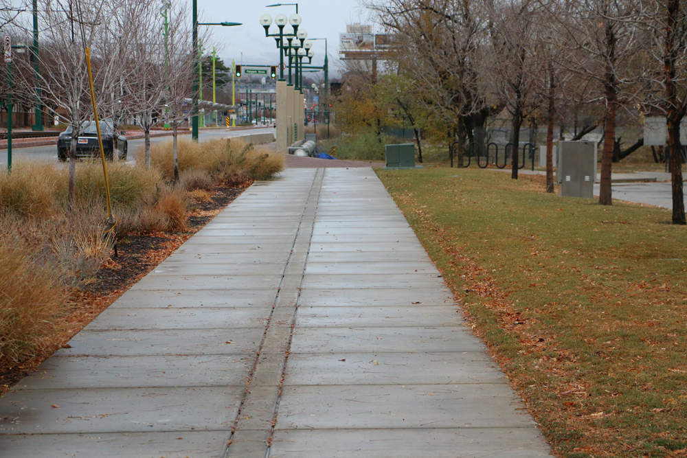
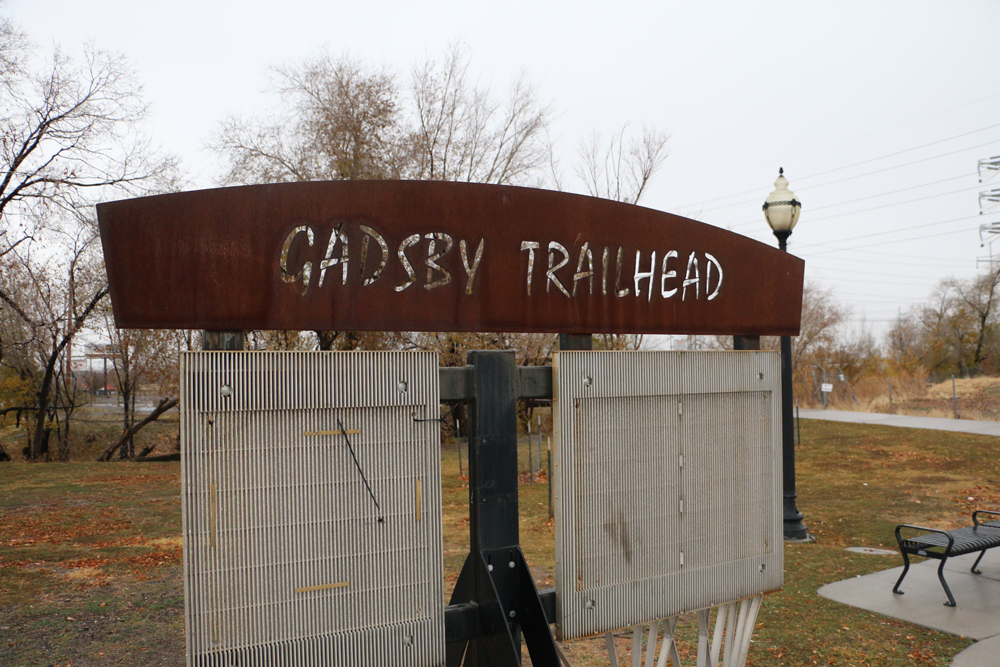
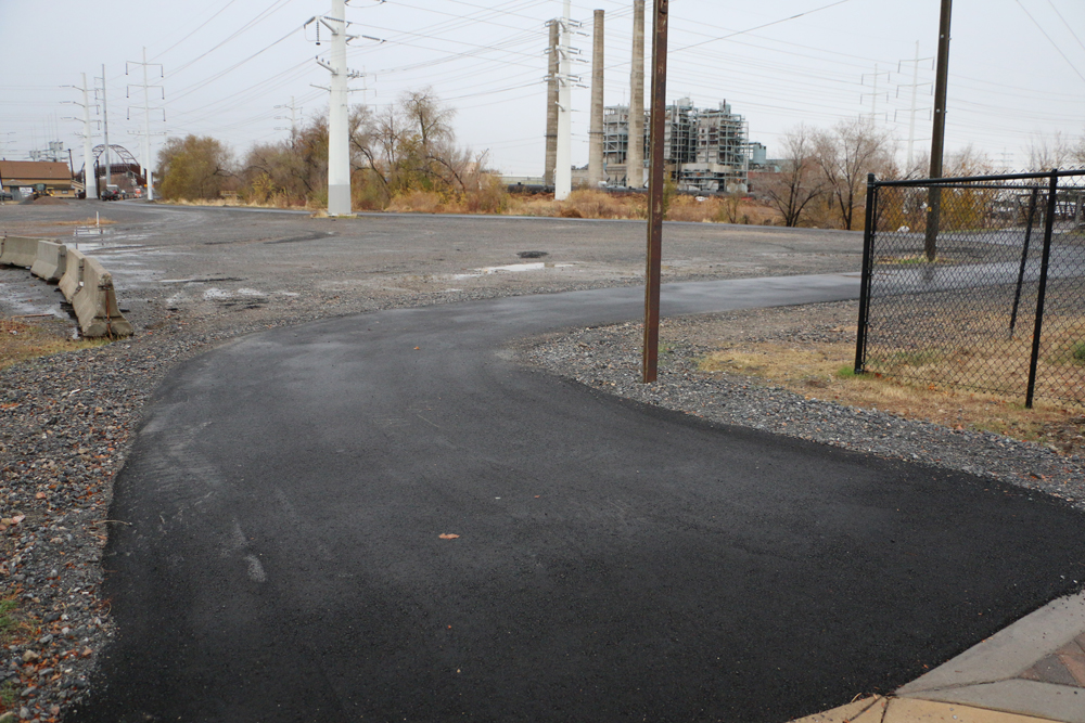
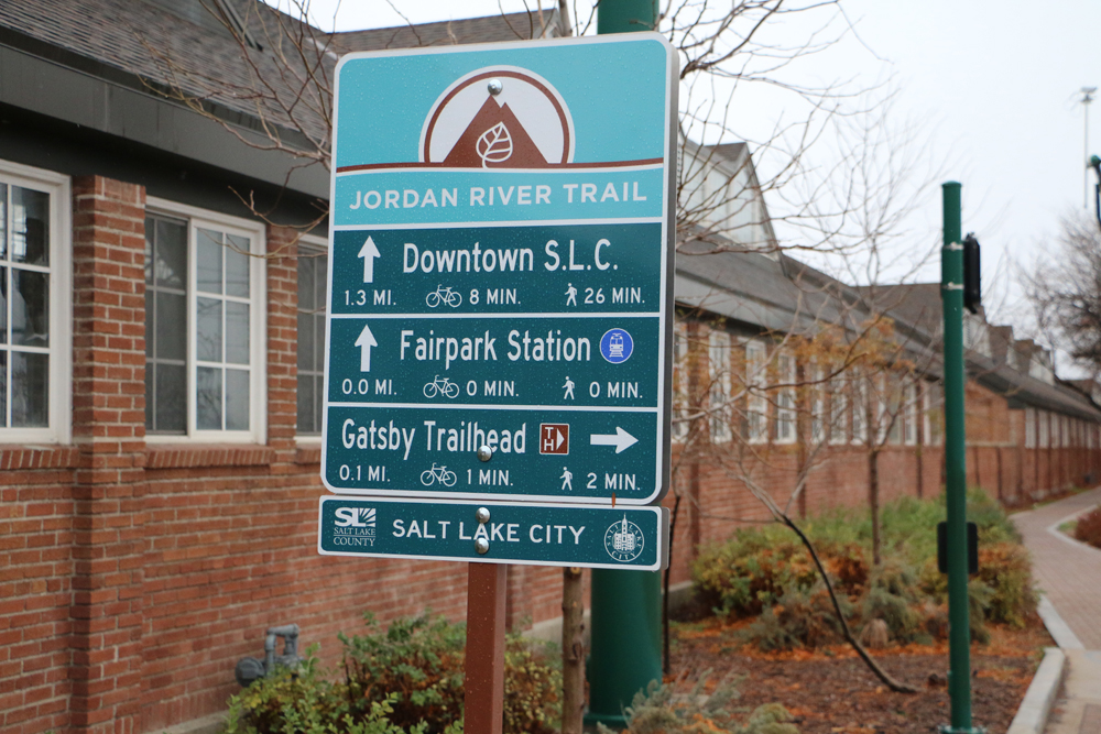
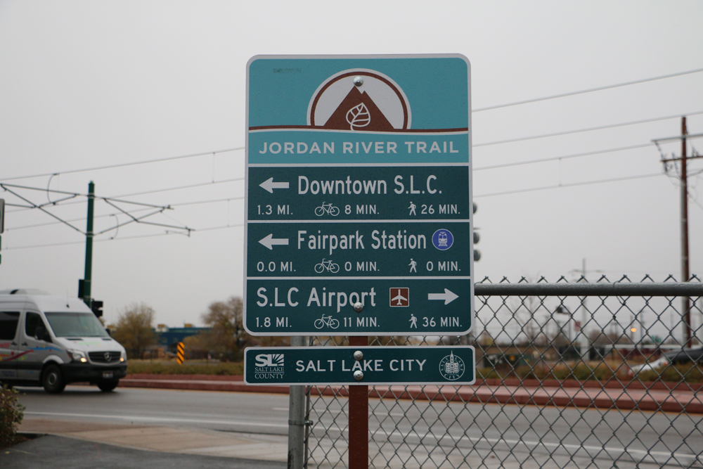
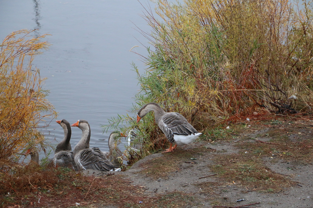
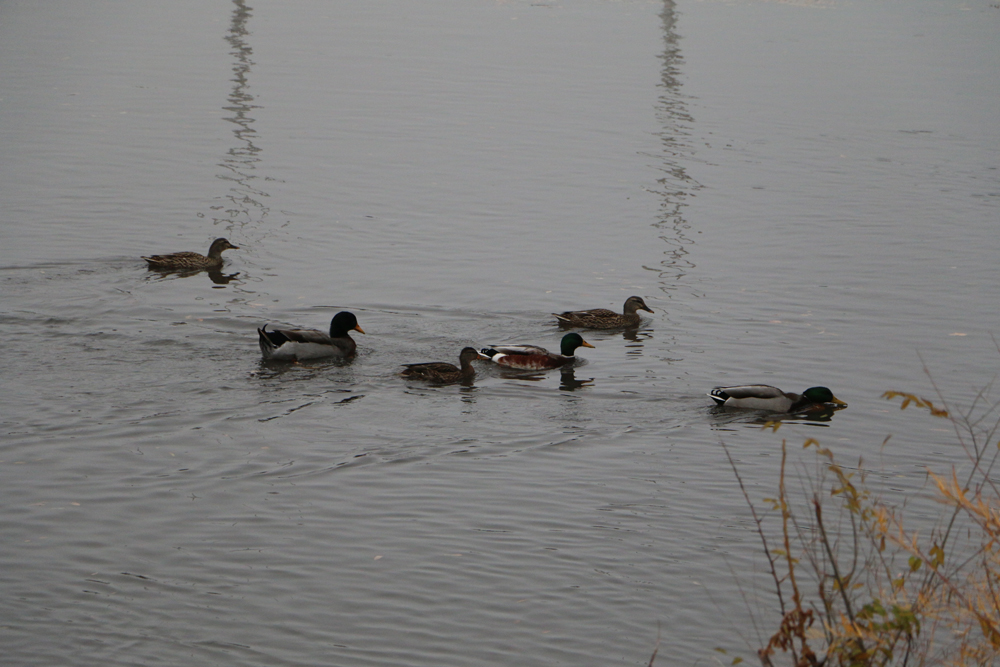
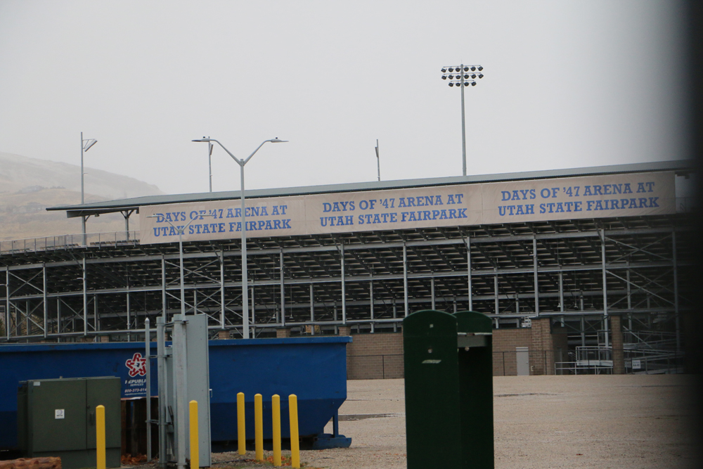
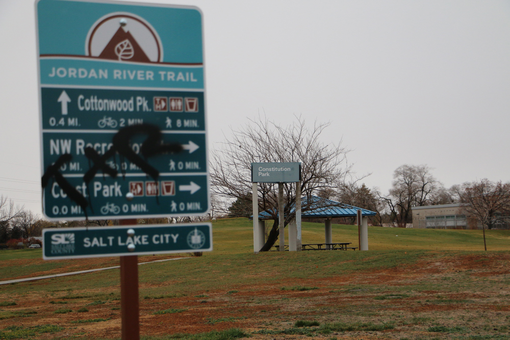
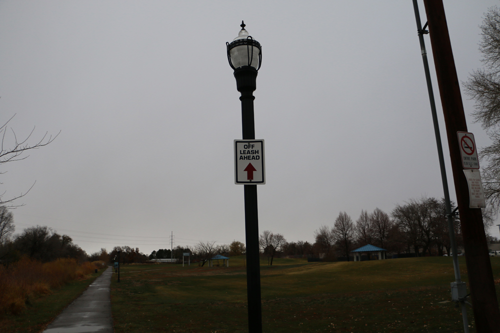
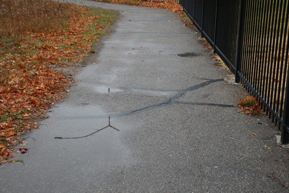
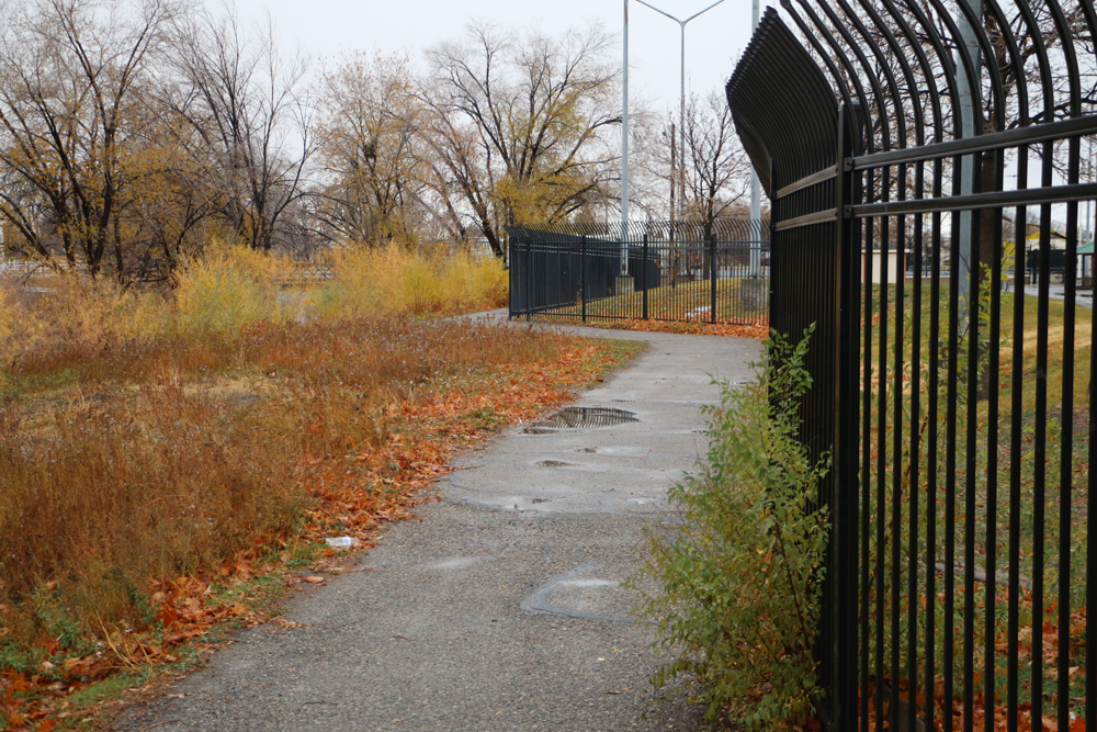
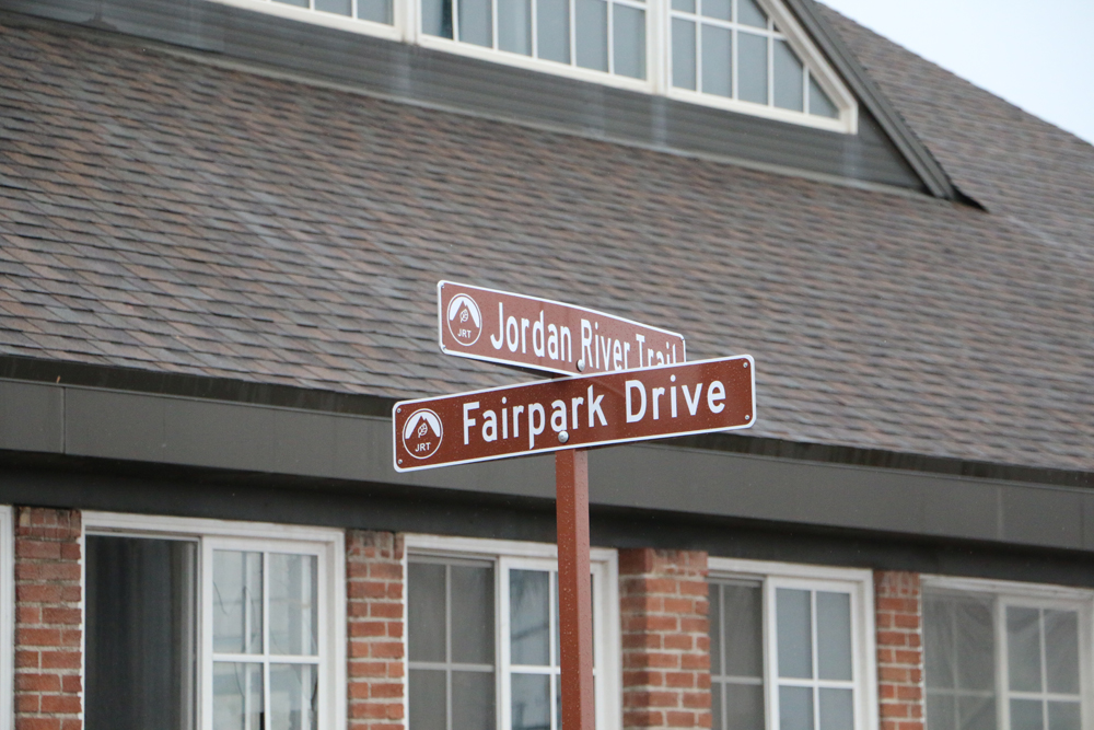
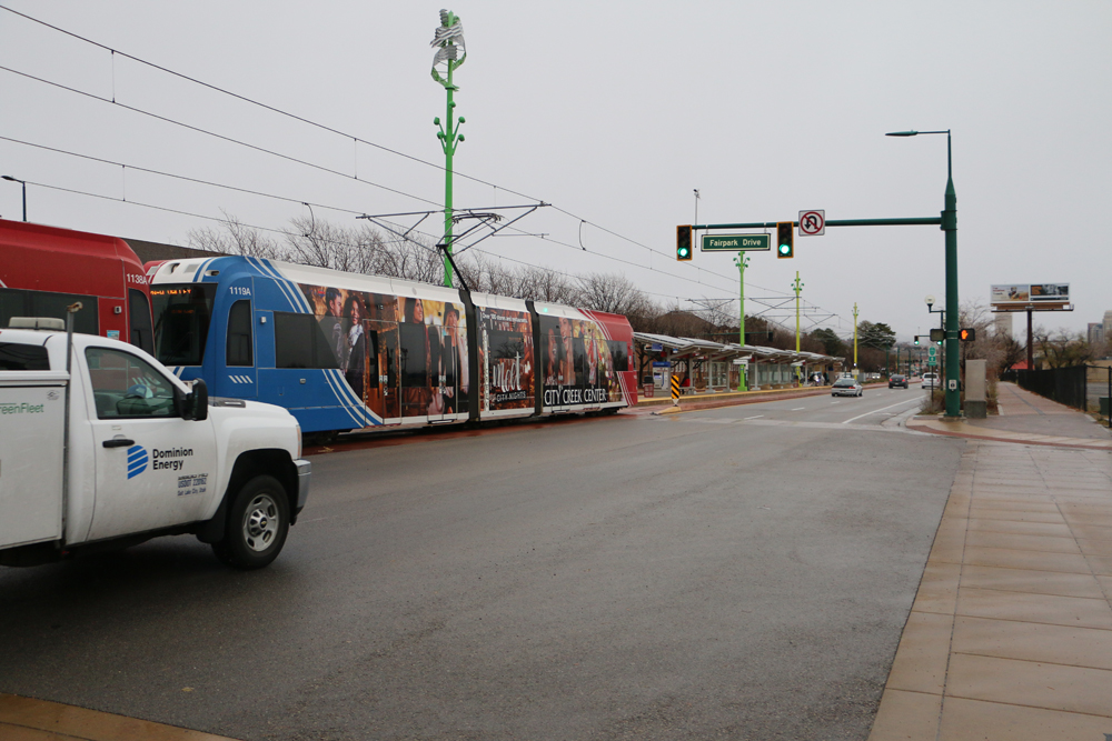
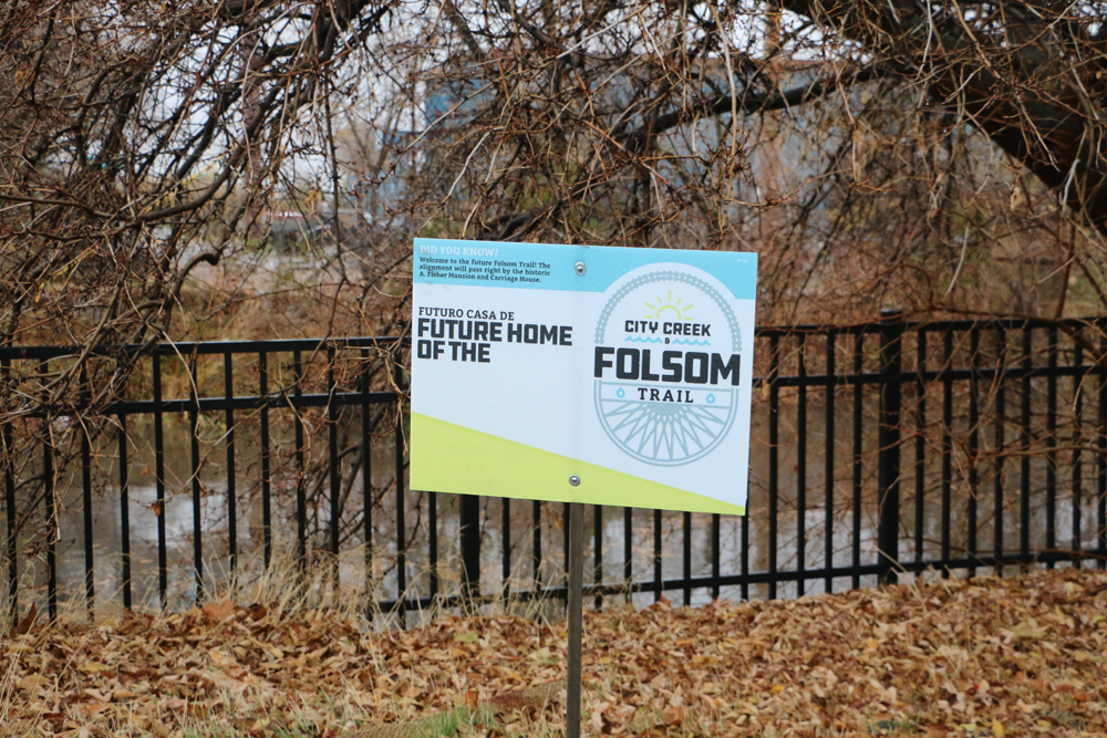
These signs won’t be necessary now that the new section of Jordan River Trail is open. Photo by Dave IltisA map showing where the Folsom Trail will intersect the Jordan River Trail. Photo by Dave IltisThe new Jordan River Parkway Bridge, looking north, over the railyard between 200 S and N. Temple is open for bikes and pedestrians. Photo by Dave IltisThe new Jordan River Parkway Bridge over the railyard between 200 S and N. Temple is open for bikes and pedestrians. Photo by Dave IltisFoam on the water of the Jordan River. Photo by Dave IltisThe new Jordan River Parkway Bridge over the railyard between 200 S and N. Temple is open for bikes and pedestrians. Photo by Dave IltisThe new Jordan River Parkway Bridge over the railyard between 200 S and N. Temple is open for bikes and pedestrians. Photo by Dave IltisThe new Gadsby Trailhead. Photo by Dave IltisThe Utah State Liquor Store is just to the west of the new section of the Jordan River Parkway. They need better bike racks. Photo by Dave IltisThe new parking lot at the Gadsby Trailhead on the Jordan River Parkway. Photo by Dave IltisThe N. Temple shared use path feeds right into the Gadsby Trailhead and the new section of the Jordan River Parkway. Photo by Dave IltisThe new Gadsby Trailhead at N. Temple where it crosses the Jordan River Parkway. Photo by Dave IltisThe new section of the Jordan River Parkway Trail near the railyard between 200 S and N. Temple is open for bikes and pedestrians. Photo by Dave IltisAwesome new wayfinding signs have been installed on the Jordan River Parkway Trail . Photo by Dave IltisAwesome new wayfinding signs have been installed on the Jordan River Parkway Trail . Photo by Dave IltisGeese on the Jordan River. Photo by Dave IltisMallard ducks on the Jordan River. Photo by Dave IltisThe new Days of 47 Arena at the Utah State Fairpark. Photo by Dave IltisGrafitti mars a new wayfinding sign on the Jordan River Parkway. Photo by Dave IltisConstitution Park on the Jordan River Parkway has an offleash dog park. Photo by Dave IltisClosed gate at the Utah State Fairgrounds. Photo by Dave IltisWhen ducks fly. Photo by Dave IltisDirt or pavement on the Jordan River Parkway, just north of N. Temple. Photo by Dave IltisThe Utah State Fairgrounds are closed where the trail intersects. Photo by Dave IltisThe Jordan River Parkway as it passes by the Fairgrounds. Photo by Dave IltisA bridge over the Jordan River, just north of N. Temple. Photo by Dave IltisThe trail could use a little TLC just north of N. Temple. Photo by Dave IltisThe Jordan River Parkway Trail, just north of N. Temple. Photo by Dave IltisGreat new wayfinding signs have been installed on the Jordan River Parkway. Photo by Dave IltisThe Jordan River Trail crosses N. Temple. Photo by Dave IltisFairpark Drive and N. Temple. Photo by Dave IltisSLGW Railroad sign. Photo by Dave IltisThe bridge over the Jordan River just south of N. Temple. Photo by Dave IltisThe new Jordan River Parkway Bridge over the railyard between 200 S and N. Temple is open for bikes and pedestrians. Photo by Dave IltisThe new Jordan River Parkway Bridge over the railyard between 200 S and N. Temple is open for bikes and pedestrians. Photo by Dave IltisThe Jordan River Pedestrian (and Bicycling) Bridge is now open. Photo by Dave IltisGates will go here. The question is, will the be friendly for tandems and for double wide baby strollers. The new Jordan River Parkway Bridge over the railyard between 200 S and N. Temple is open for bikes and pedestrians. Photo by Dave IltisBoaters be careful. Photo by Dave IltisThe new Jordan River Parkway Bridge over the railyard between 200 S and N. Temple is open for bikes and pedestrians. Photo by Dave IltisWest Salt Lake City as seen from the new Jordan River Parkway Bridge. Photo by Dave IltisDowntown Salt Lake City as seen from the new Jordan River Parkway Bridge. Photo by Dave IltisThe Jordan River, as seen from the new bridge. Photo by Dave IltisA view from the new Jordan River Parkway Bridge over the railyard between 200 S and N. Temple. Photo by Dave IltisThe new Jordan River Parkway Bridge over the railyard between 200 S and N. Temple is open for bikes and pedestrians. Photo by Dave IltisThe new Jordan River Parkway Bridge over the railyard between 200 S and N. Temple is open for bikes and pedestrians. Photo by Dave IltisThe north entrance to the new Jordan River Parkway Bridge over the railyard between 200 S and N. Templem, which is open for bikes and pedestrians. Photo by Dave IltisThe Folsom Trail will intersect the new section of the Jordan River Parkway Trail at about 200 N. Photo by Dave IltisThe Fisher Mansion. The building will be restored and turned into a public space. The new Jordan River Parkway Bridge over the railyard between 200 S and N. Temple is open for bikes and pedestrians. Photo by Dave IltisNew wayfinding signage on the Jordan River Parkway. Photo by Dave IltisThe Jordan River Parkway Trail under I-80. Photo by Dave Iltis
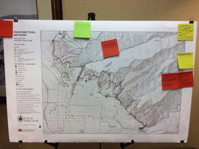
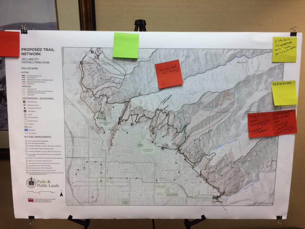
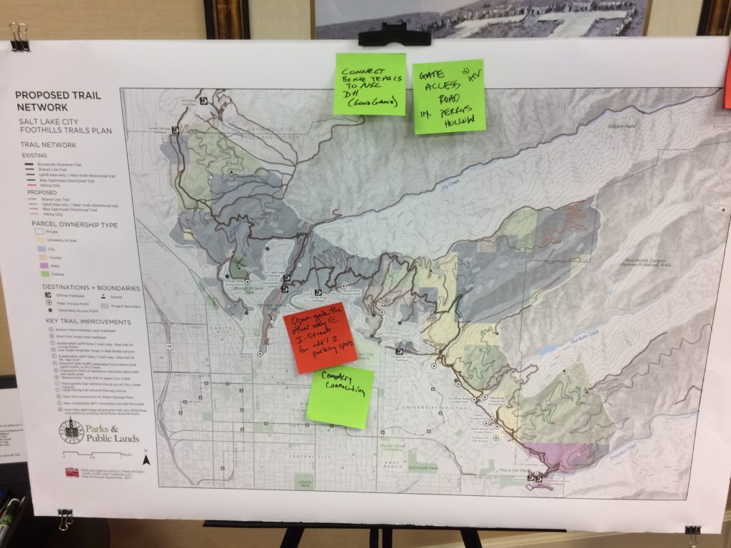
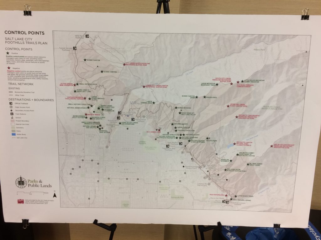
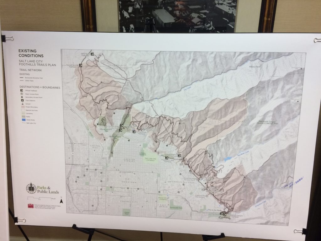
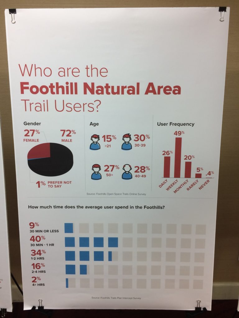
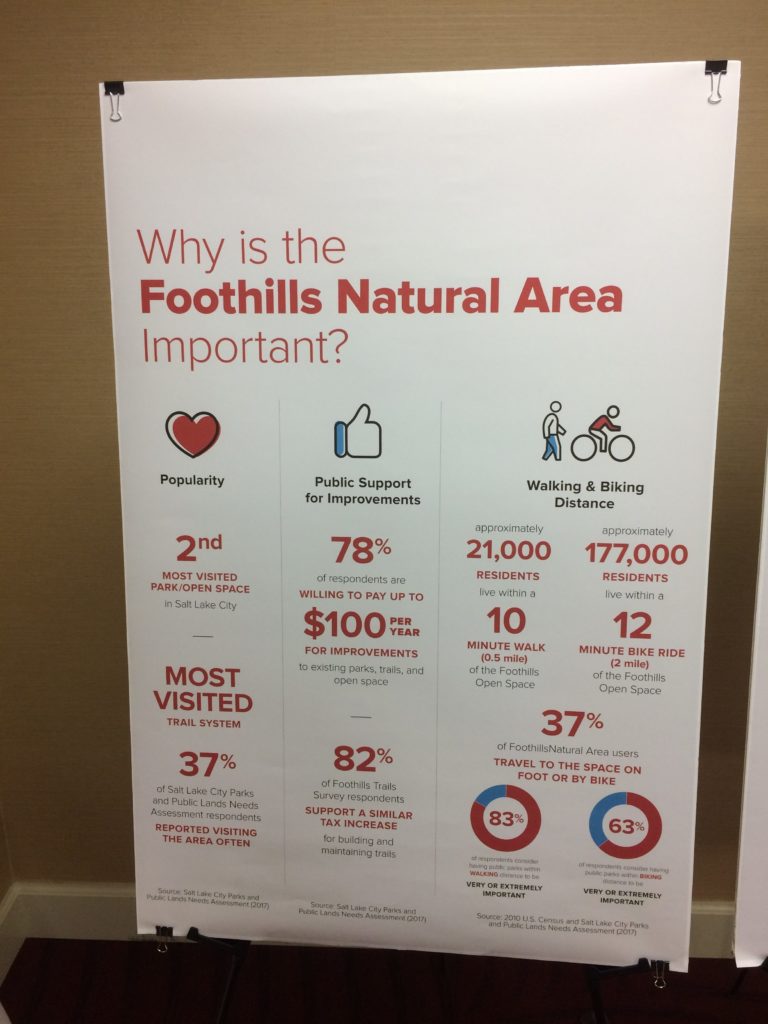
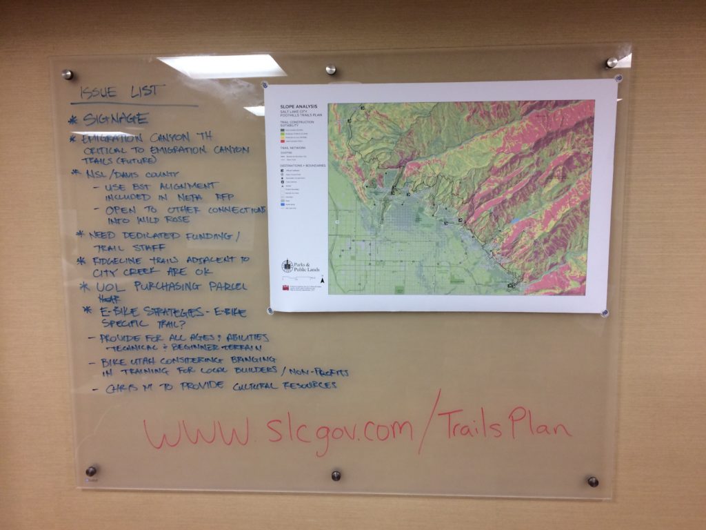
November 12, 2017 – Salt Lake City, Utah – Salt Lake City is getting ready to move forward with a new Foothills Trails Plan that includes 30 miles of new, mostly mountain bike accessible, trails in the area from the North Salt Lake/Salt Lake City border to Emigration Canyon. The planning process is still in the preliminary stages. A survey has been taken of Salt Lake City residents, initial stakeholder meetings have taken place, and a very preliminary draft of the new trails has been created.
“SLC’s Trails & Natural Lands Program will be working over the next year to create a trail system plan for the City’s north and central foothills. The primary objectives of the foothill trail plan are: (1) to provide detailed layout, design and management recommendations for a comprehensive non-motorized foothill recreational trail system that is safe, enjoyable, accessible, connected, and sustainable; and (2) to provide information to guide strategic implementation of the trail system over a 10-year time horizon. The Plan area is bounded (very approximately) by the Davis County Line on the north, by Emigration Canyon on the south, by protected watershed lands and natural areas to the east, and by developed residential neighborhoods to the west. This spring, Salt Lake City will be soliciting competitive bids for a consultant to assist with the plan effort and will be conducting public outreach through a variety of forums,” reads a statement from Salt Lake City Open Space.
The area in consideration is from the North Salt Lake border to Emigration Canyon and the Hogle Zoo area, in Salt Lake City proper (as opposed to the broader Salt Lake Valley). The new potential trails include hiking only trails, uphill bike/hiker multi-directional trails, and bike optimized directional trails. Salt Lake City is looking to build the trails over the next 10 years, and would use funding from the Open Space Trust. It’s not clear from the trails website what trust they are referring to, but it’s likely part of the Open Space Lands Program. It’s not clear yet if developer impact fees will go to the trails, but they are a potential funding source, and one that Salt Lake City has not used to their full capacity. Many of the new trails would be located in the area near the Davis County-North Salt Lake / Salt Lake City border. Alta Planning and Design, a leading bicycle and trail oriented planning firm, is a key consultant on the project.
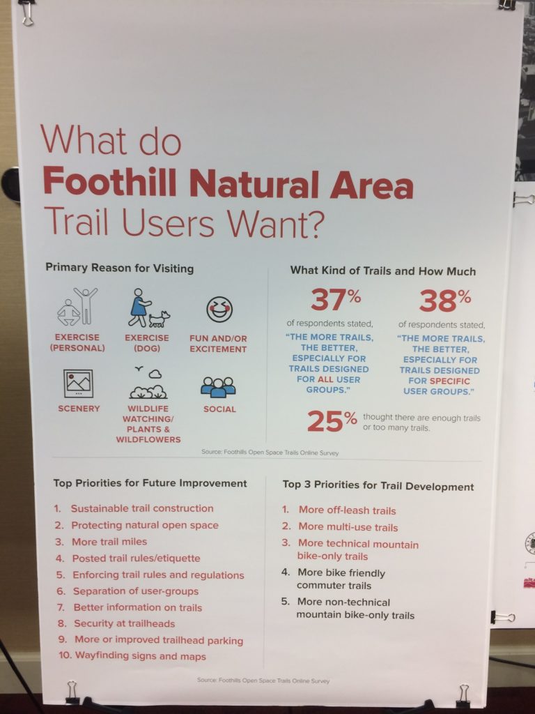
Salt Lake City resident trail users were enthusiastic in their support of more trails in the Foothills in the recent Open Space Trails Survey. Hiking is the primary current use of the Foothill trails, followed by recreational Mountain Biking, Dog Walking, Trail Running, and MTB Freeride, with a few horseback users. Almost 75% of respondents wanted to see more trails in the Foothills.
A photo gallery from the recent workshop is below. Public open houses and opportunities to comment will be coming up soon.
Cycling Utah is ecstatic at the possibility of more trails of all types in the foothills above Salt Lake City. The Trails Plan is a long needed, and incredible step forward for Salt Lake City. We don’t have comments on any of the particular trails at this time, but would very much like to see the creation of a Salt Lake Cycle Park (similar to the Draper Cycle Park) as part of the overall plan. This could be in the area above the zoo, for example. See our document, A Proposal for a Salt Lake City Recreational Cycling Plan for more ideas.
It will be important for all residents and trail users that trail conflicts are minimized, both with biking and hiking specific trails such as those that the plan proposes, and education, signage, and trail head information at appropriate locations. Salt Lake City’s great, but limited trail system sees heavy use, and proper design and education will be key to enjoyment of the trails for all for years to come.
Additionally, we encourage the Mayor and the Salt Lake City Council to aggressively utilize developer impact fees to create new recreation opportunities of all types, including the trails plan. Salt Lake City has done an abysmal job of using these fees, often returning them to the developer. Salt Lake City had a moratorium on the fees for a year in 2015 to reboot the system, but that has since expired, and there’s little evidence that things have improved.
The trail system will require ongoing maintenance and support. Some of this could come from working with the three current trails groups in Salt Lake City: The Salt Lake Valley Trails Society, Trails Utah, and the Bonneville Shoreline Trails Committee. Those groups should consider the formation of a foundation approach, similar to that of the highly successful Mountain Trails Foundation of Summit County. Note, that Summit County benefits from the resort sales tax, something Salt Lake City does not receive, so the funding of this may be at a lesser level, or need a different funding stream.
Proposed Trail Network showing existing and new trails, including hiking and biking only trails. Salt Lake City has begun a process for new trails in the Foothills from North Salt Lake to Emigration Canyon. Photo by Dave IltisProposed Trail Network showing property holdings, existing and new trails, including hiking and biking only trails. Salt Lake City has begun a process for new trails in the Foothills from North Salt Lake to Emigration Canyon. Photo by Dave IltisPotential trail access points. Salt Lake City has begun a process for new trails in the Foothills from North Salt Lake to Emigration Canyon. Photo by Dave IltisSalt Lake City’s existing trail network. Salt Lake City has begun a process for new trails in the Foothills from North Salt Lake to Emigration Canyon. Photo by Dave IltisWhat do trail users want? Salt Lake City has begun a process for new trails in the Foothills from North Salt Lake to Emigration Canyon. Photo by Dave IltisWho are Salt Lake City’s trail users? Salt Lake City has begun a process for new trails in the Foothills from North Salt Lake to Emigration Canyon. Photo by Dave IltisWhy are the Foothills so important? Salt Lake City has begun a process for new trails in the Foothills from North Salt Lake to Emigration Canyon. Photo by Dave IltisCurrent issues in the Salt Lake City Foothills. Salt Lake City has begun a process for new trails in the Foothills from North Salt Lake to Emigration Canyon. Photo by Dave Iltis
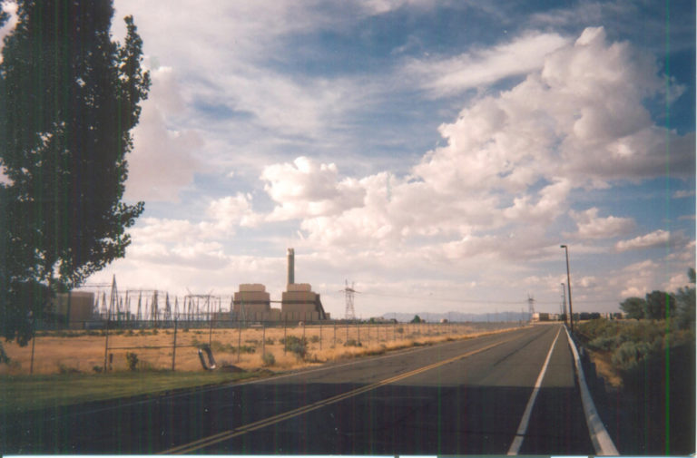
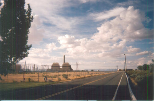
The Intermountain Power Project stands like a sentinel in the desert, and is visible for miles around. Photo by Wayne Cottrell
By Wayne Cottrell
The Delta Dunes Cruise is a 56.9-mile loop through desert communities of northeastern Millard County, starting and finishing in Delta. The city of Delta is located 133 miles to the southwest of Salt Lake City, in the vast Sevier Desert. Delta is a gateway city to the Great Basin Desert, being the last point of urbanization for about 150 miles when heading west. Delta and the surrounding communities had a population of about 4,800 in 2013, representing just under 40% of Millard County’s total. Although Delta’s surroundings can appear as dry, arid and barren, the economy is actually heavily based on the flowing waters of the Sevier River. Irrigation from the river enables an abundance of agriculture, including dairy products, in the region. The river tends to run dry to the south of Delta, though, in part because of its use in the fields, but also because of upstream damming. The DMAD (Deseret, Melville, Abraham and Delta) project stores some of the water in a reservoir, and diverts some to the IPP. The latter, the Intermountain Power Project, a coal-fired power plant, supplies nearly all of the electricity for Los Angeles County, California.
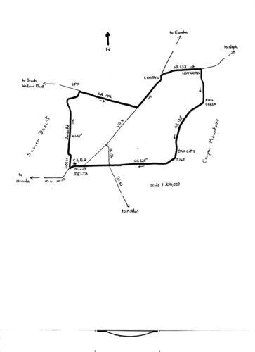
You can generate your own power in this bike ride, perhaps enough to light up one of the smaller communities in the Sevier. Although the ride passes through several towns along the way, at which you can stop to reload on fluids and refreshment, be sure to carry plenty with you for the long stretches in between. Start the ride at City Park, located in the heart of Delta, along Main Street. Head west from 200 West, on Main Street. Wake your legs up with a brisk climb and descent over the railroad tracks that border the city. You are now on double-signed U.S. Routes 6 and 50, leaving Delta. Turn right onto 1000 West at the 0.9-mile mark of the ride and head north. There are a few industrial uses out here, but the land is predominantly agricultural for the next few miles. 1000 West curves to left at mile 2.4, becoming 1500 North. Turn right at North Jones Road (mile 2.7), and continue heading north. Standing like a sentinel in the desert, well off in the distance, is the Intermountain Power Project (IPP). It is nine miles away, but looks closer than it actually is. The Sevier River snakes through the wetlands region off to your right; you may be able to catch a glimpse of it, although there really is no “high ground” out here. The low elevation of the ride (4,605 feet) is reached as you head north on Jones. About ten miles to the west of here is the abandoned community of Topaz, which served as an internment camp for Japanese-Americans during World War II. The camp’s population reached a peak of 8,255 during that time, making Topaz the fifth-largest settlement in Utah. About two-thirds of the internees were actually U.S. citizens. The Central Utah Relocation Center, as it is now called, is on the National Register of Historic Places.
The massive IPP is at the junction of Jones and State Route (SR) 174, at mile 11.6. Turn right here, and head east southeast. SR 174 is also known as Brush-Wellman Road, in reference to one of Delta’s other chief economic activities: mining. The Brush-Wellman Plant, where beryllium is extracted from ore, is actually located well west of here. For good reason: beryllium is highly toxic! Continue heading along the straight-as-an-arrow SR 174; notice the sand dunes to your left and right. SR 174 climbs very gradually to a junction with U.S. 6 (elevation 4,790 feet). There is a railroad crossing just before the junction. Turn left onto U.S. 6, now at mile 19.7, and head northeast. Enter the town of Lynndyl at mile 24.4. This town had a population of 110 in 2013, reflecting an 18% loss since 2000. The town was named after the city of Lynn, Massachusetts (true!). Turn right onto SR 132 at mile 25.7 and head east. The highway descends gradually into a valley corridor, with railroad tracks on your left, and the Sevier River coming up from your right. Enter the town of Leamington at mile 29.4. The population of 227 in 2012 was down 36% from its 1930s-era peak of 356. Turn right onto SR 125 at mile 30.65 and head south. The Canyon Mountains are to your left. At the aptly-named Cemetery Lane, the highway starts the only truly significant climb of the entire ride: a 4.2% grade for the next 1.75 miles, taking you up to 4,933 feet. After plateauing for about two miles, the climb continues, breaking the 5,000-foot elevation mark for the first time, as you enter the community of Fool Creek at mile 35.1. The story behind the name is that pioneers entered the area, excited to find water flowing in the creek. The pioneers enthusiastically returned with their families, only to find that the creek had run dry.
Map of Delta Dunes Bicycle Ride.
After leveling off again, SR 125 begins a gradual climb into Oak City. This city had a population of 592 in 2013, down 9% from 2000. Oak City was the nation’s first choice for an atomic weapons laboratory during the 1940s, at which the first A-bomb would be built. Dr. J. Robert Oppenheimer, the director of the Manhattan Project, overruled the choice, however, preferring Los Alamos, New Mexico. While pondering what might have been as you pedal on through, perhaps it is fitting that the high elevation of the ride is reached here (5,163 feet, at mile 43.8). Stay on SR 125 as it curves to the right to head west. From here, it is literally a straight shot back to Delta, over a long, gradual descent of just over 500 feet. Keep straight onto U.S. 50 at the junction at mile 52.5. Enter Delta at mile 55.3; keep straight at the junction with U.S. 6 at mile 56.1, continuing onto Main Street. Watch out for motor vehicle turning movements at this tricky intersection. The ride ends at 200 West, at City Park, at mile 56.9.
For more rides, see Road Biking Utah (Falcon Guides), written by avid cyclist Wayne Cottrell. Road Biking Utah features descriptions of 40 road bike rides in Utah. The ride lengths range from 14 to 106 miles, and the book’s coverage is statewide: from Wendover to Vernal, and from Bear Lake to St. George to Bluff. Each ride description features information about the suggested start-finish location, length, mileposts, terrain, traffic conditions and, most importantly, sights. The text is rich in detail about each route, including history, folklore, flora, fauna and, of course, scenery.
Road biking Utah Book Cover
Wayne Cottrell is a former Utah resident who conducted extensive research while living here – and even after moving – to develop the content for the book.
At the October 2017 Salt Lake County Bicycle Advisory Committee meeting, we were visited by Holly Smith, and Paul Allred from Holladay City to discuss the new park about to be built that will accommodate bicyclists. Knudsen Park, located at 6200 South Holladay Boulevard, will be over 6 acres, and will feature bike pathways, incorporating the pre-existing trails there, as well as pavilions, a playground, and a nature preserve. In addition, it will also include improvements to the intersection of 6200 South and Holladay Blvd., and overall help with connectivity for cyclists who travel to and from Big Cottonwood Canyon. During construction, which will be between November 2017 to Spetember 2018, the trails that run through the area will be closed. Therefore, designated detour routing will be 6200 South, from Holladay Blvd., to 2300 East, then southward on 2300 East to 6485 South to connect to the regional bike network. Detour wayward signage will be provided by the Holladay City. For more information, visit cityofholladay.comon Knudsen Park.
Meanwhile, Parley’s Trail was finally completed, with a ribbon-cutting ceremony back on October 17, connecting the Bonneville Shoreline Trail to 900 West. This eight-mile bike pathway now runs along I-80 between Tanner Park and 1700 East, and has the connecting bridge that connects 300 West to 900 West. The next phase will be the proposed section to connect the trail from 900 West to the Jordan River Parkway.
Winter Riding Tips
Finally, as winter approaches, many of you may still take to biking, whether for commuting or taking to the snow on your fat-tire bike. Earlier this year, I attended a seminar on winter commuting for cyclists and here’s what I learned:
First, dress appropriately for the wet weather. Make sure you have an outfit to keep yourself dry on the outside. Also, be sure to have something to keep your hands warm, whether it be gloves or bike mitts. Most importantly, though, dress warm, but not too warm. You do not want to end up sweating yourself on the inside to your detriment by putting on too many layers of clothing. Try to minimize your layering if you plan on riding your bike this winter.
Second, have something handy for red days. Inversions along the Wasatch Front have gotten worse during the winter months. So if you want to ride your bike to help lower the pollution levels, you need a mask to protect yourself from breathing in the harmful particulates in the air. Many cyclists I encountered used painter masks, which do better in filtering the finer particulates. Those can be found in hardware stores.
Finally, clean your bicycle. I recently replaced my bike chain because it rusted over from being out in the wet weather. So make sure you get lubricant made for bikes at your local bike shop or sorting goods store. And apply it gently on your chain about a day in wet weather.
That’s all for now. Have fun and be safe, as always.
Our meetings are open to the public and held on the second Wednesday of each month at the Salt Lake County Government Center at 2001 S. State Street, Salt Lake City in room N4-850 at 5:30pm. For more information, visit http://slco.org/bicycle/
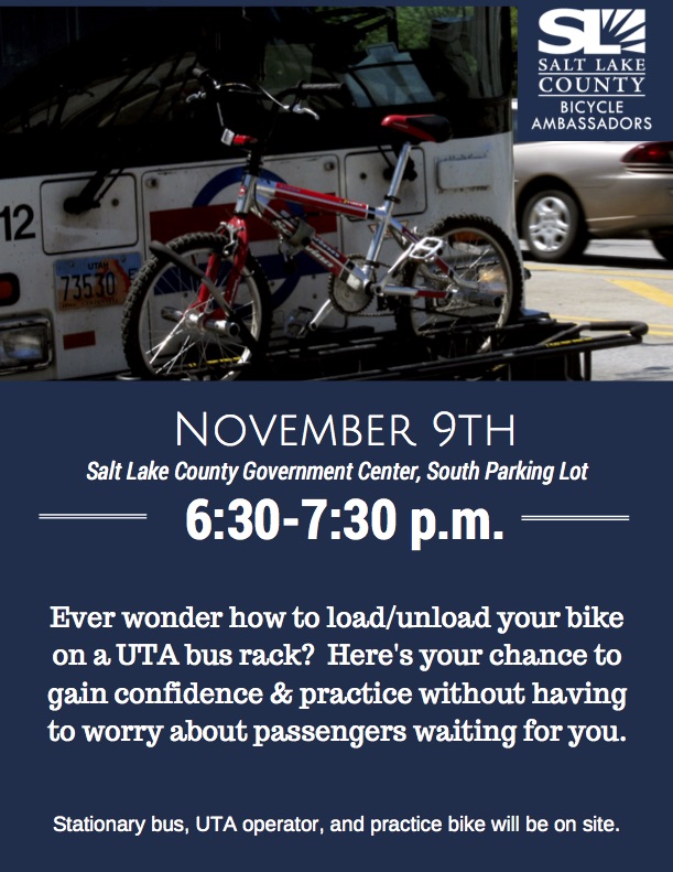
November 6, 2017 – Are you interested in integrating transit with your bike commute? Then come to the Salt Lake County Bicycle Ambassadors’ event on Thursday, November 9, 2017 from 6:30 to 7:30 pm at 2100 S and State at the Salt Lake County Government Complex Parking lot in Salt Lake City. There will be a bus where you can practice loading and unloading your bike on the bike rack.
I don’t know what it is that draws me to think up and attempt bike rides that seemingly have never been done by anyone ever before. There usually is a reason, a good reason, why such bike rides have never been done before. Number one in the Reason Department often has something to do with degree of difficulty. Two years ago I tried to become the first person to bike from Canada to Mexico on the beach (see Cycling Utah, March 2014 issue). On that solo ride, I rode on the ride-able beach for the entire state of Washington before halting my attempt at the Columbia River. I stopped there because of the danger in having to ride on my loaded fat bike on narrow, busy highways when rocky cliffs on the beaches blocked my path and forced me inland. I decided that it wasn’t worth dying to accomplish this feat—and that it could be done safely if I employed a support vehicle. This is a ride that I still look forward to undertaking again to ride the beaches of Oregon and California.
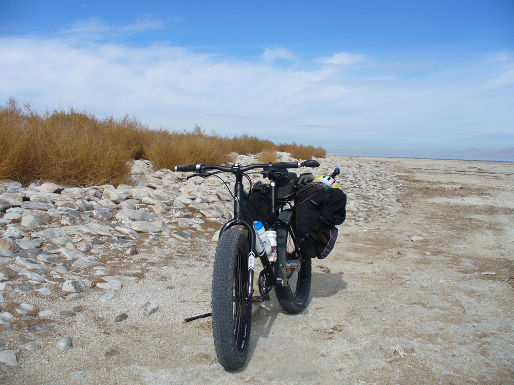
Mel reaches the northern most point of Stansbury Island, behind him, the Great Salt Lake, looking north.
Since that sandy West Coast beach ride, I have been thinking about riding my fat bike around the Great Salt Lake on the shoreline. Doing a Google search, I couldn’t find any reference to it ever having been done before. I did see that others have gone around the Great Salt Lake on roads, but couldn’t find that anyone had ever ridden around it on the sand. That was just enough to get me drooling about the possibilities. It’s curious that I never seem to think that there may be a good reason why one of my cockamamie ideas might never have been attempted. But I’m not wired that way.
Mel’s fat tire bike, near the northern tip of Stansbury Island.
One of the factors that caused me to begin thinking about circumnavigating the lake is that it was presently at a very low level. That would make the circumference of the lake smaller than usual and provide a more expansive (and possibly drier) riding surface. I began looking at the lake on Google Earth to see what the shoreline looked like. I printed off several maps of the lake to take with me, adding notes and named geographic features.
In my naiveté, I thought I could average nearly the same 9-10 mph speed that I was able to do on my fat bike when I rode the coast of Washington on the beach. Unfortunately, two important things that I failed to think about were that (1) I was helped on my coast ride by a very hefty tailwind and (2) the Pacific Ocean’s beach sand was a uniformly smooth surface. The absence of those two factors on my Great Salt Lake circumference ride changed the whole complexion of doing this ride in a timely manner.
So it was that on October 22, 2014, I set out from the Great Salt Lake Marina on my fat bike. One of my sons has a sailboat that he berths at the marina. Using his marina parking pass, I left my car there on what I hoped might be a 3-4 day swing around the perimeter of the lake. I packed sufficient supplies and water in my panniers to last at least that long.
I also realistically told my wife that this was an exploratory experiment. I might find out that it was much more difficult and challenging than I foresaw. In that case, I would retrace my steps and return to the car. I simply did not know without making an initial foray.
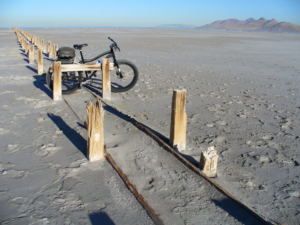
At Old Saltair on the Great Salt Lake.
After letting the marina caretaker know what I was planning, I set out from the parking lot on the part-paved/part-dirt road leading to Black Rock about 1.5 miles west of the marina. Black Rock was surrounded by a myriad of small water inlets stretching out in scattered fashion to drier-looking beach some distance to the west. Not knowing if the sub-surface could support me without sinking up to my hubs in muck, I turned back to get on the Union Pacific railroad right of way. It was marked private property, but at the moment I simply rationalized my dilemma and pedaled on that dirt road west about five miles to a place where I could easily get off the embankment onto the sand.
Upon my return to the marina two days later, I learned that Black Rock is the better, more legal, access place to the beach. The departure from Black Rock should be made by pointing your bike directly towards the Stansbury range of mountains that are south of I-80. If you point your bike in the direction of Stansbury Island, you will end up in a mucky poor situation. Every fresh water crossing I made on the south shore was accomplished without incident. The bottoms were all firm sand. With the current water level so low, none of the maps that I had, reflected in any way the present shoreline of the lake. I was on an excursion of discovery.
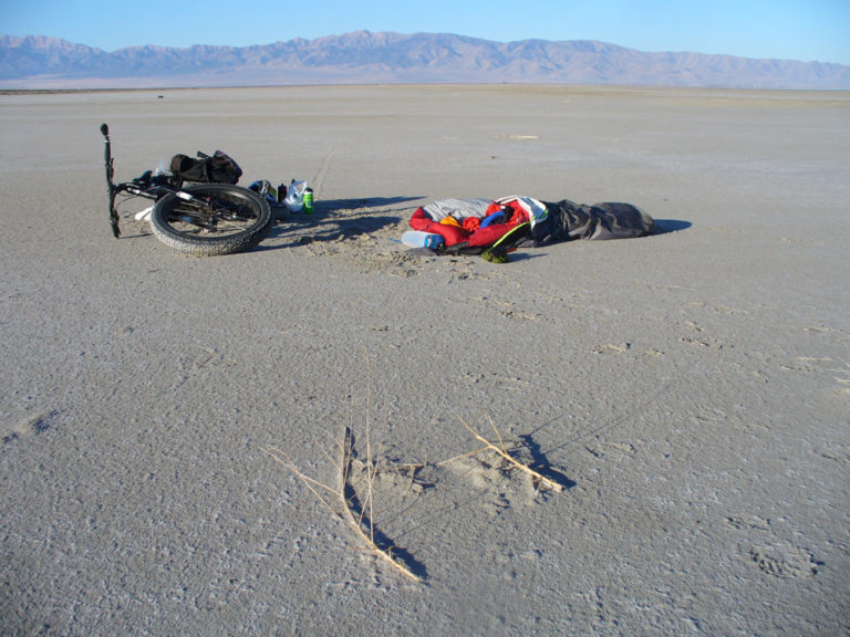
The riding surface on the south shore was very smooth and hard-packed. There were no other bike or ATV tracks. This was very much untouched. I even stumbled on an old weather balloon that may have lain there for years. I cut off the radiosonde, packed it with me, and mailed it back in its postage-paid mailer to the Weather Service upon my return home. A slight breeze off the lake brought lake insects, mosquitoes, and a disagreeable smell. I donned my mosquito-net hat, sprayed repellant, and otherwise enjoyed the ride. As soon as I rounded the southwest corner of the lake and headed northward, the smell and bugs left.
It was also at this point that I began running into evidence of other human traffic. There were many ATV tracks in evidence. I was passed by half a dozen ATVs, all traveling together back and forth to some location in the distance. They all had small-wheeled wagons trailing behind their ATVs. They were friendly and gave me a wave each time they passed. After about nineteen miles, I caught up with them while they were huddled around a large pile of white sacks. They were hauling the sacks of brine shrimp, which they had harvested by hand rakes. They told me that they rarely see other people out on the flats.
A few miles after leaving them, I reached the Morton Salt pumping canal, which led out into the lake. I rode on its canal bank road west about a mile to the trio of pumps, at which place I was able to cross over the flats north of that canal. This canal is situated on the southeast corner of Stansbury Island. On my return journey, I met a Morton Salt security guard here. He saw me off in the distance, a very foreign sight in these parts. He was curious to hear my story. He kindly wanted to make sure I had enough food and water. He also wanted to know if I’d spotted a very mean cow, which local ranchers wanted to capture. I hadn’t. In fact, I hadn’t seen any wildlife and only a couple of birds. The only people I met were the security guard and the brine shrimp harvesters. Although the landscape is bleak, it is not without its own brand of beauty. Sunrises and sunsets bordered on spectacular.
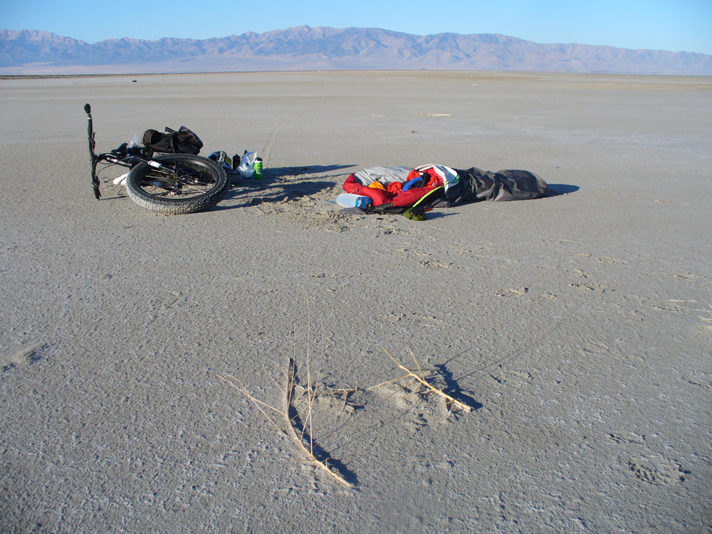
Campsite on the playa, between Stansbury Island and Black Rock, on the return trip to the marina.
About a mile north of the canal, I bedded down on the flat sand next to some big logs, after about a half day pedaling 23 miles. It was disconcerting to discover that my air mattress went flat. I wasn’t able to find the leak (even when I got home) and spent two nights on the hard playa. The next morning I awoke to a beautiful morning light playing over the east flank of Stansbury Island. Although chilly, the stunning scene made me want to get up and continue exploring northward.
I learned in coming and going to the north point of Stansbury Island, that the best riding sandy surface generally lay about a half- to three-quarters of a mile east of the base of the island. Unfortunately on the way north that morning, I ventured too far eastward toward the shoreline and got on some very rough ground. Although the ground closer to the base of the island is moister, it is also smoother. There are several fresh-water springs along the eastern flank, which seep out onto the sand. One of them had a quick-sand type bottom. When I had to cross that short stretch of brackish muck, I had to pedal quick and hard to avoid getting stuck. The Morton Salt employee told me that the springs along the base can be used in a pinch for drinking in a survival situation. I was packing plenty of water. I returned to the marina with two-thirds of my water supply intact and food enough to last another 2-3 days.
I had taken plenty of supplies because I did not know if I might be able to get around the entire lake, or if I would have to cut it short and simply backtrack to the starting point. Only twice was I able to get the bike up to 7 mph, and that only for stretches of about a quarter of a mile. Generally I poked along at about 4-5 mph. Headwinds, lack of tailwind, and a riding surface not conducive to speed bedeviled me. It was challenging to pick out a decent surface. Sometimes the places that looked dry on the surface, hid a slushy underbase that ground me down to a crawl.
It took me 32 miles of pedaling to reach the north tip of Stansbury Island from the marina. There were piles of brine shrimp, brackish tide pools, and a rocky, exposed lake bottom at that point. In times of higher water, there is a switchback road leading up and over that northern point to the west side leading over to evaporation ponds and U. S. Magnesium’s operation.
In this 3-day exploratory outing, I learned that if I want to circumnavigate the lake (and I do), I need to accomplish it over the course of different days and from different starting points around the lake. I have it planned out. Or another option would be to partner with someone and use two cars. In that way, I wouldn’t have to pedal out from the starting point and then return back the same way to get to the car.
I also learned one other very important lesson on my return journey. The shoreline of the Great Salt Lake is an easy place to get lost. When you are at the same level as the lake, you can’t see what may be beyond a distant point of slightly-elevated land. It is irksome and frustrating to go for several miles in a direction, which you think will take you to the right destination, only to discover that you have a big part of the lake still between you and where you want to go.
After crossing the Morton Salt canal, I chose to take a beeline straight to the marina rather than following my bike tracks back. Somewhere on the southwestern corner of the lake, I passed over my bike tracks and got off on some large peninsular area jutting into the lake. I was following lots of ATV tracks and thought it would lead me on a more direct route back to the marina. It didn’t. It took me eight miles out of my way and into a slushy salt area. When I finally found my way around that southwest corner of the lake, it was several hours after dark with my flashlight growing dimmer. I had to bed down for a second night on the hard-pack. My hips were taking a beating.
A week after making this initial exploratory foray, I returned to the Great Salt Lake to pedal the lake’s southern shoreline east of the marina. I parked at the new Saltair, the facility constructed in 1981. I rode 3.6 miles east from there to the Jordan River. The best riding surface in that stretch lay between the site of old Saltair and the river. I tried crossing the river and stopped at a quick-sandy island mid-river. Rather than continue crossing to its east bank at that place, I thought I might try to find another way to get to the shoreline east of the Jordan River in order to ride that stretch of shoreline. After making that decision, I headed back to the new Saltair. I then rode from that place to the marina. Although only 1.6 miles in distance, this was by far the most difficult riding surface of any that I have yet done. It was a quagmire with seeps and creeks to traverse, many with mushy bottoms. I had to snake back and forth, looking for the best places to ride. Numerous times I simply had to get off the bike and push across a mud-sucking creek bed. Let’s hope that this is the worst riding surface on the lake.
Now that I have begun this project, I have to see it through. It’s the way my mind is wired. Any reasonable person would probably chalk this initial exploratory foray up to experience and put this quest out of their mind. But it’s another year. Parts of the shoreline yet to be ridden beckon. There’s no point in wishing things were different in my Reason Department because they’re not. No doubt there will be more ramblings and wrong turns, more mud-sucking creeks, more quagmires. No doubt. More later.


 Anyone who knows me knows that I have done some epic things. But Mr. Burton has taken it to another level far beyond. Who decides to bike to the South Pole? With absolutely no experience camping in winter. At least he had the sense to do it in the southern summer. Still, I am absolutely amazed that through stubbornness and audacious tenacity he actually made it there. Kudos.
 By Dave Iltis
 Near Furnace Creek are a good handful of side trips: The Harmony Borax mine is what started civilizing Death Valley in 1881 and the mildly-interesting ruins of it are just outside of ‘town”, nearby Golden Canyon has a couple of canyon hikes and is famous for its sunset photos, and Artist’s Drive is a paved one way side-loop with a 1-2000’ climb, and both sport spectacular and colorful rock formations that even jaded Utah desert rats will find impressive. And of course there’s Badwater, the innocuous spot a few miles away that is formally the lowest spot in North America at 282 feet below sea, but is somewhat anticlimatic since it’s only a few feet lower than anywhere else and is typically full of tourists wandering around on a playa trying to figure out they should do with themselves besides take cheesy selfies.