Home Blog Page 144

A Bike Tour around the Uinta Mountains

By Lou Melini — A ride around the Uinta mountain range has been on my bucket list of short tours for over a decade. What attracted me to the route is the multitude of roads keeping a bike traveler off of US Highway 40 from Duchesne to Vernal. To the north of the Uinta Mountain range are numerous gravel roads south and west of Fort Bridger, Wyoming, that will take one away from I-80. I also like that I could do this trip from my house without needing a bus, train or car.

In addition to the route, there are ample resupply options along the way that limit the need to carry food no more than 2 days.

I did the trip with 2 “youngsters” that have gone on several overnight rides with me. Patrick and Dave were gracious enough to carry all of the food and spare water over the final 4 days along with being frequently at the front of our small pace line when we encountered headwinds. At 69, I welcomed the assistance.

The route we took is 470 miles with nearly 25,500 feet of elevation gain and of course, elevation loss. During the 7 days of riding, we averaged about 11.4 miles/hour. There were 3 long days of 80-82 miles, over 7 hours of saddle time, and lots of chamois cream.

The first of those days included riding over Wolf Creek Summit, another had 6,400 feet of elevation gain, and the 3rd long day included 46 miles of gravel roads. The one full rest day in Vernal was very welcome for my tired legs.

Planning for the trip during the coronavirus pandemic

Being anxious during the planning phase due to the uncertainty of sudden campground closures is an understatement. On the other hand, news reports of crowded state parks and other campgrounds had me worried about being turned away. Another concern was the ability to socially isolate in a packed campground. A small bottle of hand sanitizer is on my bike tour checklist, but a mask is new to the list. Then there was the nightmare “what-if” such as one of us waking up at night with a fever and a cough.

On the road in the Uintas Bike Tour. Photo by Patrick Watson

We made reservations at 3 campgrounds, a number that equals the number of campground reservations that I have made in over 22,000 lifetime miles of bike travel. It turned out that we could have rolled into any of the 3 campgrounds without a reservation, as none were full, but all were busy with campers. There was plenty of room for social distancing. Fortunately, we did not encounter any mechanical or other issues that might have delayed us from honoring our reservations. We only “stealth” camped once as the campground was closed for reasons unrelated to the coronavirus.

[Author’s Note: On a subsequent trip, all of the campgrounds that I encountered were full on the weekend and many were full during weekdays so plan accordingly.]

In order to limit our exposure to other people, we decided to do group meals that reduced our shopping exposure to one person with a shopping list for breakfast, lunch, dinner and snacks. The plan for meals worked well with the additional benefit of camaraderie within the group.

The Ride

Days 1 and 2

Day one was a meandering route through Park City after climbing to Parley’s Summit on I-80, ending south of Kamas. I’ve done this ride numerous times. Logistical options were limited with the closure of the campground at Rock Cliff recreation area

We started day 2 with just under 10 miles of relatively flat, low-traffic riding before we starting going up. The climb to the top of Wolf Creek summit is long and steep, longer and steeper than I remember in my younger days. The road has one switchback to reach the summit at 9,500 feet. The US Forest Service campground at the summit provided plenty of rocks to sit on for a much-needed rest. The next 47 miles that took us almost to Duchesne were downhill with a tailwind. For lunch, we cruised into Tabiona to the City Park, which had a great view of the southern Uinta Mountains.

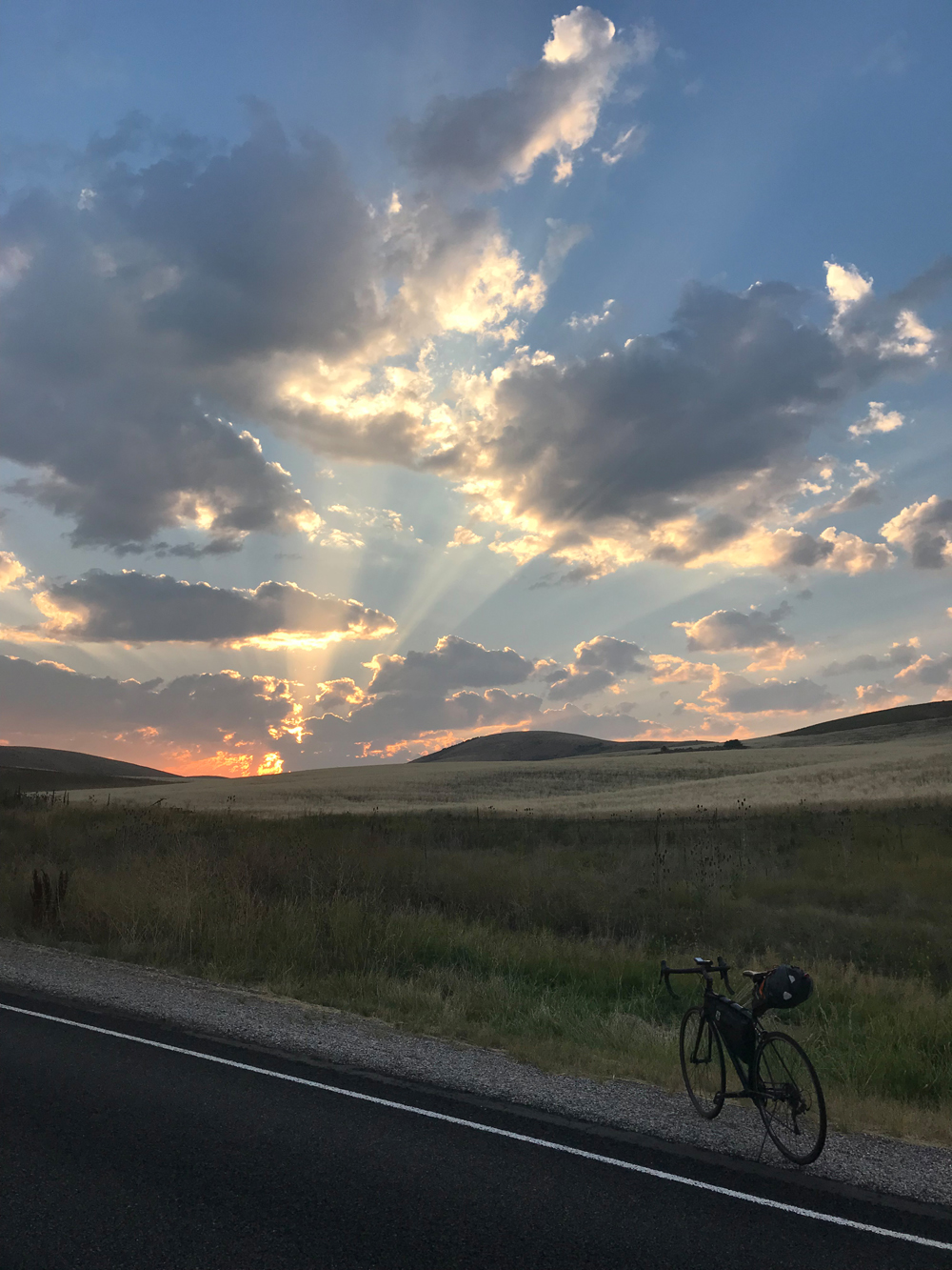
We averaged over 20 miles/hour on this 47-mile section of the ride, ending the 80-mile day with a short steep climb to Starvation State Park. We immediately changed our reservation to the campground that had much needed showers. The neighboring campers brought over beer and Pepsi that we could choose from, which was a nice experience, accompanied by beautiful views and a nice sandy place that was nearly surrounded by grass to pitch our tents.

At 11:00 PM we found out why the grass was so nice as we were awoken by the sprinkler system going off. No one put the fly on their tent as it was warm, and the stargazing was nice, but due to the wind, we were getting sprayed. There was quite a bit of shouting as we pulled up stakes and moved our tents away from the water. We quickly got everything under control at the cost of a small tear in 2 tents, plus I cut my finger pulling out a tent stake.

Typical highway and shoulder north of Vernal, Utah. Uintas Bike Tour scenes.

Days 3 and 4

The ride to Vernal from Starvation State Park was a proverbial walk-in-the-park. Relatively flat roads, a nice tail wind and except for a short section near Roosevelt and the approach to Vernal, we had roads devoid of traffic for the 65-mile day. Vernal had all we needed. The KOA campground was very clean, and well-stocked with nice people to make our stay pleasant. In addition, we had a small pool to relax in and an outdoor stovetop so we could save our fuel. As I mentioned earlier, we took a rest day here for the anxiously anticipated 80-miles and 6400 feet of climbing to Manila. In a fit of panic, I considered hiring a shuttle to take me part way. Fortunately, a cooler head prevailed when I realized that the road is open year-round and has a fair amount of truck traffic, which meant the grade of the road is fairly reasonable.

Days 5 and 6

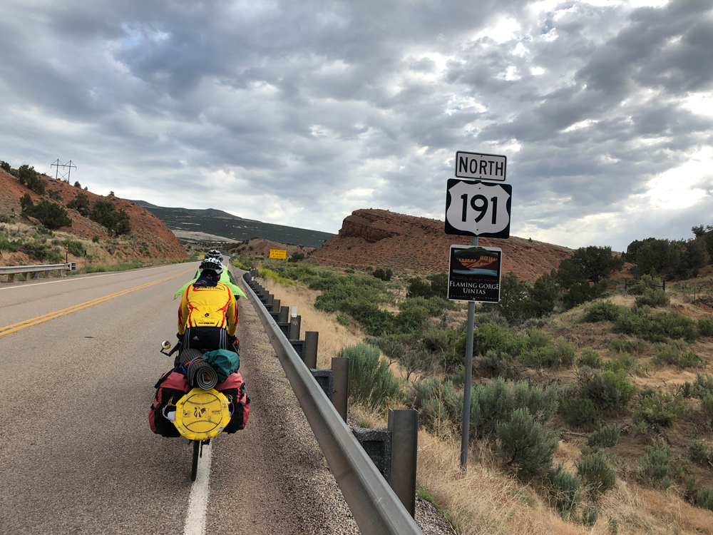
We had an early 6:30 AM start for Day 5 out of Vernal. As we approached mile ten there was a sign stating that there were 10 switchbacks and “only” 5-8% grades in the next 4 miles. With a couple of stops for scenic views, the group spun up US Highway 191 only to come to even more beautiful scenery at the summit, where we rode through a Ponderosa pine forest south and west of Flaming Gorge National Recreation Area.

On the road to Flaming Gorge. Photo by Patrick Watson

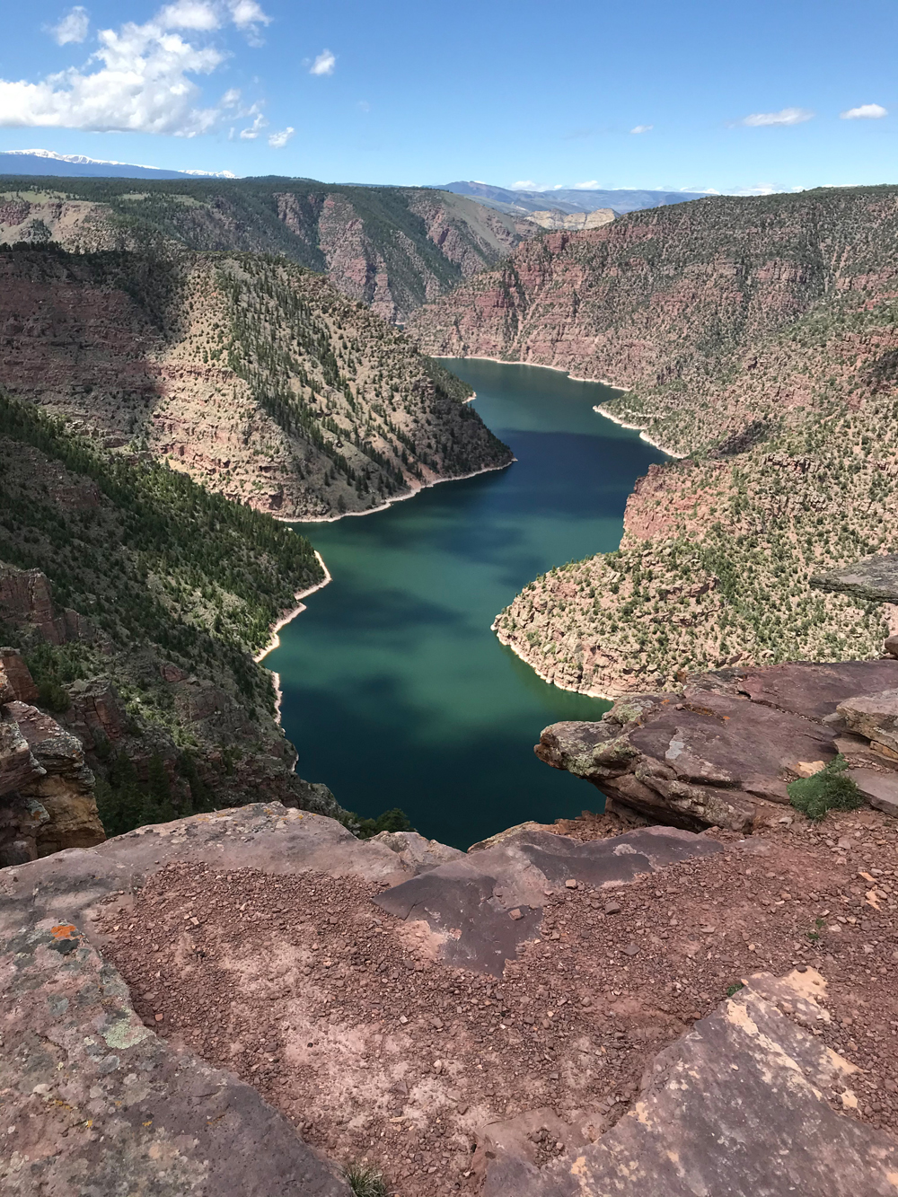
We decided the beautiful road we rode wasn’t enough, so we took a detour for lunch at Red Canyon overlook, a picture-perfect spot. In fact, it looked exactly like the postcard I purchased at the KOA in Vernal. In addition to the views, there are several small Forest Service campgrounds, a café and a visitor center that is to be included as a lodging stop on a return visit. I seem to collect ideas for more trips whenever I go on tour.

We ended the day losing quite a bit of the elevation we gained just prior to Manila. Despite the extensive climbing, we had to carry food on this leg, knowing that Manila did not have a grocery store.

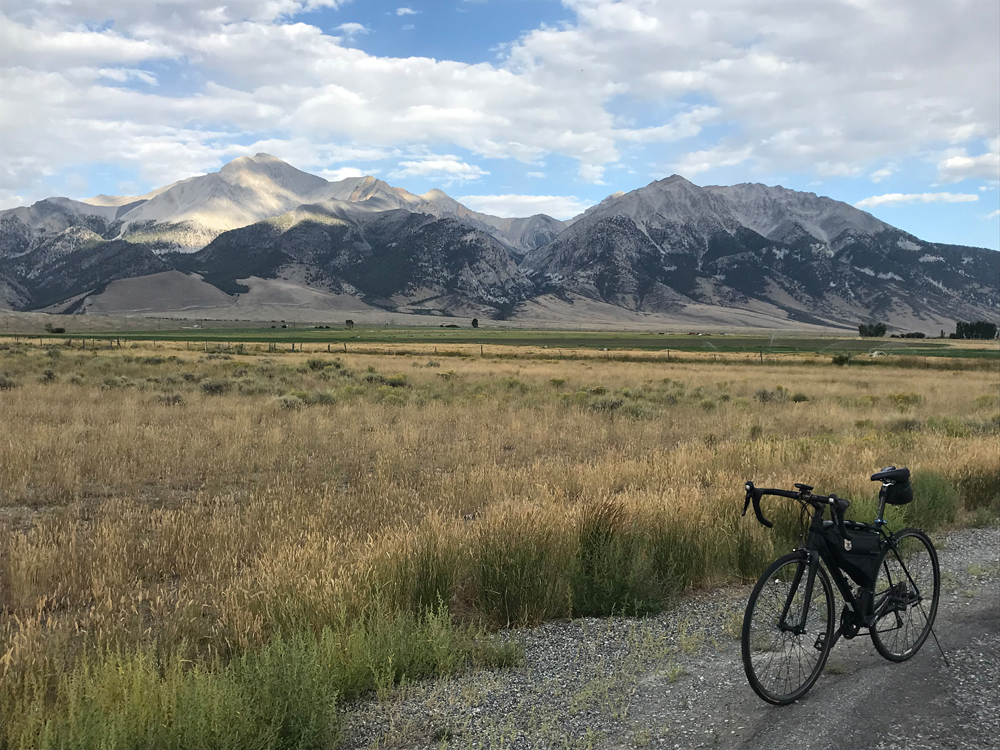
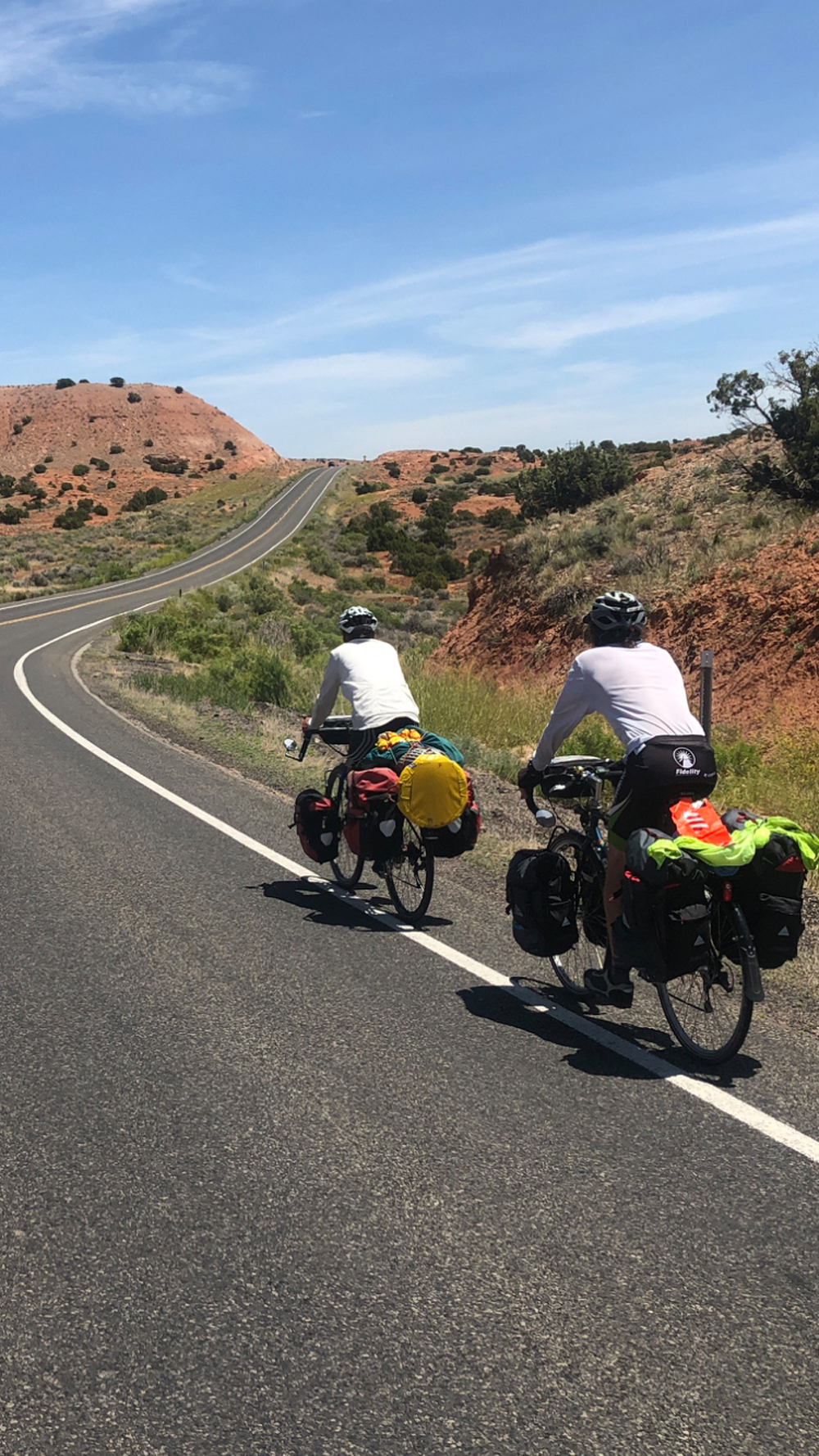
On day 6, we stopped In Mountain View, Wyoming where there is a grocery store but no camping. We had a late lunch and picked up supplies before moving on to Fort Bridger, which has camping, but no grocery. This is part of the logistics of small-town travel that I have frequently encountered. The ride on day 6 was high rangeland once out of Flaming Gorge National Monument, with little climbing, sparse traffic, and views from the north of the Uinta Mountains.

Morning Coffee on day 7

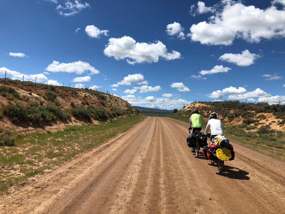
On this day we had about 2,000 feet of net elevation loss but it was still a tough day. We rode 82 miles, including 46 miles of gravel road. When we got to Chalk Creek Road, pavement, and an expected downhill, we faced a stiff uphill draft which slowed our efforts.

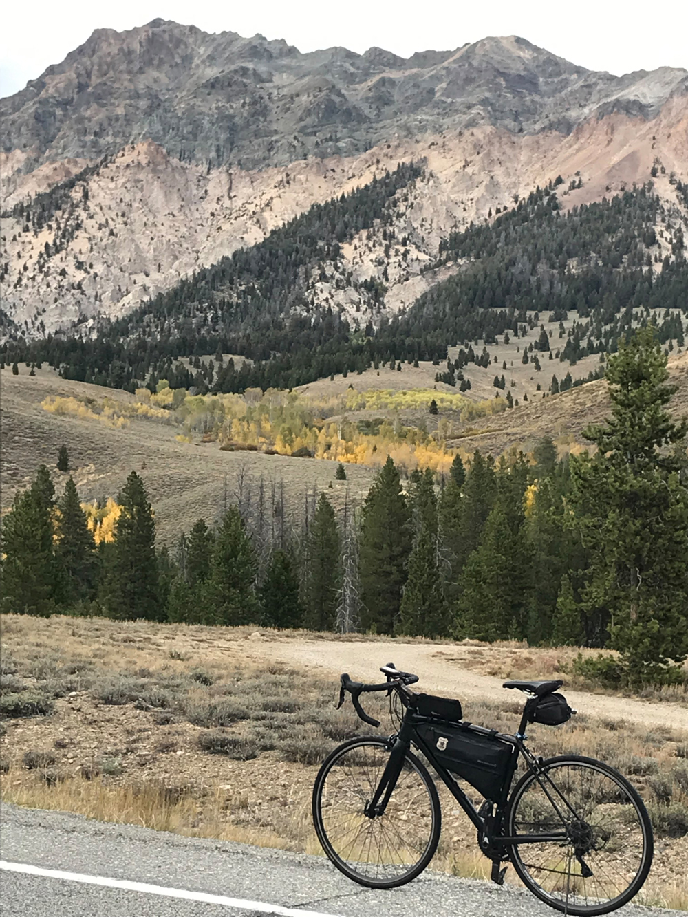
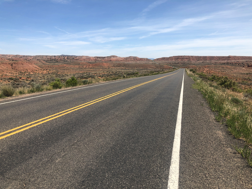
The gravel road from Fort Bridger to Utah Highway 150 (Mirror Lake Scenic Highway) was a highlight. The area is primarily rangeland, with the historical attraction of the original route of the Mormon trek into Utah.

Kilns in the Ghost Town of Piedmont. Photo by Patrick Watson

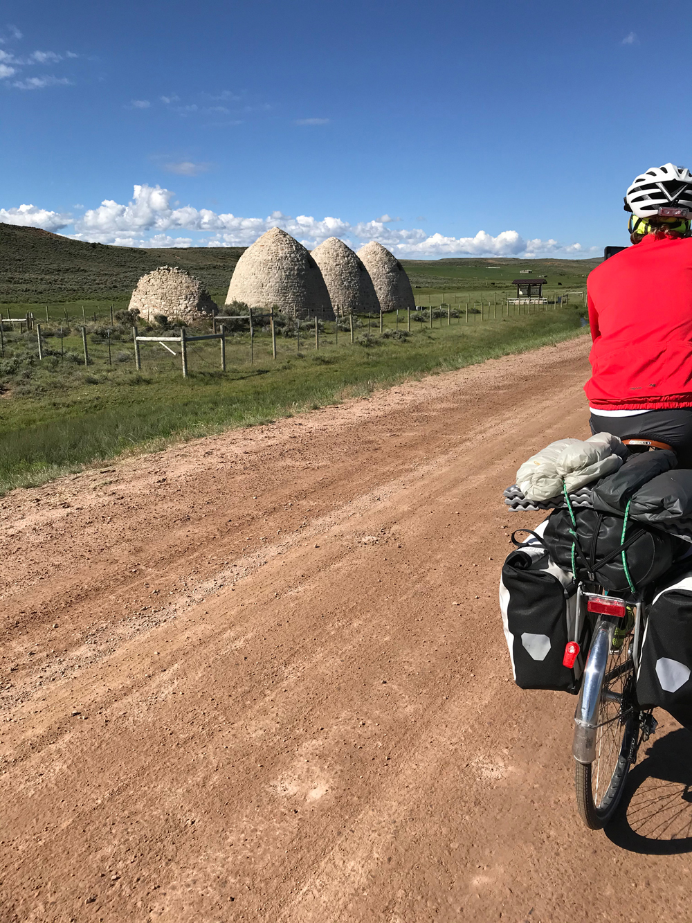
There was the obvious contrast of traditional sheepherders in a pasture shared with large wind turbines. We stopped at the Piedmont charcoal kilns, a formerly prosperous town 150 years ago but now only the kilns remain. There was a lot of wildlife along the way, though we had seen deer, antelope, eagles, osprey, and numerous small mammals and other birds throughout the ride.

When we arrived at the Coalville campground, we had dinner “catered” by Patrick’s wife, Joy. I was beat; beat up tired after the ride. I took a shower then wandered to the office in the slim chance of having coffee, as I didn’t feel like firing up my stove and having instant coffee. As with every tour, a story emerges.

Patrick and Lou on gravel road to Chalk Creek road and eventually to Coalville. Photo by Patrick Watson

There were 2 employees when I entered the office. I asked the young girl behind the counter about coffee. She was about to direct me to the back when the guy stocking shelves spoke up and said; “The coffee is back there, pointing to the back of the office. I made it fresh this morning.”

I looked at him and said, “It’s 4 o’clock! Fresh this morning?”

He said it was in the special carafe that kept it fresh and warm adding that I could try it before I bought it. So, I tried it, then filled my camp mug and added enough sugar to make it OK.

When I approached the cashier, I asked; “So how much is this morning’s coffee?”

The guy interjected and said $1.50. As I slid 2 $1 bills across the counter, the cashier sheepishly slid one back and said; “That’s plenty for morning coffee”.

Dinner was absolutely fantastic. I am still saying thank you to Patrick and Joy for the meal. I turned in early for a good night’s sleep.

Day 8

Dave suggested that we return to Salt Lake City via Henefer and East Canyon, a wise choice as we avoided Park City traffic and the duplication of a route we took on day one. I was home by early afternoon and already looking forward to riding the loop again.

History along the tour

There is a lot of history along the route of this tour. The most notable history is between the old trading post and now city of Fort Bridger and the former city and current ghost town of Piedmont, both located in Wyoming.

In 1842 or 1843, depending on source, Jim Bridger and his partner Louis Vasquez established Fort Bridger to trade with Native Americans and service emigrant traffic along the Overland Trail.

Later emigrants on the Oregon, California, and Mormon trails used Fort Bridger to obtain supplies. Though now famous, Fort Bridger at the time was not as well outfitted as the more “luxurious” Fort Laramie on the eastern Wyoming plains. Fort Bridger also serviced the Pony Express, the Transcontinental Railroad and the Lincoln Highway. When I-80 was built, Fort Bridger was bypassed along with the towns of Lyman, Urie, and Mountain View that now only see traffic as part of a historic byway.

Brigham Young and the Mormon pioneers took control of Fort Bridger in 1853 or 1855 depending on source, to service emigrants on the Mormon trail. In 1857 Fort Bridger became an Army post for most of the next several decades, ending their control of Fort Bridger in 1890.

In 1928 the Fort was sold to the Wyoming Historic Landmark Commission. In 1933 the original 38-acre site became a Wyoming Historical Landmark and Museum.

After leaving Fort Bridger, we stopped in Piedmont, a once thriving town established in 1867 to provide railroad ties for the Union Pacific Railroad. Kilns were built to provide charcoal for the railroad and the Salt Lake City steel industry.

In 1940 the town ceased to exist following the rerouting of the railroad a couple of decades earlier. The name Piedmont was derived from an area in Italy where 2 of the early residents came from. Three of the 5 kilns are still present and were listed on the National Register of Historic Places in 1971.

Near Piedmont are historical markers and encampments where the original route of Mormon pioneers passed through. Small iron rail monuments are also present as reminders of the original transcontinental railroad.

Tour Summary

We left Salt Lake City on June 13, arriving home on June 20. The high temperature for the 8 days was just over 80. There were 3 mornings that we woke up with lows of 39-40 (Kamas, Manila and Fort Bridger). Doing the ride a couple of weeks earlier may insure more comfortable temperatures, but the week we rode was a bit cooler than the previous week, so we got lucky with the weather. We only used the flies on our tents when cooler morning temperatures were expected. The only precipitation we experienced was a brief hailstorm as we approached the Daggett County line north of Vernal, the summit of our climb that day.

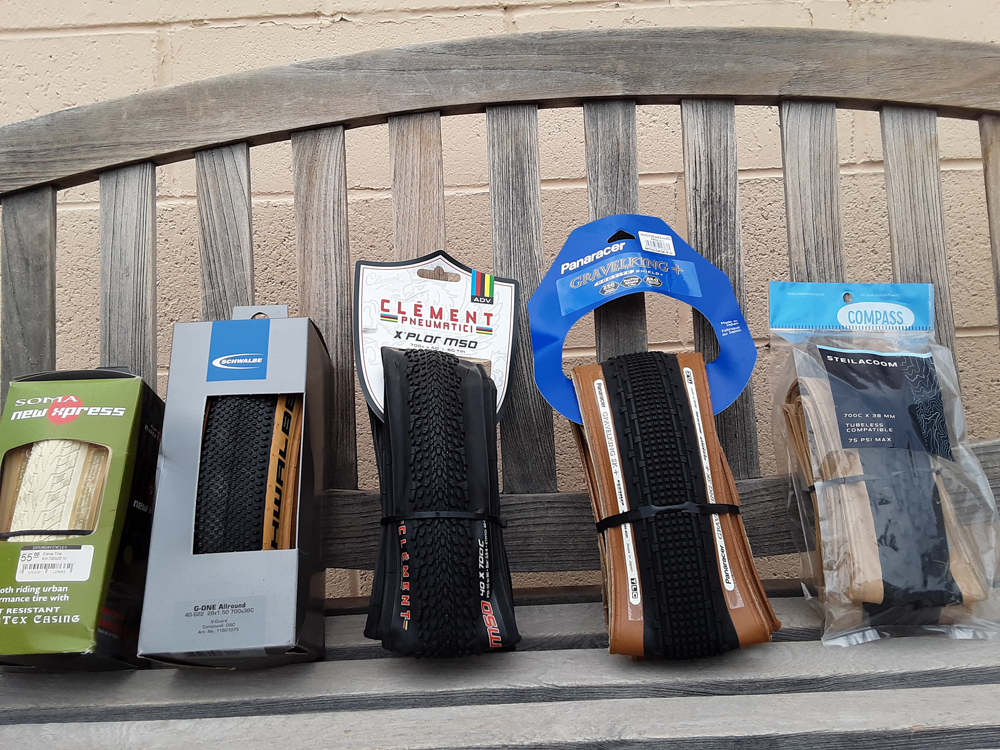
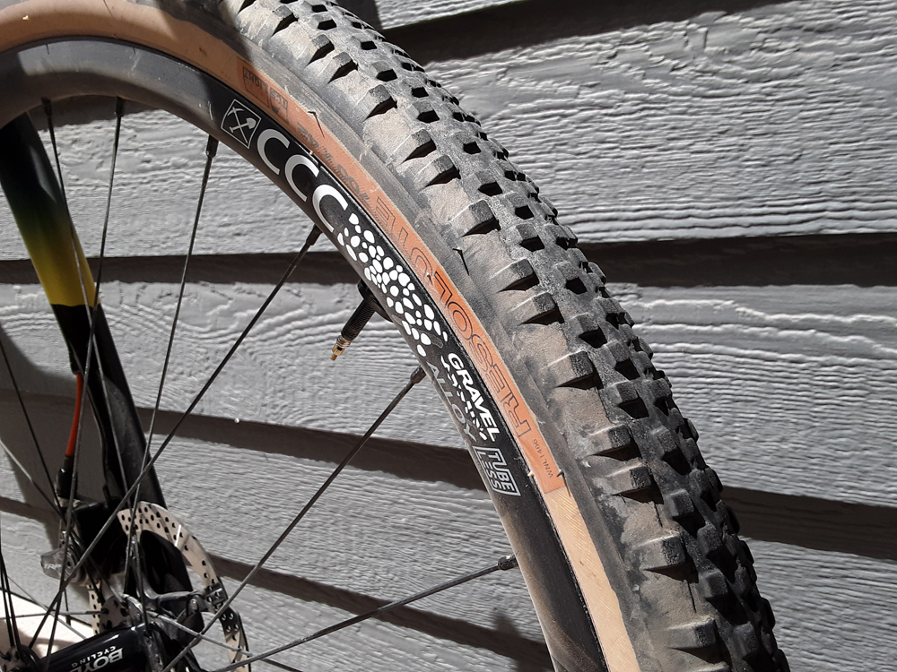
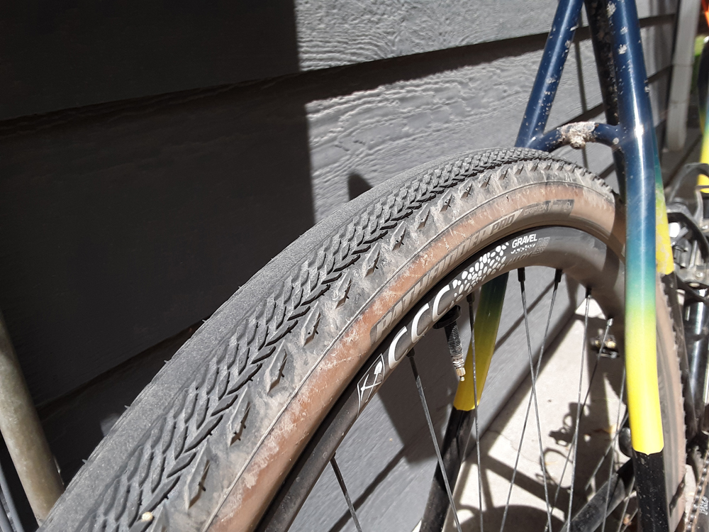
Tire sizes ranged from 700Cx32- to 38-mm on our bikes. No one struggled on the gravel roads, though the ride was bumpy at times. We had one flat tire for the entire tour from a small piece of wire imbedded in the tread. Each of us had a low gear in the range of 20-21 gear inches (24 tooth chain ring/32 tooth cassette ring), which was adequate for Wolf Creek and East Canyon summits.

Flaming Gorge! Photo by Patrick Watson

We stayed in 4 commercial campgrounds, one state park, and one location that I will leave as undisclosed. We had a shower at the end of each day save one, a luxury that we all preferred at the end of long days in the saddle. Forest Service land is available at some of the higher elevations near Wolf Creek summit and Flaming Gorge if one wants to stealth camp or stay in forest service campgrounds.

We traveled mostly on low-traffic roads. Shoulders on roadways were generally narrow. Except for one thrown beer can near Tabiona, traffic was friendly and polite. Not once did I feel like I was on the wrong road. We used a combination of DeLorme maps (provided by me, the old guy) and GPS navigation from the young guys, go figure. Both worked well, though the GPS gave better detail on the gravel roads.

We had redundancy with tools, kitchen items (stoves and pots), and water filters. We ended up only needing the water filters one night. The redundancy helped as one filter clogged and couldn’t be fixed.

For me, traveling on my bike is the most enjoyable and memorable aspect of cycling. This particular tour was outstanding. Scenery, nice accommodations and two great riding partners made this a memorable bucket list tour that I hope to someday repeat. I just hope my aging body and confidence cooperates.

2020 Fears, Tears and Beers Enduro Showed Events How to Survive a Pandemic

COVID-19 Couldn’t Stop the Longest Running MTB Enduro in North America

By Kurt Gensheimer — 2020 was the year of busted plans, particularly if you are in the events business. But there’s one event that didn’t get shut down, the longest-running mountain bike Enduro in North America, Fears, Tears and Beers (FTB) in Ely, Nevada, founded in 2004. Without mass starts, instead featuring individual timed segments, Enduro as an event format is far more COVID compliant. Also, with a cap of only 150 riders, FTB was able to spread those riders out over courses ranging from 20 to 45 miles in length. FTB co-founder and course designer Kent Robertson remarked that the event could have easily topped 150 riders, thanks to a wait list that would have pushed the event well over 200 riders.

Photo courtesy John Shafer, photo-john.net

Instead of canceling the event all together, FTB organizers rescheduled it from its usual early June date to September 26 in the hopes of buying time and better understanding how they could pull off a safe and socially distanced event. Thanks to the organizers, county officials and members of the Great Basin Trails Alliance – a beneficiary of the event – FTB had a COVID-19 plan approved by White Pine County and the event happened, seemingly without issue and with everyone donning proper protective gear.

“It felt good to provide folks with some much-needed event energy in a year with almost no events,” said Kyle Horvath, tourism director for White Pine County. “The Ely community was incredibly supportive of putting on FTB, and community leaders came together to put an effective COVID-19 operating plan in place. I was also happy to see that riders were respectful of our safety requests and acted responsibly.”

Photo courtesy John Shafer, photo-john.net

Aside from not being able to do the signature rollout through both Jailhouse and Nevada Hotel casinos, not having a banquet dinner at the end of the event and requesting that all participants and spectators wear masks and space six feet apart when gathering at Broadbent Park, this year’s FTB seemed to feel somewhat normal in a very abnormal world. The only thing that wasn’t familiar was the course – most definitely a good thing – as for the first time in its 15-year history, FTB featured new courses for each category.

“The silver lining this year was that because of new safety guidelines and a 150-rider limit, we were able to try things like new segments, transfers and staggered starts,” said Horvath. “We got some great feedback, and it will help us make the event even better next year.”

Thanks to the diligent work of the Great Basin Trails Alliance, Ely has been growing its singletrack mileage over the last three years. Just to the southwest of town, Ward Mountain boasts nearly a dozen miles of new trail, including the new Powderberry trail, a descent of approximately five miles and 2,000 vertical feet, a featured segment in FTB that pushed the legs and lungs as well as tire grip, given conditions on event day were incredibly dry and dusty. Powderberry trail is a worthy addition to the network, delivering a good mix of flow and technical, rocky descending through tight corners; a hand-built trail that took Kent Robertson five years to construct.

Photo courtesy John Shafer, photo-john.net

Also new for the Pro class was a trail called Rob’s Knob just to the north of town off the shoulder of Squaw Peak near the notorious Whorehouse Hill trail (Ely isn’t quite up to date yet on politically correct nomenclature). Rob’s Knob is an incredibly steep and technical downhill track featuring numerous rock slab drops and moments of bike surfing over sandy, loose soil. The views from the top of downtown Ely and Ward Mountain to the south are as commanding as the attention required to ride Rob’s Knob without going wheels up.

After 45 miles, more than 7,000 vertical feet of climbing and a full eight-hour day spent riding the Pro course, your faithful correspondent was quite worn out crossing the finish line, collapsing face down on the nicely manicured lawn of Broadbent Park. Thankfully, a cheering section dubbed “Party Mountain” got me over the hump, twice, motivating riders back up the formidable climb from Ward Mountain campground to the top of Iceplant Trail, one of Ely’s best descents; a screamer of a downhill singletrack with high-speed corners, whoops and a few optional rock drops peppered in.

Although the face coverings at the finish in Broadbent Park couldn’t reveal otherwise, there were far many more smiles than there were fears or tears in this year’s FTB. What about beers? There were still plenty of those enjoyed after the ride, but this year they were more of the bring-your-own kind, consumed while waiting for a lucky winning ticket in the post-event raffle.

“Thanks to the support of Cannondale and Salt Cycles, as well as everyone who bought tickets for the raffle, Great Basin Trails Alliance was able to raise a lot of money for new trails,” said Horvath. “Even though most mountain bikers have never heard of Ely, we’ve been supporting the mountain bike community for decades, and it’s great to see people finally recognizing that Ely isn’t a newcomer in the mountain bike game. We’ve been here and will continue to be here.”

In the year of busted plans, FTB successfully navigated the treacherous pandemic waters, bringing a moment of positivity in a world recently overrun with disappointment.

Peter Drinkwater – Embracing the Hour Long Bike Commute

By Jamie Morningstar — Peter Drinkwater is a forty-something software product manager, father of five, proud Utah Valley resident, and newly-reborn distance cycle commuter.

After years of cushy 2-mile commutes, Peter’s employer, Ancestry.com, recently from Provo to Lehi. The office move increased Peter’s commute to almost 20 miles, but rather than giving up the benefits of his bike commute Peter embraced the chance to try out a long commute by bike.

Peter riding from Orem to Lehi on the Murdock Canal Trail. Photo by Mary Drinkwater

CU: Tell us about your cycling background.

PD: I learned to ride as a kid. Back then it was all about riding around the neighborhood with a pack of wild boys, making jumps to ride off, and hanging out with my friends.

My life as a cycle commuter began during my college years at Brigham Young University. I didn’t have a car and I lived 6 miles from the university and 4 miles from my job. So, for my high school graduation my parents gave me a bike. It was an early mountain bike, a Schwinn Sierra, and I rode it to and from classes and then to and from work most days. I rode through all kinds of weather and all year long and I really came to enjoy the cycle commuting experience. It was great to start the day with some exercise and I liked the feeling of getting to school feeling awake and ready to learn. I also enjoyed seeing the change of seasons up close and personal.

Later I got a car and shifted gears to recreational mountain biking. Over the years I’ve commuted to work and ridden around town, sometimes consistently and other times infrequently.

Over the last 10 years I had settled into a pretty good routine of riding to work almost every day. Work was only a few miles from my home, but a couple of months ago my job moved out to a new office in Lehi. I decided to give the longer commute a try and so far it has worked out well.

CU: You’ve enjoyed both mountain biking and commuting over the years. What are the unique benefits of each style?

PD: Commuting was really where it started for me. I didn’t have a car of my own until I was in my early twenties, so a bike was a good way to get school, work, friends houses, or wherever I needed to be. For me, biking on the road has nearly always been about utility and getting from point a to point b. Commuting on the bike is good for the world and it’s good for me.

Mountain biking, on the other hand, has always been about recreation – spending time outside and with friends, seeing beautiful places, getting away from it all, and pushing myself to climb or come down something difficult. I really like them both commuting and mountain biking, but I think of them pretty differently.

CU: What’s your new commute like?

PD: My commute is almost 19 miles each way of mostly flat riding. I ride from Orem to Lehi, near the Point of the Mountain between Utah and Salt Lake County.

The best part of my ride is that 34 of my daily 38 miles are on the Murdock Canal Trail. The Trail is flat, smooth, away from traffic, and just a delight to ride on [CU: For more information about the Murdock Canal Trail, see the July 2015 Issue of Cycling Utah online at cyclingwest.com].

My goal is to commute by bike two or three times each week. The rest of the days I work from home or from another office in Orem, so on a good week I don’t drive out to Lehi at all.

So far, the weather has been excellent for the long commute, so I’m still waiting to see how I’ll do with the longer commute in dark, cold, rain, and snow this fall. I’m pretty well equipped to ride in most weather conditions, so I’m hoping I can ride almost year-round.

CU: 38 miles is a serious commute! How do you cope with the logistics of a long ride before and after work?

PD: My daily commute takes me just about an hour each way. I’m lucky to have a casual office where I can roll in sweaty and out of breath and just start working. Once I cool down a bit, I take a shower and change for the day.

The bike storage room at Ancestry.com’s new Lehi office. Photo by Peter Drinkwater

The new Ancestry.com office is well equipped for cycle commuters. The office has secure indoor bike storage, nice showers with towels, shampoo and soap available, and some excellent free food and refreshment options. There are a fair number of people who ride to the new office and it’s an honor to hang my bike next to theirs.

To carry my essentials for the day, I use a pannier attached to a back rack. I carry my lunch, my clothes for the day, bike tools, and anything else I might need for the day. I prefer a pannier so I can avoid carrying a backpack – packs can get pretty sweaty and unpleasant on a long ride.

I recently rigged up a clothesline under my desk using some strong magnetic hooks so I can hang things up to dry during the day. Luckily, my coworkers are very understanding – one is even a fellow cyclist who has a commute very similar to mine.

CU: How has the transition to a longer commute been?

PD: It took a few trips to get the legs used to the longer ride, but it’s been pretty smooth.

The hardest adjustment has been the commitment of spending an hour each way commuting and the resulting reduced flexibility in my schedule. With my former short commute, I was pretty spoiled. Now I can’t just pop home for lunch or to pick up something I left or run out to something at one of the kids’ schools. Before I leave home every day, I have to make sure I have everything I need for an eight-hour workday plus two hours of riding.

CU: What bike do you commute on?

PD: I have several bikes, but for this longer commute I’ve been using a Diamondback Haanjo Comp. It’s a combination road and gravel bike that I found on sale when I needed a bike for a long-distance ride I did with some friends. It’s very sturdy, but still fairly light. It has good tire clearance and came with some wider, knobby tires which may come in handy once winter comes. The only changes I’ve made to the stock setup are adding a rear rack and putting on road tires that I can run at 120 psi. My bike handles the commute very well, though I haven’t fully adjusted to the drop bars and often think about switching them out for something flat.

CU: What advice do you have for readers who want to make their lifestyle more bike-friendly?

PD: I guess I’d just say, “do it”. Grab a bike, hop on it, and ride somewhere. You can start out small, riding around town with your family. We ride to the store, church, the park, the library, and other places around town. Sometimes we all just hop on our bikes and head off somewhere, typically with the soft glow of the sunset gently coloring the western sky and lighting up the mountains to the east as we enjoy the evening

If you want to try out cycle commuting, just do it. If you haven’t ridden much, talk with someone who can help get your bike set up to fit you right, and then just get on it and ride. See what works, what doesn’t, and then adapt.

This is a great time to be a commuter. There are so many good resources out there and such great equipment available. Just get out there and find something that will work for you.

If you have a suggestion for a commuter profile, have a commuter question, or other comments, please send it to [email protected].

Utah Jazz Great Mark Eaton Dies in Apparent Bicycle Crash

Mark Eaton, a former Utah Jazz player and the NBA Defensive Player of the Year in 1984-5 and 1988-9 has died at 64.

Eaton was found unconscious on Long Rifle Road near his home in Summit County Friday evening, May 28, 2021, following an apparent bike crash. Medical personnel arrived at the scene and Eaton was transported to a nearby hospital where he died. The Summit County Sheriff’s Office said there were no witnesses to the crash and no reason to believe a vehicle was involved in the incident. The Utah Office of the Medical Examiner will determine the cause of Eaton’s death.

SALT LAKE CITY, UT - MARCH 25: of the Utah Jazz of the Portland Trail Blazers at EnergySolutions Arena on March 25, 2015 in Salt Lake City, Utah. NOTE TO USER: User expressly acknowledges and agrees that, by downloading and or using this Photograph, User is consenting to the terms and conditions of the Getty Images License Agreement. Mandatory Copyright Notice: Copyright 2015 NBAE (Photo by Melissa Majchrzak/NBAE via Getty Images)
SALT LAKE CITY, UT – MARCH 25: of the Utah Jazz of the Portland Trail Blazers at EnergySolutions Arena on March 25, 2015 in Salt Lake City, Utah. NOTE TO USER: User expressly acknowledges and agrees that, by downloading and or using this Photograph, User is consenting to the terms and conditions of the Getty Images License Agreement. Mandatory Copyright Notice: Copyright 2015 NBAE (Photo by Melissa Majchrzak/NBAE via Getty Images). Photo courtesy Utah Jazz.

“The Utah Jazz are profoundly saddened at the unexpected passing of Mark Eaton, who was an enduring figure in our franchise history and had a significant impact in the community after his basketball career,” the team wrote. “Mark played his entire 11-year NBA career with the Jazz and his number was retired as an NBA All-Star and two-time NBA Defensive Player of the Year,” the Utah Jazz said in a statement. “His presence continued around the organization as a friend and ambassador while giving back as a businessman and volunteer to his adopted hometown in Utah. We extend our deepest condolences to his wife Teri and their extended family. Mark will be greatly missed by all of us with the Jazz.”

SALT LAKE CITY, UT - OCTOBER 04: Mark Eaton presents Rudy Gobert #27 of the Utah Jazz his defensive player of the year trophy during the meet the team event at vivint.SmartHome Arena on October 04, 2019 in Salt Lake City, Utah. NOTE TO USER: User expressly acknowledges and agrees that, by downloading and or using this Photograph, User is consenting to the terms and conditions of the Getty Images License Agreement. Mandatory Copyright Notice: Copyright 2019 NBAE (Photo by Melissa Majchrzak/NBAE via Getty Images)
SALT LAKE CITY, UT – OCTOBER 04: Mark Eaton presents Rudy Gobert #27 of the Utah Jazz his defensive player of the year trophy during the meet the team event at vivint.SmartHome Arena on October 04, 2019 in Salt Lake City, Utah. NOTE TO USER: User expressly acknowledges and agrees that, by downloading and or using this Photograph, User is consenting to the terms and conditions of the Getty Images License Agreement. Mandatory Copyright Notice: Copyright 2019 NBAE (Photo by Melissa Majchrzak/NBAE via Getty Images). Photo courtesy Utah Jazz.

The Jazz also provided the following background about Mark Eaton:

Mark Eaton, 1957-2021, played his entire NBA career (1982-93) with the Utah Jazz. The 7-4 center out of UCLA was drafted by the Jazz in the fourth round of the 1984 NBA Draft. In his 11 NBA seasons, he appeared in 875 games, totaling 5,216 points, 6,939 rebounds and 3,064 blocked shots (fourth-most in NBA history). He led the league in blocks in 1984, ’85, ’87, and ’88.

Eaton was a two-time NBA Defensive Player of the Year (1985 and 1989), a 1989 NBA All-Star and was named to five All-Defensive teams (three First Team and two Second Team honors). One of the best defensive players in NBA history, Eaton holds the NBA record for most blocks in a season (456) and career average blocked shots per game (3.50).

After Eaton retired from the game in 1993, he only further established himself as a member of the Salt Lake community. Eaton owned two restaurants, Tuscany’s and Franck’s in Holladay. He also became an author and a motivational speaker.

Eaton’s #53 jersey was retired by the Utah Jazz during the 1995-96 season.

The Jazz also shared the following tweets:


Cycling West and Cycling Utah’s Late Spring 2021 Issue is Now Available!

Cycling West and Cycling Utah Magazine’s Late Spring 2021 Issue is now available as a free download (12 MB download). Pick up a copy at your favorite Utah, Idaho, Wyoming, Nevada, Montana, Colorado, Arizona, New Mexico and Northern California bike shop or other location.

Download the Magazine Now!

Cycling West Late Spring 2021 Cover Photo: Always a speedster on the climbs, Rain Felkl works her way through a long, low-grade pass, pedaling past 6,000 feet on Highway 395 in California. Read the full story in our Winter 2020 issue online at https://www.cyclingwest.com/category/issues/magazine/2020-pdfs/ Photo by Clara Hatcher
Cycling West Late Spring 2021 Cover Photo: Always a speedster on the climbs, Rain Felkl works her way through a long, low-grade pass, pedaling past 6,000 feet on Highway 395 in California. Read the full story in our Winter 2020 issue online at https://www.cyclingwest.com/category/issues/magazine/2020-pdfs/
Photo by Clara Hatcher

Contents

  • A Trip to Mexico: Bike Repair as Community Service — page 3
  • Pete Buttigieg Has a Mixed Record With Regards to Bicycle Policy, But Cycling Advocates are Hopeful — page 6
  • Bike Lanes are Good for Business — page 6
  • May is Bike Month! — page 7
  • A Lonely Century in the Heart of the Great Basin — page 8
  • Caliente, Nevada Offers Trails to Satisfy Any Type of Rider — page 9
  • Facilitating a Group Ride with New and Developing Riders — page 10
  • Simple Carbohydrates for On the Bike Fuel — page 11
  • A Bicycle Tour to the Parks of Southwestern Utah — page 12
  • Developing Endurance for Long Rides — page 22
  • Three Man Break – The Bicycle Art of Richard Vroom — page 23

The Athlete’s Kitchen: Hot Weather Hydration Tips

By Nancy Clark MS RD CSSD — Steaming hot summers bring up nutrition questions for athletes who are training and competing in the heat:

  • How can I tell if I’ve had enough to drink?
  • Should I be consuming extra electrolytes?
  • Is it possible to drink too much?”
Nicolas Masbourian reaching to grab a fresh bottle and ice sock from soigneur Émilie Roy. Stage 4, 2018 Tour of Utah. Photo by Steven Sheffield

With summers getting hotter and longer, here are some practical hot weather sports nutrition tips.

To start, let’s look at the physiology of keeping the body cool. Normal body temperature is 98.6°F (37°C). When you exercise, your body temperature increases. At 104°, you are in the danger zone. If you were to really overheat and get to 107.6°F (42° C), your cells would get damaged –similar to how raw egg white coagulates as it starts to cook. You don’t want that to happen!

  • To dissipate the heat generated by working muscles, blood flow to the skin increases and your sweat glands get activated. As sweat evaporates from the skin, it provides a cooling effect.
  • Humid heat (New England) is physiologically more stressful than dry heat (Arizona). Hence, athletes who will be traveling to a sporting event want to acclimatize to the environment in which they will be competing.
  • With repeated training in the heat for more than an hour a day, the body acclimatizes over the course of 7 to 14 days. You’ll notice greater exercise capacity. In one study, endurance increased from 48 to 80 minutes.
  • The more you train in the heat, the more you sweat. While this helps keep you cooler, the additional fluid loss can easily lead to progressive dehydration if you do not fully replace sweat losses on a daily basis.
  • Sweat losses of 2 to 3 pounds per hour are common among athletes who exercise vigorously in the heat; some lose more than that. You don’t need to replace every drop of sweat, but you do want to minimize losses, so you end up losing less than 2% of your body weight (3 pounds for a 150-pound athlete).
  • “Drinking to thirst” generally works for day to day living and fitness exercisers, but not always for athletes. Studies suggest drinking to thirst often results in body water deficits of 2% to 3% among athletes who sweat heavily in the heat. That level of dehydration impairs athletic performance. Hence, ironman Triathletes, marathoners, and other endurance athletes should have a drinking plan that balances losses with intake.
  • To learn how much sweat you lose during exercise, weigh yourself nude before and after a hard workout, accounting for any fluid consumed during the session. If you have lost, let’s say 2 pounds per hour (32 ounces, 1 quart), target drinking 6 to 8 ounces every 15 minutes the next time you exercise at that intensity and under those weather conditions. Practice drinking that volume of fluid, to train your gut to handle it comfortably.
  • Monitor progressive under-hydration by taking daily weights first thing in the morning. A downward weight trend can be a warning sign of inadequate fluid replacement, particularly if the morning urine is dark and concentrated. (Yes, it could also reflect fat-loss.)
  • You can tell if you have adequately rehydrated by monitoring the color and volume of your urine—as well as how often you need to urinate. For example, if you sweat heavily during your workout and then don’t pee for five hours afterwards, you are underhydrated. Urine that is dark and concentrated is another warning sign.
  • On a daily basis, your goal is void a significant volume of urine that looks like lemonade, not beer, every 2 to 4 hours. Google urine color chart for a visual resource.
  • When you sweat, you lose not only water but also electrically charged minerals (electrolytes), more commonly known as sodium, calcium, magnesium, and potassium. Sodium (a part of salt) is the main electrolyte of concern.
  • Because you sweat off proportionately more water than sodium, the concentration of sodium in blood actually increases during exercise. In standard (i.e., not extreme) exercise situations, replacement with electrolyte supplements is needless; food eaten at meals/snacks offers ample electrolytes.
  • The primary purpose of sodium in a sports drink is to enhance fluid absorption and retention, as well as enhance absorption of carbohydrate. The amount is inadequate to replace sodium lost in sweat. For example, a slice of bread offers about 125-200 mg sodium; 8-oz. Gatorade offers only 110 mg.. Gatorade Endurance formula, 200 mg.
  • If you will be exercising for hours on end in the heat (i.e., all-day bike ride, ultra-run, or tennis tournament), you can lose a significant amount of sodium. Assuming you will be consuming food during the extended exercise session, you can replenish lost sodium with peanut butter & jelly sandwiches (500 mg sodium), thin pretzels (490 mg/1-oz) and cheese sticks (200 mg/stick).
  • Caution: Do not over-consume plain water and/or sports drink during extended exercise unless you are taking in other sources of sodium. Excess water dilutes the reduced amount of sodium in the blood and can lead to hyponatremia (low blood sodium), a life-threatening condition that can result in death. This can happen, for example, with slow (4-hour) marathoners who diligently drink at every water station, regardless of thirst.
  • After exercise, if you need sodium, you will crave salt and should honor those salt cravings with crackers and cheese, pickles, pizza, potato chips, V-8 Juice—or more simply, sprinkle salt on your recovery meal.
  • Most healthy, sweaty athletes can set aside public health guidelines to “limit your salt intake.” Replacing sodium losses is important to rebalance your body.
  • When you know you will be sweating for more than an hour or two in the heat, plan to boost your pre-exercise salt intake. By consuming 300 to 500 mg sodium before you exercise, the sodium will already be in your body, working to retain water and retard dehydration. During extended exercise, plan to target 500 to 700 mg sodium per hour (and more if you experience muscle cramps).
  • Chocolate milk is preferable to sports drink to enhance rehydration. It offers more sodium (150 mg vs 110/ 8 oz) —as well as more carbohydrate (to replenish glycogen stores) and protein (to repair muscles). Drink wisely!

References:

  1. Consensus recommendations on training and competing in the heat. British Journal of Sports Medicine 2015, 49(18): 1164-1173
  2. Practical Hydration Solutions for Sports. Nutrients 2019; 11(7):1550

Boston-area sports nutritionist Nancy Clark, MS, RD CSSD counsels both casual and competitive athletes, helping them eat to win. The new 6th edition of her Sports Nutrition Guidebook is a best-selling resource. For more information, visit NancyClarkRD.com

Trek Recalls Bontrager Satellite City Bicycle Pedals Due to Fall and Injury Hazards

0

Name of product: Bontrager Satellite City Bicycle Pedals

Hazard: If the recalled pedals are incorrectly installed by the retailer during assembly, they can fall off the crank arm of the bicycle, posing fall and injury hazards to the rider.

Remedy: Replace

Consumers should immediately stop using bicycles equipped with the recalled pedals and contact their local authorized Trek retailer for instructions on receiving free installation of replacement pedals.

Consumer Contact: Trek at 800-373-4594 from 8 a.m. to 6 p.m. CT Monday through Friday or online at www.trekbikes.com and click on “Recalls” under “Legal” at the bottom of the page for more information.

Photos available: https://www.cpsc.gov/Recalls/2021/Trek-Recalls-Bontrager-Satellite-City-Bicycle-Pedals-Due-to-Fall-and-Injury-Hazards

Recall Details

Recall date: May 26, 2021

Units: About 316,500 (In addition, about 28,650 in Canada)

Description: This recall involves Bontrager Satellite City Pedals, which were installed as original equipment on Trek “Allant+,” “Dual Sport+,” “FX 2,” “FX 3,” “Verve 2,” “Verve 3,” and “Verve+” model bicycles. “ZTR02” is stamped on the bicycle’s pedal and on the pedals that were sold separately as a replacement part. The pedals have orange reflectors on the outside edges.

Incidents/Injuries: Trek has received 132 reports of the recalled pedals loosening, locking up or falling off, including seven reports of riders falling and experiencing injuries, including scrapes, bruises and road rash.

Sold At: Trek Bicycle stores and other bicycle stores nationwide, and online at trekbikes.com from January 2018 through April 2021 for between $600 and $6,000. The pedals were also sold separately for about $30.

Importer: Trek Bicycle Corporation, of Waterloo, Wis.

Manufactured in: China

Recall number: 21-142

Five Great Central and Southeastern Idaho Century Rides

By David Collins — Idaho is blessed with iconic geography and interesting diversions. Although these rides include stunning scenery, they often feature hidden gems and forgotten highways and byways – a cyclist’s dream – filled with unforgettable imagery, points of historical interest and quirky pit-stops.

Extended shoulder seasons are usually the best time to ride most of these routes but depending on your skills, equipment, local conditions and road closures, you might be able to ride throughout much of the year. Be weather aware, riding conditions can swiftly change.

Excursions and explorations are part of the fun of unsupported bicycle touring at your own pace. Mileage estimates are approximate and may vary depending on your tracking system and whims of the ride. Be sure to tell someone your plans and allow them to track your location using a smartphone or other device.

Solo or unsupported distance cycling often presents potentially dangerous situations related to terrain, weather, equipment, traffic, navigation and mental awareness. Even experienced cyclists must plan carefully and use wise judgment to successfully mitigate inherent risks of the sport or terminate a ride before it turns injurious or deadly. If you are new to the sport or have never ridden a bicycle 100 miles in a single day, learn the ropes with a seasoned buddy or local riding club before giving one of these routes a go.

Make sure to check maps, plan your route and check local road conditions before you go. As with any ride, be aware of your surroundings and of roadway traffic.

Time to fill water bottles, stuff gear bags, click in and start pedaling central and southeastern Idaho’s great century rides.

Sage, Sun Valley, and Sawtooths Ride. Photo by David Collins

Sage, Sun Valley & Sawtooths

Route: Shoshone, Bellevue, Hailey, Ketchum/Sun Valley, Stanley (one way). North on Idaho 75. 116 miles.

Terrain: Farms and ranches, sage and lava basalt, charming and sometimes chichi townships, a high mountain pass and breathtaking alpine skylines.

What to See: Flats from Shoshone until a few miles south of Bellevue (where long mild rollers lazily rise and fall) passing through fertile farm and ranch lands, miles of sage and lava field basalt and nearby notable caves. Traffic builds just as you approach Bellevue and doesn’t disappear until a mile or two past Ketchum. The road is still flat through Belleview, Hailey and Ketchum/Sun Valley, but fabulous hills and mountains jump right out of the landscape (not hard to imagine how these mountains got their Sawtooths name). Be sure to pit stop in a town or two and keep your eyes out for movie stars and celebrities flying into Hailey on their private jets and musing around town with the locals. A quick mile or two detour from Ketchum to the famed Sun Valley Lodge is a must too. The resort area is cycling friendly and laced with paved bike trails. The road begins to climb at about the 75-mile mark and crests a few miles later (after a 6 – 7% grade climb) on the top of Galena Summit at 8,700 feet. Enjoy riding down the other side into a valley lined by stunning ragged and high alpine mountains (think Idaho Alps). Pick-up the headwaters of The River of No Return (Salmon River) and finish out the day by rolling mostly flat through the valley to Stanley.

Selfies and Photo Ops: From the beginning to Stanley: Mammoth Cave signs; Shoshone Ice Cave sign; Nobel Prize winning author Ernest Hemmingway’s grave (in the Ketchum Cemetery on Main Street); Sun Valley Lodge and pond; mountain pass views, ascending & descending; Galena Lodge; Headwater of the River of No Return sign; Sawtooth Fish Hatchery; Sawtooth Mountains throughout (beginning from about Hailey until Stanley), river crossings and bankside views (Wood, Salmon)

Wildlife: Mule deer, elk, moose, mountain goats, cougars, bobcat; lynx, bears (black and grizzly), snakes, beaver, fisher, marten & mink, porcupines, pronghorn, fox, wolverines, birds of prey and prize trout (brook, bull, lake, rainbow, steelhead, cutthroat) and salmon (chinook, sockeye/kokanee).

Best Post-Ride Eats: Mountain Village Restaurant in Stanley. After slipping past the friendly stuffed black bear trophy, find a seat in back of the log cabin lodge style restaurant, cash in your free drink tokens (given at check-in at the Mountain Village Lodge) and take a few sips while pondering between the House Smoked Baby Back Ribs and the Sausage Plate (featuring andouille, black & blue and garlic knackwurst from Jackson Hole Wyoming’s Bovine and Swine). A small side of sirloin chili made with dark beer and topped with cheddar cheese wouldn’t hurt either, since this is a recovery meal and proteins are just what the doctor ordered. Another drink or two and you’ll be set for some serious time in the sack.

Still Have Legs, lungs and Sunlight? Turn west at the sign for Redfish Lake (near Stanley) and drop a line in the Sawtooths’ largest alpine lake – home to prize sockeye/kokanee salmon. Even if you don’t have a rod & reel, the short detour is worth the photo ops with the lake and alpine mountain backdrops (about a 5-to-6 mile total detour depending on where you turn back).

Notes: Although several villages dot the way, cell coverage is weak or not available for long stretches of the ride. This route features prime three-season riding (winter road cycling conditions are usually dangerous and often unpredictable). Also, you’ll be rolling through the Wood River Valley, be sure to stop periodically and breathe deeply though your nose. It may be the best outdoor aroma in America, especially after one of the common summer showers.

Row of Giants - Mackay to Salmon Ride. Photo by David Collins
Row of Giants – Mackay to Salmon Ride. Photo by David Collins

Mackay to Salmon

Route: Mackay (pronounced MACK-ee), Challis, Ellis, Salmon (one way). North on Hwy 93. 112 Miles.

Terrain: Rolling roads through rural valleys surrounded by dramatic foothills and looming peaks, turns hilly – cresting over Willow Creek Summit just over 7,000 ft, riverside riding from Challis through the final destination.

What to See: Ghost towns Cliff City and White Knob west of Mackay. The ghost town sign on Main Street in Mackay is about all that’s left standing though, so if you don’t have time, don’t pursue the actual sites, or if you do, don’t be disappointed since rubble may be all you find after hiking a mile or two; miles of riding through the Lost River Mountains including past several 12,000+ ft. mountains starting with Mount Borah through the Mackay Dam (Borah, Leatherman, Church, Donaldson, Breitenbach, Lost River and Bad River Peak, an honorable mention rising just 46 ft short of being a twelver too); Grandview Canyon featuring rugged and jagged cliffs side-to-side descending into Challis; mostly flat riverside riding from Challis on, often hugging the banks of the River of No Return (discovered by Lewis and Clark – until 1950, boats could not ascend the main canyon, so the Salmon got the nickname “River of No Return”, large tracts of untamed wilderness still blanket the Salmon River Mountains); Sacajawea Interpretive, Cultural and Educational Center near her childhood home – today’s Salmon.

Selfies and Photo Ops: Periodic Peaks to Craters Scenic Byway signs; Ghost Towns of Mackay sign (see What to See above); long lineup of twelvers in the Lost River Mountain Range, Mile High Outfitters laser cut sign on the northern edge of Challis; too many Salmon River photo ops to mention here, deer warning and “Say no to drugs and alcohol, let’s go fishing” billboards just north of Challis; Ellis Post Office storefront; Idaho Hermits sign about 11 miles before Salmon; 45th Parallel sign; Statue of Sacajawea at the Sacajawea Interpretive, Cultural and Education Center (seek an especially good angle showing the giant Bitterroot Mountains in the back ground – her childhood playgrounds); Welcome to Salmon, Home of Sacajawea sign on south side of town.

Wildlife: Mule deer, elk, moose, mountain goats, cougars, bobcat; lynx, bears (black and grizzly), snakes, beaver, fisher, marten & mink, porcupines, pronghorn, fox, wolverines, birds of prey and prize trout (brook, bull, lake, rainbow, steelhead, cutthroat) and salmon (chinook, sockeye/kokanee).

Best Post-Ride Eats: Bertram’s Brewery on Andrews Street in Salmon. Ice cold house-brewed beer is the calling card here but don’t let that fool you – this casual brewpub also boasts delicious steaks and seafood. Try the Blackened Rainbow Trout served with mango salsa, paired with house-brewed Hazelnut Ale. If you have room, order the Fish Tacos too, not what you may be expecting though, they’re mini corn taco bowls cradling battered cod, cilantro, lime, guacamole, mangos and some kind of magic potion. Who would’ve guessed a joint in Salmon would build out foodie tacos? A tasty end to a memorable ride.

Still Have Legs, lungs and Sunlight? To ride the other side of the Lost River Range, head south from Mackay to Arco, and up the Sacajawea Historic Byway through Leodore to Salmon. It’s a whale of a ride and may require an overnight stay along the way (178 miles instead of the more direct route described above). Traffic flow is non-existent, and the unpopulated miles of smiles will thrill you. If you go this way, be sure to take the short gravel road detour to well preserved giant kilns from 150 years ago (can’t miss the signs).

Notes: Like many routes through central Idaho, cell coverage is unreliable and/or unavailable for many miles of this ride. Careful planning will help mitigate your chance of related problems. Also, like the Sage, Sun Valley & Sawtooths ride, this route should be considered for three seasons only, winter attempts may turn dangerous and/or impassable. If you choose the Leodore route (see Still Have Legs), be prepared with extra water, nutrition, and camp gear if you turn it into a two-day ride, since periodic fuel stops are rare.

Over the Border Sunrise. Photo by David Collins

Over the Border

Route: Preston, Thatcher, Grace, Soda Springs, Freedom WY, Etna WY, Alpine WY (one way). North on Idaho 34, north on Non-County Road, east on Creamery Road, north on 89 to Alpine. 122 miles.

Terrain: Aggressive rolling farmlands, Caribou –Targhee National Forest, a handful of agriculture & mining-centric towns and plenty of climbing.

What to See: Pioneer Historic Byway landmarks; a few miles north of Preston, a picturesque bridge over a waterway which connects a small pond on the west side of the road to the larger Foster Reservoir on the east side; fertile farm and ranchlands through Soda Springs; Lewis and Clark Trail crossings; Oregon Trail crossings; Blackfoot River Reservoir (home to several bird species including oft seen soaring bald eagles and white pelicans; skirt hems of Grays Lake National Wildlife Refuge; Caribou-Targhee National Forest; Freedom Firearms; northern armlet of the Star Valley Scenic Byway including a brief roll near the southernmost tip of the Palisades Reservoir; at the finish line, the Snake River as it flows into the Palisades Reservoir.

Selfies and Photo Ops: Napoleon Dynamite storefronts (the cult comedy was filmed in Preston), rising roller horizon emerging from the Foster Reservoir water crossing; the vast open patchwork of farmlands unfurled around Thatcher and Grace; various roadside farm stands; Blackfoot River Reservoir resort and campground at water’s edge; Soda Springs historical marker sign (near South 3rd Street West on the west side of Soda Springs) explaining the acid taste and “effervescing” gasses of the water; Oregon Trail Memorial with picturesque cliff back drop (look for the signs for the short detour to the memorial in Soda Springs) Freedom Firearms sign (Freedom WY), manufacturing home of famous single-action revolvers; Snake River in Alpine.

Wildlife: Upland gamebirds, birds of prey, pelicans, turkeys, fox, coyotes, beaver, deer, elk, rattlesnakes, gamefish, mountain lions, bears, martens and badgers.

Best Post-Ride Eats: Bull Moose Saloon in Alpine. As part of the on-site Bull Moose Lodge, Saloon, Restaurant and Liquor Store joints, the restaurant serves up reasonably priced mountain town fare. It won’t be the finest meal of your life, but the food is good and the atmosphere is relaxing after a long ride. Start off by drenching a basket of fries in ketchup and a half dozen chicken taquitos while sipping a drink or two, the saloon and liquor store sister businesses make for lots of hard options. Entrée up with a rib-eye steak and all the fixings or the prime rib (only served on weekends). Warm pecan pie and ice cream for dessert and you’ll be ready for bed – no problem there, just cross the parking lot and stop, drop and sleep in your log cabin-ish room at the lodge.

Still Have Legs, lungs and Sunlight? Head east on Hwy 26 to Hoback Junction (24 miles). It’s a winding road that hugs the Snake River through a famously picturesque canyon. If you extend your ride to include this leg, chances are, you’ll be riding near dusk, which is a great time to take in the beauty of the greater Jackson Hole region. Fish will be jumping and big mammals will be strolling nearby. There’s a good shoulder to ride most of the way, but be sure to have proper lights on your bike, especially as daylight fades. And of course, you’ll note how close you are to Jackson Hole as you study the map. Take another day or three and ride through town on your way to cycling two national parks; Grand Teton and Yellowstone.

Notes: Don’t be fooled by the rightfully so romantic description; the ride features 5,000+ feet of elevation gain which can pack a surprising punch if you’re not expecting it. Be prepared to make frequent stops for pictures, but keep your eye on the clock, otherwise you may run out of daylight before you’re done and night riding in the area is not advisable.

Atomic Aircraft Engine Prototypes - Idaho Falls to Arco Ride. Photo by David Collins
Atomic Aircraft Engine Prototypes – Idaho Falls to Arco Ride. Photo by David Collins

Idaho Falls to Arco (with Craters of the Moon loop)

Route: Idaho Falls, Butte City, Arco, Craters of the Moon National Monument and Preserve, back to Arco. West on Hwy 20 with a little back tracking for a second visit to Arco after riding around in the Craters of the Moon National Monument and Preserve. 116 miles.

Terrain: Flats, flats, flats, with a few miles of risers between Arco and Craters of the Moon.

What to See: 14 Mile Cave (14 miles west of Idaho Falls) – takes a little while to sneak a peek, but it’s worth it if you’re into caves; Three Great Buttes dominating the southern skyline upon leaving Idaho Falls; EBR-I, the world’s first nuclear power plant and museum is a quick detour worth checking out; two gigantic structures (across the parking lot from EBR-1) are test stands containing atomic jet engines – remnants of a joint U.S. Air Force and Atomic Energy Commission program to build a nuclear-powered aircraft in the early 1950’s (President Kennedy cancelled the program after a decade of work); kitschy Butte City buildings; cliff face in Arco proudly displaying “class of ___” giant graffiti marks going back decades; various Arco murals and signage bragging “Arco, Idaho – First City in the World to be lit by Atomic Power”; Craters of the Moon National Monument and Preserve – worth the entrance fee which includes access to a cycling-friendly loop that winds through cinder cones, lava tubes, volcanic bombs, tree molds and spatter cones all in a surreal setting that sometimes really does seem like a cousin to lunar surface scenes depicted in NASA pictures.

Selfies and Photo Ops: Downtown historic buildings including the 1915 terra cotta Renaissance Revival Shane Building on Shoup Avenue; the 1926 Italian Renaissance Bonneville Hotel on Constitution Way and the 1909 Romanesque Revival motif I.O.O.F Building on Park Avenue; Snake River waterfalls in downtown Idaho Falls; Philo T. Farnsworth related signs (see Still Have Legs); opening miles of flat desert horizon; Great Butte southern backdrop; EBR-1 and Arco signs (see What to See); Pickle’s Place in Arco; too many spots to mention in the Craters of the Moon National Monument and Preserve – the loop in the preserve is a nature photographer’s playground; rolling hills horizon between Arco and Craters; storefronts and buildings in Butte City and Arco.

Wildlife: Rattlesnakes (locals tell sobering stories, legends and likely whoppers about rattlesnake infestations in the Great Buttes area – yikes!), river otters, mule deer, elk, fisher, marten & mink, porcupines, pronghorn, fox and birds of prey.

Best Post-Ride Eats: Pickle’s Place in Arco. Think delicious homemade fare served in a family owned and operated restaurant. The 4-piece broasted chicken dinner is outstanding. It’s some kind of heavenly fried chicken-ish thing they create in the kitchen and serve up crisp and hot. Be sure to add a couple of whole pickles to the order and wash it all down with huckleberry lemonade. Finish in style with a double order of pie a la mode. If you ride this route in reverse, order up a couple of double cheeseburgers at the Blue Wave Bar and Grill on Rollandet in Idaho Falls. Best burgers in Idaho – bar none.

Still Have Legs, lungs and Sunlight? Add another 15 miles by starting in Rigby (instead of Idaho Falls) and heading south on HWY 20. Why Rigby? Home of the Farnsworth TV and Pioneer Museum, Rigby boasts they are the childhood home of Philo T. Farnsworth, who invented television. You may not have time to peruse the tiny museum, but it’s worth a selfie or two featuring one of the related signs in and around Rigby.

Notes: Pay close attention to restricted access signs west of Idaho Falls. They mark miles of Idaho National Laboratory (INL) boundaries. INL is a Department of Energy base historically focused on nuclear energy, national security and environmental science. They take their “stay out” signs seriously and are not friendly to those who don’t.

American Falls to Pocatello Ride, a scene from Arbon Valley. Photo by David Collins

American Falls to Pocatello (the Arbon Valley Loop)

Route: American Falls, Rockland, Holbrook, Arbon Valley, Mink Canyon, Pocatello. South on Idaho State Hwy 37 to the edge of Holbrook, east on W 2000 S, north on 17200 W (turnoff to Arbon Valley), north on Arbon Valley Road, east on Mink Creek Road (turns into Bannock Hwy) to Pocatello. 117 miles.

Terrain: Immediate aggressive rollers slowly smoothing into Rockland, slices through high distant (or sometimes close) mountains, lush fertile farmland and livestock country, deceitfully testy mild and medium climbs and descents capped off with passage through a higher mountain pass.

What to See: Modern windmills strewn throughout the opening miles of the first foothills; main Rockland drag – just a few hundred yards long; two-mile detour through tiny Holbrook; Curlew National Grasslands (route passes through the grasslands twice), giant pivot irrigation systems covering acres of farm and ranchland; flat lands of Arbon Valley punctuated by periodic short arroyo rollercoaster bumps; Mink Canyon cabins and homesteads (from humble to palatial); old town Pocatello’s historic buildings; Montana coined itself ‘Big Sky Country’ but the big sky phenomenon leaked southward to this route, look up and take in the expansive skies amidst your likely struggles with the winds (see Notes).

Selfies and Photo Ops: Windfarm backdrops; Rockland Post Office façade; boarded up big blue house just north of Holbrook (reminds me of the popular turn of the century kids TV show Bear in the Big Blue House); Welcome to Holbrook sign on the east side of the village; a ghost town like outbuilding that’s barely standing in a drunken lean (on the east side of the road before the Mink Creek turn – can’t miss it); cross in front of the Arbon Valley Bible Church; landscape near the cresting Mink Creek pass; original art deco-ish Chief Theatre sign from 1938 in old Pocatello; the Idaho State University Greek pillars on Red Hill (a Pocatello landmark and I.S.U. icon).

Wildlife: Mule deer, elk, pronghorn, snakes, upland gamebirds, birds of prey, mountain lions, bears, martens, badgers, skunks and other little varmints.

Best Post-Ride Eats: Elmer’s on 5th Avenue. A laid-back joint serving home cooking in generous portions awaits your après cycling meal. Salad for a post-ride starter? Usually not in my plan, but the Dungeness Crab BLT salad is an exception and kicks-off supper with a lilt. For the entrée, tuck into the 12 oz. slab of prime rib (only available after 4:00 pm). Since breakfast items are served all day, follow the protein-laden meal with lingonberry crepes. They are sweet, tart and dusted with confectioners sugar, the perfect finisher after a long day of pedaling all the way around the Arbon Valley Loop.

Still Have Legs, lungs and Sunlight? Head north from Pocatello on Hwy 91 through Chubbuck and into Fort Hall, a township in the Native American reservation of the Shoshone-Bannock Tribes. While you’re there, get one of those savory bison burgers at the gas station by the casino (24 miles there and back).

Notes: Wind! Entering a windfarm right out of the gate hints this may be a challenging day in the saddle. Since it’s an abbreviated loop that passes through and around different canyons, hills and mountains, it’s not likely you’ll enjoy a prevailing tail wind on any given day. Thankfully, continuous headwinds are not likely either. Be prepared for winds from every side. Also, ride with extra fuel and water since merchant stops are few and cell coverage is spotty or nonexistent for much of the route.


Tips and Tricks for UNBOUND Gravel From Race Veterans

UNBOUND Gravel has a way of testing you unlike any other event we’ve been a part of. There’s no shortage of wisdom available on how to prepare and what essentials to bring with you, but we decided a little more instruction from those who have earned their stripes in the Flint Hills wouldn’t hurt in the least. Former UNBOUND winners Colin Strickland and Yuri Hauswald, in addition to Emporia’s own local Kristi Mohn and 5x finisher Neil Shirley share their insight.

Gravel racing at the UNBOUND Gravel event in Emporia, Kansas. Photo by Ian Matteson
If there’s one thing you wish you knew before your first UNBOUND, what would it be?

Colin: There haven’t been any big surprises for me out there; it’s hard, but that was in no way a surprise. The best piece of advice I can think of is to bring sunscreen because it’s a long day out there under the sun, and that can toast you. I was used to riding in the sun, and I was still burned.

Kristi: I think I had the advantage of all the advice, so I will share the two biggest tips. Every second counts – use your time in checkpoints wisely, recover and eat on the bike (use those downhills/flats or when you may have to walk). And remember to look up and enjoy the amazingness of the Flint Hills.

Yuri: Pack a mud stick! The prairie peanut butter mud is real, so having a painter’s stick to help clean your wheels/tires/etc. is crucial to keep you rolling and your hands from becoming a muddy mess.

Neil: Not to get too caught up in the race element and make sure to enjoy the experience. The start is hectic, but after the first 50 miles things relax and it’s such a great time to remember how fortunate we are to literally get to spend the entire day riding bikes. That’s a cool thing. Also, make sure you know how to use the navigation on your cycling computer since the course is not marked. The day of the race isn’t the time to learn how to use the navigation features.

Gravel racing at the UNBOUND Gravel event in Emporia, Kansas. Photo by Ian Matteson
Kansas is flat, right?

Colin: Kansas is rolling. I’d say it’s punchy for a lot of the course, and even when it is flat, that seems equally as hard. The wind can make you feel like you’re going a lot slower than you should be, and that can be hard to wrap your mind around.

Kristi: Some sections are flat, but really, this race is death by a thousand paper cuts. One hill after another.

Yuri: I was definitely under that misperception before I did my first Unbound in 2013, and Boy Howdy was I in for a rude awakening. The Flint Hills are rolling, lumpy/punchy climbs, if you will, but those rollers take a serious toll after 200 miles and can add up to well over 9k of total ascent when it’s all said and done. I’ve often equated it to a twelve-round boxing match where you’re taking jabs/kidney punches, that doesn’t feel like much for the first eleven rounds, but by the twelfth, you’ve got internal bleeding and are begging for it to end.

Neil: There will be times when you’re in the Flint Hills and you’re looking out as far as you can see, and all there are is roller after roller. It’s kind of a nice rhythm change going from flat to climbing to descending. Coming from the West Coast, I’d just always heard Kansas was flat, but I can assure, that’s not the case.

There seem to be two schools of thought on how much to carry with you. Some opt to bring the kitchen sink, while others go with an unsettling level of simplicity. What do you carry?

Colin: I’ll have a 2-liter hydration pack in addition to two bottles on the bike for hydration. I like using a top tube bag that sits behind the stem to store 5-10 gels to access them easily. For tools, I’ll bring a small pump, two Co2 cartridges (16g), a tube, Dynaplug kit, multi-tool with a chain breaker, and extra link. I’ll be sure to have fresh Orange Seal in the tires.

Kristi: I keep it simple and trust the years of riding out here. I’ll have a couple of tubes, a patch kit, tire plugs, chain link, multi-tool, tire boot, 3 Co2 cartridges, hand pump, and my nutrition. I do have a second set of all of that at the checkpoints, so I can swap out if I need to.

Yuri: I’m a tweener when it comes to these two schools of thought-definitely not a minimalist, but also not carrying the kitchen sink. So, what’s in my CamelBak Chase Bike Vest? Besides the 50 oz of water, I always carry the following repair items: two tubes, two Co2s, a hand pump, a quick link, a tire boot (know that a spent GU gel wrapper can work in a pinch), a mini-bottle of lube, a paint “mud” stick, a multi-tool, Dyna Plugs, and a tire lever.

Neil: My first year of UNBOUND, I rode in a skinsuit and three water bottles – ready to get through the day on fitness alone. That didn’t go so well. Since then, I’ve realized that the ultimate goal is to finish, so being prepared with the basics to make that happen is important. For me, that’s a couple of Co2 cartridges, Lezyne mini pump, super glue (rather than tire plugs), Lezyne multi-tool with a chain tool, and spare link. It’s not too much, but just enough to get out of a jam.

Gravel racing at the UNBOUND Gravel event in Emporia, Kansas. Photo by Ian Matteson
Do you have any nutritional advice for those that haven’t spent double-digit hours in the saddle before?

Colin: I would advise you to weigh heavily on solid food for the first five hours before you start on the gels and quick burn stuff. It’s good to vary your palette so you can have some food that doesn’t make you want to barf. You might not be in the mood for sweet one moment and then something salty the next, so it’s good to have options.

Kristi: You better practice.

Yuri: While everyone’s digestive system is different, and what may work for me nutritionally may not work for you, I do think there are some pretty standard nutritional guidelines to follow that will help you get through. I like to call this nutrition plan the “Sip, sip, nibble nibble,”…meaning that you need to always have little bits of hydration/food going into your system the whole time you’re out there. In terms of calories per hour, riders should shoot for anywhere between 200 to 300 calories per hour, and be sure to vary the form factors-liquid, solid, gel. For me, I get my calories in the form of GU Energy Labs Roctane Energy Drink mix, which has 250 calories per bottle, as well as a mix of GU Roctane gels (100 calories), and GU’s Chews (25 calories per piece). I’ve trained my gut to use these products/form factors, and it’s what has helped fuel thousands of miles in the Flint Hills. I strongly recommend training with what you’re going to race with so that you can find out what flavors/form factors work best for your system. Also, it’s a good idea to have a variety of flavors of products to choose from as your palette/tastes will change throughout the day. One last tip: Be sure to have some comfort, or motivational, food in your pit. Whether it’s bits of PB&J, salami, candy bar, Coke, pizza, etc., having some real food at times can help save you when your gut gets tired of sports nutrition.

Neil: I’m always amazed what happens to you after 8 hours and the foods you thought would be the fuel you needed for the day are no longer palatable. Taking in liquid calories for electrolytes is definitely crucial, as is eating solid foods whenever possible. I’m a big fan of First Endurance EFS and will mix that to get in 150 calories per hour. I’ll supplement the EFS with homemade granola bars for another 100-150 calories per hour. From there, I can adjust depending on how I’m feeling and if I am craving something different. I always make sure there is a wide range of food available at the checkpoints to ensure I have anything I might want.

What’s been the hardest part for you in the past, and how did you get through it?

Colin: Wherever the headwind section is. And it’s guaranteed to be there, whether it’s early in the day or late. That’s the most brutal mentally and physically. I recommend studying the weather pattern to see what’s predicted. That was key to me winning in 2019, knowing that if I got through mile 100-150 of headwind, I would be turning into a tailwind for the final 50. I knew the suffering would be finite.

Kristi: I was lucky enough to not really have a hard part, but it may very well be because it felt special and an honor to get to ride it. It was an amazing day in the saddle.

Yuri: My Achilles heel when it comes to the Flint Hills is the heat and humidity that can hit you like a furnace blast. To mitigate the crippling effects it can have on me, I try to do the following: 1) Hydrate the week leading into Unbound; 2) Wear white/reflective sun sleeves to keep the sun off my arms; 3) Have ice socks (pantyhose filled with ice) at my pit so that I can drape them around my neck, or shove them in my sun sleeves to help cool my core temp; 4) The inaugural year of the DKXL in 2018 was excruciatingly hot, so I wore a hydration base layer from CamelBak but froze the bladder, so I had a 50 oz block of ice on my bike for the first few hours of the race. This saved me and got me through the hottest part of the day, and allowed me to finish second; 5) Pour little bits of water over your head or on your sun sleeves, which will help keep your body/core temp lower.

Neil: Overcoming setbacks and not having the ability to perform up to the capacity you expect from yourself. I had to overcome mechanical mishaps my first couple of years, and that was hard knowing how much preparation went into the day. Ultimately, being mentally prepared to roll with the punches and staying committed to getting through the day regardless of what’s thrown at you is something you’ll reflect back on with a lot of pride. It can be easy to give up if you have an issue, especially if you have a specific performance goal, but that’s not at all what the spirit of the event and gravel riding, in general, is about.

Is there a perfect tire size for UNBOUND?

Colin: I’d say 42mm is about right out there. It’s not the place to look for weight savings in your tires.

Kristi: 38. Boom.

Yuri: Having returned to the Flint Hills for the past eight years and having experienced countless flat tires and torn sidewalls in that time, I can honestly say that there is no perfect size or silver bullet when it comes to tires. That said, I think you don’t want to run anything less than a 40mm (although the year I won it, I was on 38s) and that you should seek out tires with really good sidewall protection, even if they’re heavier. You’ll forget about that extra weight when you roll across the finish line, fingers crossed, without having suffered any flats or tire issues.

Neil: 40mm seems like the magic number to me. It has enough volume to deliver the comfort and impact protection I’m looking for, notably when using ENVE wheels with the Wide Hookless Bead rim technology. Tires are definitely not the place to look for weight savings at an event like UNBOUND considering how sharp the flint rocks are out on course.

What’s the difference between racing vs. riding in terms of what you bring or how you set up the bike?

Colin: If you’re going to be out there for 17+ hours, you have to think about riding in the dark, and having a good front light is going to be crucial so you can keep going safely. That and lots of tire plugs.

Kristi: If I’m riding, I’m more likely to do the kitchen sink approach and make sure I have a little bit of everything.

Yuri: Personally, there’s no difference for me. In my opinion, there’s no need to skimp on all the necessary tools/food/gear items that will get you through the Flint Hills. No matter how you approach UNBOUND, you’re guaranteed to have a tough day out there. The gear I carried for the year I won is the same as what I’ll carry for 2021.

Neil: What Colin experiences when he goes sub-10 hours compared to what the bottom half of the finishers do is almost two entirely different events. For someone anticipating a 16 or 17+ hour day, having a powerful headlight, a change of clothes at the last checkpoint in case it’s a muddy year, and a hydration pack that is 2-3 liters to ensure you have enough fluids between checkpoints is important.

Event info: June 4, 2022 – UNBOUND Gravel, Emporia, KS

Masters Road Nationals Head to Albuquerque, NM in August, 2021

COLORADO SPRINGS, Colorado (May 26, 2021) — USA Cycling is excited to announce that the 2021 Masters Road National Championships will head to Albuquerque, N.M. on August 5-8, 2021. Riders ages 35 and older will gather in the high desert to compete in the Time Trial, Road Race, and Criterium.

Masters Nationals is coming to Albuquerque, NM in August of 2021. Photo courtesy Visit Albuquerque

“We have put ourselves on the map as a premier destination for large-scale sporting events,” said City of Albuquerque Mayor, Tim Keller. “We are grateful to host the USA Cycling Masters Road National Championships not just this summer, but next summer, too!”

On Thursday, August 5, the racing kicks off with the Time Trial on Atrisco Vista Blvd. The venue is close to the historic Petroglyph National Monument. Men 65+ and women 55+ will compete on a 20-kilometer course. Men 35-64 and women 35-54 will compete on an extended version of the course, going 40-kilometer.

“Bernalillo County is thrilled to be a part of this esteemed event that will bring visitors and activity back to the metro area,” said Bernalillo County Parks, Recreation and Open Space Director Debbie Jo Almager. “Not only will these athletes have the opportunity to experience the county’s state-of-the-art facilities, such as the Vista Grande Community Center, but the beauty of our natural resources and welcoming nature of our community as well.”

Starting at the Vista Grande Community Center in Bernalillo County just east of Albuquerque, the road race will take center stage on Friday and Saturday, with competitors tackling a challenging course with Heart Break Hill as the defining feature.

“We are honored to be welcoming back prestigious events such as the 2021 USA Cycling Masters Road National Championships to our city as well as the energy and vibrancy this event will bring to our community,” said President & CEO of Visit Albuquerque Tania Armenta. “Albuquerque is excited to welcome these world-class athletes – and their friends and families – to our city and looks forward to cheering them on this August.”

The four-day event concludes on Sunday, August 8, with the sprinters’ race, the criterium. The race will happen at the scenic Balloon Fiesta Park, home of the Albuquerque International Balloon Fiesta. Racers will tackle a fast, broad, five-corner course that will test all riders.

“We are excited to bring a National Championship to the City of Albuquerque,” said Tara McCarthy, Director of National Events. “Not only will racers face challenging courses, but families will also be able to take advantage of one of the most culturally diverse cities in America through Albuquerque’s architecture, artwork, cultural centers, and cuisine.  We’re thrilled to work with the City of Albuquerque, Bernalillo County, and Visit ABQ to provide a wonderful experience for our membership.”

USA Cycling can’t wait to get the 2021 season rolling after a year of canceled events, and will be bringing a total of 16 National Championships to the United States. A full list of this year’s National Championship events can be found on USA Cycling’s website.

A Guide To Gravel Bike Tires or A Theoretical Treatise on Tire Selection

By Bobby Kennedy — Now that the gravel calendar is blooming like myrtle spurge, it’s time to talk tires.

Why now? Because I get asked about tires, and ask others for recommendations about tires, more than any other subject by an absolutely enormous margin. They make more difference to your ride than nearly any other component on the bike, possibly barring the saddle. Tires can make or break your ride but using the right tire for every ride potentially means having several dozen sets all queued up and ready to go, which means no, no way in hell. Especially not if you’re running without tubes.

An assortment of gravel tires. Photo by Bobby Kennedy

So there’s no better time to figure out what kinds of tires are best for you and your ride, or to figure out whether angels have navels, or if that one-handed clap you can kind of do counts, or if trees only fall in the presence of an observer than right now, when we’re basically barred from all the productive things that would otherwise call us back to sanity.

Ground rules: this is not a tire review. This is a theoretical treatise on tire selection theory. If you aren’t sitting down, get on that. The largest bike parts distributer in the US, Quality Bicycle Products, lists over 1500 models of tire in its inventory. Not all of those are for gravel, but a lot are. And QBP doesn’t carry a lot of brands, or even all the gravel tires produced by the brands that they do carry. So yeah, we’re going to stay general. Hopefully, after you read this, you can help someone else find their tires rather than being the nth person to ask, “What tire should I run for ______?” We’re going to talk about design rather than model.

But what makes for a good gravel tire? Gravel is weird because the surfaces are often worse than you’d find on dedicated mountain bike trails, but the tires need to roll fast and (usually) fit into frames that won’t accommodate tires larger than 42mm (this is changing, but 42mm is pretty common). So out-and-out mountain bike tires won’t fit. To make it more difficult, most people tend to ride decent amounts of pavement on their gravel bike, so tires should be fast, too. There are a few different kinds of gravel tires and they basically fit into one of these three categories: hardpack, hardpack with knobs, full-on knobbies. So, God help us, let’s begin.

First Thing: Bigger is Almost Always Better

No matter what kind of tire you run, bigger tires will give you better traction, comfort, and float than smaller sizes of the same tire. There are limits. A big tire can still ride like a rock if it has a full puncture belt and you pump it up to 1000 PSI. But, unlike on asphalt, where efficiency is king, traction and comfort are what make you fast on dirt and gravel. Bigger tires are also heavier, usually, so there’s that, but even a little higher weight often won’t overcome the benefits of being able to float over loose surfaces. I got dropped on my own Salty Lizard 100 course by a bunch of guys on mountain bikes because we rode on a ton of sand that my 700c x 40 tires wouldn’t let me drift over like their 29 x 2.3” tires let them. Longer courses, too, usually favor big, comfy tires – not a lot of 40 mm tires on the Tour Divide. But, on the other hand, if you need a good tire for the Crusher in the Tushar, weight and efficiency become important again: no one wants to lug 4 lbs. (roughly two light 29” tires) up the Col de Crush. So yeah, whatever else you read below, remember that bigger is almost always better except when you’re about to climb 10k’ in a competitive setting.

Supple As Flip: Hardpack Tires

Hardpack tires – the Panaracer Gravelking, Hutchinson Sector, Maxxis Refuse – rely on teeny treads, volume, soft rubber, and suppleness to keep you anchored to pavement and hardpack dirt. That tread might be siping (Gravelking and Sector) which looks like wee little ridges, or a file tread (Challenge Gravel Tire, Maxxis Refuse, and IRC Boken), which looks like lots of dots or tiny diamonds. Some, like Vittoria’s Terreno Dry, rely on space-age materials that I’m just flat not qualified to discuss. Hardpack tires roll really fast on those miniscule treads, basically like road tires. The tiny treads hook up just enough with nearly-solid surfaces to keep you from skittering all over the place, while the suppleness (just a minute on that one) of the tire helps it to deform around the road surface and keep those treads pressed firmly into the terra. None of these are industry terms, btw. I’m just demystifying marketing here.

Anyway.

Suppleness is the quasi-sexual term for how much and how readily the tire deforms under pressure. Tires with a thin carcass (rubber outside) and cap (rubber on the top) tend to be pretty supple because there’s not much material to deform in the first place. That can be awesome. Supple tires tend to be more comfortable at a given size and pressure than non-supple tires. They also have a built-in puncture-resistance because they’ll deform over a sharp thing rather than resist it and get stuck. Think of trying to poke a hole in a piece of paper that’s pulled taught versus one that’s just kind of floating loose. They can also be very, very fast because that comfort and ability to deform means that you can just chug on through whatever you hit.

But being supple and having tiny treads alone won’t keep you on the ground, so many truly hardpack tires often have a fairly soft rubber compound as well. This is definitely the case with the Boken, not so much with the Sector. The official term here is “durometer,” the relative hardness of the material itself. Soft, low-durometer compounds deform and grip more easily and can rebound more comfortably than harder durometer compounds, but they also wear faster and break easier.

So, the skinny on these tires is that they’ll generally handle asphalt and asphalt-like surfaces just fine, but they might explode when exposed to rocks. That depends heavily on the compound and whether the company has added a puncture-resistant belt, but the trade-off there is that the belt generally decreases the ability of the tire to deform and thus, its beautiful suppleness. These tires are generally very round as well since they don’t have shoulder knobs, which is great for cornering on hard surfaces, not so hot at digging into sand. However, that roundness can make them absolutely amazing at surfing through deep, fresh gravel. Really, it’s beautiful. Everyone should experience it at least once.

Send It: Knobbies

Knobby tires sit on the far side of the spectrum. They tend to feature large knobs on top and shoulder knobs that are meant to bite into softer surfaces. That’s the secret of knobbies: they bite into things that are softer than the knob material. When they bite, you have great traction and you can rail things that would wipe out riders on slicks. But on pavement, which is way harder than the tire material, your knobs are useless. This is why even knobby tires generally have a round silhouette: they have to maintain some kind of even traction on pavement. Squared-off profiles might bite well in soft conditions but when you get back on hardpack, they’ll try to lose grip when you lean the tire over the corner of the profile. My WTB Resolutes are very much knobby tires, but the knobs are arranged so that looking at them, they appear to have a solidly round silhouette. The Resolute is pretty sweet.

WTB Resolute gravel tire. Photo by Bobby Kennedy

And they bring up a good point about those knobs. In front tires, knobs are pretty great. You can lean the bike over into turns and not loose traction because when the rear wheel goes out from under you, you can recover, but if the front goes, the only place you’re going is over the bars. In the rear, those knobs can help you grip on loose climbs, but they tend to interfere with your efficiency and traction everywhere else. In the rear, the knobs on a Resolute squirm under rider weight/power. So instead of that planted feeling of a tire holding on for dear life, you get a feeling like pulling Velcro. Braking, that interrupted surface between knobs doesn’t grip as well as a slick or semi-slick because, well, there’s nothing there. The knob might grip, but it can’t bite, and its effective edge (the bit that works on the ground) is smaller than the smooth surface of a slick, or the center line of a semi-slick.

In general, the best things to think about with knobs are: how tall and how many? Widely spaced knobs can get you better traction in very loose conditions like sand and mud, where you need to be able to get rid of material as you move. Same with tall knobs, which bite deeper into the nasty stuff but will squirm more on hard surfaces. Closely-spaced low knobs, like on the Maxxis Rambler or Panaracer’s own ticket to tire immortality, the Gravelking SK, will roll and grip better on hardpack but can leave you washing out when you’re caught in the sand trap. So, it’s a question of what you think you’re going to end up on: the faster you think you’re going to be travelling on really crappy surfaces, the more and taller knobs you need. As a bonus, knobby tires often come with extra protection, though some, like the Resolute, just come with sidewall protection and depend on tubeless tire sealant and the knobs themselves to prevent punctures. In the latter case, knobby tires can sometimes be actually lighter than semi-slicks and slicks, which have a continuously thick carcass around the whole tire. I’m running a Resolute in the front and a Specialized Pathfinder semi-slick in the rear that outweighs it by at least 40 g despite being the same labelled size. So why would I want to run it, when I don’t have as much grip on dirt as with another Resolute or as much grip on pavement as with a slick? Well…

Specialized Pathfinder Pro Gravel tire. Photo by Bobby Kennedy

Semi-slick Tires

Some tires try to split the difference between a pavement tire and a knobby by combining both into one tire. Semi-slicks often have some kind of transition and shoulder knob but a fairly continuous and fairly smooth centerline that’s supposed to give you the efficiency on the road of a slick. They can be more or less continuous or smooth. The Specialized Pathfinder is a peaky (triangular-silhouetted) semi-slick with a perfectly smooth centerline and lots of finger-like transition and side knobs for grabbing loose stuff pretty much only while you’re leaning it over. It rolls incredibly smooth on pavement (as semi-slicks are wont to do) and doesn’t squirm under power, wasting energy. It’s the same principle as the equally-peaky WTB Venture, which has a more-or-less continuous centerline, depending on size, but has way, way more of those finger-like transition and shoulder knobs. Both tires grab well in decently loose stuff and very well in powder-over-hard, but are (for me) useless in mud and deep sand. I have witnessed people ride deep sand with both tires, but they aren’t competent enough in powder to make up for my incompetence, and that’s what counts. The centerline is almost always made from harder stuff than surrounding knobs, allowing it to last longer than the knobs on a knobby tire. Lasts longer on the road, but has a harder time on anything slippery (it’s vice versa with knobbies, which can wear down really quick on the road). If you ride a lot of pavement but have a local trail that you like to hit on your way to climb mountain roads and don’t mind getting loose when the descent gets loose, semi-slicks are pretty great, as long as you don’t mind the hefty weight penalty of that continuous strip of rubber. They almost always weigh more than sister models from the same brand. But the efficiency’s better. Your choice.

So, Which Tire Should You Buy?

HA! Good luck. No clue. But ask yourself, how hard are the surfaces you ride? Do you need to be more efficient or more comfortable? Do you really stink at sand? Generally, a good rule of thumb is to get a tire that’ll basically handle your go-to ride without wearing down after two go-arounds – knobbies last a pretty long time when they never touch asphalt. Or hit up your local gravel race promoter because we might act all curmudgeonly when we get the damned tire question again, but really, we love feeling needed. And aside from the certitude of knowing that angels do not actually have navels, that’s what we need right now.


20 is Plenty Campaign for Street Safety Launches in Salt Lake City, Utah

SALT LAKE CITY, Utah (May 25, 2021) — Sweet Streets, a people-first transportation advocacy organization, is calling on Salt Lake City  to enact and enforce a 20 mph default limit on city-owned streets where people ride bicycles, live, work, play, shop or attend school or worship, with timely emphasis on routes connecting with schools and neighborhood byways. They will be launching their campaign on Wednesday, May 26, 2021. Cycling West has signed on as a coalition member.

20 miles an hour is plenty for Salt Lake City streets. Photo by Taylor Anderson

Research from the countries and U.S. cities that have already adopted a 20 mph citywide speed limit shows this is a powerful way to save lives and promote walking, biking and transit.

“We’ve been looking at the data and looking at what the impact would be for Salt Lake City, and there’s clear evidence that lower speed limits on neighborhood streets would improve the health, safety and inclusiveness of our city streets,” says Myron Willson, Co-Founder and Board Member of Sweet Streets.

Automobile speed directly impacts bicycle and pedestrian safety. If hit by a car at 20 mph, 9 out of 10 pedestrians will survive a crash, at 30 mph only 5 out of 10 will survive, and at 40 mph, only 1 out of 10 will survive. The same logic applies to bicyclists who are protected only by the clothes they are wearing.

The implementation involves a simple change to Salt Lake City code. The current code reads, “On all streets and at all places, the prima facie speed limit shall be twenty-five (25) miles per hour, except as otherwise provided in subsection A of this section, or in such other streets or places as otherwise posted or marked as directed by the city transportation engineer.” — Salt Lake City Ordinance 12.36.020.B — Speed Limits.

The campaign requests that the code be changed to a 20 mph default, rather than 25. Other cities such as Seattle, Washington have implemented this, along with decreased speeds on arterials. Seattle also reduced the default speed limit on arterials to 25 mph, while a few higher volume streets were reduced to 30 or 35 mph.

Currently, Salt Lake City has a number of streets with a speed limit of 20 mph, notably, 300 South and a portion of South Temple, along with a few other downtown streets.

“We’re making our first steps in forming a coalition of community organizations and members of the public who want safer streets today,” said Taylor Anderson, another Sweet Streets Co-Founder. “We’re calling on the City Council to update the city’s ordinance around speeds to prioritize safety. If you live in Salt Lake City and you care about safe streets for all modes of transportation, we ask for your help in this effort.”

People can find out more information about Sweet Streets Salt Lake City on their website, or on social media. The group has launched a petition for others to show support and will begin passing out lawn signs to supporters at an event on Wednesday, May 26, at 5:30 p.m.

Currently, coalition members include Sweet Streets, Cycling West, Building Salt Lake, the Bicycle Collective, Moms Clean Air Force, Disability Law Center, and SL City Real Estate.

What: Sweet Streets will be handing out lawn signs and handbills in support of our call for a default 20 mph speed limit on neighborhood streets.

When: Wednesday, May 26, 2021 – 5:30 PM

Where: 600 East between 2700 South and Warnock Avenue in Salt Lake City, Utah

Idaho’s Sawtooth 200 Road Cycling Event Set for June 5, 2021

BOISE, Idaho (May 25, 2021) — OmniGo! announces the Sawtooth 200. Originally the Lyle Pearson 200, the newly named event is now presented by Audi Boise and continued support/sponsorship from George’s Cycles. The 2021 Sawtooth 200 will take place the weekend after Memorial Day on June 5th, 2021.

The Sawtooth 200 will be held on June 5, 2021. Photo by Matt Green

The Sawtooth 200 is traditionally held the weekend after Memorial Day, before summer holiday traffic begins, allowing for the best course experience for participants. The 200-mile route for relay teams of 4 to 6 cyclists includes 5 major climbs and over 12,000 feet of climbing, while the 100-mile route for 2-person teams and solos includes 6,000 feet of climbing and 2 major climbs. Both distances follow one of the most scenic northern routes showcasing Idaho from Boise to Sun Valley.

This will be the 15th running of this cycling event and there has been no holding back in making it a day to remember. Working with the Sawtooth Brewery, the finish expo will be a spring beer fest with food and entertainment. Entry fee includes a meal and beer for each team member plus one support person! All finishers will receive a custom pint glass, and there will be awards for the fastest teams and male and female solo riders. The Limelight Hotel is offering special rates for those who want to spend the weekend in the beautiful Ketchum/Sun Valley, Idaho area.

The Sawtooth 200 road cycling event was founded in 2006 under the original name Lyle Pearson 200. It has been a longtime favorite with a loyal following and has created lasting memories and strong bonds between cyclists.

The Sawtooth 200 is also excited to announce additional sponsorship from the Sawtooth Brewery, Club Ride cycling apparel, Kate’s Real Food energy bars, Squirrel Nut Butter chamois cream and the Limelight Hotel. Promoter OmniGo! is a Boise founded timing company that supports timing and results for a variety of athletic events from coast-to-coast.

For information and registration visit www.sawtooth200.com

Deer Valley Resort to Open For Summer Mountain Biking on June 18, 2021

DEER VALLEY RESORT, Utah (May 20, 2021) — Deer Valley Resort welcomes guests back to the mountains for a summer season full of outdoor activities. Summer chairlift operations are scheduled to run daily from June 18 through September 6 and then for three additional long weekends, Friday-Sunday, through September 26, 2021, weather and conditions permitting.

Deer Valley has a variety of lift serviced and cross country trails. Photo by Eric Schramm, Courtesty Deer Valley Resort.

A wide range of on-mountain offerings include lift-served mountain biking, scenic lift rides, guided historical hikes and yoga experiences, standup paddle boarding, al fresco dining, and live outdoor concerts at Snow Park Outdoor Amphitheater.

“After a successful winter season thanks to our loyal staff and guests, we look forward to getting our summer operations up and running,” said Deer Valley Resort President Jeremy Levitt. “Locals and visitors alike can enjoy our accessible trail system for hiking and mountain biking, scenic chairlift rides and a variety of award-winning dining options for an unforgettable summer experience.”

Mountain Biking

Nearly 70 miles of mountain bike trails sprawl across six mountains, including four flow trails designed by Gravity Logic. Three convenient chairlifts provide riders access to Deer Valley’s world-class terrain and unforgettable vistas. Chairlifts will operate from 10 a.m. to 5 p.m. daily, June 18 – September 6, then three additional weekends (Friday – Sunday) through September 26, 2021, weather and conditions permitting. Bike season passes are available for a reduced rate of $400 this summer, giving mountain bikers a world-class experience at an incredible value.

For the after work or sunset loving mountain bikers looking to maximize every minute of summer’s daylight, Twilight Tuesdays return this summer. Chairlifts will run for extended evening hours from 4 to 8 p.m. on the following Tuesday evenings: June 22, 29; July 6, 13, 20 and 27; and August 3, 10 and 17. All Deer Valley summer operations at both Snow Park and Silver Lake Lodges will stay open for the extended Twilight Rides, including private mountain bike lessons if reserved in advance.

Deer Valley offers a large fleet of high-quality, full-suspension mountain bikes for rent. Guests can also rent or purchase all the accessories they will need on-site for a thrilling ride.

Deer Valley’s Mountain Bike School offers passionate and knowledgeable mountain bike coaches to help guests navigate Deer Valley’s thrilling trails and teach the proper downhill biking techniques. Private lessons and group clinics are available for adults and children of all abilities. Reservations are available by calling 435-645-6648.

Other activities include hiking, stand up paddleboarding, and summer concerts.

For more information, visit: DeerValley.com

Trapper’s Loop by Paul Larson

Title: “Trapper’s Loop.”
Artist: Paul Larson
Medium: Acrylic
Size: 26×36 inches (framed)

Trapper's Loop. Acrylic. Painting by Paul Larson
Trapper’s Loop. Acrylic. Painting by Paul Larson

Artist statement: “I’ve been inspired by woodcut art from long ago. There is so much to see in two colors; and what I paint comes from not looking at anything that I actually see, but is more subconscious in origin. My style is what I’d call Abstract Realism. I took up road cycling nearly four years ago and have become an addict, to say the least. This piece is called ‘Trapper’s Loop,’ based upon one of the many sections of road I ride in the glorious mountains of Utah. I look forward to doing my cycling related art.”

For more of Paul’s art, see: facebook.com/paullarson or text at 269-254-7619