Home Blog Page 185

Bikepacking Canyonlands’ White Rim Trail

By Cole Taylor – Last fall I discovered the world of bikepacking, the blissful union of my two favorite activities. I was inspired to ride the White Rim from browsing bikepacking.com, where there is a page that was helpful in planning. I called up two of my mountain biking friends and asked them about doing it over spring break, at the end of March. Thankfully, one of them said yes.
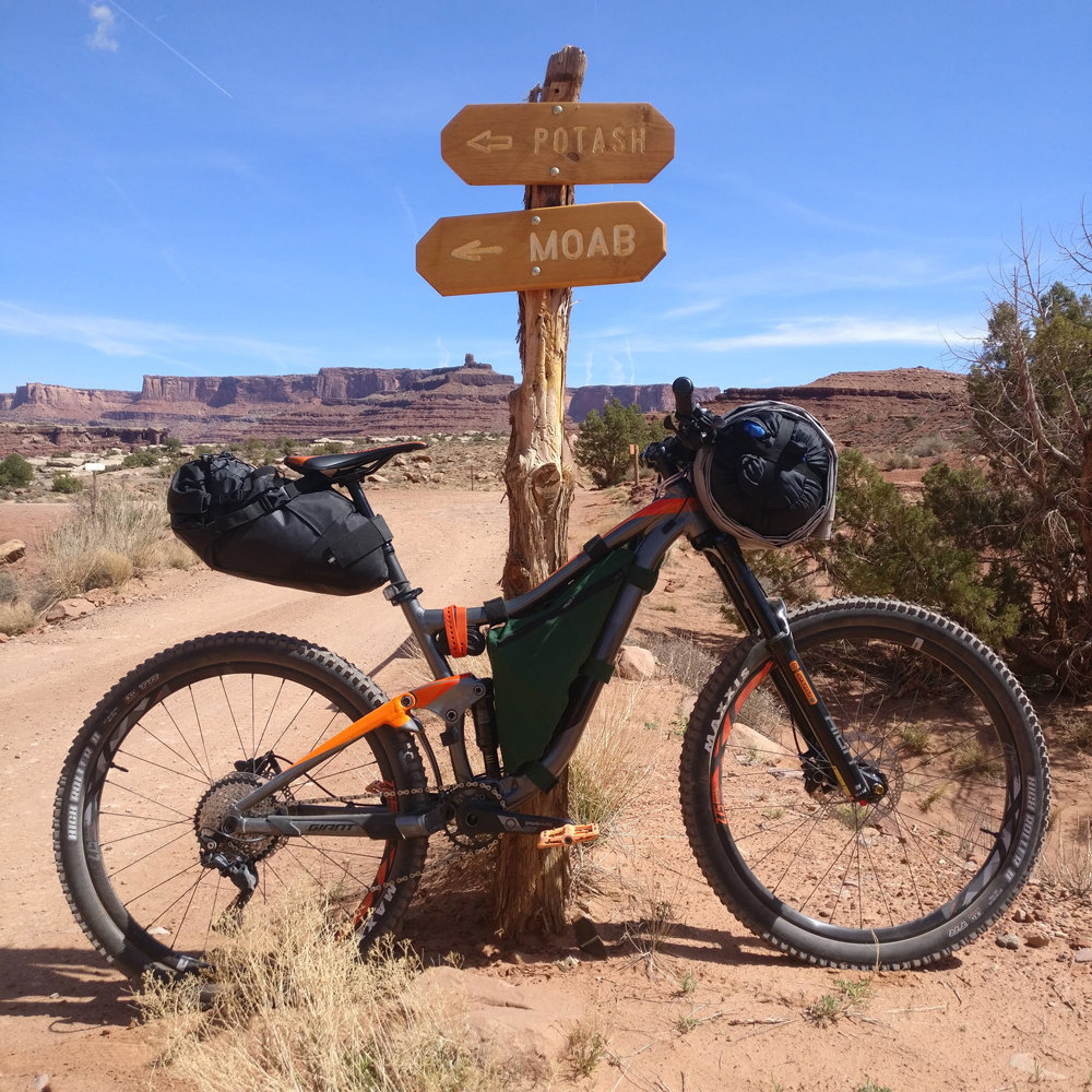
 

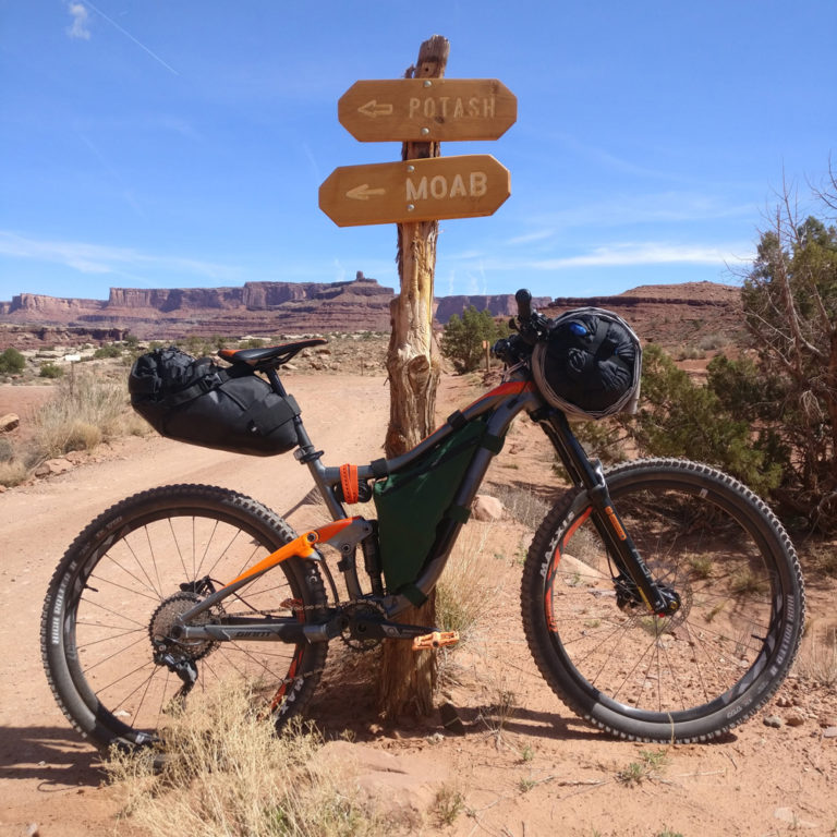
On the White Rim Trail. Photo by Cole Taylor

Neither Louis nor I had ever done any bikepacking before. One month before the trip we didn’t have any bikepacking gear of any kind. I was also able to find an article on bikepacking.com about making frame bags. In a stroke of luck, my mom had some lengths of Cordura nylon she’d been saving in a closet for several years. We sewed frame bags for both of our mountain bikes. I was using the Giant Trance I had just purchased in January, and Louis was on his GT Verb. I managed to fit my stove, mess kit, stakes, 16 ounces of water, multi tool, and some of my trail food in my frame bag. Additionally, Louis and I both bought bikepacking seat bags. This was where I put my pad, jacket, clothes, and food. Three liters of water fit comfortably in my backpack.

We knew we needed a practice run before the real deal. After contacting city officials I confirmed that it is okay to camp out in Eagle Mountain, Utah (just try to avoid private property). For anyone wanting to go on a weekend bikepacking trip or try it out for the first time, this is a great place to do so. We found that the gear we brought worked just fine and we had everything we needed. We felt prepared to take on the White Rim.

Day One: Shafer Road to Airport

19 Miles

We made the long drive down to Canyonlands and pulled off at the intersection of Highway 313 and Shafer Road, which takes you over the edge of the mesa and out to the Rim. After eating lunch, Louis and I were itching to get started. It felt a little surreal that we were actually doing this. Before long, we were cruising down the road’s smooth, steep switchbacks. The cliff edge of the upper mesa rose on either side of us like the majestic walls of some ancient city, framing the distant horizon, on which we could see Dead Horse Point and the canyon through which the Colorado flows. The ride down this section was definitely the biggest emotional high of the entire trip for me. With the road winding into the distance below us, we flew down the switchbacks and felt the breathtaking thrill of the wild, beautiful expanse of nature that extended endlessly ahead.

The ride on this day was easy, thanks to the massive elevation drop, and we reached Airport campground in less than two hours. There were some people at our campsite with a broken down jeep, waiting for another party to return from Moab with parts. They, like many other groups we encountered, had mountain bikes along with their vehicles. Save for two crazies we met who were doing the whole road in one day, no one beside us was doing it self-supported. This is because the only place to filter water is at Potato Bottom, from the Green River. We weren’t completely on our own, however- we had someone camping up in the main part of the park who agreed to hike down and meet us on the second day with water. Other than that, we carried or filtered everything we needed.

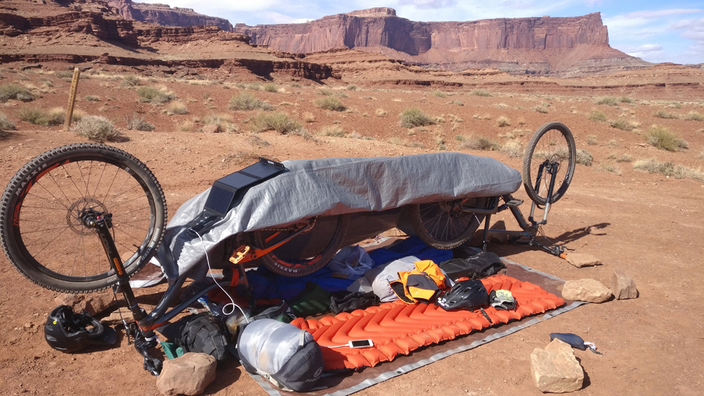
Louis and I spent the rest of the day practicing our bunnyhops and walking around, and then we built a tent out of a tarp using our bikes as supports. We cooked dehydrated dinner on portable stoves (no campfires allowed) and then went to sleep. Well, Louis went to sleep. My side of the tent kept coming loose due to the gusts of wind that night, and I struggled to relax enough to fall asleep. Somehow I snatched a few hours before the next morning, which was good because Day 2 was going to be long and tiring.

Day Two: Airport to Potato Bottom

47 Miles

We knew this day was going to be a beast of a ride, with considerable elevation gain and many miles of road to cover. I would have liked to space our campsites more evenly, but we only got on the reservation system four months prior when almost everything was taken. We rose before sunrise, ate, and got on our way. At a predetermined time, we met our water supplier at the intersection with Gooseberry Trail. After that, the road followed the edge of the mesa (the white slickrock here gives White Rim road its name) as it squiggled in and out over the vast, breathtaking surrounding landscape.

The biggest thing that impressed me about the desert was the overwhelming silence. When we stopped for breaks, we would sit on the dusty soil and hold our breath. Nothing. No breeze. No airplanes. Just the faint static in your ears that you hear in the total absence of sound. Every once in a while, the scuttling of a lizard’s feet, movement of a blade of grass, or sound of a bird’s wings from 200 feet away would catch our attention. There was one spot where a particular cliff formation made it so you could shout and hear the echo of your voice for 10-15 seconds. It was incredibly therapeutic to spend three days without the constant buzz of suburban life playing in the background.

There were a couple climbs on this day that were pretty difficult. The last of these had 500 feet of elevation gain culminating in a loose, exposed patch of road Louis and I affectionately named the Filthy Beast. We had quickly discovered on this trip that climbing with a fully loaded bike is a lot harder than climbing normally. Shortly before reaching the base, we met a pair of cyclists who were doing the whole route in one day. We talked and climbed the road together, and I learned that their names were Jeff and Walter and that they had driven all the way from Kansas to ride the Rim. Meetings like this are one of my favorite parts about mountain biking — you may be from different parts of the country but you always have something in common. After the four of us reached the summit, we saw that road started to descend gradually toward Potato Bottom, the site of our next camp. By mile 43, Louis and I were utterly exhausted. When we finally rolled into the campsite, we gratefully flopped onto the ground, took our shoes off, and felt the cool sand between our toes. Before sleeping, we filtered water from the Green River. The bank was eroded and crumbly, turning a simple filtering run into a long, sketchy ordeal. Once we had what we needed, we went back to camp and retired to our sleeping bags. It would be a good, long night of rest after a hard day.

…Or, it would have been, if I hadn’t heard a tiny scuttling of feet on the tarp next to my head. A tiny mouse had decided to hang out in our camp while we were trying to sleep. He was cute, and he stopped bothering me after the first time, but poor Louis said that after I went to sleep the mouse climbed over him seventeen times (seventeen! Yes, he was counting) before he decided to relocate and sleep on the boulder that was our kitchen. After that he finally went to sleep. Guess we were even after my sleepless night on the previous day.

Day Three: Potato Bottom to Mineral Road/Hwy 313 Junction

26 Miles

We packed up faster and started earlier this morning than on the first and set out as soon as we could, eager to finish and get back to the car (non-dehydrated food! That alone was enough to motivate us). The road went up and over a low plateau, then followed the river as it wound in a wide, lazy arc. We passed the sign that marked the end of White Rim Road and the beginning of 13-mile Mineral Road, and not long after, came to the switchbacks that take you up onto the very top of the Island in the Sky mesa. After clearing the switchbacks, there was not much to note about Mineral Road except that it is incredibly flat, smooth, and boring. If I did White Rim again, I’d definitely cover this road first to get it out of the way. Our trip came to an unexpectedly early end (but one that we appreciated) when we spotted a van in the distance, driving toward us. I had already pledged that despite how much I despised the piece of hell that was Mineral Road, I would bike all the way to the end. Louis, I said, could hitch a ride if he wanted — we had already been offered at least one — but I wanted to stick it out so I could say I completed the entire ride, all 92 miles of it. However, it’s hard to stick to that philosophy when your friend pulls up in the van six miles away from the end of the road, you’ve just eaten your last granola bar, the sun is shining overhead, and the road ahead seems to climb slowly on forever. We decided to put our bikes in the van and enjoy some non-dehydrated food while we drove the last six miles. We felt satisfied enough with what we had done.

All things considered, our first try at bikepacking went really smoothly. We didn’t run into any major mechanical failures (the biggest scare was when Louis’s leaky brakes started smoking on the way down Shafer Road), the weather was ideal, the pit toilets at every campsite were stocked, and the mileage was not too difficult. I would recommend White Rim to anyone interested in bikepacking. If I were to do it again, I’d like to make a few changes. First, I’d do it the other way around, starting on Mineral Road and ending on Shafer. Second, I’d want to drop water at the Gooseberry intersection to avoid relying on someone for water. Third, I’d split up camps more evenly so we cover more miles on the first day and fewer on the second. If you do this route, definitely do what we did and plan it in the spring or late fall so you avoid the crippling heat during the middle of the summer. Other than that, White Rim was a blast. Now I just have to research where I’m going to bikepack next.

Cole Taylor works and volunteers at the SLC Bicycle Collective and loves the Utah cycling community.
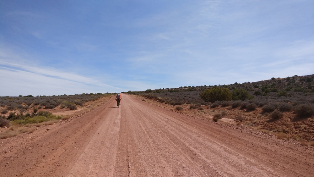
Mineral Road on the White Rim Trail. Photo by Cole Taylor
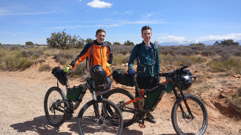
Louis and I with all of our gear just before leaving. Photo by Liz Taylor
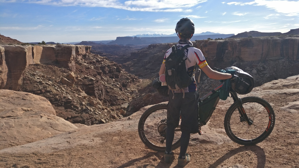
Cole Taylor overlooking a canyon on day 2 on the White Rim Trail. Photo by Louis Lozier
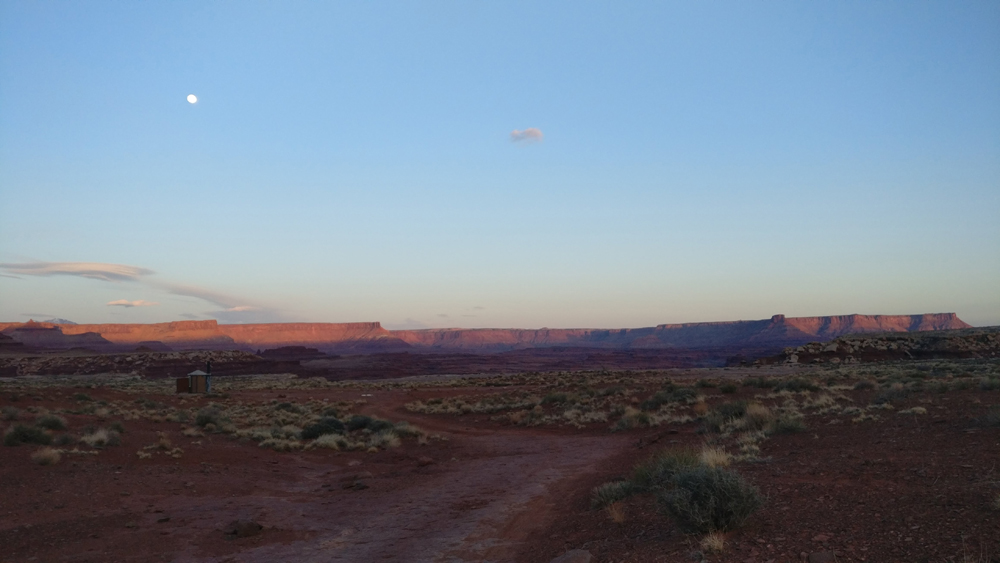
Sunset facing east from Airport camp ground on the White Rim Trail. Photo by Cole Taylor
Our janky tarp tent- we gave up and slept under the stars the second night. Photo by Cole Taylor

The Off the Couch Teton Picnic – An Adventure Filled Triathlon

By Brad Peterson –

“It’s my lucky day”, I thought as I rode my road bike into the Jackson Hole town park around 1:25 am. The band in the Million Dollar Cowboy bar was still jammin’ and the fancy LED accessory lights on several Harley’s were lighting up the street. Apparently nobody else thought that it was the perfect day to piece together the Grand Teton Picnic Triathlon.

By nature, mancations are designed to be a mystical journey requiring very little thought, excessive suffering, a Clif Blok, ibuprofen, PB & banana sandwiches, and Infinit Nutrition based diet, and little or no sleep. More powerful than Prozac and typically less expensive than a nice dinner with your wife, mancations, short for man vacations, are life-altering experiences. The goal is to suffer; to have the ultimate adventure, without becoming an epic; and to complete it within the time constrained pass that you’ve negotiated with your family. And while not limited to males, it is typically the male brain that has the limited capacity to dream up crazy ideas without adequately considering the probability of failure.

As the world economy has transitioned toward the experience economy, so too has the mancation continued to evolve. To create a richer, more satisfying experience, it is becoming more acceptable, and even advised (by other males), to add an OTC (off-the-couch) designation to your adventure. While an OTC designation is often applied to ones lack of adequate training for organized events like LOTOJA, RAGNAR and Leadville, there is a growing movement to simply design your own adventure, then not train sufficiently for all or part of it. The best part about designing your own OTC adventure is that you can cater it to you own abilities, training schedule (or lack thereof) and goals. In most cases PR’ing (personal record) or winning are irrelevant when you’re simply focused on surviving. The Teton Picnic was intended to be an OTC event.

I’d read bits and pieces about David Gonzales Teton Picnic since he first completed it 2012. The basic idea, as I understood it, was to ride your bike from the Jackson Hole town park to Jenny Lake, swim across the lake, climb the Grand (via the Owen Spalding route) and then reverse the entire process. But I also understood that David had designed the picnic for his purposes and I had mine.

For the last 25+ years the Tetons have been my favorite August mancation destination. Having summited the Grand T. almost 50 times, including four times already this year, I’m always eager to explore to new options, routes and ideas.

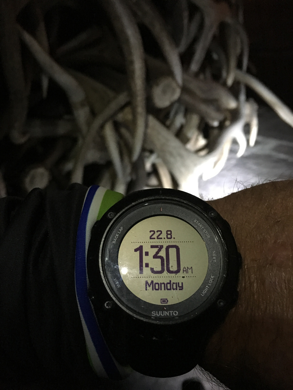
The Teton Picnic started at 1:30 am in order to be able to finish in time for pizza at Caldera Pizza in Jackson, Wyoming. Photo by Brad Peterson

At 1:30 am I took a photo of my watch and started pedaling toward Moose Junction and the Lupine Meadows trailhead. Instead of riding straight to Jenny Lake and swimming all night I opted to start by climbing the Grand via the Direct Exum route. If speed isn’t part of the equation, then why not redesign the course to include a more challenging ascent that links 6-pitches (5.8) of the lower Exum ridge with the easier and more traditional upper Exum ridge? My climbing partner, Mike Morris, had agreed to meet me at the Lupine Meadows trailhead at 2:30am.

As I crossed the old wooden bridge and rode down the washboard laden dirt road two giant bull elk stood on the side of the road and stared at me. It was 42-degrees and nearly a full moon as I pulled in to meet Mike.

By 3 am I had changed into my running shorts and La Sportiva Bushido approach shoes and was heading toward the summit. Our packs full of a small selection of BlackDiamond ultralite cams, a thin 7.3 mm x 60 m rope, my TC Pro climbing shoes, a Petzl SITTA harness, layers of warm clothes, a couple of ProBars and Infinit Nutrition in my 1-1/2 liters of water. After 50’ish ascents I know exactly what to expect: six switchbacks, 4 miles to the Meadows campground, 8.25 miles to the summit, 3-1/2 hours to the lower Saddle and then it quickly gets windy and cold. The lower Saddle is also where we would be able to refill with water for the summit and descent.

What we hadn’t anticipated was that the wind on the lower saddle was a consistent 40mph and that the spring had virtually dried up. We sat and shivered while the small hose trickled a liter of water into each our hydration bladders. Shivering is always a required part of the experience, with bonus points if it’s too cold to talk or move your fingers.

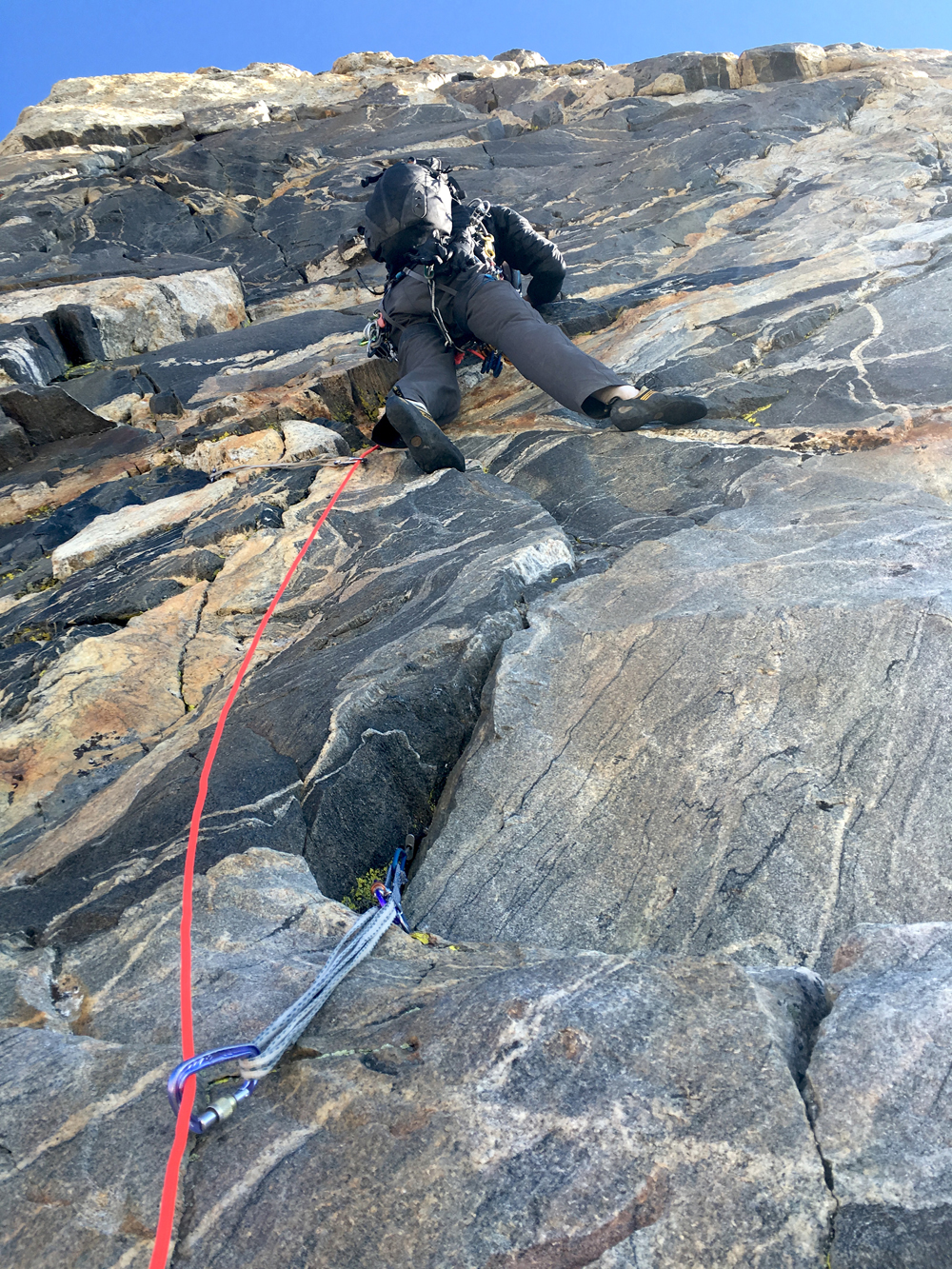
Mike Morris climbs the Grand Teton. Photo by Brad Peterson

By 8 am we’re roped up at the bottom of the first pitch and I am heading up into the first chimney. Mike and I continue to swap leads, while the other person froze, up the next 800’ until emerging onto the ledge below the Golden Staircase. This is the section where Wall Street intersects the ridge and distinguishes the upper and lower Exum routes. Two parties were surprised to see us come from nowhere. It’s 10:30 am by the time we coil the rope and start soloing toward the summit via the upper Exum ridge.

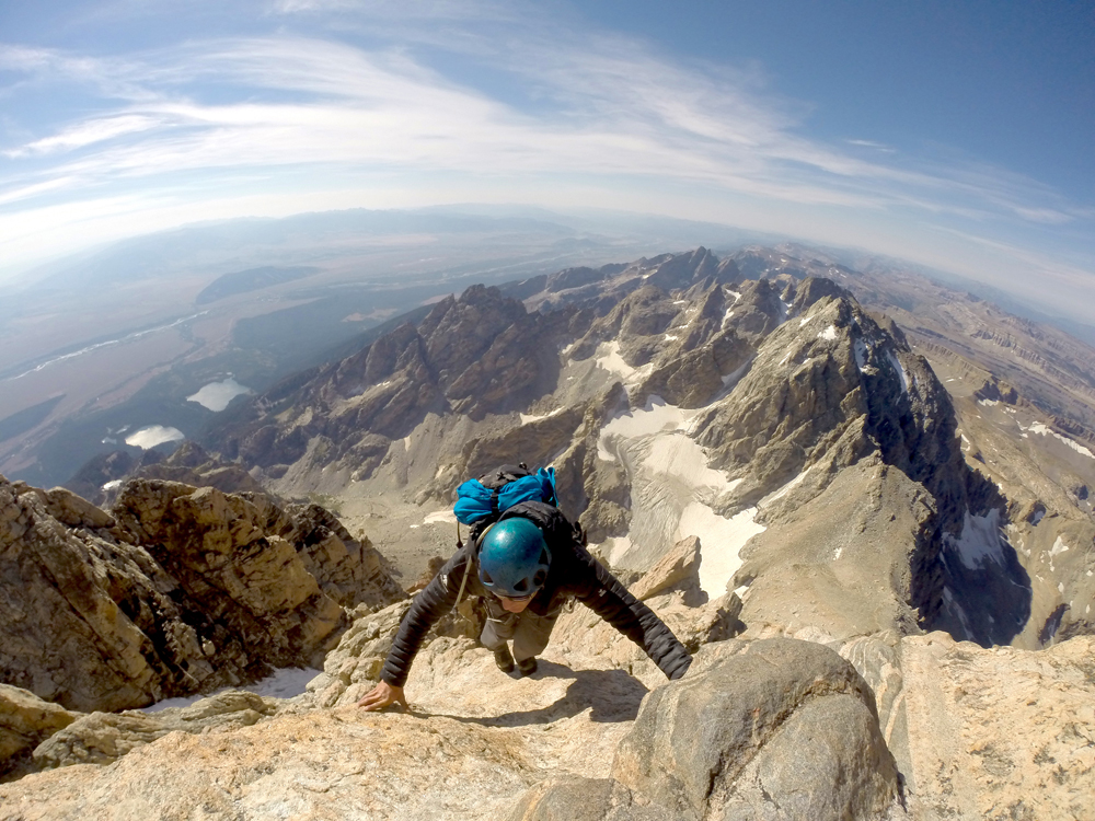
Mike Morris on his way to summiting the Grand Teton. Photo by Brad Peterson
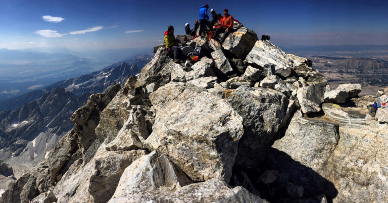
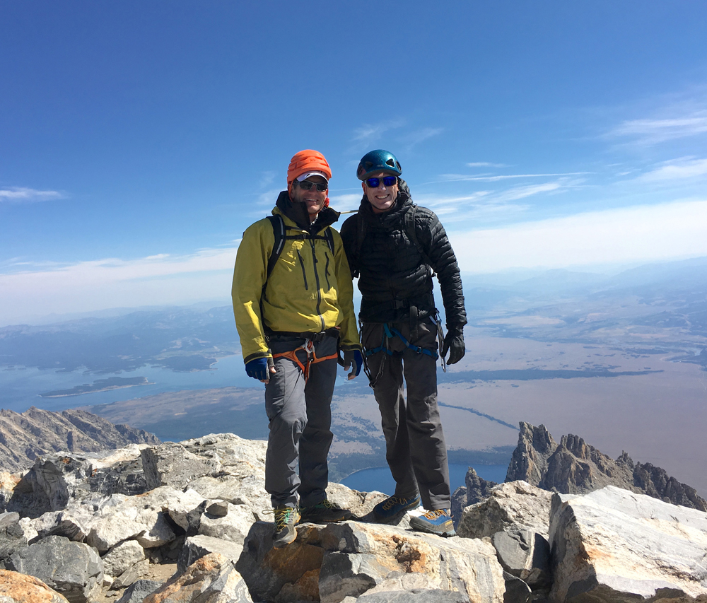
Brad Peterson and Mike Morris on the summit of the Grand Teton. Photo courtesy Brad Peterson

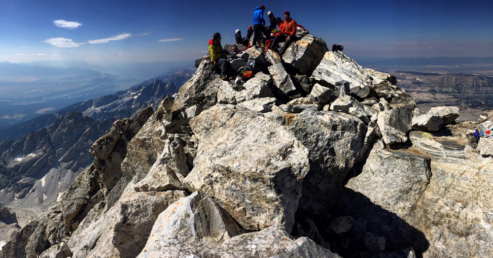
As a whole the upper Exum ridge is easy. If it were 15’ off the ground people would never consider a rope a requirement, but it’s windy, your heart rate is racing from climbing at 13,000’, there is a lot of exposure, and everyone around you is roped up. We proceeded to scramble around several parties, then took Ted Wilson’s recommendation to climb the Unsoeld layback thus bypassing the infamous V-pitch. That put us on the summit at 11 am where we proceeded to have our picnic. An Exum guide asked us if we climbed up from the parking lot to which I replied that I’d started in Jackson. “So you’re doing the PICNIC? And you came up the Direct Exum Ridge? I bet that you’ll have the record, because you’re the only one who has probably done it that way.” I wasn’t interested in a record, I was only interested in a new adventure, like doing the Grand Traverse, the WURL or White Rim in a day. I never get tired of the view from the summit.

A picnic at the summit of the Grand Teton. Photo by Brad Peterson

By 11:30 am we’d finished our picnic and were starting the 7,600’ descent back to the parking lot. I had still completed less than half of my adventure. We down climbed Sergeant’s Chimney then rappelled off the lower anchors by partnering with Jackson Hole Mountain Guides. I’m sure that David advocates down climbing the Owen Spalding route, but I happen to be 20’ away from the Exum guide, Gary Falk early this summer, when he fell 2,400’ down the west face to his death. I’m not going to take unnecessary risks today.

Mike and I split up at the moraine when I decided to start jogging back to the car. I wanted to finish before Caldera Pizza closed back in Jackson. Mike was not in a hurry and decided to take his time.

By 3 pm I’d arrived back at the parking lot and was riding towards the Jenny Lake ranger station with my wetsuit in my backpack. This is about as far as I had planned ahead. I had no idea where I was going to swim or any additional logistics. I also hadn’t realized that much of the eastern shore was under construction and that the southern wind was strong enough to blow me significantly off course. Apparently this is where the OTC, lack of planning, and foresight designation was earned.

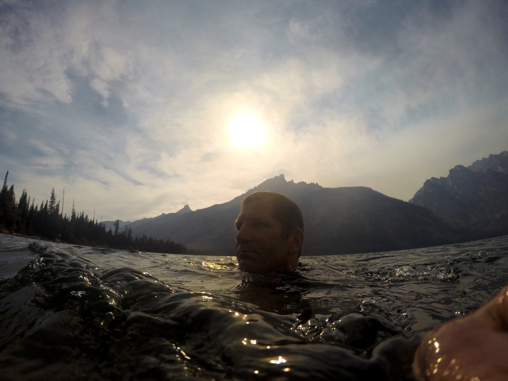
Brad Peterson on the swim leg of the Picnic mountain triathlon at Jenny Lake. Photo by Brad Peterson.

As the official event organizer I made an executive decision to start at a small rocky beach just past the boat dock where tourists can get shuttled across the lake. As I changed into my wetsuit and waded into the water several Asian tourists decided that I made for a good photo subject. It was windy and waves were quickly crashing into my face as I set out without a definitive plan. Swimming directly across the entire lake was not an option at this point, so I swam out a couple of hundred yards off-shore then started following the shoreline before cutting straight across the southern tip. 45-minutes later I’d reached the southwestern shore and started back. The swim was surprisingly fun and ended up being about 1-1/2 miles.

As I emerged from the water another family from New Jersey was now playing on the small beach. We talked for 10-minutes while I changed out of my wetsuit, before hopping back on my bike for the final 22-mile ride back to Jackson. Completing the picnic seemed incomprehensible to them. I assured them that it wasn’t as challenging as it appeared. They didn’t believe me.

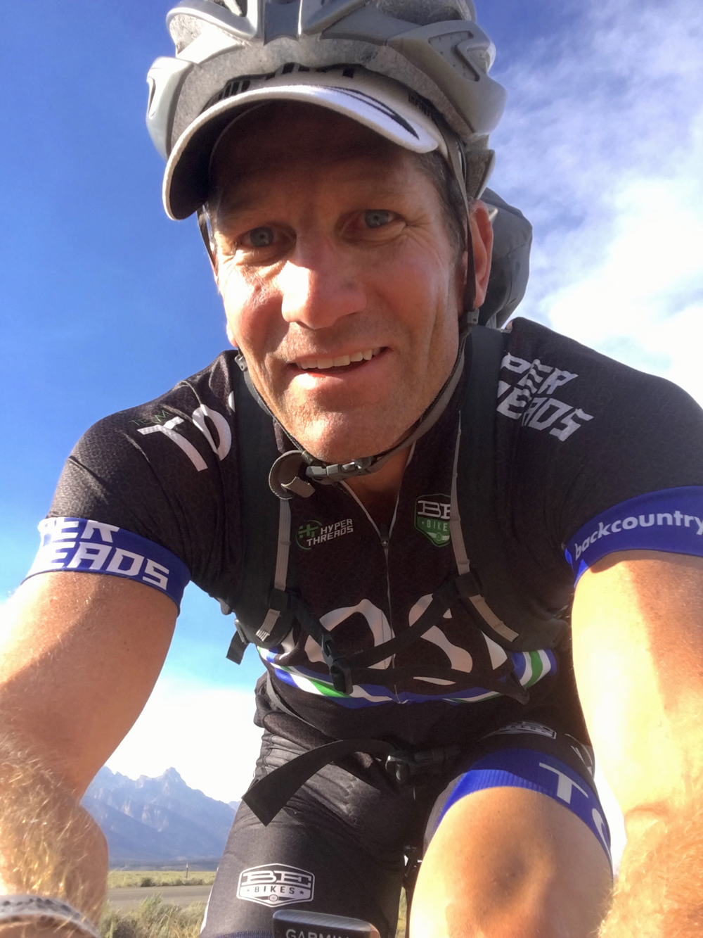
Brad on the 22 mile bike leg of the Teton Picnic. Photo by Brad Peterson

The same southern wind was now a much stiffer headwind. It was a little after 5 pm when I started down the bike path toward Moose Junction. I was on autopilot. I could bike for hours. As I rounded the corner from Moose Junction and headed toward Jackson I started to consider what additional activities I could add to future picnic’esque adventures. At this point I was sure that I’ll finish in the light which leaves me feeling a little unfulfilled. “What if next time I brought my kayak or paddle board and added a section on the river?”


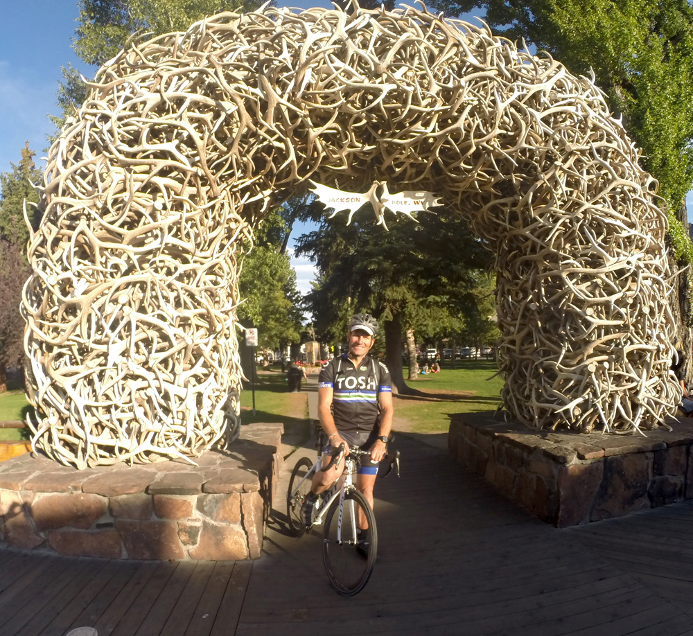
After 17 hours and 9 minutes, Brad completed the Teton Picnic. Photo courtesy Brad Peterson

Finally, at 6:39 pm, after 17-hours and 9-minutes I rode through the Jackson Hole traffic and back through the elk antler arch. I was sure that someone could complete it in half the time that I did but for that day I had the winning time and an amazing adventure. It’s amazing what people are capable of completing with a little creativity. Go design your own picnic.

Brad Petersen can be found on Instagram.com/OutdoorBrad or www.MoonflowerExpeditions.com


A Bicycle Tour of Boulder and Fort Collins

At the end of August 2016, Bike Utah took a group of elected officials and staff from Utah on an active transportation tour of Boulder and Fort Collins, Colorado. The goal of this tour was to open people’s eyes to all of the potential active transportation opportunities we have in Utah and how implementation can truly transform communities. Participating in this tour were elected officials and staff from Ogden City, Weber County, Davis County, Layton City, Provo City, BYU, Wasatch Front Regional Council, and UDOT.

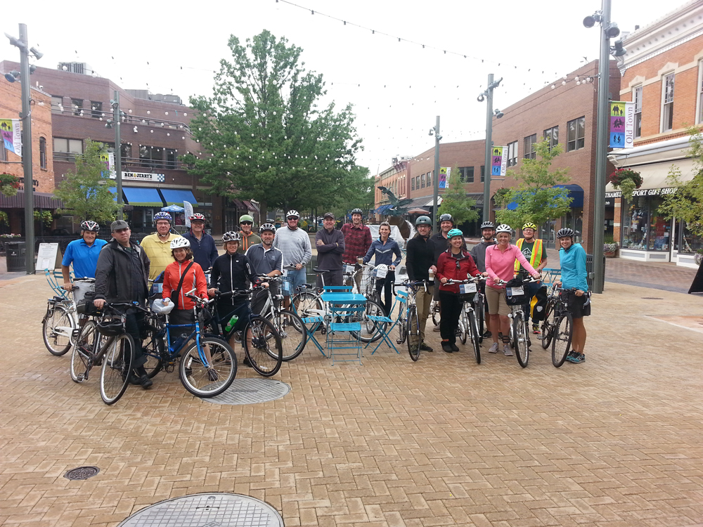
Utah officials visited Boulder, Colorado to learn how they approach cycling in this platinum level Bike Friendly Community. Photo courtesy Bike Utah

Boulder and Fort Collins are two of the five Platinum Bicycle Friendly Communities nationally as designated by the League of American Bicyclists. These communities face many of the same challenges as we do in Utah: air quality; physical inactivity; and livability as well as topographic and seasonal challenges.

Boulder boasts more than 300 miles of dedicated bikeways, including a well-established multi-use pathway network that connects most of the major destinations across the city without ever having to get on a roadway. Boulder has 75 underpasses, making it possible for almost completely uninterrupted travel, no matter where you are headed. Our tour of Boulder included stops at Valmont Bike Park (one of the premiere urban bike parks in the country), Boulder Junction (a mixed-use, pedestrian-oriented neighborhood), and Boulder’s protected, on-street bicycle network. This community is not without its challenges. They are facing excessively high housing costs and now dealing with the transportation impacts of having a designated urban growth boundary that is necessitating longer commute distances. Regardless, Boulder’s bicycle mode share in excess of 12% is an outstanding example of how serious investment in active transportation infrastructure can transform a community and how people get around.

Utah officials visited Boulder, Colorado to learn how they approach cycling in this platinum level Bike Friendly Community. Photo courtesy Bike Utah

Within the last few years, Fort Collins has truly ramped up their efforts and they show no sign of stopping. Their 2014 Bicycle Master Plan indicates a 7.4% bicycle mode share with a goal of 20% by 2020. They have an outstanding lineup of educational and encouragement programs, including numerous different bicycle ambassador programs targeting different populations, a wide variety of Safe Routes to School educational programs, and a bicycle friendly driver training program. Fort Collins’ bike share program launched earlier this year and is already showing early signs of success. The most inspiring part of our tour in Fort Collins was the integration of all groups in order to grow all types of bicycling. Bike Utah spoke at their monthly Northern Colorado (NoCo) Bike Show, which included city staff, advocacy group staff, trails group staff, riding clubs, and the racing community. If there is one key takeaway from Fort Collins it’s that everyone needs to be engaged collaboratively in order to get bicycling to a point where it is a widely accepted transportation and recreation mode.
Bike Utah plans to continue these tours on an annual basis and we look forward to bringing more elected officials and staff from across Utah with us.

For more information on Bike Utah, visit http://www.bikeutah.org.

Report Looks at Causes and Patterns in Bicycle Crashes

1

By Charles Pekow – 

If you’re in a bicycle accident at night, you’re more likely to get killed than you are in a daytime crash. And while most bike crashes occur on urban roads, the ones on rural ones result in a greater chance of a fatality. At least these facts describe the case in Florida.

Cycling West Cycling Utah Magazine logoBecause of a high concentration of bicycle fatalities, the Florida Department of Transportation decided it needed detailed information about bicycle safety. So it hired Florida International University in Miami to prepare a complete study of bicycle crashes in the state. Researchers examined all 23,036 known bike accidents in the state between 2011 and 2014. They identified the five “hot spots” in the state where crashes are more likely to occur and examined reams of other data that show where to focus safety efforts. Cyclists over 64, for instance, were more likely to die in a crash than younger ones. And males were more likely to die than females. Many were under the influence of alcohol or drugs when mortally wounded or killed on bike.

While sidewalk cyclists got their share of getting hit, they were much less rarely killed than those riding on the street.

A few other factoids the Florida study found: Helmets proved a better safety tool than lights or reflective clothing or lights. The most common mistake cyclists made involved failing to yield. Making U-turns and riding against traffic also resulted in many self-caused wounds. Other big hazards: unusual intersection design, driveways too close to intersections, and dooring.

At least Florida found the issue of bicycle safety important enough to take on and tackle with a comprehensive report that can serve as a guide for making cycling safer. Now with the precedent, maybe some other states can follow suit.

Find the Statewide Analysis of Bike Crashes at https://www.fdot.gov/docs/default-source/content-docs/research/Completed-Proj/Summary-SF/FDOT-BDV29-977-23-rpt.pdf


2017 Study Shows Bicycling and Walking Generate $425 Million in Economic Impact in Utah

There is a large push across Utah toward encouraging more widespread use of active transportation modes. This includes bicycling and walking for both transportation and recreation. In his “Utah Life Elevated 2020” objectives, unveiled at the end of May, Utah Governor Gary Herbert stated the following goal: “Develop an additional 1,000 miles of family-friendly trails and bike paths over the next 10 years to provide and promote active connections to school, work and outdoor recreation in urban and rural communities throughout the state.”

A recent study commissioned by the Utah Transit Authority, Bike Utah, and other partners quantified some of the economic and health benefits associated with active transportation. The year-and-a-half long study engaged many stakeholders and created county-level profiles as well as county-level analyses and tools. The study deliverables included a review of existing data via a literature review, a compilation of best practices related to engineering, education, and encouragement of active transportation as well as an economics analysis report to quantify the direct, indirect, and induced benefits of active transportation in Utah.

Bicycle related business and tourism have an economic impact of $425 million and are responsible for more than 3,500 jobs across the state. The study identified two case studies showing the economic impact of specific multi-use path and bicycle trails. The Murdock Canal Trail in Utah County costs $113,000 each year to maintain, however it generates over $3,600,000 million annually in economic impact. This is in addition to a one-time economic impact of $26 million and 234 jobs to build the trail. Bicyclists who visit Dead Horse Point trails in Moab generate $19 million annually in economic impact (more than $11 million from overnight trips).

There are also significant health benefits that can be realized from engaging in active transportation. Nearly 45 percent of Utahans get less than the 150 minutes of recommended physical activity each week. These people could save $3.07 in annual healthcare costs for every mile they walk or $0.75 for every mile they bike. For example, if a person walked 2 miles per day, every day of the year, they would average $2,235 in annual savings on their healthcare costs. A similar person riding a bicycle 10 miles per day would save $2,730 each year.

In addition to the informational reports, a series of calculators have been created out of this study that can be used by communities to assess the economic and health impacts of specific infrastructure developments or active transportation events, such as organized bike rides. The calculators are specific to each of the counties in Utah and are available for any community members to use. The study and the associated calculators are available here: www.bikeutah.org/atbenefitsstudy

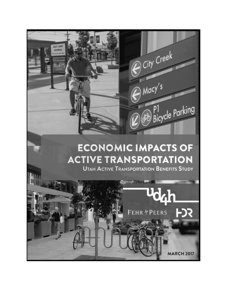
The full report is available at: Economic Impacts of Active Transportation: Utah Active Transportation Benefits Study

Partners on this study included: UTA; Bike Utah; Utah Department of Transportation; Governor’s Office of Energy Development; Utah Department of Health; Salt Lake County Health Department; Salt Lake County Office of Regional Transportation, Housing, and Economic Development; Wasatch Front Regional Council; Tooele County Health Department; Weber-Morgan Health Department; Mountainland Association of Governments; Park City Municipal Corporation; Intermountain Healthcare; and the Salt Lake County Bicycle Advisory Committee.


Bike Fit: Your Body or Your Bike.

0

Cyclists as a whole are prone to seeking improvement, either against their own personal performance or against others. Strava wouldn’t be the as popular as it is, and Zwift would not be on a meteoric rise if this was not the case. You define what sort of improvement motivates you. It may be riding a longer distance; knocking out a nominated distance in a faster time; entering a new event; achieving more elevation in a ride; improving sustainable power or simply having more fun on the bike.

To achieve any improvement it’s vital that you and your bike are working well together as an integrated unit. If not, then that is probably the first place to start. Which may mean a bike fit. Or not. In August I attend a 3 day bike fit symposium in Colorado to hear the latest on bike fitting from researchers and practitioners, many of whom have a deep background in physical therapy and an understanding of how a cyclist’s physical condition can impact their cycling comfort and performance. The presentations and conversations highlighted the dilemma all experienced bike fitters face when seeing a client. Is it their body or their bike? i.e. what are the cause and effect relationships that are detracting from this persons cycling experience? Is the priority adjusting their bike, or adjusting their body so it can function better on the bike?

Some detective work is involved to answer these questions, and one of the clues is how the bike looks without the rider on it, and then how the rider looks on their bike. If I look at a bike and I see some funky angles at the seat or handlebars, and uncommon relationships between these two parts, there is a high probability the rider’s body is being forced into a compromised position, and the issue is in the bike set up. This is usually confirmed when I see the person on their bike and pedaling, through measurement and observation of body angles and posture, as well as their symptoms. Changes to the equipment usually bring about significant improvements for the cyclist.

On the other hand, if a bike set up looks “normal”, and the cyclist looks good and measures up well on their bike, there is a higher probability that there are some physical factors at play that may not be resolved through making adjustments to the equipment. A bike fit in isolation of a movement assessment and remedial exercises may not result in any meaningful gain.

As a cyclist, how do you decide who to see and what to do? If you are out on a club or group ride, and someone says “you really need a bike fit”, they are probably seeing a noteworthy compensation going on in your riding form that makes them wince. It’s hard to see yourself on a bike from all angles, and someone else’s perspective can be beneficial. If it’s that obvious, it’s probably the bike that needs adjusting. This also applies if any discomfort you are experiencing only happens while you are cycling, and not during other activities.

However if you know your bike fit position is reasonably refined and you experience some aches, pains or niggles which occur not only when cycling but during other activities, you may be better off seeing a body specialist. This could be a PT, chiro, acupuncturist or sports med doc.

Now let’s say you go and see a sports massage, PT or a Sports Medicine doctor about a physical complaint you experience. They are unlikely to rectify the issue satisfactorily if your bike set up continues to provide a source of aggravation to your body. Or if you see a bike fitter to address an issue, but they are not able resolve your discomfort through adjustments to the bicycle, there are probably some subtle but habituated body movement patterns and restrictions that are holding you back. Improvement may only come from mobility and strengthening exercises. For this you may need to consult with a PT, athletic trainer or strength and conditioning coach. For those with a motivated DIY approach to body work, pick up a copy of the recently published “Maximum Overload for Cyclists by Jacque DeVore and Roy M. Wallack, published by Rodale. Maybe you don’t need a bike fit, you just need your thoracic spine mobilized, your hip flexors stretched out, and your glutes woken up!

John Higgins wants to elevate your cycling experience. He operates BikeFitr – an independent bike fitting studio, and Fit Kit Systems – supplying equipment and education to bike retailers and fitters. Contact: [email protected]

Mountain Biking in Cedar City’s Three Peaks Recreational Area is a Hoot!

By Lukas Brinkerhoff – Junies!

I’ve got Mitch Curwen’s wheel in my sights and I don’t intend to let it get away. The Juniper trees seem to be the only obstacle as the trail winds its way through the forest with wide flowy trails. Intermittent rocks pop up keeping my interest as we pedal around Three Peaks Recreation Area. I’m focused on that rear wheel in front me. Suddenly, it starts to leave the ground and I realize I am about to enter one of the infamous bridges of the area.

Ending 917 – The Voodoo Tree. Photo by Lukas Brinkerhoff

Cedar City has typically been a town you drove through to get to Southern Utah’s high alpine riding in the summer. It was a stepping stone to get sodas and chips as you headed toward the paradise of shuttle runs and lift-assisted riding. Thanks to a forward-thinking BLM and the passion of local riders, there has been a surge of trail building in and around Cedar City in the past couple of years transforming the area into a burgeoning destination for mountain biking. As a destination from St. George, it takes about the same amount of time to get to Gooseberry as it does to get to Cedar. The summer temperatures are significantly lower than in St. George, and contrasting our traditional Southern Utah trails, there is an abundance of beginner and intermediate singletrack to pick from.

Part of this uptick in trail building included updating and adding to the trails at Three Peaks.

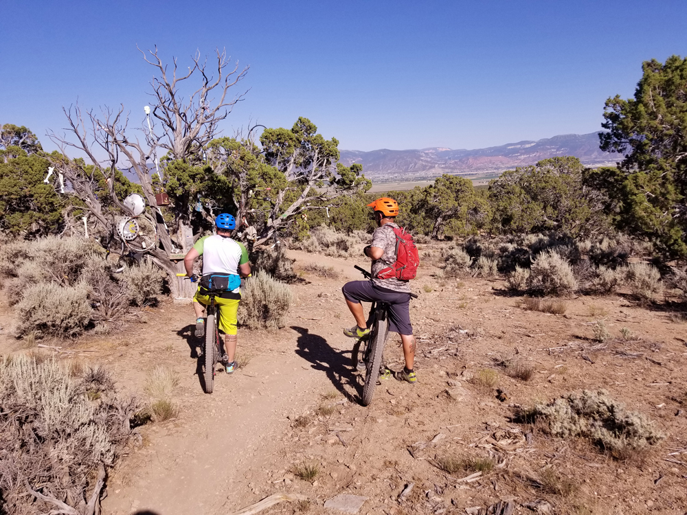
The Three Peaks Recreational Area boasts about 15 miles of singletrack. The trail network is built in a way that shorter sections of trail link together allowing for small, short rides, or longer, more difficult ones. It’s kind of a pick your own adventure type of a place. Speaking of adventure, one of its unique characteristics are added features. The Voodoo Tree is a rather regular looking Juniper that has been decorated with old things that were discarded around the area. You’ll find a bunch of bones, a hub cap and other assorted randomness. There’s also a spot with a grill and a giant pile of bones off to the one side. The additions will give you a chuckle or make you LOL like the kids say these days..

And there are bridges…

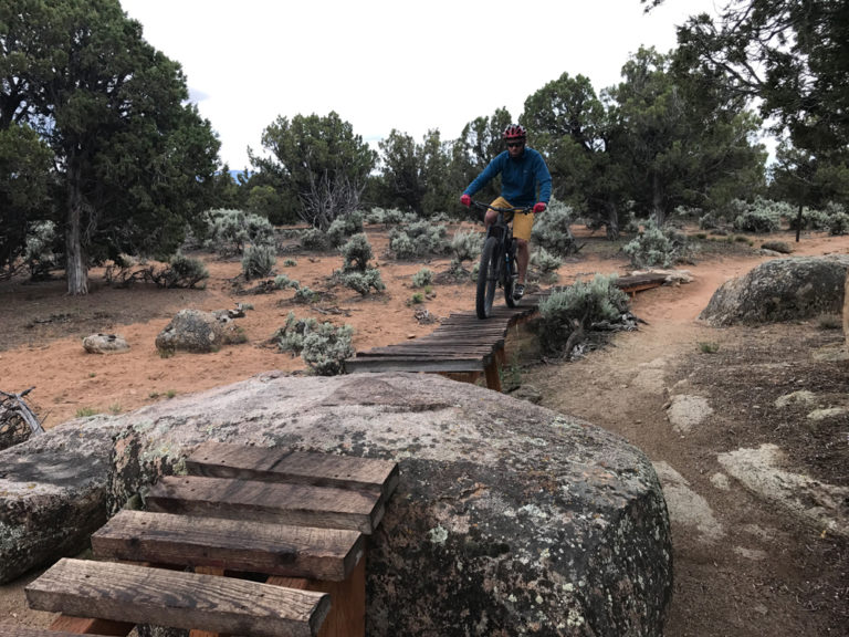
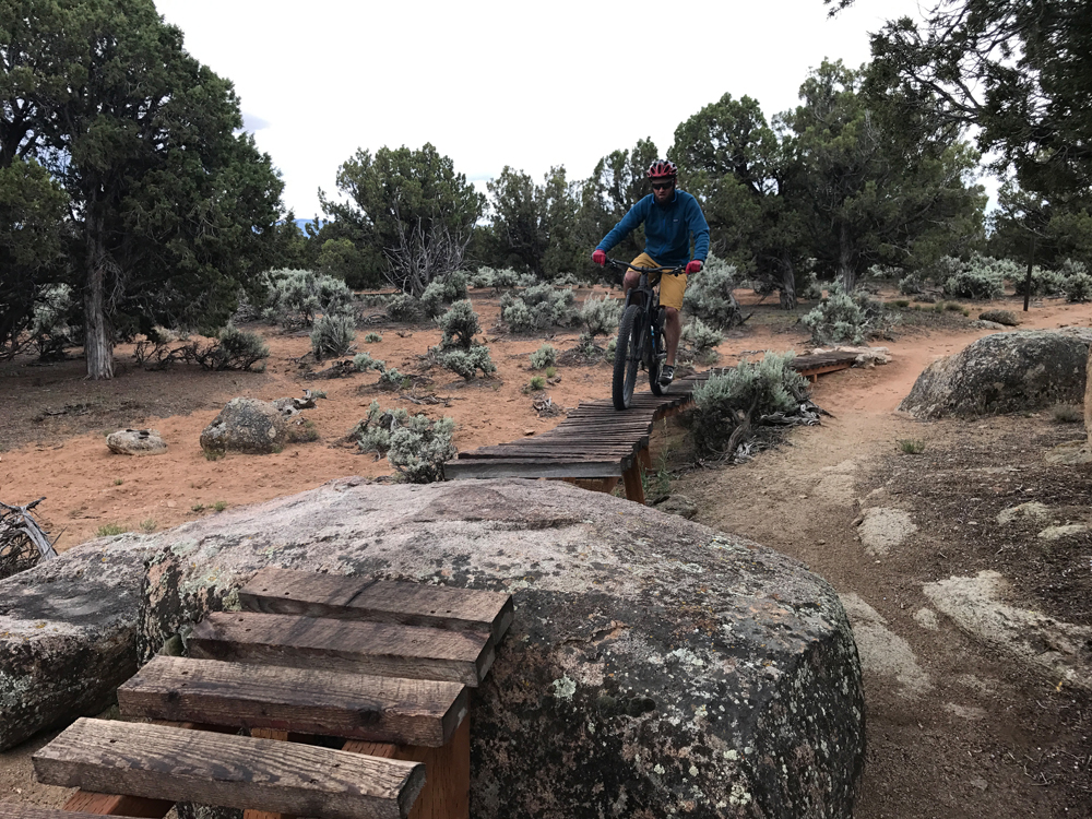
Moose riding a platform. Photo by Joey Dye

Actually, I’m told for legal reasons they are platforms not bridges, but the idea is the same. You have what is essentially a ladder bridge that gaps over washes, sandy areas and some that even link together rock features. All the bridges have ride arounds if being off the ground isn’t your thing. They are also signed so they won’t catch you off guard. The sign tells you how wide and how high of the ground they are letting you decide what your comfort level is as you work up to some of the higher ones.

All the trails within the network are rated as beginner or intermediate. These trails are a great place to cut your teeth, or spin those legs out as fast as you can. The trails flow well, the climbs aren’t steep and the downhills are a hoot. Take your chances on the bridges, we fell in love with them once we got over our fear of heights.

The key to mastering the bridges is to commit. None of them are narrow enough to require any serious balancing skills. However, once on them stopping to put your foot down can be a bit of an issue. Doing so has been known to result in a tumble back down to the ground. I’ve also found that putting the bike in a slightly harder gear than you would normally pedal helps. It allows you to keep consistent pressure on the pedals. Riding your brakes a little produces the same results. Keeping the pressure on the pedals helps you feel more in control of the bike and will add some confidence as you learn the way of the bridges, er, I mean platforms.

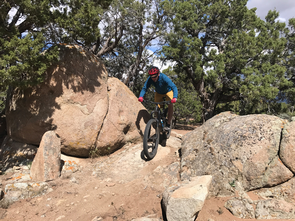
The most popular trail for the network on MTB Project is Lost World. The trail takes advantage of the rock features in the area. You can access Lost World by heading up the Race Course to Big Hole Loop hanging a right and then another right will put you on Lost World for a fun ripping descent.

One of the many rock features that will keep you on your toes. Photo by Joey Dye.

As I mentioned, there are tons of options and variations on how to ride this area. Unfortunately, trying to detail the bigger rides is akin to listening to a Californian give directions. Somehow they always end up on Mulholland Drive. If you can find a local to show you around, it’s the easiest way to learn the system. Otherwise, we recommend checking out the Practice Loop first to warm up your legs. Then hit the Race Course Loop for some classic Three Peaks and then move on to all the other trails until your legs give out or the sun goes down.

The area is well signed. Last time I was out there a couple of weeks ago, all junctions were marked with carsonite signs listing the name of the trail. There is a full network sign at the trailhead. If you are heading out alone, take a picture or list out the trails you want to hit. Once you are out pedaling, there isn’t much to tell you how to get where you want to go. The Practice Loop even has some interpretive signs to help newbies learn the ropes of riding the area.

The Recreation Area has a bunch of other amenities in addition to the trails. There is designated camping, frisbee golf, a shooting range, RC car course and ATV trails. Plenty of things to have your significant other do if they aren’t of the pedaling persuasion or if you want to make a weekend out of it.

Mitch’s wheel takes me right up on the bridge leaving me with one option, pedal it out. We rip over the bridge and back into the Junies. I let out a “Woot!” and all I can think is I love riding in Cedar City.

Getting There

From the South:

  • Head North on I-15.
  • Take exit 59 for UT-56 toward Cedar City
  • Turn right onto UT-56 W/W 200 N
  • Turn right onto N 3100 W
  • Turn left onto W 4800 N/W Midvalley Rd
  • Continue till you see the trailhead

From the North:

  • Head south on I-15
  • Take exit 62 for UT-130 toward Cedar City/Enoch
  • Turn right onto UT-130 N
  • Turn left onto E 4800 N/E Midvalley Rd
  • Continue till you see the trailhead

Lukas Brinkerhoff blogs about mountain biking and life at mooseknuckleralliance.org.

Designing and Building Trails

People always ask me what’s involved in building trails. To begin with, it’s not as easy as it may seem. There is a process to building trails professionally. That process usually starts with a land owner or manager contacting our company about the idea of having a trail. They usually have a general idea of where they want the trail to start and key points of interest they would like to see along the way. It’s important to know the property boundaries of the project area as well as the general topography.

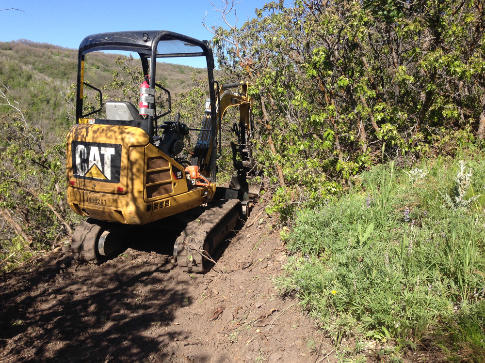
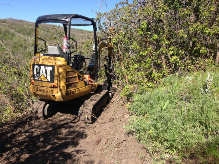
Mini excavators allow builders to make more trail with less hand labor. Photo by Donald West

Another important factor is the funding for a project. Some projects are funded through recreational trail programs or through special use taxes in a community. Non-profit organizations are able to receive donations from individual donors to help a trail project come to fruition. The costs of building the trail can vary widely depending on the scope of work, but it isn’t unusual for most trails to run between $2-5 per foot. Exceptions would include downhill trails with lots of dirt work and ladder bridge features and trails through steep side slopes or where the trail is routed through heavy surface rock or bedrock. Some of the costs of construction can be reduced with partnerships with volunteer organizations which can provide labor for hand built trails or finishing behind machine built trails.
Trail Design

Once the property is determined and funding is acquired, the next step in the process is the design of the trail. This usually involves several site visits to determine any difficulties that need to be addressed during construction. This could include steepness of the terrain, how rocky it is, density of vegetation and type of vegetation. At this point, we will identify key points of interest and what type of user group will be using the trail. This will help determine the flow of the trail and the average grades the trail will maintain.

Next we start flagging the trail. We use a clinometer to help us accurately determine trail slope in percent grade. Most beginner trails are in a 0-3% grade, intermediate is 3-8%, and expert trails are greater than 8% average grade. The roughness of the trail surface also makes a huge difference in the difficulty of the trail.

Mountain bike trails usually require additional considerations. Trails can be built for directional use (i.e. uphill only or downhill only). Trails can be built as a flow trail or a natural feeling trail. A flow trail usually is machine built with most natural obstacles removed form the tread surface. It usually includes unsloped banked turns and switchbacks, rollers, step ups or downs, doubles, etc.. Natural trails will route trails over rock features and be more likely to include off-camber or root-covered surfaces that can not be avoided while staying on the trail.

Trail Construction

Trail construction is the next phase of the project. Professional trail builders use machines to help build trails in most building situations. This involves mini dozers and/or excavators. The size of the excavator is determined by the type of trail you’d like to build. Bigger machines are useful when moving a lot of dirt, like on a downhill trail with big table top jumps. Smaller machines allow you to build more cross country trails with more of a hand-built feel. Smaller machines can make a tread as narrow as 30 inches.

On machine built trails, we always finish with hand tools. This includes but not limited to chainsaws, loppers, axes, McClouds, rakes, etc. In rocky terrain we have used jackhammers, hammer drills, wedges, sledge hammers, chisels and more.

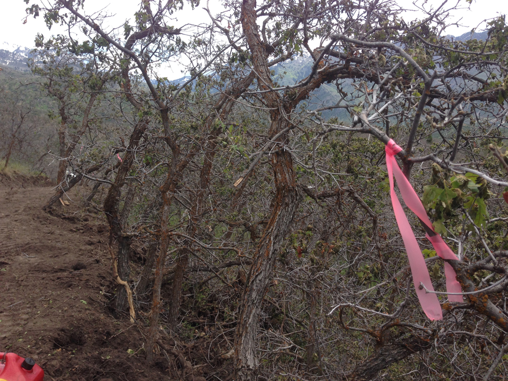
The flagging we used during the design phase is used as a general guideline for the construction if the trail. As we build the trail we allow, the trail to undulate along the flagged corridor to add interest and flow to the trail. We avoid straight lines and long sections of continuous grades.

Flagging is used to show the general trail corridor location. Photo by Donald West

As we need to we add grade reversals and dips to make sure any water that gets on the trail surface flow off as quickly as possible. Trails are normally out-sloped at 4-6% to allow the water that crosses the tread from above doesn’t turn and flow down the trail. Water is one of the most damaging forces of nature on trails. A poorly designed trail is very susceptible to erosion. Trails that follow the fall line (i.e straight down the hill) or trails that exceed 50% of the terrain cross-slope are likely to erode faster. This can be accelerated by differences in soil texture. Sandy soils have less cohesiveness than clay soils, so they are more likely to erode on steeper sections of trail. Some of these general rules can be broken if the trail includes natural or added rock along the tread surface.

Mountain bikers have also added wooden bridges or ladder bridges over uneven terrain or wetland areas. Wooden features are used to create a roller coaster like feel as well by including wall rides, banked turns, rollers, and jumps. Most trails cross streams or wetland areas at some point in the trail. In these areas we utilize bridges or create turnpike (i.e raised surface) trails. The possibilities of trail design and construction are only limited to the builders imagination.

Mapping and Trailheads

Once the construction is complete the trail needs to be mapped and the trail needs to be appropriately signed to allow users to safely navigate the trail or system of trails. Trailhead signs are useful in order to allow users to have a general understanding of the length and difficulty of the trails they are about to ride. Trail signage with difficulty level is useful for land mangers to help them manage risk by telling the users what type of experience they will have on a particular trail.

Designing and building trails is a multi-faceted and complex business and trade. It takes in consideration environmental and social factors in the design and construction of trails. Trails allow people to travel across landscapes on foot, bike, or vehicle than would be nearly impossible without there existence. They provide an outlet for our need for exploration, our need for physical activity, and a separation from a more industrialized world. Trails allow us to be more interconnected by providing corridors that allow us to easily transition from the human-built world and the nature that surrounds us.

Donald West is a Project Manager for Trail Ace Construction. Trail Ace Construction, a member of Professional Trailbuilders Association, was established in 1997 and is based out of White Bird, Idaho. You can find out more information about the company by calling Bonner Brumley at 385-228-5560 or find us at www.trail-ace.com.

For resources for learning how to build trails, check out “Lightly On The Land, The SCA Trail Building and Maintenance Manual” by The Student Conservation Association or “Trail Solutions, IMBA’s Guide to Building Sweet Singletrack.” You can also find more resources www.trailbuiders.org.

Rebecca’s Private Idaho Breaks Attendence, Fundraising Records

Rebecca’s Private Idaho, presented by MiiR 2019 Gravel Cycling Race and Festival Wraps with 36% growth in riders, 35% of the field women. Kaysee Armstrong and Joshua Berry defend Queen’s Stage Race Titles, Armstrong and Colin Strickland take the win in the 102-mile Baked Potato; New Course Records Set Event Drives Fundraising Total over $44,400 for Be Good Foundation, Benefitting Four Bike Causes.

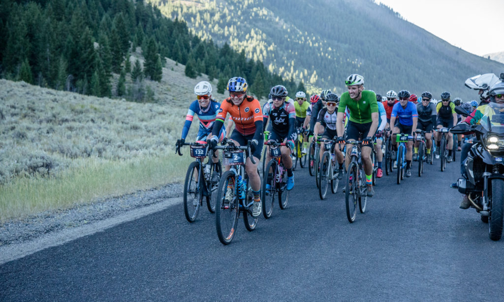
KETCHUM, IDAHO (September 8, 2019) – Seven-time world champion, professional cyclist, Mountain Bike Hall of Fame Inductee and globally celebrated endurance athlete Rebecca Rusch welcomed a record-breaking sold-out field of 1,200 riders to her hometown and drove fundraising efforts that raised $44,400 for global, national and local bike causes. Rusch’s seventh annual signature event, Rebecca’s Private Idaho presented by MiiR is one of the world’s largest and most celebrated gravel cycling events. The event has grown to include gravel cycling’s first stage race — encompassing a four day festival that is now a driving force behind the huge surge in gravel cycling.

Rebecca Rusch greets the morning on Sunday, September 1, 2019 at the start line. Photo by Linda Guerrette, courtesy Rebecca’s Private Idaho.

Participation in the multi-day festival, which draws a mix of professional cyclists from a range of bike disciplines as well as amateur athletes, grew 36% compared to 2018, with events spanning Labor Day weekend in the Ketchum and Sun Valley, Idaho area. In addition, this year’s field was comprised of 35% women. Rebecca’s Private Idaho (RPI) events include The Queen’s Stage Race: a 4-day series of gravel bike races, and multiple course options on Sunday: the 20-mile TaterTot, 58 mile French Fry or 102 mile Baked Potato course. The RPI festival also includes how-to clinics, social events, live music and two race expos. “I started Rebecca’s Private Idaho to share my backyard with cycling friends and showcase this world-class terrain. I’m amazed by RPI’s growth in both numbers and mission: from a local bike race to a global movement that has inspired a huge interest in gravel cycling and supports organizations from Idaho to Africa through related fundraising for my Be Good™ Foundation,” said Rusch. “We’re now a four day event that not only raises money for important bike related charities, but we have become the area’s biggest sporting event and a serious driver for the local economy and tourism.”

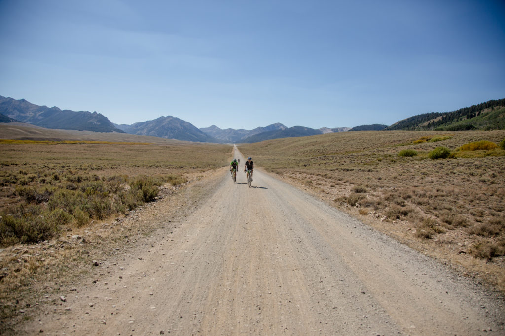
Photo by Linda Guerrette, courtesy Rebecca’s Private Idaho.

Joshua Berry defended his 2018 title in the 4-day Queen’s Stage again this year with a combined time of 8:10:54,431 . Kaysee Armstrong also repeated her win in The Queen’s Stage race in the women’s field, winning each stage, including Sunday’s signature 102-mile Baked Potato course in a time of 5:39:00,965, for a combined winning stage race time of 9:17:09;917. Colin Strickland took top honors in the Baked Potato in 5:04:37,035 . In the 58 mile French Fry, Jesse Thomas and Caitlyn Vestal grabbed first place in their divisions. In the TaterTot 20 miler, 16 year old Zane Lyon took the win in the Men’s division and 14 year old Paige Dehart took the top spot for the Women. Full results are here. Because of new, more technical additions to the Baked Potato new course records were established this year by Berry and Armstrong in the Queen’s Stage Race; by Strickland and Armstrong in the Baked Potato course. This year’s event lived up to its growing number of accolades, cited as one of the world’s 25 best bike rides by Outside Magazine and one of the top five gravel cycling events by Global Cycling Network .

Proceeds from various aspects of the event including VIP party, online auction, and merchandise sales went to Rusch’s Be Good™ Foundation which will direct funds to global, national and local bike organizations including World Bicycle Relief , PeopleForBikes.org , Idaho’s Interscholastic Cycling League and The Wood River Trails Coalition . In addition, presenting sponsor MiiR pledged a donation of up to $15,000, which included a matching challenge grant of $5,000 to inspire additional fundraising from riders and spectators. And a new Rebecca’s Private Idaho partner this year was Sun Valley Records, which programmed live music for the weekend’s Off the Wagon party and created a compilation, “Picture in My Mind, ” whose title track was inspired by the story of Rebecca and her father, with 10% of proceeds going to Be Good Foundation. “Inside the Gravel” with Steve Porino and Patrice Diallo.

Also new for 2019, one of cycling’s favorite duos added unique perspective during The Queen’s Stage Race: NBC Sports Network journalist and Sun Valley resident Steve Porino, and Patrice Diallo, his long-time professional motorcycle driver at the Tour de France, hit the gravel roads of Idaho to provide a fun twist on their typical grand tour coverage in videos produced by Adventure Scout Media and Idarado Media. These and full RPI video coverage are available here.

Commuting in Sanpete County – Mind the Cyclist, Mind the “Shoulder”

By Clara Hatcher – 

When I moved to Ephraim, Utah, for my internship at the Sanpete Messenger in Manti, I was given a bike.

“Just take it,” I was told. “You’re only here for eight weeks, anyway.”

As he spoke, Ephraim’s Alley Cat Bike Shop owner Brian Hester pointed to an ’85 Schwinn Traveler. Bright blue with original tires, the bike even came with a rack over its back wheels. It looked like it had never been ridden.

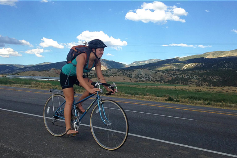
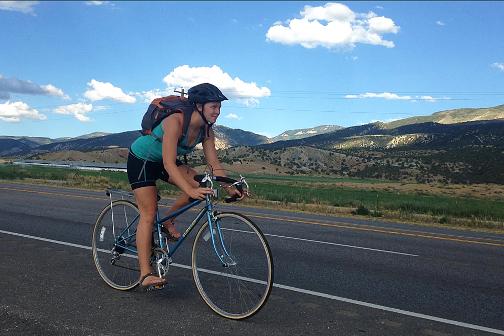
Alley Cat Bike Shop in Ephraim set Clara up on a vintage 1985 Schwinn Traveler for the commute. Photo by Robert Stevens

I bought a new, flat-black Cannondale helmet from him to make up for the lack of funds he was receiving for his generosity with the bike.

A helmet, I thought, would also be a good idea considering the roads I would be riding on to get to my work at the Messenger. My only fear was that I might get a flat on my commute.

The ride from my house in Ephraim to the paper in Manti clocks in at just over 7 miles. In the first 20 minutes of riding I realized the 2-foot-wide “shoulder” was not exactly accommodating for road bikes. That mini shoulder, scattered with potholes and the occasional dead chipmunk, lasted for the first 2.5 miles of my morning commute and the last of my afternoon ride.

Three times so far, Brian has passed me on his own bike. When I see him he waves, smiles and continues on pedaling through his morning ride.

Before I came to Utah, my impression was that it would be a generally outdoorsy state. I think of places like Zion and Moab National Parks and make connections with backpacking, hiking, rock climbing and mountain biking. Still, Brian told me to be careful on my ride when I picked up the bike. I asked if cars were generally aware and cautious of cyclists.

“They can be,” he said, simply. “Some, not so much.”

This became clear in the first day of riding. Some cars would drive by me as if unaware of my presence on the road. Some cars veer out farther than necessary, giving a comically wide berth. Three times, I have been honked at somewhat aggressively.

Unfortunately, some cars drive far too close. Once, a silver Chevy truck passed me with a foot of space. My hand would have hit the side view mirror had I reached out to try. Still, I ride through and chuckle at the “share the road” sign that signals the start of Highway 89 out of town.

Clara Hatcher commutes 7 miles each way each day from Ephraim to Manti in Sanpete County, Utah. Photo by Robert Stevens

After a few weeks, I got used to the cars. Then came the road maintenance. 

Within three weeks of riding an average of 70 miles per week, that shoulder disappeared with Highway 89’s top layer of pavement. Someone had called in to complain about the roads. As a quick fix, two half-mile-plus sections of the 2.5 miles out of Ephraim were scraped up to reveal gravel-y black tar that made riding feel like I was perpetually pedaling over highway rumble strips.

Riding on the smooth pavement following those first 2.5 miles felt like flying.

Most of the time, I love my ride to and from work. Being on my bike for an hour a day gives me more energy and time to be outside. It’s a remedy to sitting in an office at a computer for 40 hours a week. My ride takes me through the valley Manti and Ephraim rest in, with mountains and canyons on either side. I say hello to the cows behind wooden fences and politely nod to farmers and farm hands that pass on ATV tracks to the side of the road.

Some days, though, my ride feels like some kind of strange punishment I’ve assigned myself. I wake up exhausted and look up at my ceiling, thinking about the torture that is morning exercise. My legs ache for the first few miles. The higher gear that normally feels smooth feels like I am pedaling through molasses.

On those days, something changes slowly around the third mile. The songs in my head change from melancholy tunes to upbeat club music. Pedaling gets easier and I take whatever gear I can manage up the last hill into Manti.

No matter what, I have found that I am happier hopping off my bike in the morning to sit at my desk for the day. At the end of my commute home, I feel accomplished with what my body and mind have done.

There are two weeks left in my internship at the Messenger, now. After my work here is over, I will be back home in Duluth, Minnesota, and then in Milwaukee, Wisconsin, to complete my final year at Marquette University. I will not be biking nearly as much and I will surely miss the time I spent cycling 70 miles a week across Sanpete County.
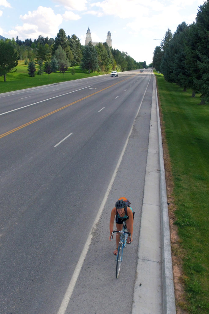
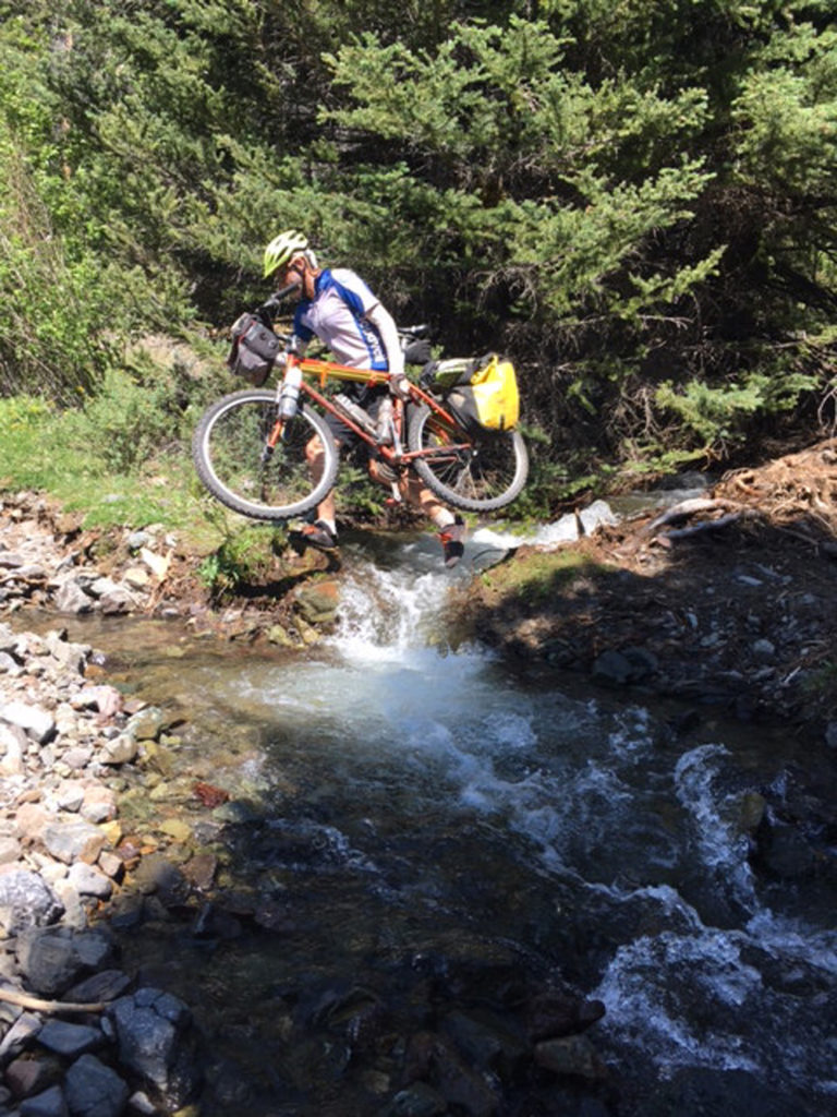
Clara Hatcher was a summer intern in 2017 through the International Society of Weekly Newspaper Editors at the Sanpete Messenger in Manti, Utah, and a full-time student finishing her Bachelor’s degree in journalism at Marquette University in Milwaukee. As a Minnesota native, her love of the outdoors began in Northern Minnesota’s Boundary Waters and grew with environmental conservation work in AmeriCorps NCCC.

Bike Packing in the Sun Valley and Stanley Region of Idaho

By Tom Diegel – In the heat/heart of the summer even avid Utah bike tourers sometimes can find it difficult to do bike tours in our fair state; sure there are nice high roads like Mirror Lake Highway and Skyline Drive on the Manti Plateau, but the bicycle’s ability to cover long distances will invariably result in plenty of low-elevation roads where brain-searage from the heat is quite real. Utah’s central location gives it good proximity to warmer climes in the colder months and cooler places in the summer, so it’s relatively easy to get to weather and terrain that’s great for bike tours. And as one of the cooler spots in the intermountain West with practically unlimited quiet back roads, the Sun Valley/Stanley area of Idaho is perfect for hot-season riding.

A fat tire bike may be a little overkill for the gravel roads, but it proves it’s worth when the trails get tighter. Photo by Tom Diegel

A few years ago Idaho Republican congressman Mike Simpson sponsored a bill to create the Boulder-White Clouds wilderness. It created a lot of controversy in Idaho’s recreation community, since many of the trails in the new wilderness areas were originally established by intrepid motorcyclists and have since cherished favorites of the sizeable Sun Valley mountain bike crowd. The creation of the wilderness had the unfortunate effect of pitting historically-aligned conservation-minded recreationists against one other (some argued that was part of Simpson’s strategy, since wilderness creation is not typically a GOP activity) but ultimately it passed the House unanimously and President Obama signed the bill designating wilderness, thereby instantly shutting bicyclists out of large sections of Ketchum and Stanley’s local mountains.

The big snow year in Idaho created runoff that blew out trail crossings. Photo by Ashley Patterson

For better or worse, the wilderness area is parceled into three pieces (The White Cloud, the Hemingway-Boulders, and the Jim McClure and Jerry Peak Wilderness Areas), and as with several of the Idaho wilderness areas, some key corridors exist that enable linked mountain crossings. One of those corridors creates a passage from the East Fork of the Salmon to the main Salmon drainage and allowed us make a great 3-4 day loop out of Ketchum.

We started rolling past the toney Sun Valley resort and soon enough were on the graveled Trail Creek road that climbs 2300 feet up to the pass that sits between the impressive Pioneer Mountains to the south and the equally-grand Boulder Mountains to the north, as well as forming the divide between the Big Wood and Big Lost rivers. A long cruise on fast dirt/gravel roads found us paralleling the Big Lost, and while yes, it’s cooler up there than in Utah, it’s still warm enough that a dip in the chilly river was a refreshing way to recharge after the long climb! Soon enough our knobby tires were humming on pavement, and it wasn’t long before we saw the first key to our loop: Walker Way, which is a double track that runs along the eastern foot of the Boulder Mountains before ultimately climbing 1400 feet to another 8000 foot pass and ending with another long cruiser descent down to the East Fork of the Salmon.

The East Fork of the Salmon is under-appreciated; while it has plenty of water and is really beautiful, a combination of limited whitewater and a lot of private land have kept it off the radar of fishermen and rafters, and most folks barely know it exists. But it’s the gateway to the classic Little Boulder/Big Boulder mountain bike loop (just barely outside the new wilderness boundary) and the upper reaches of the drainage that conceal craggy peaks, high mountain lakes, and yes, a rideable slot to get up and over to the main Salmon drainage on the backside of Galena summit (the main highway pass between Ketchum and Stanley).

Given that we had allocated 4 days for what we figured was a 3-day trip and the fact that the East Fork of the Salmon was a little awkward to get to, we decided to do a “layover” day hike up into some of those craggy peaks and crystalline lakes. We stashed our gear at the bottom of the Big Boulder road, rode the few miles up to the trailhead intending on riding up the trail a couple of miles to where the mountain bike route splits off to link up to with the Little Boulder. However, the huge Idaho snowpack and subsequent melt from this year had pushed Big Boulder Creek over its banks and destroyed the trail, so we started our hike earlier than anticipated (near a ranch that was a private inholding, whose owner chose to paint the word “TRUMP” in huge letters on his roof??!!) and indeed had a great hike to the first of the brilliant Boulder Lakes.

Back down at the bikes we continued to trundle our way up the traffic-free East Fork Salmon road towards the long-abandoned Bowery Ranger station, where not one but two great hot springs awaited us. The only thing better than soaking in a hot springs is soaking in a hot springs with a beer in hand. Given we were traveling light, we decided it was time to invoke our oft-practiced Begging for Beer strategy. Our first stop at a free BLM site had us chatting with some nice folks and netted a couple cherry sodas but no beers. A mile later, the sight of a Toyota Tundra with a rocket box parked next to a Sprinter held more promise. Not only were we right, but they were old river dog friends from California in between kayak trips on the Middle Fork and Main Salmon rivers, so our beers were happily shared with friends before we rode the last few miles to camp and enjoy the hot springs as the sun set over the looming Boulder Mountains.
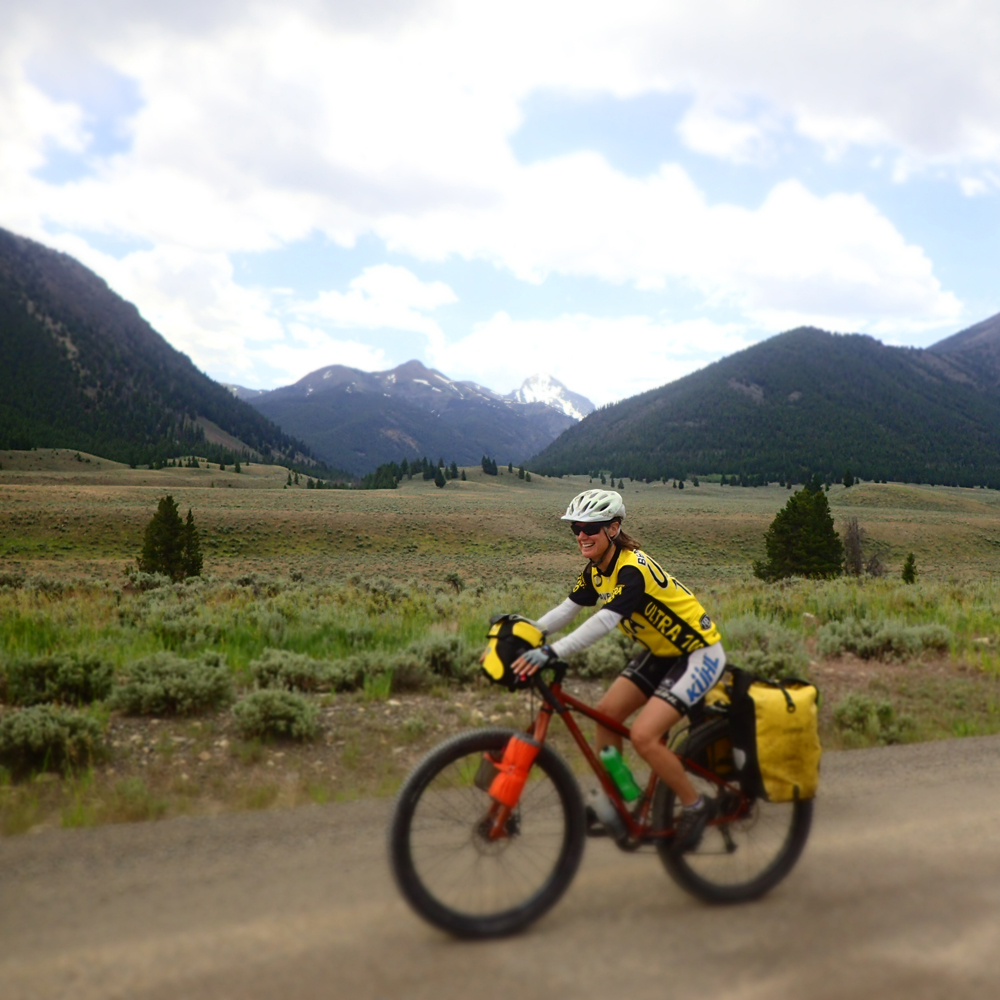
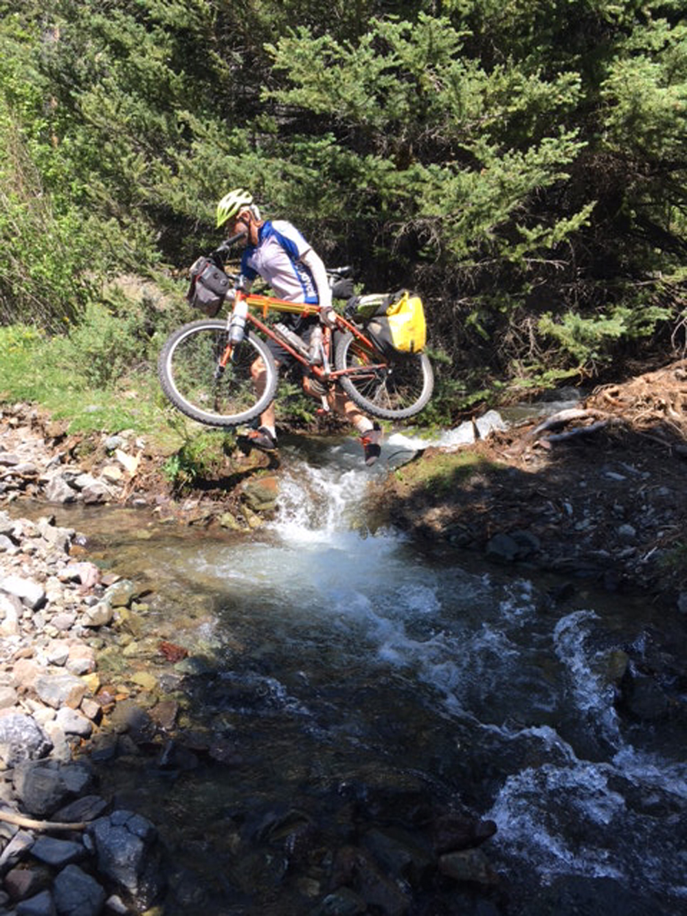
The road ended, the trail began, and the first challenge of the day was to get across the river. The East Fork of the Salmon is big enough that we thought there “had” to be a bridge, but to our surprise the trail ended at one bank and started at the other, with plenty of icy water charging past in between. It looked borderline do-able, so I threw an unloaded bike onto my shoulder, grabbed a stout stick, and started across; what could possibly go wrong? I got about three quarters of the way, the stick got swept out of my hand, and I decided to lunge for the last few feet, and…fell. As the current poured over me I did a sort of sea-lionesque body hurl for the bank and somehow made it to the shore, with the benefit of a huge jolt of adrenaline offsetting the shock of the frigid water. I was not willing to try again without a bike, much less do it with another bike and gear or encourage the much-lighter Ashley to give it a go. Fortunately, an upstream scout revealed a braided section with 2 channels, and with a bit of effort we were successfully across and noodling up a great singletrack towards the mountains.

Up high the East Fork is made up of two forks: the South Fork and the West Fork (of the East Fork; Idaho has a lot of these) and our wilderness-free route went up the West. It was only about 1400 feet up to the pass in a few miles; how hard could that be? In a year of big snows and big winds that blew out creeks and blew down trees…pretty hard. It was clear that we were the first folks to go up that trail this year and if we weren’t pushing our bikes up steep, rutted, gravelly trails we were hauling them over and under big logs that needed additional branch trimming to navigate. Though it was challenging, within a couple of hours we reached the top (we knew we were getting close when we hit snow!) and it was clear that motos had come up from the other side, so we had a long, fun, technical descent down into the Salmon Valley. We staged nicely for a diner breakfast at Smiley Creek Lodge by camping in the foothills. After rolling downhill to a fine omelet we headed up the nice dirt road/double track that parallels the north side of the highway up to Galena Summit with its jaw-dropping views of the nearby mighty Sawtooth Mountains. Once on top of Galena a fast zip down to Galena Lodge provided access to the Harriman Trail, the famous doubletrack that acts as the course for the Boulder Mountain Tour Nordic race.

Wilderness designation can be tough on cyclists, but in the case of the Boulder and White Cloud mountain wilderness areas, it was just parceled enough to unlock a stellar bike tour…and a great way to beat the heat!

Nuts and Bolts:

  • Start and finish in Ketchum/Sun Valley Idaho
  • Mileage – about 160 miles
  • Know before you go: the route is about 5% singletrack, 75% gravel roads, and 15-20% paved road
  • The only food available is the diner at Smiley Creek Lodge, but there’s water along most of the route; 2-3 bike bottles is fine.
  • The quality of the roads is fine and there is almost no traffic. 
  • It’s easy to stay out of wilderness where bikes are not allowed.
  • Are there bears? Maybe, but we didn’t even think of that. Check with the Forest Service to be sure and learn about proper backcountry camping techniques.
  • Camping – From above Big Boulder Creek, all land is National Forest, and backcountry camping is allowed. Some land on the East Fork of the Salmon is private and precludes camping.


The east side of the Boulders provides easy, swift desert riding. Photo by Tom Diegel
Boulder Mountain area double track is worthy. Rider: Tom Diegel Photo by Ashley Patterson
Heading up the nice singletrack of the upper East Fork of the Salmon. Photo by Tom Diegel
Better views and far less traffic than the highway over Galena Pass. Photo by Tom Diegel
Not all bikepacking is easy, especially early season. Photo by Tom Diegel
Life is simple and good when it’s done on a bike in the backcountry. Photo by Tom Diegel

USA Cycling Names 2019 UCI Road World Championships Teams

0

U.S. National Team includes 72-time National Champ Coryn Rivera, 7-time World Champion Chloe Dygert and 5-time Road World Championships rider Lawson Craddock

COLORADO SPRINGS, Colo. – USA Cycling announced the athletes that will represent the United States in the Elite Men’s and Women’s Time Trial and Road Race at the 2019 UCI Road World Championships which will place in York, Great Britain, September 22-29, 2019.

The U.S. National Team will start the eight-day competition with a strong group of time trialists. Among the competitors in the women’s elite individual time trial are Amber Neben (Lake Forest, Calif.; Cogeas-Mettler Pro Cycling Team) who won the UCI World Championship Time Trial in both 2008 and 2016, 2019 Pan American Road Championships ITT winner Leah Thomas (Boulder Creek, Calif.; Bigla Pro Cycling) and 2016 Olympic and seven-time World Champion Chloe Dygert (Brownsburg, IN.; Sho-Air TWENTY20) who recently won all four stages of the Colorado Classic. For the men’s elite individual time trial: five-time Road World Championship U.S. National Team member Lawson Craddock (Houston, TX., EF Education First) and 2018 UCI Road Team Time Trials World Championships Silver Medalist Chad Haga (McKinney, TX; Team Sunweb) will represent Team USA.

For the men’s elite road race, the U.S. National Team will include the 2019 USA Cycling Pro Road National Champion, Alex Howes (Denver, Colo.; EF Education First), three-time U23 World Championships team member Neilson Powless (Roseville, Calif.; Team Jumbo-Visma), Craddock, and Haga. Dygert and Thomas will double up on the ITT and the women’s Road race. 72-time U.S. National Champion Coryn Rivera (Newport Beach, Calif.; Team Sunweb), the 2018 Colorado Classic Champion Katherine Hall (Saratoga, Calif.; Boels-Dolmans) and 2019 USA Cycling Pro Road National Champion Ruth Winder (Lafayette, Calif.; Trek-Segafredo) will form one of the most versatile U.S. National Teams Road World Championships teams.

Scott Schnitzspahn, Vice President of Elite Athletics for USA Cycling is excited to see the mix of veteran and young riders compete, “The (U.S. National) Team is filled with some of the strongest riders the U.S. has, who complement each other’s strengths. We have very solid group of Juniors, U23s, and Elites who have won over 10 World Championships. With the recent success from our riders, we’re in a good position for a medal finish in multiple races.”

Among the Juniors and U23 riders on the U.S. National Team are several 2019 National Champions: Zoe Ta-Perez (Orange, Calif.; LUX Cycling Development Team), Megan Jastrab (Apple Valley, Calif.; Rally UHC Cycling), Quinn Simmons (Durango, Colo.; LUX Cycling Development Team) and Ian Garrison (Decatur, Ga.; Hagens Berman Axeon) winner of both U23 and Men’s Elite Individual Time Trial
“Our Juniors and U23 riders had been racing in Europe all summer and have dominated many races. Both our women’s and men’s junior programs are in the top three in the Nations’ Cup rankings,” said Jeff Pierce, Director of Elite Athletics, Road and Track. “Combined with the Elite team, we are looking forward to seeing our Red, White and Blue kits race aggressively in Yorkshire.”

The U.S. National Team roster is as follows:

INDIVIDUAL TIME TRIAL

Junior Women:

  • Zoe Ta-Perez* (Orange, Calif.; LUX Cycling Development Team)
  • Megan Jastrab (Apple Valley, Ca; Rally UHC Cycling)

Elite Women:

  • Leah Thomas* (Santa Clara, Calif.; Bigla Pro Cycling)
  • Amber Neben* (Lake Forest, Calif.; Cogeas-Mettler Pro Cycling)
  • Chloe Dygert (Brownsburg, Ind.; Sho-Air TWENTY20)

Junior Men:

  • Quinn Simmons* (Durango, Colo.; LUX Cycling Development Team)
  • Michael Garrison (Decatur, Ga.; LUX Cycling Development Team)

U23 Men:

  • Ian Garrison* (Decatur, Ga.; Hagens Berman Axeon)
  • Brandon McNulty (Phoenix, Ariz.; Rally UHC Cycling)

 Elite Men:

  • Lawson Craddock (Austin, Texas; EF Education First Cycling Team)
  • Chad Haga (McKinney, Texas; Team Sunweb)

ROAD RACE

Junior Women:

  • Megan Jastrab* (Apple Valley, Ca; Rally UHC Cycling)
  • Ava Sykes (Athens, GA.; LUX Cycling Development Team)
  • Zoe Ta-Perez (Orange, Calif.; LUX Cycling Development Team)
  • Katie Clouse (Park City, Utah; DNA Pro Cycling Team)
  • Gabrielle Lehnert (Eugene, Ore.; LUX Cycling Development Team)

Elite Women:

  • Ruth Winder* (Lafayette, Calif.; Trek-Segafredo)
  • Leigh Ann Ganzar* (Austin, Texas; Hagens Berman-Supermint)
  • Coryn Rivera (Newport Beach, Calif.; Team Sunweb)
  • Tayler Wiles (Fairfax, Calif.; Trek-Segafredo)
  • Leah Thomas (Santa Clara, Calif.; Bigla Pro Cycling)
  • Chloe Dygert (Brownsburg, Ind.; Sho-Air TWENTY20)
  • Katharine Hall (Saratoga, Calif.; Boels-Dolmans)

Junior Men:

  • Quinn Simmons* (Durango, Colo.; LUX Cycling Development Team)
  • Gianni Lamperti* (Sebastopol, Calif.; LUX Cycling Development Team)
  • Michael Garrison (Decatur, Ga.; LUX Cycling Development Team)
  • Magnus Sheffield (Pittsford, N.Y..; Hot Tubes Development Cycling Team)
  • Matthew Riccitello (Tucson, Ariz..; LUX Cycling Development Team)

U23 Men:

  • Brandon McNulty* (Phoenix, Ariz.; Rally Cycling)
  • Kevin Vermaerke* (Rancho Santa Margarita, Calif.; Hagens Berman Axeon)
  • Lance Haidet* (Bend, Ore.; Aevolo Cycling)
  • Ian Garrison* (Decatur, Ga, Hagens Berman Axeon)
  • Matteo Jorgenson (Boise, Idaho; AG2R La Mondiale)

Elite Men:

  • Alex Howes * (Denver, Colo.; EF Education First)
  • Lawson Craddock (Austin, Texas; EF Education First)
  • Chad Haga (McKinney, Texas; Team Sunweb)
  • Neilson Powless (Roseville, Calif.; Team Jumbo-Visma)

Automatic qualifiers are noted with an asterisk (*).

To cheer for Team USA at the 2019 World Championships, please follow @UCI_Cycling and @USACyclingLIVE on Twitter. For more about the 2019 UCI Road World Championships, please visit the event website at https://worlds.yorkshire.com

Shaking Off Numb Hands

So far this year the most common issue I have encountered as a bike fitter are cyclists experiencing numb hands. Many of you will have experienced occasional numbness or tingling while cycling, but for some of you this is a recurring, persistent experience that detracts from your ability to go the distance you desire or enjoy your riding as much as want to.

If you are frustrated with regularly having to change hand position, or shake out your hands to restore feeling and circulation, some insights into the contributing factors may help you find relief. Numb hands are common to both road and mountain bike riders, and a rarer condition in tri /tt riders who are in the aero position. As a fitter, sometimes I am able to resolve the issue immediately, and sometimes it takes multiple trials and tries.

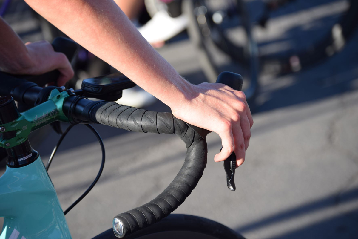
Numb hands are a common problem for cyclists. Photo by John Higgins

Which part of your hands go numb, whether it is one or both hands, how long it takes before the onset of tingling or numbness, what of riding terrain it occurs on (pavement, dirt, uphill, downhill), and how long before the issue resolves once you are off the bike are all important clues for exploring and solving this problem. If the numbness is intermittent, takes a few hours of riding before it commences, and/or quickly resolves once you are of the bike, then this is a mild case and probably requires only a small change to be eliminated. However if you get hand numbness within an hour of riding; it occurs on every ride; and/or doesn’t resolve for a few hours or even until the next day, then you are at high risk of developing long term nerve damage (peripheral neuropathy) and there is something significantly wrong in your bike fit position, or riding technique.

Preventing hand numbness requires problem solving back up through the cause and effect chain. You experience the effect. The cause of hand numbness is nerve compression. There are 3 primary nerves servicing the hand (radial, medial and ulnar), and the area of the hand that experiences numbness is a clue as to which nerve or nerves are involved.

The cause of nerve compression is excessive and sustained pressure on the nerve. As supporting weight causes pressure, the problem is rephrased as “what is it about this cyclist’s position that is resulting in the hands bearing too much weight?”

The 3 primary reasons are:

  1. A handle bar too high and/or close to you. Your upper body wants to be more forward and down to stimulate core muscle and back fascia engagement to set up for generating power, but is prevented from doing so. Your hands are pushing back against the bars to counteract the forward forces of your torso. Most likely the bars are too high in relation to your saddle. Often hand numbness goes hand in hand with shoulder tension in this situation. Flip your stem down and/or move spacers from under the stem to the top. You may also need a longer stem. This will give your upper body more space to function in.
  2. The saddle is too far forward in relation to the bottom bracket. Without your hands on the bars to hold you up you would topple forward off the saddle. Too much of your weight is being transferred to the handlebars for support, instead of being directed through the saddle and your legs. This creates unnecessary weight and compression on your hands. You need a “lighter touch” on the bars. Move your saddle back (even 10mm can make a big difference). Can you ride with no hands without tipping forward off the saddle?
  3. Handlebars too far away or too low. This is the opposite of number 1, and similar to number 2 but for a different reason. Too much of your weight is being transferred from the saddle to the bars and you are having to “hold yourself up”. Often hand numbness is combined with neck tension in this situation. To transfer weight back into the saddle and legs you may need a shorter stem; stem with a steeper angle; more spacers under the stem; or a handlebar with a shorter “reach”.

In addition to these 3 primary causes, there are several smaller adjustments that can also have a big effect – for the better.

3 secondary factors:

  1. Saddle tilt angle. A saddle that is too “nose down” serves to transfer load to the bars as you subconsciously push back on the bars to prevent yourself from sliding forward on the saddle. This may also cause some IT band inflammation as the legs are also being called upon to snap you back into place on the saddle. Even half a degree of saddle tilt adjustment can fix this. It’s not to say your saddle should be perfectly level (this depends on you and the saddle type), but it will usually be close to level.
  2. Bar ergonomics. The rotation of the handlebars, the position of the hoods or grips, and the in/out rotation of hoods all affect weight distribution and pressure on the hands. A small tweak to any one of these can have a nuanced but profound effect on pressure distribution and therefore nerve compression. You should feel even pressure through your hands, not have it concentrated in one area.
  3. Getting gripped. If you are novice rider on pavement or trails, you may be feeling nervous on descents, and that can manifest as a death grip on the bars. You are creating pressure and nerve compression from muscle tension that is excess of that needed to control your bike. You need a grip on the bars, but not a death grip! This can also happen to habituated and experienced riders, perhaps more so on steep climbs. Cycling safely and comfortably requires many skills, and one of these skills is learning how much grip you need on the bars in different situations, and being able to relax your hands while still maintaining control.

As you can see there are many potential factors that can result in numb hands, and it can take some Sherlock-like skills to sleuth out the true culprit. Often the secondary evidence of “what else hurts” can provide a clue to the fundamental and underlying cause. In the absence of clues a trial and error approach may be needed to achieve the reasonable expectation that you can go riding without your hands going numb, and not have to shake them out for relief.

John Higgins wants to elevate your cycling experience. He operates BikeFitr – an independent bike fitting studio, and Fit Kit Systems – supplying equipment and education to bike retailers and fitters. Contact: [email protected]

Colorado Classic Sets Dates to Return in 2020

Colorado Classic Sets Dates to Return in 2020 with Four-Stage Race August 27-30. Game-changing race a major success in debut as all-women’s pro event; VF Corporation to return as presenting sponsor.

(DENVER, CO — September 10, 2019) – Based on the overwhelming success of the Colorado Classic® presented by VF Corporation in its debut as an all-women’s pro race just two weeks ago, the event plans to return next year on August 27-30, 2020 (pending UCI approval of the dates) with a similar all-women’s format, along with VF Corporation as the presenting sponsor, organizers announced today.

“We wanted to create a race that challenged the norm for women’s pro cycling, while building a sustainable platform for the future of the sport,” said Lucy Diaz, COO of RPM Events Group, organizers of the Colorado Classic. “We are inspired by the response and recognition around our event — the racers loved it, the fans showed up, our host cities provided fantastic support, people tuned in to the streaming that was broadcast all over the world, and new and returning sponsors were thrilled with the event. We are using the momentum from this year to turn our attention towards planning the 2020 event. We have a great foundation to build on and are excited to explore new elements and opportunities with our key stakeholders.”

“The energy, spirit, and sense of community surrounding this year’s race was exhilarating, and we were proud to play our part for our new hometown, the pursuit of active lifestyles and the movement for women’s empowerment,” said Anita Graham, VF Corporation’s Chief Human Resources Officer and Public Affairs. “We look forward to supporting the Colorado Classic again next year to help celebrate the amazing women athletes who inspire others with their drive, hard work and achievement.”

The 2019 Colorado Classic, which coursed through Steamboat Springs, Avon, Golden and Denver August 22-25, 2019 was a triumphant success, despite early skepticism from some insiders that the all-women format would be unpopular or unsustainable. Among this year’s achievements and highlights are:

A historic and dominating performance by overall champion Chloe Dygert-Owen from Sho-Air TWENTY20, with a four-stage sweep of the Gates Corporation GC Leader while also claiming four straight days as the FirstBank Sprint Leader, Colorado Tourism Office Queen of the Mountain and the VF Corporation Best Young Rider.

Chloe Dygert (Sho-Air Twenty20) celebrates her overall win after dominating the 2019 Colorado Classic. Photo courtesy Colorado Classic/RPM Events.

More than 30,000 fans lined the streets and mountainsides to watch and cheer the women riders with unbridled energy and passion. Many spectators broke out into tears at the start of the race. Police in the caravan were waving cowbells out their windows.

Several hundred thousands watched the race live from start-to-finish each day on a race-owned innovative worldwide streaming and TV network that included Spanish-language simulcasts, social media coverage, and distribution through Altitude Sports — plus on-demand replays, available now.

The first-ever cycling simulcast on the Kiswe Cloudcasting platform, in partnership with GPSeries1 in Costa Rica, broadcast in Spanish.

A prize purse of $75,000 — one of the richest payouts per day in the world for a women’s race — and more than what the men received last year at the Colorado Classic.

An additional $25,000 was crowd-sourced for riders and local non-profits through a Bonus Cash Lap “prime” program that awarded cash to the fastest sprinter each day of the race. In Avon alone, the prime raised $10,000 — perhaps the largest in history for a women’s cycling race.

Jennifer Valente from Sho-Air TWENTY20 was the big winner in the Bonus Cash Lap, bringing home $10,000 for wins in Avon and Denver, more than many women pro cyclists earn in an entire year.

Veteran Lindsay Goldman, who co-owns, manages and rides for the Hagens Berman/Supermint team (in their last stage race as a pro team), all while working a full-time job and taking care of her 18-month-old baby, earned the Audi Most Inspirational Rider jersey on Stage 1 Steamboat Springs, presented by Smartwool.

Katie Hall of the US National Team and 2018 Colorado Classic champion, earned the Audi Most Inspirational Rider jersey with an epic final climb in Stage 2 in Avon presented by FirstBank. The US National Team was formed in partnership with USA Cycling, bringing the top college riders to the race who were led and mentored by Hall, herself a former college champ.

Ayesha McGowan (ALP Cycles Racing), who is racing to become the first African-American female pro cyclist, earned the Audi Most Inspirational Jersey for Stage 3 in Golden. “It’s a pretty big deal,” McGowan said after the race. “It’s been phenomenal to be a part of it. I raced my heart out and the crowd today was insane.”

On the final day, Stage 4 in Denver presented by Gates Corporation, Brazilian racer and Colorado resident Flavia Oliveira (Fearless Femme) earned the VF Corporation Most Badass Rider jersey while the event’s oldest rider, 52-year-old Edwige Pitel (Cogeas Mettler Look), who crashed on the final lap but bounced right back into the saddle, earned the Audi Most Inspirational Rider jersey.

To learn more about the Colorado Classic presented by VF Corporation, visit coloradoclassic.com or follow @coloradoclassicpro on Instagram and Facebook for the latest updates.

SelectHealth Renews Support of GREENbike Non-Profit Bike Share System

SALT LAKE CITY, UT (September 10, 2019) — SelectHealth, a founding supporter of GREENbike has renewed its title sponsorship of Salt Lake City’s non-profit bike share system through 2021. With Selecthealth’s support, the bike share system has thrived and become a true asset to Salt Lake City – promoting active transportation, improving air quality and offering 24 hour round-the-clock alternative access to downtown events.

A commuter taking advantage of GREENbike’s ready availability to get around downtown Salt Lake City. Photo by Dave Iltis.

“SelectHealth is a true community leader. GREENbike is lucky to have a title sponsor like SelectHealth who understands the value that active transportation adds to the community!” Said GREENbike executive director, Ben Bolte. “Greg Reid and his team at SelectHealth have been highly engaged with GREENbike since 2012, even before we had bikes on the ground.”

One of several GREENbike stations in downtown Salt Lake City. Photo by Dave Iltis.

The local non-profit bike share system is dedicated to offering the community an affordable, convenient and sustainable transportation option. Over the past seven years, the GREENbike program has offset more than 4,660,000 pounds of CO2 and other pollutants from entering the air, avoided more than 5,140,000 vehicle miles from impacting local roads, while burning nearly 69,400,000 calories in the process.

“We support GREENbike,” said SelectHealth Public Relations Manager, Greg Reid. “We are committed to helping people live the healthiest lives possible supporting fun, versatile and active ways to enjoy our great city!”

Nighttime visitors to downtown Salt Lake City using GREENbike to get around. Photo by Dave Iltis.