Planners take note: E-bikes are here to stay. So you’d better take them into account when designing communities. Or so says a study from Norway, which may be ahead of the United States in e-bike use and planning. The Institute for Transportation Economics at the Norwegian Centre for Transportation Research looked at Norway’s four largest cities and advises that by integrating e-bike usage, “municipalities and regional development authorities can steer urban mobility to a more sustainable direction.”
The research team calculated that people will be able to get to thousands of jobs by e-bikes that they couldn’t or wouldn’t ride a regular bike to because of the speed differential. And with greater job accessibility, planners should account for more jobs in a given city center, says Land Use Development Potential and E-bike Analysis: A Study of Cycling & Land Use Planning.
Find the study in English and Norwegian at https://www.toi.no/getfile.php?mmfileid=50260.
PRESS RELEASE – SALT LAKE CITY (June 5, 2019) – Organizers of the 2019 Larry H. Miller Tour of Utah revealed details today for the 477-mile (767.8-kilometer) race route, taking place across northern Utah on Aug. 12-18. Thirteen Utah Office of Tourism King of the Mountain climbs will be contested across the grandeur and grind of alpine terrain, including 37,882 feet (11,546 meters) of elevation gain. A total of 15 Utah Sports Commission Sprint competitions will be held during the week — the most since 2015.
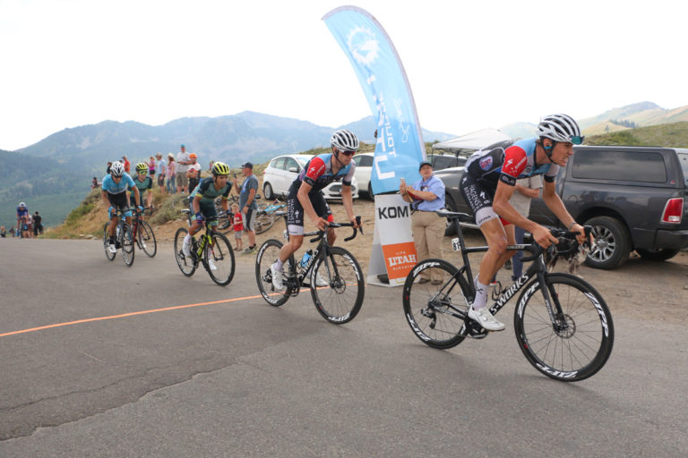
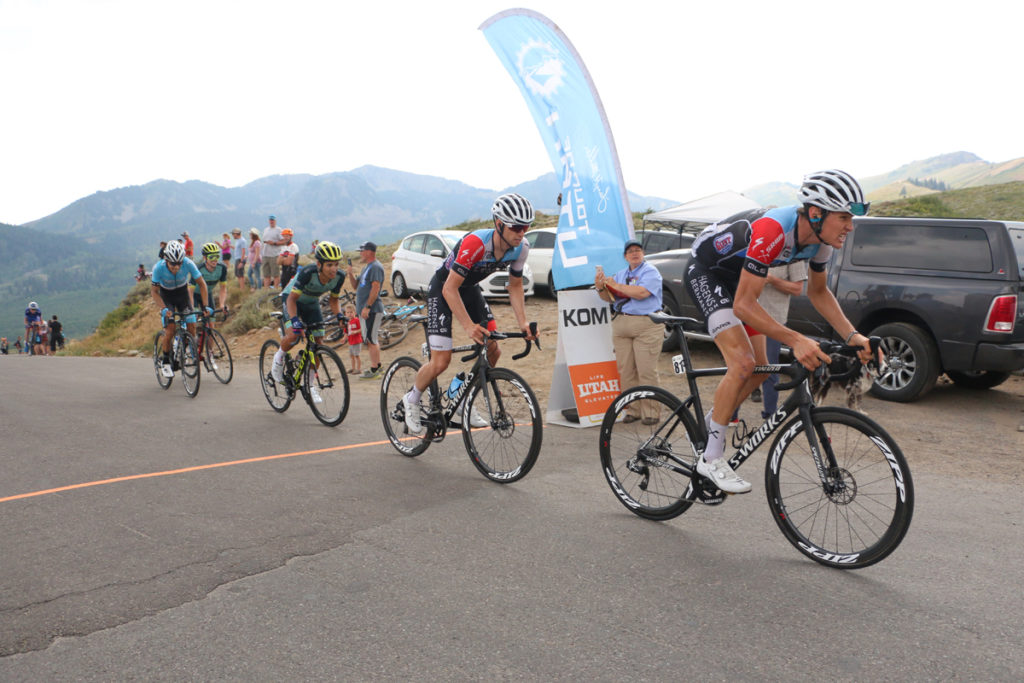
The Tour of Utah returns to Park City in 2019. Here, Riders crest Empire pass in Stage 6 of the 2018 Tour of Utah. Park City, Utah. Photo by Dave Iltis
2019 is the 15th year for the men’s cycling stage race, known as “America’s Toughest Stage Race,” which will challenge the professional athletes with seven heart-pounding days of racing. It is the sixth year for the Tour to be sanctioned as a 2.HC-rated (hors categorie) stage race by the Union Cycliste Internationale (UCI), making it one of the premier events for professional cycling teams in North America.
Corporate partners also have been announced for the opening Prologue and each stage of the Tour of Utah. Detailed maps and videos for race week are now available at the official web site at www.tourofutah.com.
New territory will be covered on four days of racing, beginning with the mountain Prologue at Snowbird Resort that is perched at 8,000 feet above sea level. A few firsts also include circuits in North Logan City and North Salt Lake, and a challenging climb up and over the Olympic Parkway at Utah Olympic Park. Returning to the Tour are the summits of two legendary climbs — Powder Mountain and Empire Pass — both rated as HC, or beyond classification. Back by popular demand is the downtown Salt Lake City circuit race, held in the evening with eight laps past the Utah State Capitol and City Creek Canyon.
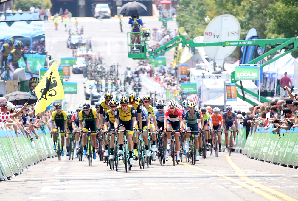
The peloton heads up the super steep Start/Finish climb. 2018 Tour of Utah Stage 4, August 8, 2018, Salt Lake City, Utah. Photo by Cathy Fegan-Kim, cottonsoxphotography.net
“This year’s Tour of Utah has a number of exciting route highlights from a new overall start at Snowbird Resort to the popular circuit race at the Capitol on a Friday evening. The return to Powder Mountain Resort this year will certainly be an epic stage. A true champion among the 120-plus athletes will be crowned at the end of race week in Park City,” said John Kimball, managing director of the Larry H. Miller Tour of Utah.
Route Highlights for the 2019 Larry H. Miller Tour of Utah
477 miles/ 767.8 kilometers
37,882 feet/ 11,546 meters of elevation gain
13 Utah Office of Tourism KOM climbs
15 Utah Sports Commission Sprint lines
First overall start at Snowbird Resort
Second time for mountaintop finish at Powder Mountain Resort since 2015
Third Prologue since 2011
First full weekend of racing in Park City area, with seventh time as overall finish
The first four race days and the final day on Sunday will feature early afternoon start times, between 12:20-12:30 p.m. MT, allowing for race finishes between 3:30-4 p.m. Stage 4 on Aug. 16 will take place from 6-8 p.m. for a Friday twilight performance. The next day, Saturday, Aug. 17, will begin with staggered start times for The Ultimate Challenge and the Tour of Utah. Two ride options for the amateur event will depart from Canyons Village at Park City Mountain between 10:30 a.m.-12:30 p.m. The pros will depart on Stage 5 at 2:30 p.m., with an estimated finish time at 6 p.m.
National television broadcasts for the Tour of Utah will be available across the U.S. on FOX Sports Network (FSN), followed by one-hour highlight shows each evening; check local listings for air times. TourTracker presented by Adobe will provide live start-to-finish race coverage via web cast and mobile applications all week. More details regarding Tour Tracker coverage and FSN regional programming will be made available in August.
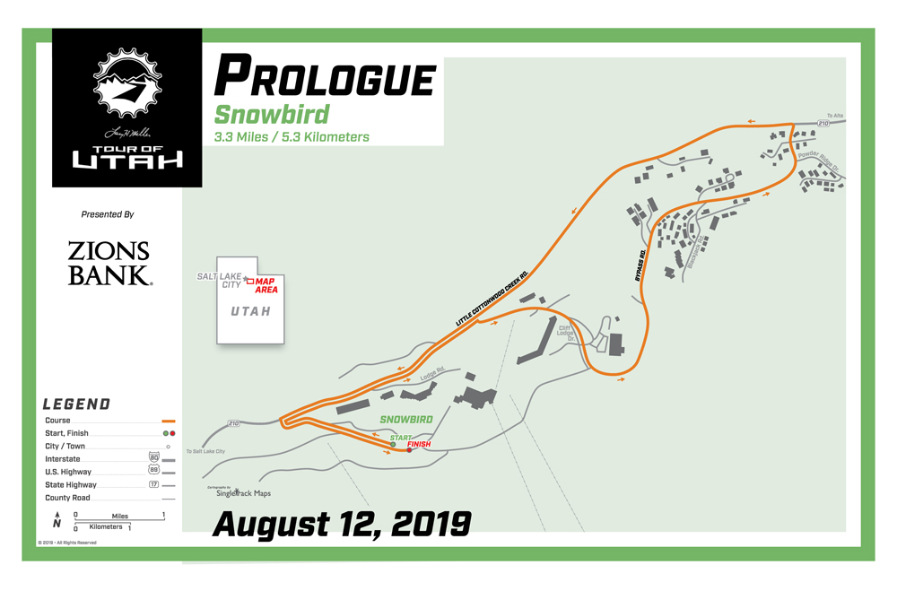
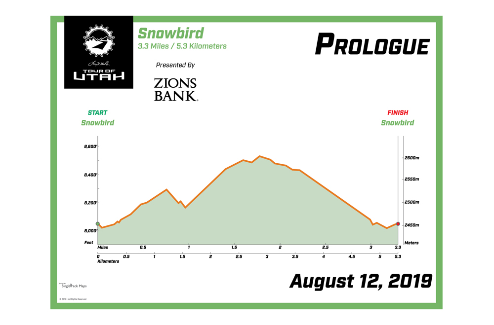
For just a third time since the Tour joined the UCI America Tour in 2011, a Prologue presented by Zions Bank will lead off race week. Snowbird Resort will host this short time trial for the first time on Monday, Aug. 12. This 3.3-mile (5.3 km) race against the clock will go vertical in Little Cottonwood Canyon as it will follow Bypass Road to snake around The Cliff Lodge. Once back on Little Cottonwood Creek Road, each cyclist will put on the afterburners for the 1.5-mile descent to the finish line, located at Entry 2 behind The Lodge at Snowbird. Spectators will have excellent viewing opportunities around Snowbird Resort to see the riders pass in both directions.
On the weekend prior to the race, Snowbird Resort will host the Team Presentation on Saturday, Aug. 10. A full schedule of fan festivities will be offered Saturday and Sunday to be announced this summer.
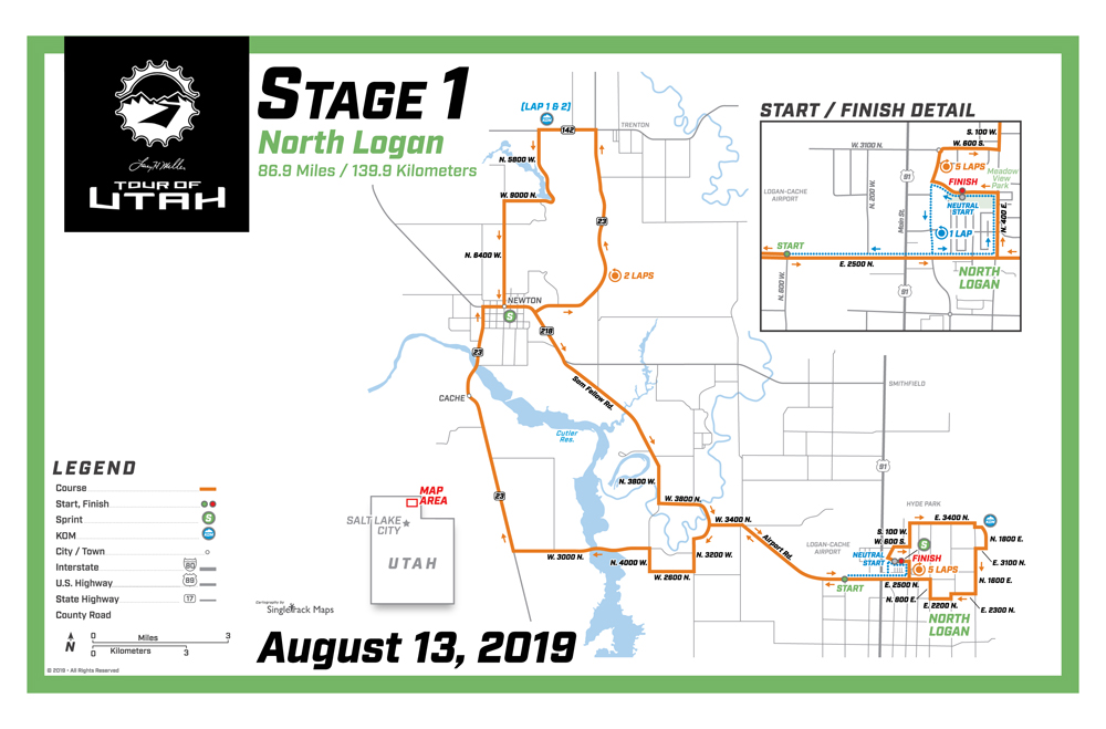
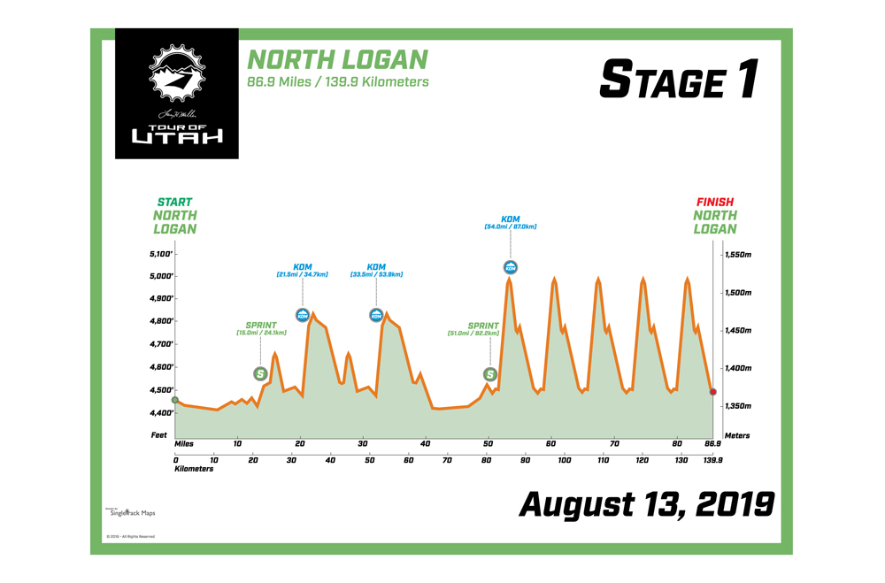
Stage 1 will return to the Cache Valley in northern Utah for a third time, and an inaugural visit to North Logan City. The Tuesday, Aug. 13 contest features a completely new 86.9-mile (139.9-km) course that traverses the western slopes of the Bear River Mountains for 4,310 feet of elevation gain. The first Utah Sports Commission Sprint line of the week will be contested in downtown Newton. Then the peloton will make two circuits around Little Mountain, passing less than 10 miles south of the Idaho state line. On each circuit outside Trenton, the first two Utah Office of Tourism King of the Mountain (KOM) points will be awarded.
After the final pass through Newton, the race will follow Sam Fellow Road to Airport Road and re-enter North Logan City for five fast and furious finishing laps. Rolling in a clockwise direction, the cyclists will pass the finish line area at Meadow View Park on each lap, which is 7.2 miles (11.6 km) in length. Notable on this first of five laps will be the final Sprint and KOM points of the stage. Each swoop around the circuit should take 15-18 minutes to complete, providing spectators with a full hour of action in downtown North Logan City.
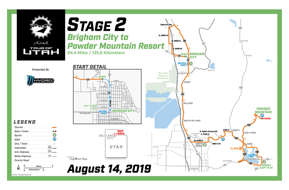
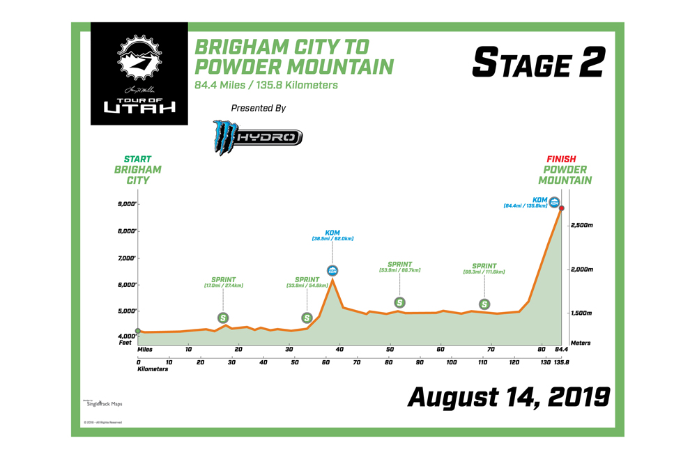
Stage 2 presented by Monster Hydro brings a wild west showdown to the 8,900-foot summit of Powder Mountain on Wednesday, Aug. 14. It has been five years since the Tour introduced the massive ascent on one of the steepest roads in Utah. State Route 158 connects the town of Eden to Powder Mountain Resort with gradients rising to 16 percent. The 8.6-mile scale will pack a punch to the legs and lungs of the best climbers in the world for the Stage 2 finish.
The 84.4-mile (135.8-km) Stage 2 begins for a second time in Brigham City, with festivities in front of the stately Box Elder County Courthouse. After 1.5 ceremonial miles along Main Street, the race officially starts on Promontory Road (State Route 13) and will make a 34-mile loop through the northern section of the county. About 40-50 minutes later, the race will pass through Brigham City again, moving southbound on Main Street. A Utah Sports Commission Sprint line will be contested at the West Forest Street intersection.
The race will then proceed south on Highway 89 to access Weber County. A second Sprint line will be held along W. 2700 North in North Ogden, setting up a Category 2 Utah Office of Tourism KOM on the North Ogden Divide. Once through the narrow, winding pass, the race will circle the Pineview Reservoir twice, rolling in a counter-clockwise direction. Sprint points will be awarded on both laps through Huntsville, using State Route 39. From there it is the final push to complete 7,310 feet of elevation gain for the day to Hidden Lake Lodge on the summit of Powder Mountain. This new section is an extra 1.4 miles above the tree line than was raced in 2015.
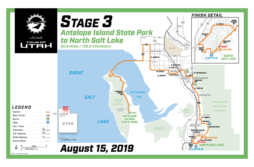
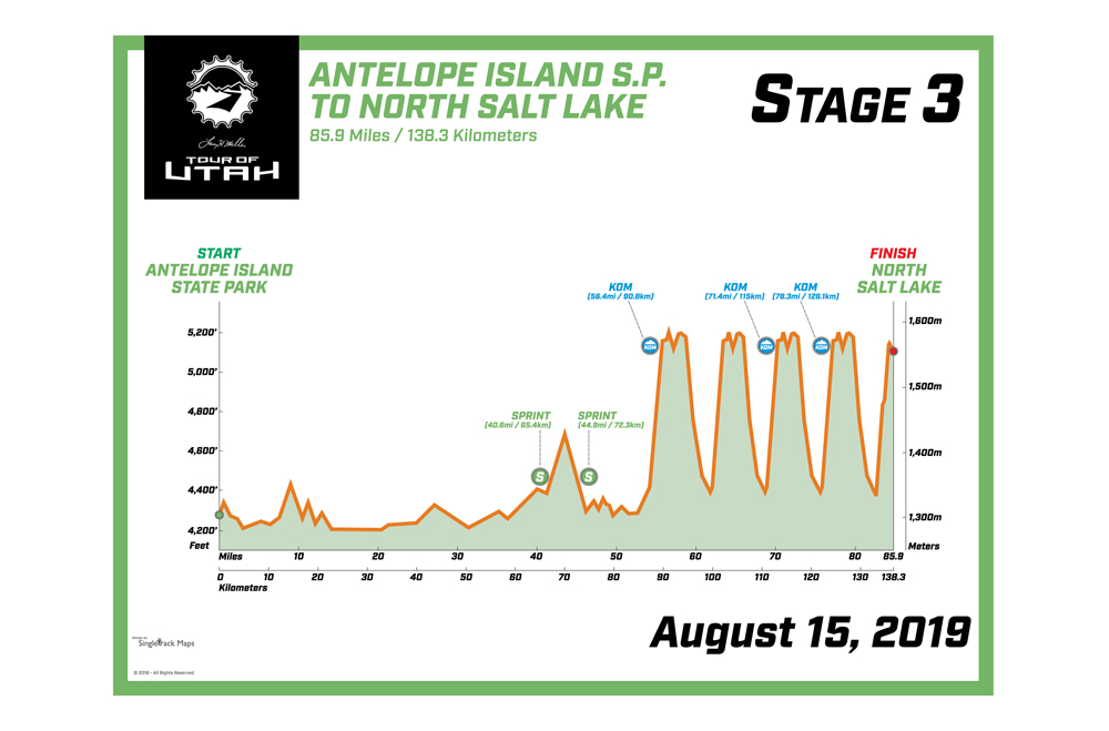
Stage 3 on Thursday, Aug. 15 begins for a fourth time at Antelope Island State Park. From the drop of the flag at Field Garr Ranch, the race surges northbound on the largest island in the Great Salt Lake. After crossing the 7- mile causeway, the race will wind through the communities of West Point, Layton, Kaysville, Fruit Heights and Farmington. Riders will vie for two Utah Sports Commission Sprint lines in northern Davis County in Layton and Fruit Heights.
Most of the 5,895 feet of climbing on this 85.9-mile (138.3-km) stage will be collected when the route skirts the Wasatch Mountains south of Layton, with three Category 3 climbs in the final 29 miles. Following a punchy KOM up the Bountiful Bench, the route follows a new southbound stretch of Bountiful Boulevard for finishing circuits in first-time host city North Salt Lake. The riders won’t have long to admire the stunning view across the valley to the Great Salt Lake, with a right turn on Indian Springs Road for 3.75 laps of a 6-mile circuit in North Salt Lake. Two laps will award more KOM points. Before a fourth full lap is completed, the stage winner will be decided in front of Eaglewood Golf Course.
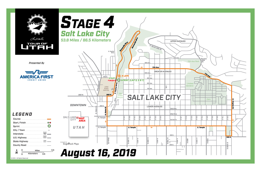
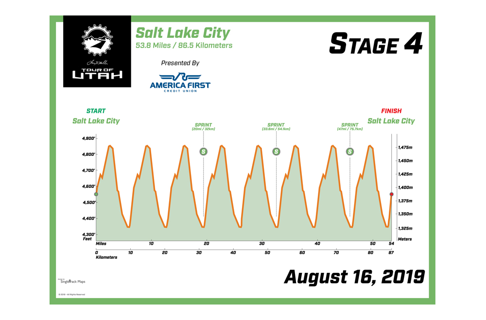
Stage 4 presented by America First Credit Union returns to downtown Salt Lake City for the 12th time in Tour history. The traditional circuit course is back for a third time, with the high-speed descent of N. Virginia Avenue, severe incline on N. State Street, and start/finish line on East Capitol Boulevard next to the Utah State Capitol campus. This 6.7-mile (10.8-km) circuit is the same course that was first introduced in 2013 and used again in 2017. There will be eight total laps this year, for 53.8 miles (86.5 km) of racing. Intermediate sprints will provide bonus points on laps 3, 5 and 7. The after-hours workday affair will take place 6-8 p.m. Stage 4 will offer a number of viewing areas for residents and visitors, including City Creek Canyon and Reservoir Park. There are no Utah Office of Tourism KOM points on Friday; however Stage 4 packs a punch with 4,460 feet of elevation gain.
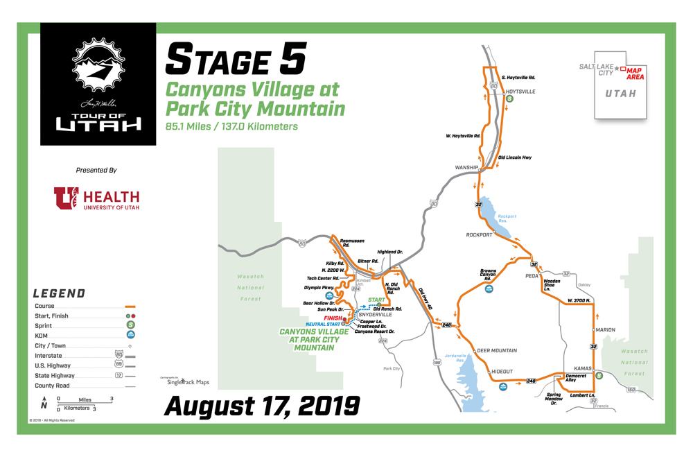
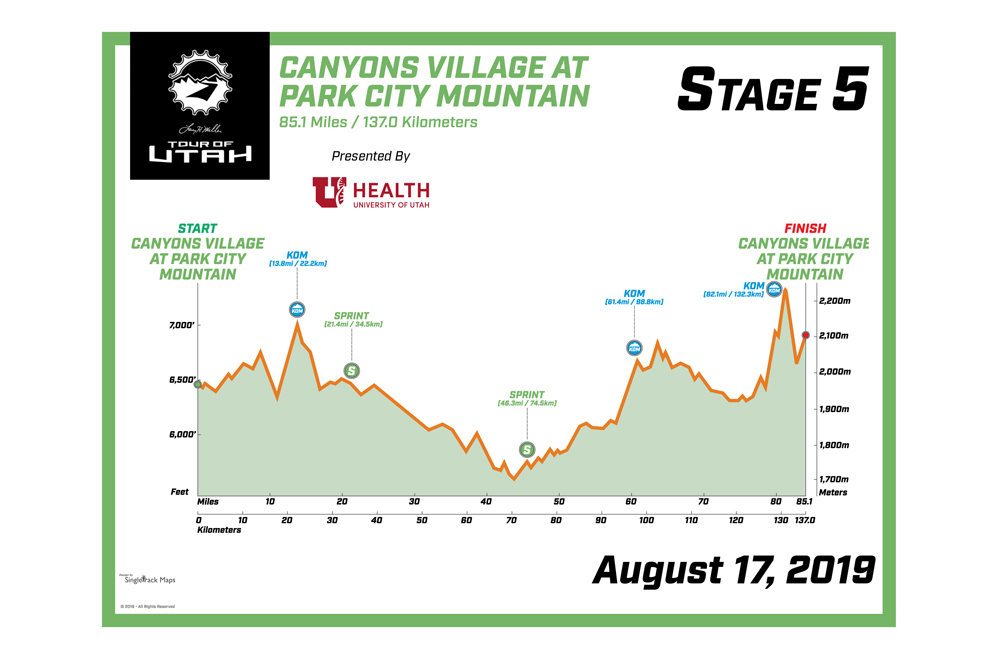
For the first time in race history, Canyons Village at Park City Mountain will host both the start and finish on Saturday, Aug. 17 for Stage 5 presented by University of Utah Health. A winding trail across Summit County will take the race past Jordanelle and Rockport reservoirs for a total 85.1 miles (137 km) and 5,236 feet of climbing. Sprint lines in the meadowlands of Kamas and Hoytsville are bookended with KOM lines along the mountainous terrain near the Jordanelle Reservoir and up the often-traversed Browns Canyon.
The route will twist around Kimball Junction for a possible General Classification shakeup in the final six miles. Riders will cross the top of Utah Olympic Park for the first time and face a blazing downhill on Bear Hollow Drive. The final push is vertical along Canyons Resort Drive and High Mountain Road to the finish line in the heart of Canyons Village at Park City Mountain. The professional teams start the course from Canyons Village at Park City Mountain at 2:30 p.m., with an expected finish at 6 p.m. Following the award ceremonies, the after- party for Stage 5 includes a free concert as part of the annual Summer Concert Series.
Earlier on Saturday, two gran fondo-style bicycle rides will roll out from the same start area. The Ultimate Challenge presented by University of Utah Health, now in its ninth year, offers a unique cycling event for amateurs to ride one of the demanding mountain courses used by the pros. This year Sunday’s Stage 6 route will be used by The Ultimate Challenge participants and include a shorter 44-mile option. There will be timed sections on the 94-mile route at Wolf Creek Ranches and over Empire Pass. The longer route begins at 10:30 a.m. and the shorter route begins at 12:30 p.m. For registration ($95-$140) and more information, visitwww.tourofutah.com/experience/ultimate-challenge.
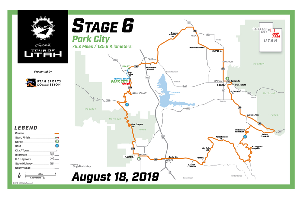
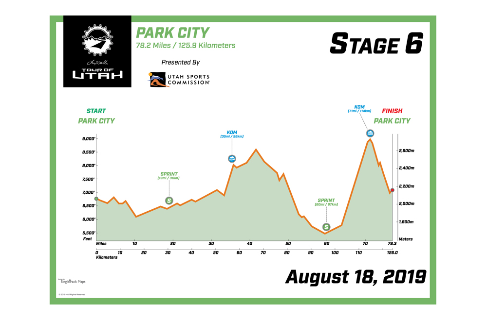
Stage 6 presented by Utah Sports Commission brings back the overall finish to Park City on Sunday, Aug. 18. It is the 10th year Park City has served as a host city, and seventh time it will host the final stage of the Tour. No need to make changes to a proven course first introduced in 2012, which features 78.2 miles (125.9 km) and 10,000 feet of climbing.
The route will pass down Browns Canyon and encounter a Sprint line in the town of Kamas. Then an aspen tree-lined, 2.1-mile KOM follows in the private community of Wolf Creek Ranch, a Category 2 climb that reaches a maximum pitch of 22 percent. A technical descent into Wasatch County will allow the riders to regroup through Heber City before the final sprint line in Midway. Then an all-out assault for the climbers will take place on the six- mile climb along Pine Canyon Road, with pitches from 10-20 percent gradient. The H.C. summit of Empire Pass is the final KOM and the highest point of the race for the week at 9,700 feet above sea level. A blistering descent down Mine Road leads to the finish in front of historically massive crowds along Upper Main Street in Park City.
The Larry H. Miller Tour of Utah is free to all spectators, making professional cycling one of the most unique professional sports in the world today. It remains a 2.HC-rated stage race on the UCI America Tour, making it one of the premier events for professional cycling teams in North America. The Tour is also part of the USA Cycling Pro Road Tour. More information about the Larry H. Miller Tour of Utah can be found by visiting www.tourofutah.com, as well as social channels Facebook (tourofutah), Twitter (@tourofutah), Instagram (@thetourofutah) and YouTube (Tour of Utah).
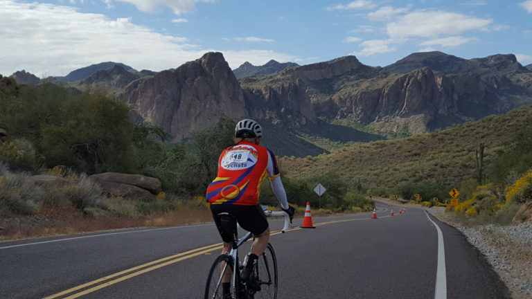
Rider (unknown) on Bush Highway. Photo by David Ward
I can’t even begin to count how many organized rides I have participated in. I have to say, I believe I have enjoyed every one. What’s not to like? First and foremost, you are out riding your bike, typically on a ride you expect to challenge you at least somewhat. Also, most of us do it with friends and/or family. So you have good company. And you are riding with a whole bunch of other people who, like you, love this sport and enjoy a good organized ride.
But, what can detract from a good organized ride is just that: Good organization. Maybe there aren’t enough aid stations, or they promise a lot of good food and snacks and fail to come through. Maybe the aid stations are poorly placed. Or maybe they run out of food. Or perhaps by the time the slower riders arrive at the finish, all the booths and vendors are packing up and leaving, so there is no more free Coke or beer at the end, or the promised post race meal can no longer be had. Maybe they failed to have a water stop at the top of a tough climb.
Well, all those have happened to me. And when it does, it diminishes my enjoyment of the ride, leads to gripes from my cohorts and me, and just takes some of the fun out of the day’s experience.
But on April 6, my daughter, Marielle, and I participated in El Tour de Mesa, an event sponsored by Holualoa Companies and held in, you guessed it, Mesa, Arizona. On a stop a couple of years ago at a bike shop in the area during a visit to my daughter and her family, I had seen a flyer for El Tour de Mesa and thought then I should ride that some time with Marielle. Naturally, I soon forgot about that, but Marielle saw something on it about a month before this year’s ride and asked if we wanted to come down. So we did.
The packet pick up was a breeze (though admittedly we showed up early afternoon to beat the crowd), and we duly arrived early Saturday morning and lined up for the 6:30 a.m. start. El Tour offered two distances, a metric century and a metric half century. While we both lacked early year distance training, we opted for the 100 kilometer ride as it had much more appeal.
Starting in downtown Mesa, the route for the metric century headed north to where it met the Beeline Highway. From there, it rolled through the Salt River Recreation Area and Tonto National Forest as it circumnavigated Phoenix area’s East Valley landmark, Red Mountain. A couple of miles before the halfway point, the route turned onto Bush Highway which it followed for the next 12 miles before turning left onto Usury Pass Road which led up and over Usury Pass and back into East Valley. Once back in the valley, the route wound through East Valley and back to the start/finish in Mesa.
Well, I absolutely loved this ride. For starters, it is a beautiful ride. You have to appreciate desert beauty, and this was desert beauty at its best. With the frequent (for the Phoenix area) rains, and even some snow, the desert flowers were in full bloom and the desert landscape was as green (desert green, to be sure) and colorful as you will ever see it. To me, it was simply stunning..
Also, the aid stations were good. Organizers had made it clear in the registration booklet that there would be simple snacks, fruit and water at the stops. So, we were ready for that. We had a good breakfast before leaving, and took enough energy drink, bars and chews to get us through. The stops had pretzels (which I much appreciated for the salt), oranges and bananas,. They probably had a few other items too, but those were the snacks I liked.
Additionally, the route planning and control was amazing. All the intersections leading out of Mesa were controlled, as you would expect, and we were able to ride through with no stops. Also controlled was the one stoplight on the back side of the route so we could roll right through that. That was a bit of a surprise. But what astounded me was that for the last nearly 20 miles of the ride through East Valley and to the finish in Mesa, every single intersection with a stoplight or stop sign was also manned, and traffic was stopped to allow us to ride through. We must have ridden through 20-30 intersections on this ride, all manned. Except for the aid stations we stopped at, we never had to put a foot down till the finish. Incredible.
The frosting on the cake, though, was the stretch from where we left the Beeline Highway until after we had turned onto Usury Pass Road and ridden up and over Usury Pass. This tends to be a busy section of road, with narrow shoulders on Bush Highway for a good portion of the road. I know, because I have ridden over Usury Pass numerous times, and I rode on Bush Highway out to Saguaro Lake one time a few years ago. One must contend with a lot of traffic, including a bunch of big trucks pulling boats to and from Saguaro Lake, a popular recreation area.
For El Tour de Mesa, though, our lane for this stretch of nearly 20 miles was blocked off to traffic, with a pilot car alternately shuttling the traffic each way in the other lane. This section has outstanding mountain vistas, a lovely landscape of red rock contrasting with green cacti and the other desert flora , and on Bush Highway, the blue waters of Saguaro Lake . We could ride, climb and descend with a full lane at our disposal and enjoy the scenic desert landscape. It was a very special part of the ride.
Finally, with about 7 miles to go, we enjoyed a special moment. As we were riding down Lindsay Road, just on the back side of where Marielle lives, we saw a small group of people with a sign. It turned out to be Marielle’s husband and children, my wife, and another daughter and her son, all cheering us on. It was unexpected, and a thoughtful and touching moment.
El Tour was held in connection with Cyclo Mesa, Mesa’s family friendly bicycle festival. So, instead of a finish with just sponsors’ and vendors’ booths, there was also a zip line, a rock climbing wall, bungee trampolines, BMX stunt shows, and inflatable slides and bouncing houses, some of which my grandchildren took advantage of, and which made coming to the finish to meet us enjoyable for them. It was, indeed, not just an event finish, but truly a festival.
El Tour de Mesa was a real treat. A metric century was a perfect early season ride for me. There was not too much climbing, mainly the 3.5 mile climb up Usury Pass. As you can imagine, the Phoenix area does not have much real climbing, and many consider Usury Pass a huge challenge which, frankly, it isn’t. But again, it was just right for me at this time of the year.
Adding it all together, controlled intersections, a nearly 15-mile stretch with a full traffic lane for just us cyclists through the most scenic part of the ride, a beautiful desert landscape and sweeping views, and a daughter there ready to ride it with me, I plan to be back again for El Tour de Mesa.
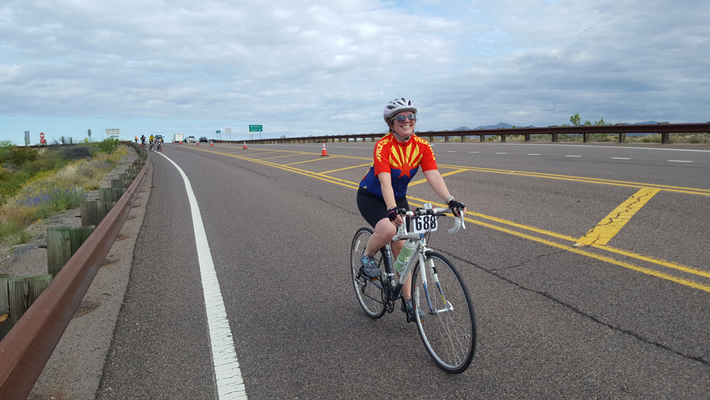
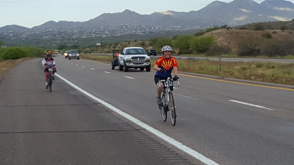
Marielle on the entry to Bush Highway in El Tour de Mesa. Photo by David Ward. Photo by David WardMarielle on the Beeline Highway in El Tour de Mesa. Photo by David Ward
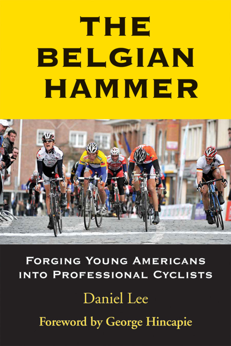
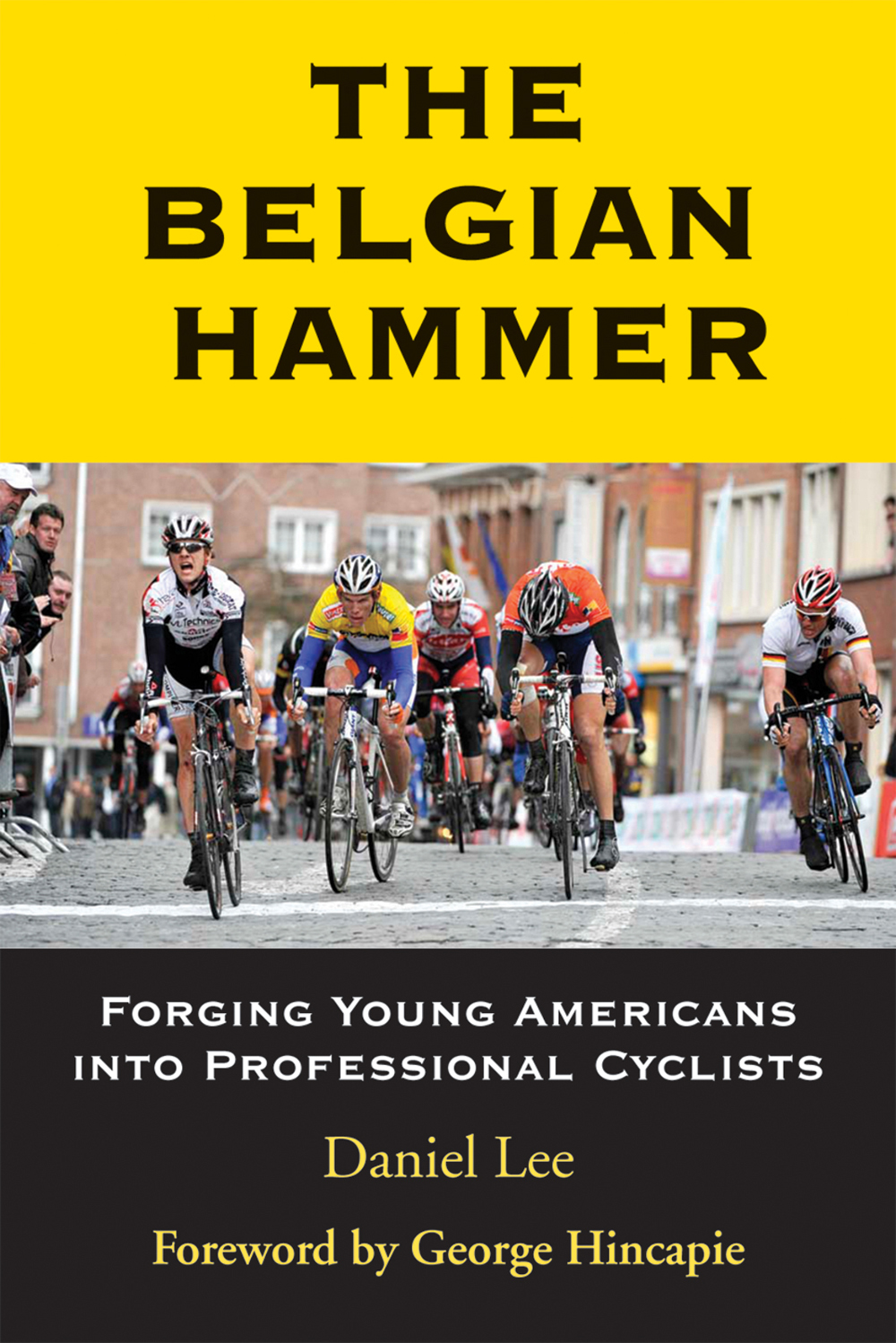
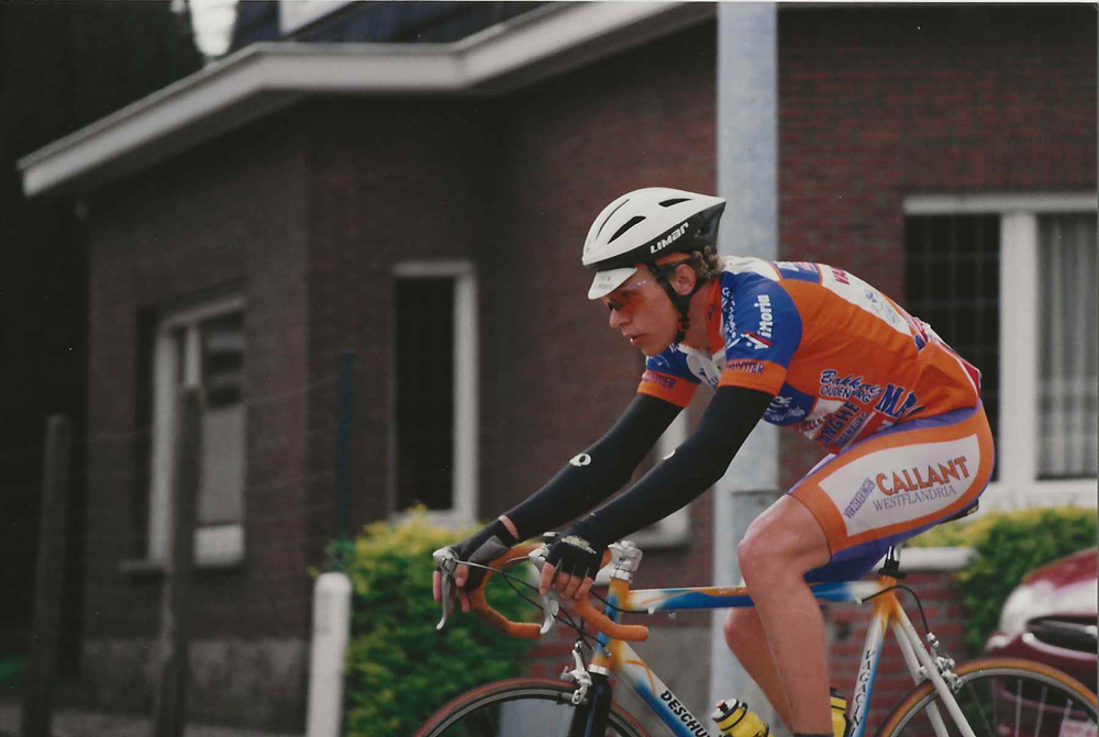
The subtitle of the book, Forging Young Americans into Professional Cyclists, sums up the gist of the book. Young cyclists from 19-21 years of age, perhaps older, go to Belgium to seek their potential to become a professional cyclist. The test of their potential lies in the ability to do well in the infamous kermesse (or kermis) races of Belgium. There may be 150 or more riders in these weekly (or more frequent) events, with each rider putting down “the hammer” from the start of the 100-kilometer race. The hammer never lets up as the riders fight for position throughout the race on narrow roads, some with cobblestones, along with sharp turns and short steep hills. And then there are the racing conditions: “The race started off in chilly dry conditions but quickly deteriorated to a cold wet slog”. If you are not in the top 50 you are going nowhere in your career potential.
The book is older with a copyright date of 2011, but by simply changing the names of the young riders featured in the book (Phinney, King, Craddock) and it becomes relevant to 2019. The Belgian Hammer is a hard look at what it takes to be at the top of European cycling. Not only is the racing described but the whole culture of living in Europe is detailed, food, lodging, and the towns in which the riders live. In addition, there are the costs of time such as a leave of absence from college and money, almost $1400 for room, board and racing. It’s no wonder that only a select few move on.
Former local pros, Jeff Louder and Levi Leipheimer have one-sentence mentions in the book. Former CEO of USA Cycling and Salt Laker Steve Johnson also has a brief interview section in the book. Bicycle racing fans that have followed the sport will recognize many of the names and races discussed in the book. You will also be treated to many behind-the-scenes interviews that Mr. Lee was able to obtain from his personal connections to many of the riders. The Belgian Hammer gives you a rare and memorable look into the lives of those hoping to make it to the top of the profession cycling ranks.
As interesting as the book was to read, listening to Jeff Louder discuss his time in Belgium was even more entertaining. Jeff is the owner of TrainLouder.com, a personal training business for anyone that wants to improve their cycling skills from up and coming Junior racers to the weekend recreational rider. Jeff is also the Manager (Director Sportif) for the Hagens/Berman Axeon professional cycling team. I wish to thank Jeff for his time.
Cycling West: Tell the readers about your start in Belgium.
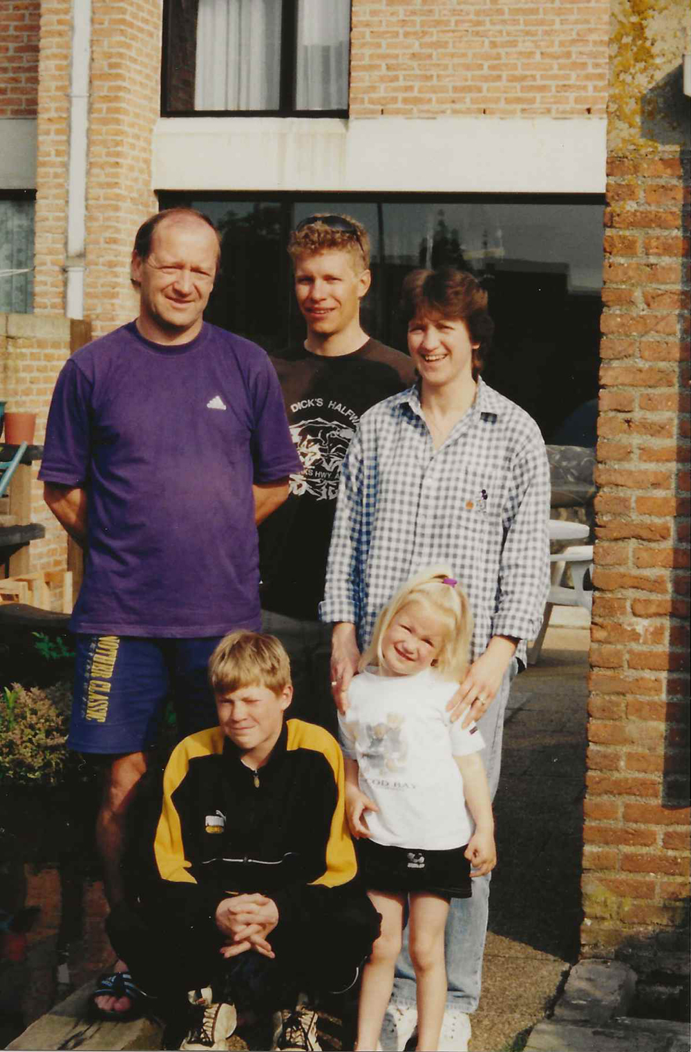
Jeff Louder: My father, Ken, found an advertisement for a room in the bottom floor of a house in Belgium during an Internet search, so off I went. The book says I was a graduate of the Cycling Center but at that time it was less formal, just a room in a basement. I was about 20 and passionate to become a cycling pro. The living conditions were OK but after a year I moved in with the DeWulf family. They understood my needs as they had a relative that almost entered the pro ranks. I stayed there about 5 years. The Dewulf’s were a large reason for my success. Greta did a lot for me. I learned Flemish along with her 3 year-old daughter, Zoe.
Jeff Louder with the Dewulf family in their backyard in Oostende, BE. Clockwise from left: Marc, me, Greta, Zoe, Enzo. Date unknown, likely 2001. Photo by Jeff Louder
During my first year I lived with a bunch of other Americans that were doing the same thing as me. My roommates and I would ride our bikes to all of the races, some of which were quite far. Occasionally we took the train. We sometimes rode home in the dark, or would catch a train home. We missed a few races because of transit delays. It was crazy when I think back about it. With the DeWulf’s I had transportation to the races. They also helped me join a team, which allowed me to enter bigger races.
C.U.: Your start in Belgium racing was not at all auspicious. When did you realize you were going to make the pros?
J.L.: The first year I mostly learned the hard way. In my first race I crashed, broke my bike, my helmet and cut my cheek where I still have a scar. I was taken to a hospital by ambulance two cities from the race and dropped off. My race bag and wallet was still at the start/finish area of the race. Not my expected experience. I did obtain a ride back from a Belgium rider that also crashed and was brought to the same hospital so there was a little good news. The rest of the season went better but I made a lot of mistakes and feel like I went home with my tail between my legs.
Jeff Louder racing in a Belgian Kermese in 1999 (my last year as an amateur). Photo by Greta Vermote
I didn’t lose my desire to succeed and once I got back to Utah and recovered a little I began preparing to go back for another year. That second year I had a lot of top-10 finishes and had several wins in the Belgium races. If you made the “cut” and had your name in the newspaper as one of the top finishers the local people noticed. I had my name in the paper and heard my name mentioned quite a bit by the local citizens. I didn’t expect to get onto a pro team after that second season but I think I got lucky. I won the right race at the right time, and had a meeting with Gerard Buelens the manager of Tonnissteiner-Colnago the next day. He offered me a contract.
C.U.: As the book points out, you were one of a small group that made the leap to a pro contract. What set you apart from the other riders that may have had near equal talent?
J.L.: I did have talent, but not amazing talent. I put in a lot of hard work along with a strong desire to make it. I feel like mentally, I just had to do it so I persevered and made the cut. A lot of riders were doing the same but I managed to become a pro. I also think I was lucky as a lot of things in my favor also fell into place.
C.U.: Jeff, thank you for your time. I had a good time listening to your stories. Good luck with the Hagens/Berman Axeon team. If anyone wishes to improve his or her cycling experience you can contact Jeff at [email protected].
The Belgian Hammer: Forging Young Americans into Professional Cyclists, by Daniel Lee; 2011; Breakaway Books; Breakawaybooks.com; ISBN-10: 1891369911
Maybe you are familiar with intervals, maybe you have followed a structured interval workout on your trainer over the winter, maybe you have heard your friends talk about doing intervals. In a nutshell, intervals are repeated efforts with recovery between. ‘Intervals’ of work, interspersed with recovery. The reason they work is because with the recovery between, you are able to more consistently hit power or effort targets than just going out and trying to go hard the whole time. (Because you will fade). Riding of any kind will improve your fitness. But we are all strapped for time and doing intervals will be your most efficient use of ride time. Of course, lapping a climb for a set of intervals may not be as interesting as riding a loop with fun, interesting scenery. But you can do that too! Save your looping, adventure/exploration rides for the days you have more time and you will ride at a lower intensity. For time crunched days, try intervals! Here are a few things to keep in mind as you test the interval waters;
Not all intervals should be at a maximal effort. Depending on the type of intensity required for your goal event(s), the time of year, and your current fitness, you may do intervals at a range of intensities and/or with a range of goals. You may have a goal based on a rate of perceived effort, heart rate, power, cadence, or other objectives.
Intervals can vary in more than intensity and duration. You will change the training effect by adjusting the amount of recovery between, how hard you start or finish the interval, adding surges, changing cadence, incline, and more.
As I mentioned, intervals may be targeted around goals other than watts or effort but that is the most common type of interval. For example, you might do a set of four intervals of 10 minutes at tempo power/effort and work your way up to three to four 20 minute intervals of that power/effort. You might do six times two minutes of VO2 power/effort and work your way up to nine times and/or up to four to five minutes. The types, reps, and duration will vary dramatically depending on your current fitness and goals.
You don’t need a power meter to do intervals but it will allow you to perform the intervals more precisely. Remember that if you train by heart rate zones, your heart rate is a response to an effort. It is your body’s response to how hard you are pedaling. But it doesn’t say anything about objectively how hard you are pedaling (how many watts you are producing). What your response is (your heart rate) can be affected by how tired you are, if you are dehydrated or hungry, if you are hot or cold, if you have had caffeine, if you are tired, and a myriad of other factors. Not to mention heart rate is lagged so will not catch up to your effort for some, even many minutes.
Based on the above, if you are not training with a power meter, your rate of perceived effort may be a more accurate training metric than heart rate. Most people have little faith in their ability to assess rate of perceived effort but when blinded against a power meter, most of us are pretty good. Think of the rate of perceived effort scale from 1-10 like this:
Active Recovery: 1-4 (very easy, soft pedaling or not much more)
Endurance: 4-5 (you can chat but you are starting to work)
Tempo: 6-7 (hard endurance pace, conversation only in brief phrases between heavy breathing)
Threshold: 8 (hard, about the max you could sustain for an hour, single word answers, conversation not possible)
VO2: 9 (hard surges for a several minutes)
Anaerobic Capacity: 9-10 (just below sprinting)
Sprinting/Max: 10+
Don’t overshoot. Start the set of intervals and each individual interval conservatively. The worst way to do an interval is to overshoot and either have to back off or stop completely. Better to be conservative, hold steady, ramp up if you have something left, and finish strong!
These tips give you a beginners idea of training with intervals. For further information or coaching inquiries, please contact me through one of the means below. I’ll see you on my favorite interval hill!
Sarah Kaufmann is the owner of K Cycling Coaching, as well as a professional XC and CX racer based in Salt Lake City, Utah. She can be reached at [email protected] or 413.522.3180.
It’s been a long and wet winter and spring. Yes I’m stating the obvious, but let’s look on the bright side… summer is here and it’s likely to be hot hot HOT! Sometimes that calls for the mid-ride stop at 7-11 for a slurpee (aka sugar rush or brain freeze), and often we crave that post-ride smoothie. There’s nothing as refreshing as a chilled beverage on a hot day (including the adult kind), but the focus of this article is the SMOOTHIE. Let’s talk about all the ways we can use the blender to meet nutrition needs as well as quench that thirst!
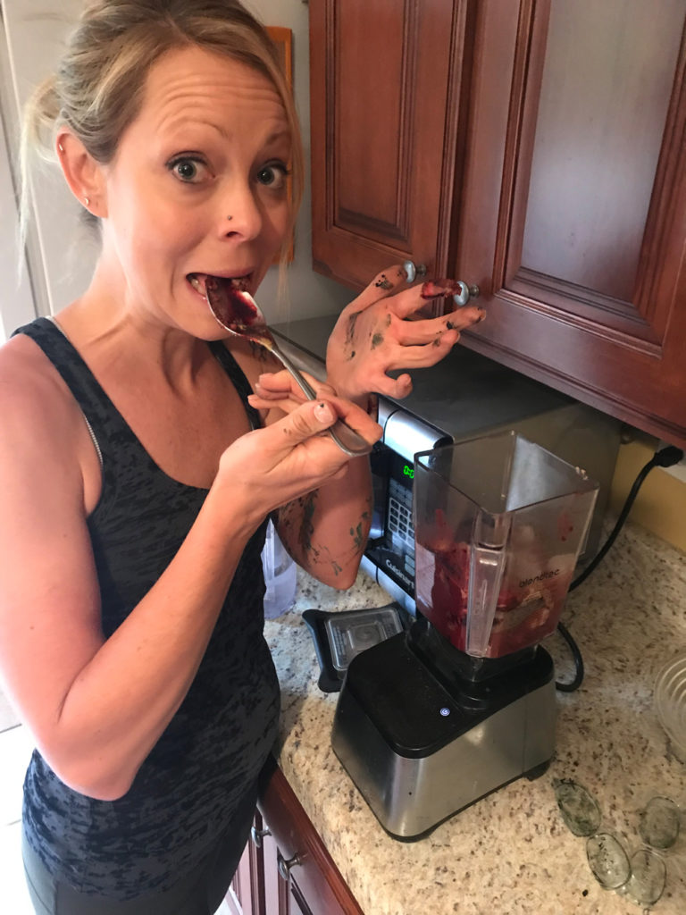
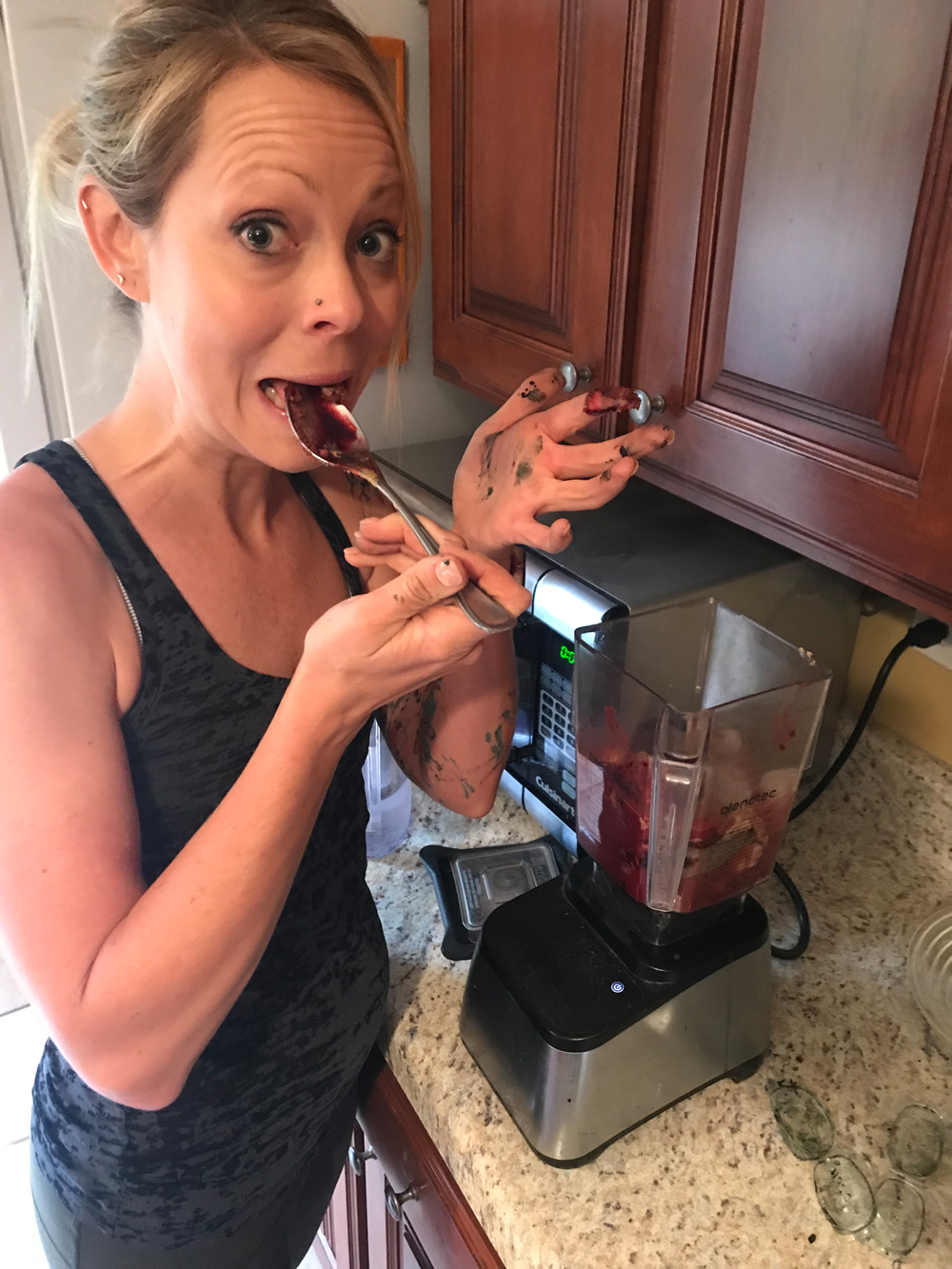
Breanne in the process of creating a smoothie. Photo by David Harward
You can blend a smoothie as a meal replacement to take on-the-go or to work. It’s a great way to conveniently pack nutrients into a cup without a lot of prep. After training is another great time to utilize a smoothie for immediate recovery, as we all know it can be hard to eat right after a ride, and you need to replenish hydration losses, so a smoothie is great way to meet all those needs.
Proper recovery should replace the energy and nutrients that were utilized during exercise to repair, rebuild and prepare for the next training bout and/or competition. During endurance exercise, glycogen stores (muscle and liver) are rapidly depleted. Thus, glycogen replenishment is a critical component of recovery nutrition, particularly when there is less than 24 hours between training bouts and/or competitions (e.g., two-a-day workouts, triathlon training, or stage racing). Athletes need approximately 1-1.2 grams carbohydrate per kg of body weight post exercise to maximize the rate of glycogen resynthesis. Although not a primary fuel, a small amount of protein must also be replaced post exercise to minimize loss of lean tissue and support tissue repair. There is also some evidence to suggest that protein consumed post exercise may expedite glycogen resynthesis. Athlete’s consume 0.4 grams of protein per kilogram of body weight at approximately the same rate and on the same schedule as that for carbohydrate.
Whether you’re blending up a sweet treat for a meal replacement or as recovery from riding, be sure to mix things up in the proper ratios for your body. It’s easy to go crazy with all the ingredients, and the calories add up quickly. This can be great for recovery, just be mindful of how much fruit, protein, etc. you need (If you’re not sure, give me a call and I’ll help you determine the numbers). I put together some recipes that you can use for a variety of smoothies. I hope you enjoy them, enhance them, have fun with the yum!
Note that milk alternatives (almond, rice, soy, hemp, etc.) are typically fortified with similar nutrients to milk, so would be fine alternatives to get the right proportions of macro and micro nutrients. So, no matter your preferences for food or drink, the most important thing to remember after every ride or race is to get your recovery nutrition in within 30 minutes of finishing, so your body can immediately absorb those nutrients and start to replenish its losses, rebuild damaged tissues, hydrate and prepare for the next ride. Keeping quality gas in your tank can only help your engine run its best and achieve your optimal performance capabilities on and off the bike.
Recipes!
Yummy Power Shake
Ingredients:
1 cup non-fat chocolate milk or soy milk
1 banana
1 TBS peanut or almond butter
1 TBS ground flax seeds
Ice
Nutrition Facts:
Kcals: 310 Carb; 45g; Fat: 13g; Protein: 9g
Green Machine
Ingredients:
3/4 cup non-fat milk or soy milk
2 pitted dates
1 banana
1 cup chopped kale leaves
1 cup spinach leaves
1/2 cup fresh or frozen berries
Ice
Nutrition Facts:
Kcals: 330; Carb 78g; Fat: 1g; Protein: 11g
Berry Bliss
Ingredients:
1/2 cup non-fat, greek, or soy yogurt
1 banana
1 cup fresh or frozen berries
Ice
Nutrition Facts:
Kcals: 30; Carb: 53g; Fat: 0g; Protein: 25g
Raspberry-Avocado Shake
Ingredients:
1 avocado, peeled and pitted
3/4 cup orange juice
3/4 cup raspberry juice
1/2 cup frozen raspberries
Nutrition Facts:
Kcals: 526; Carb: 67g; Fat: 30; Protein: 5.7g
*** this can be 2 servings, so drink one, save/freeze the other, or share the love!
Breanne Nalder, MS, RDN has a Master’s degree in Nutrition with an emphasis in Sports Dietetics at the University of Utah. She is a Registered Dietitian, the nutrition coach at PLAN7 Endurance Coaching, and races on the road and gravel on the professional level. For personal nutrition coaching, you can reach Breanne at 801-550-0434 or [email protected].
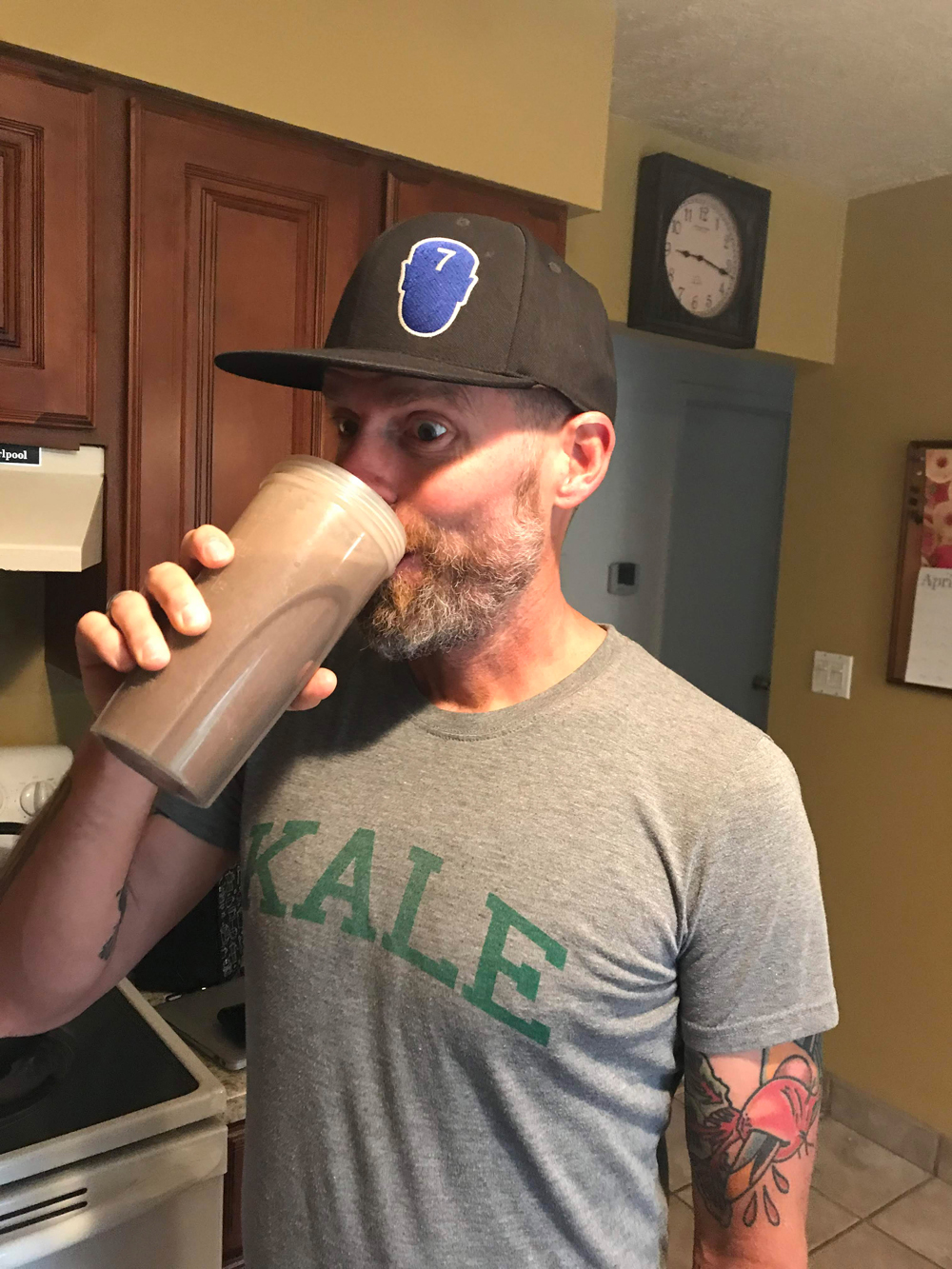
Smoothies are a great food choice for cycling. Photo by Breanne Nalder
SALT LAKE CITY (June 3, 2019) – Individuals and groups are needed to fill as many as 1,200 volunteer shifts for the 2019 Larry H. Miller Tour of Utah, scheduled from Aug. 12-18. A variety of positions are being offered by Local Organizing Committees (LOC) that are hosting stage starts and finishes at this summer’s international cycling event. Volunteer applications are being accepted online at the Tour of Utah website. (https://www.tourofutah.com/experience/2019-volunteers)
Volunteer assignments are available for one or multiple shifts. Group assignments for families, corporations, clubs and civic organizations are encouraged to inspire teamwork and support the local community. Each LOC will provide training in advance of race week and manage assignments to best meet the time and talent of volunteers. Every volunteer will receive a commemorative Tour of Utah T-shirt, hat, sunglasses, sunscreen products and a 12” x 12” clear cinch sack, which can be reused at most stadiums for personal items. Snacks and water will also be provided daily.
Snowbird Resort will host pre-race festivities Aug. 10-11, as well as the Prologue on Aug. 12. Other races days will be hosted across northern Utah: North Logan City (Aug. 13); Brigham City and Powder Mountain Resort (Aug. 14); Antelope Island State Park and North Salt Lake (Aug. 15); Salt Lake City (Aug. 16); Canyons Village at Park City Mountain (Aug. 17), and Park City (Aug. 18).
The largest number of shifts available are for course marshals. Volunteers in these positions find themselves close to the action, and along some courses will be able to see the race pass multiple times. The recommended age for volunteers is 18 and older. Applicants must sign a waiver, or have a signature provided by an adult or legal guardian if the applicant is 17 years of age or younger.
General registration will remain open through early August. A “Frequently Asked Questions” section is provided on the website to provide descriptions of specific positions, opportunities for groups and more information. Individuals interested in working as traveling course marshals for all seven days of race week should send a request via email to [email protected].
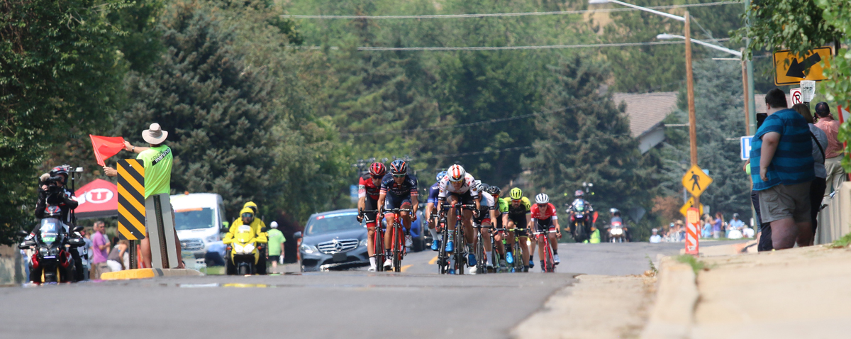
Volunteer for the Tour of Utah to be a course marshal or for many other jobs. The person in green is keeping the riders apprised of a road hazard in Stage 4 of the 2018 Tour of Utah, Salt Lake City, Utah. Photo by Dave Iltis
Maybe you live in a community with a mayor not very sympathetic to bicycling. Or commissioners on your county board represent the boonies where no one cares to bike. Does that mean you can’t convince local government to support bike projects?
It may mean broken glass on the path but it doesn’t mean it will give you a flat that you can’t fix and move on. A mayor and an advocate from Nebraska explained at the 2019 Bike Summit of the League of American Bicyclists how bike advocates can deal with decision makers who appear unlikely to support bike projects.
Bellevue, NE, a suburb of Omaha, wanted to build a bike path to neighboring Offutt Air Force Base, mainly for the benefit of commuters, explained Rita Sanders, who completed her second term as Bellevue mayor at the end of last year. But the board of nearby Cass County “is a very conservative forum. They don’t want bicyclists riding there,” she said. But the board had to approve bike lanes over a bridge on the route.
“Farmers said if we have bicyclists going over the bridge, our tractors will not be able to go over it,” Sanders said, explaining the opposition. Transportation officials promised to work with the farmers to ensure their tractors could get around.
So to put some pressure on the board, advocates for the route sought approval from everyone else first. Five other cities and county boards along the route approved it. Since they realized they were the only ones standing in the way of a popular project, the board ultimately voted 4-1 to OK the project. “There is always some commission who does not vote on reason or fact,” Sanders said.
And if you can’t get a Complete Streets policy that requires bicycles to be considered in every project, take it one project at a time, advised Julie Harris, executive director of the Nebraska Bicycling Alliance.
By Turner Bitton — In mid-July of last year, Salt Lake City re-established a bicycle patrol squad on the city’s west side to patrol the neighborhoods of Rose Park, Poplar Grove, and Glendale. Area residents greeted the news with enthusiasm and excitement. As many readers may know, Salt Lake City has had bicycle squads for years and the west side COP bicycle squad is not so much new as it is redeployed to assist with the city’s efforts to improve coverage and support for west side neighborhoods. Coupled with the opening of a new police sub-station on North Temple the new squad represented a celebrated increase in resources for west side communities.
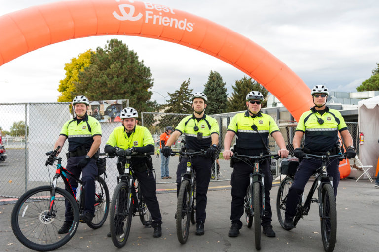
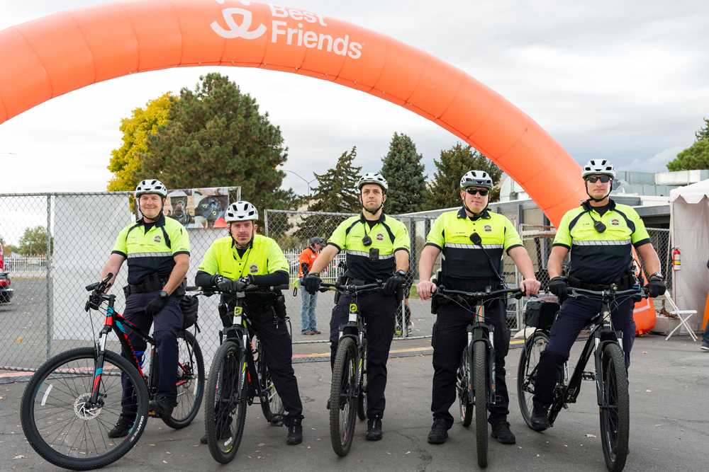
The Salt Lake City Westside Bike Squad. Photo by Alex Gallivan, www.gallivanphotography.com
Research conducted in communities across the country has shown that bicycle squads are associated with improved civilian-officer relations (Menton, 2007), cost savings, faster officer response times, and environmental benefits (Vonk, 2003). The average fully-equipped police bicycle costs roughly $1,200 and has very little maintenance when compared to vehicles yet bicycles can respond more effectively to areas throughout the west side that patrol vehicles cannot. This includes areas along the Jordan River, the numerous alleys and walkways, and inside of the many housing complexes.
Cycling West spoke with Officer Clinton Fox, a member of the west side bicycle squad to hear about the past year of work for the bicycle squad. Below is a transcript of the interview with Officer Fox:
CW: First of all, what is your position with the bike squad? How long have you been with Salt Lake City Police Department?
OF: I have been with the Salt Lake City Police Department for 3 years, but I have been in law enforcement for over 10 years. With regards to the bike squads, there are only officers and supervisors. I have been with bikes for over a year and am not a supervisor.
CW: After a year of operation on the west side is there anything unique about being in the bike squad on the west side?
OF: This squad has some very unique issues to deal with. On the west side, we have the Jordan River Trail, Gateway Inn project area, as well as some of the highest rates of drive-by shootings.
Being on a bike gives us the opportunity to patrol the trail and give much-needed attention to areas that are used by all types of people but that are hard to get to using normal patrol techniques. While riding a bike you become much more a part of your surroundings making us more approachable and more involved. Being on the bike squads we are responsible for helping some of the other specialty units in the department. Some of our plainclothes officers utilize us because of our flexibility and it is often essential to have uniformed officers present during some of their operations. Another benefit of us being so flexible is that when we have spikes in specific crimes, like drive-by shootings or any other conceivable crime, we make those areas our priority and we can patrol either in our cars or on bikes making us very versatile.
Another unique aspect of this squad is that we are each assigned a target area. We are responsible for meeting with and creating a dialogue between us and the different businesses in that area. This gives the owners/managers a one on one opportunity to give us their complaints and to hear their feedback regarding what they see as the major problems facing their community.
CW: What’s it like to commute by bike as a law enforcement officer? Does it make the job significantly different than in a patrol vehicle?
OF: Without a doubt being on a bike is harder than being inside a patrol car. If doing police work was easier on a bike, everyone would be on bikes.
The obvious reasons are that you have to pedal everywhere you go. Do this with body armor, a duty belt, and all the other essential gear we must carry makes it a little bit more difficult. With that being said, we do limit ourselves to only taking calls within a limited area, and we are non-call responsive meaning that we are not the first in line to get dispatched to calls in any zones. It is our responsibility to listen to the radio and we self-dispatch to any call that it is within our capabilities to adequately handle.
Like I mentioned earlier though. Being on our bikes forces us to blend into the public. We interact with people at a much higher rate than simply passing through a neighborhood in a car. We ride with people walking and talk to them and try to be as engaging as possible. We stop at crosswalks and intersections and flow with the everyday foot traffic that is passing through our areas. This is, in my opinion, one of the best parts about being on any bike squad.
CW: Is there anything that sticks out in your mind as one of the successes of the bike squad?
OF: I believe the major successes of this COP Squad has been the interaction that we have had in the Gateway Inn area of North Temple. This has been one of our biggest targeted enforcement areas and we have had some major success with stemming the flow of narcotics and prostitution. Being on our bikes has put us on a face to face basis with many of the locals. I have spoken with many of the shop owners/management and they have thanked us for our presence in their neighborhood. Our continued presence in this area has forced many of the dealers to move to other areas and we are forcing them to adapt to us.
OF: Our constant presence in the area of the Gateway Inn, coupled with the many arrests in the same area has had a very positive influence on the neighborhood. We are constantly battling the epidemic of narcotics in this area, but we are seeing positive effects from our operations.
CW: Lastly, is there anything you’d like readers to know about the bike squad or law enforcement more broadly?
OF: My personal take on the bike squad is that we have to be different than your everyday beat cops. I believe that all cops need to be approachable. But when you roll up on a mountain bike people look at you different, they treat you different. In a good way. I have high-fived more random people on my bike than at any time before. I have had conversations with people walking on sidewalks that left both them and me laughing for really no reason. People approach us for directions, or even dining suggestions believing that we must know where all the best food is. Being on the bike squads is an opportunity to represent your department in a way that just driving by and waving will never accomplish. It’s a way to really connect and be one with the community that you serve and to give special attention to areas like parks or biking trails that otherwise go un-serviced for the most part.
Our bike squad wears all the protective equipment we can. Bright yellow shirts, helmets, gloves, lights on the bikes. But it is still very dangerous. Riding through downtown, crossing North Temple or Redwood Road, or doing everyday cop stuff like foot pursuits or even traffic stops (we have recovered at least two separate occupied stolen cars while on our bikes) we have to be aware that we are at the mercy of every moving vehicle around us. Our situational awareness has to be high when working on a bike. Bike safety and training is extremely important and takes the awareness of not just us but all motorists.
Lastly, I would like to thank your readers. Being a police officer is 100% about service. We would not be here without the support of the public we serve. It is my honor to work for such a great police department and to serve such a wonderful community. I have worked for several police agencies in Utah and SLCPD is by far the greatest department to work for. The people of Salt Lake City are incredible, and it is amazing the love and support they show for us and all first responders. I would like to say thank you to the citizens of Salt Lake City for allowing me to serve them.
References:
Menton, C. (2007). Bicycle patrols: an underutilized resource. Law and Order.
Vonk, K. (2003, April). Bike Patrol Case Studies: Ann Arbor and Univ of Michigan. Law and Order.
Turner C. Bitton is an avid cyclist and is well-known for his commitment to public service. He lives in the Glendale neighborhood of Salt Lake City with his husband Chase and their two dogs Charley and Moose.
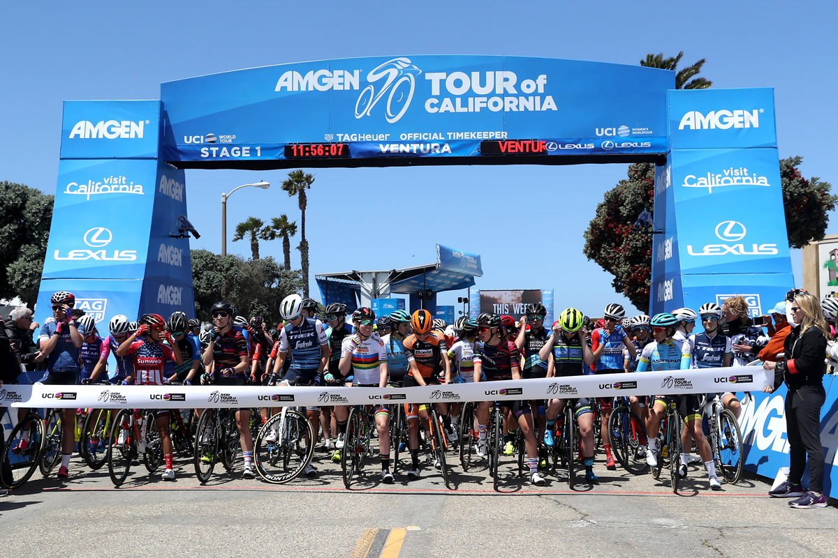
The Amgen Tour of California Women’s Race took place from May 16-18, 2018. The three stage race was held concurrently with the last three stages of the men’s race.
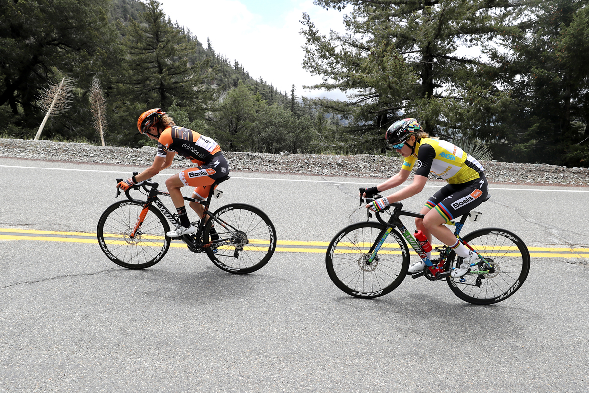
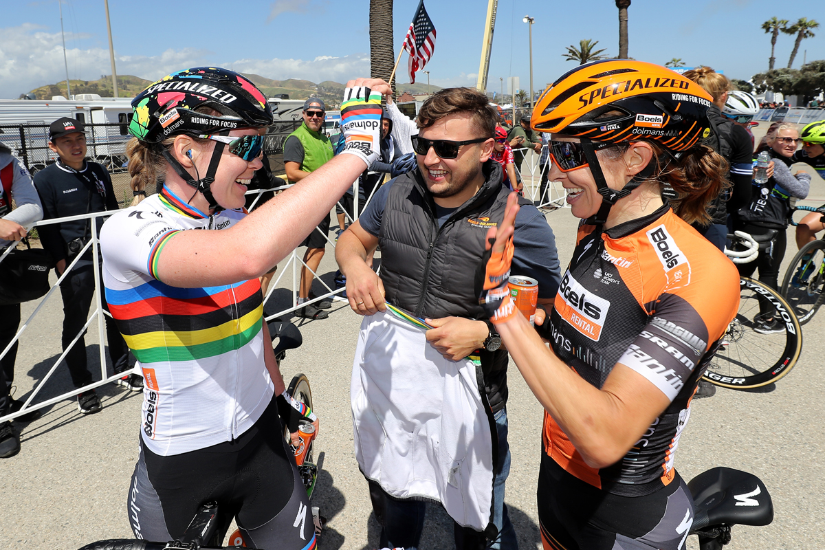
The Boels Dolmans Cycling Team dominated the Amgen Tour of California Women’s Race empowered with SRAM with World Champion Anna van der Breggen(NED) and teammate Katie Hall (Oakland, Calif.) taking a decisive win and second place finish respectively as the women’s three-day race concluded at the Rose Bowl.
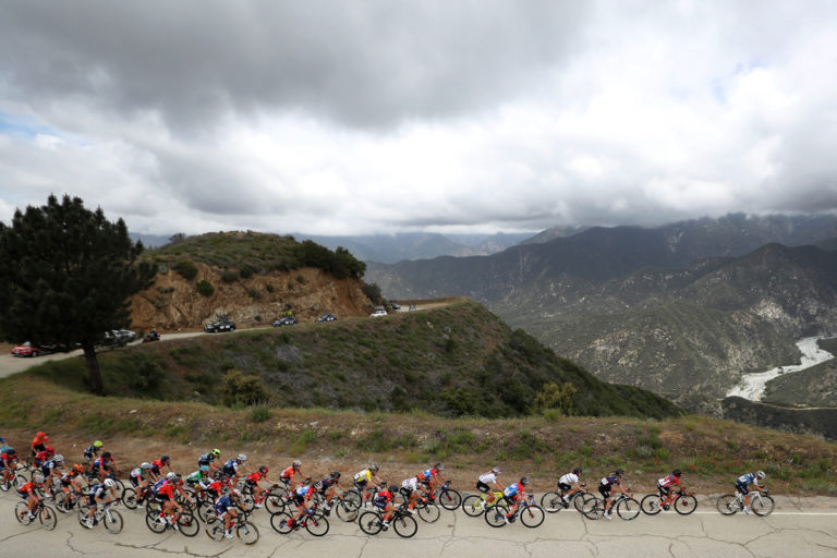
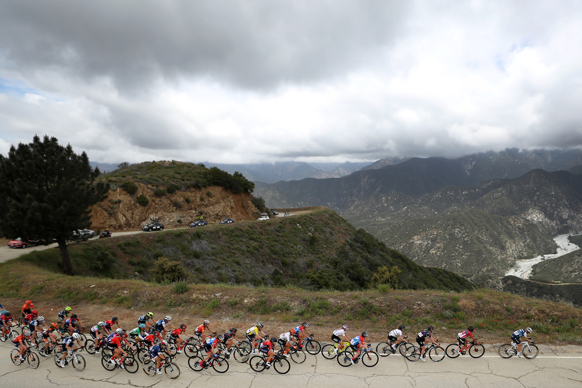
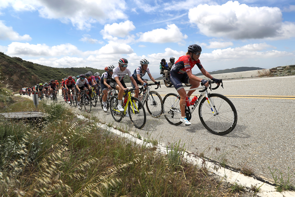
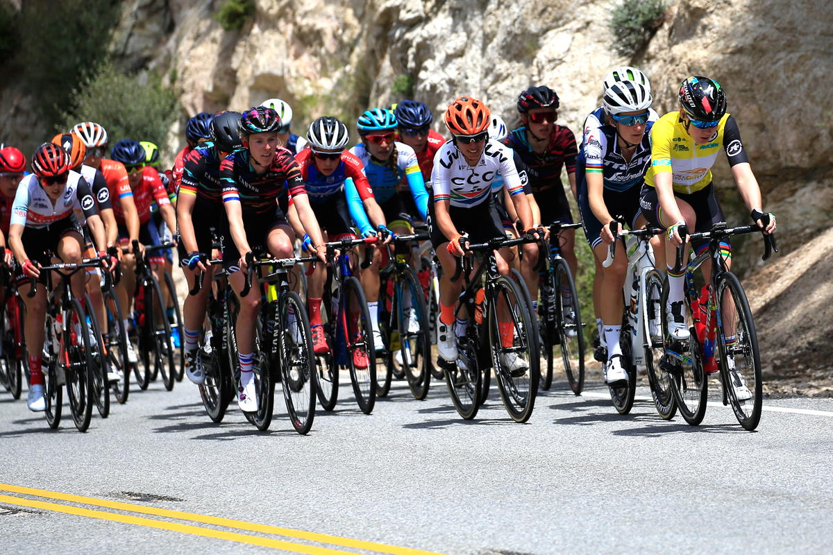
The peloton on the Mt. Baldy climb during the Amgen Tour Of California Women’s Race 2019, Stage 2, a 74km stage from Ontario to Mt.Baldy (1959m) on May 17, 2019 in Ontario, California. Photo by Sean M. Haffey/Getty Images
Now teammates, the two had the same overall result as competitors in 2017 when van der Breggen pulled out the win 1 second ahead of Hall, who went on to win the 2018 race. In addition to her second race championship, van der Breggen will take home the Visit California Sprint Jersey. This is Hall’s third consecutive overall podium finish.
OVERALL RACE RESULTS:
Anna van der Breggen (NED), Boels Dolmans Cycling Team (NED) 8h32’34”
Katie Hall (USA), Boels Dolmans Cycling Team (NED) +0:29”
Ashleigh Moolman-Pasio (RSA), CCC – Liv (NED) +1:06”
Clara Koppenburg (GER), WNT ROTOR Pro Cycling Team (GER) +1:25”
Katarzyna Niewiadoma (POL), CANYON/SRAM Racing (GER) +1:34”
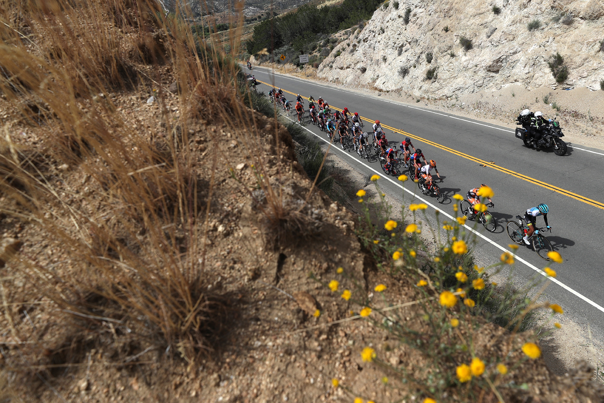
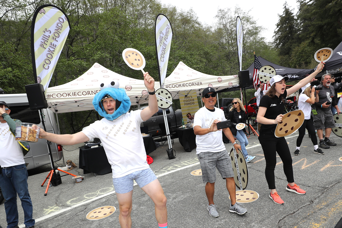
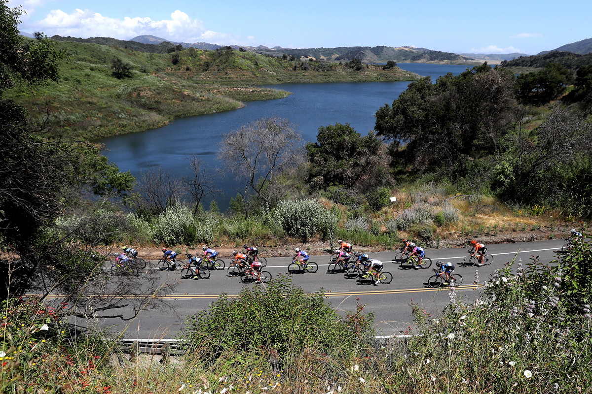
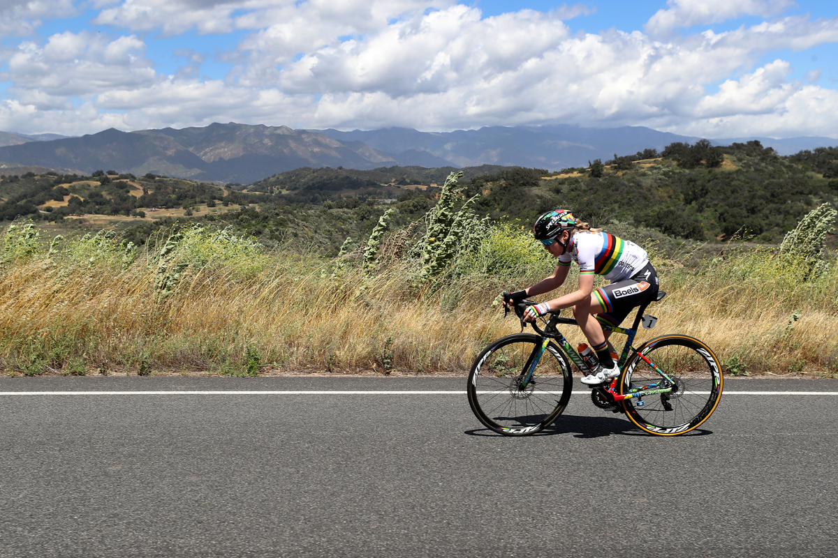
Stage winner Katharine Hall (Oakland, California, Boels Dolmans Cycling Team) Anna Van Der Breggen (Netherlands, Boels Dolmans Cycling Team) on the Mt. Baldy Climb of the Amgen Tour Of California Women’s Race 2019, Stage 2 a 74km stage from Ontario to Mt.Baldy 1959m. May 17, 2019 in Ontario, California. Photo by Sean M. Haffey/Getty ImagesThe peloton during the Amgen Tour Of California Women’s Race 2019, Stage 3, a 126km stage from Santa Clarita to Pasadena on May 18, 2019 in Pasadena, California. Photo by Sean M. Haffey/Getty ImagesPhil’s Cookie Corner! Fans cheer on cyclists during the Amgen Tour Of California Women’s Race 2019, Stage 2, a 74km stage from Ontario to Mt.Baldy (1959m) on May 17, 2019 in Ontario, California. Photo by Sean M. Haffey/Getty ImagesStage winner Anna Van Der Breggen of The Netherlands and Boels Dolmans Cycling Team and Katharine Hall of The United States and Boels Dolmans Cycling Team celebrate after the Amgen Tour Of California Women’s Race 2019, Stage 1 – a 96,5km stage from Ventura to Ventura on May 16, 2019 in Ventura, California. (Photo by Sean M. Haffey/Getty Images)The peloton during the Amgen Tour Of California Women’s Race 2019, Stage 2, a 74km stage from Ontario to Mt.Baldy (1959m) on May 17, 2019 in Ontario, California. Photo by Sean M. Haffey/Getty ImagesThe pack during the Amgen Tour Of California Women’s Race 2019, Stage 1 a 96,5km stage from Ventura to Ventura on May 16, 2019 in Ventura, California. Photo by Sean M. Haffey/Getty ImagesAnna Van Der Breggen of The Netherlands and Boels Dolmans Cycling Team on her way to winning stage 1 of the Amgen Tour Of California Women’s Race 2019, a 96,5km stage from Ventura to Ventura on May 16, 2019 in Ventura, California. Photo by Sean M. Haffey/Getty ImagesCompetitors stage prior to the Amgen Tour Of California Women’s Race 2019, Stage 1; a 96,5km stage from Ventura to Ventura. Photo by Sean M. Haffey/Getty ImagesAnna Van Der Breggen of The Netherlands and Boels Dolmans Cycling Team, Elizabeth Deignan of The United Kingdon and Team Trek – Segafredo, Tayler Wiles of The United States and Team Trek – Segafredo, Ashleigh Moolman-Pasio of South Africa and Team CCC – Liv compete during the Amgen Tour Of California Women’s Race 2019, Stage 3, a 126km stage from Santa Clarita to Pasadena on May 18, 2019 in Pasadena, California. Photo by Sean M. Haffey/Getty ImagesElisa Balsamo of Italy and Team Valcar Cylance Cycling wins the Amgen Tour Of California Women’s Race 2019, Stage 3, a 126km stage from Santa Clarita to Pasadena on May 18, 2019 in Pasadena, California. Photo by Sean M. Haffey/Getty Images
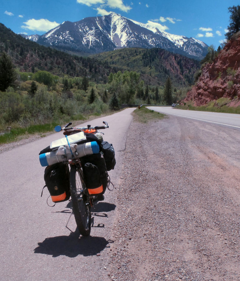
West of Craig, Colorado on U.S. 40. A Bicycle Tour of Western Colorado. Photo by John Roberson
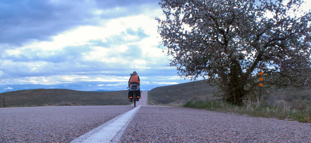
The following is a description of a mid-May bicycle trip that I took through parts of the western third of Colorado. I traveled solo for 10 days, and I was completely self-supported. I rode an old-school mountain bike with 26 inch rims, made by Rivendell Bicycle Works, and it performed beautifully. I started and finished my trip in Vernal, Utah. It was a wonderful trip!
Day 1
The weather was lovely as I rode east from Vernal that first morning. The rains of the previous day had given way to calm, fragrant air and beautiful, partly cloudy skies. I put in the first few miles getting accustomed to my load while also considering my options for the next week or so. I was excited to explore some new byways and revisit a few places I’d passed through on previous trips, to see how things might have changed. I’d camp out under the stars, climb and descend a few passes, and experience a variety of terrain. I was sure it would be lots of fun!
The highway miles from Vernal to the Colorado line were easy. I had grand views of distant red rock cliffs, a very nice shoulder to ride on, and a sweet tailwind to help me along. I crossed the Green River at Jensen, Utah and climbed up and out of the river bottoms. I stopped at the Musket Shot Springs historical site east of Jensen, to stretch my legs and to marvel at the spunk of those two old travelers, Dominguez and Escalante. I paused again at the Colorado state line.
I spent about 45 minutes in Dinosaur, Colorado, taking an very nice break at the Conoco station. I bought some juice and a popsicle, and I sat in the shade for a while before continuing east on U.S. 40. I rode all afternoon, pushed along by a light tailwind and encouraged by the quiet roads, which made it easier for me to relax and enjoy the sights. By late afternoon the sun had given up and gray clouds were filling the skies. Wet weather was still a few hours off, but I’d be sure to pitch a shelter when I stopped to camp.
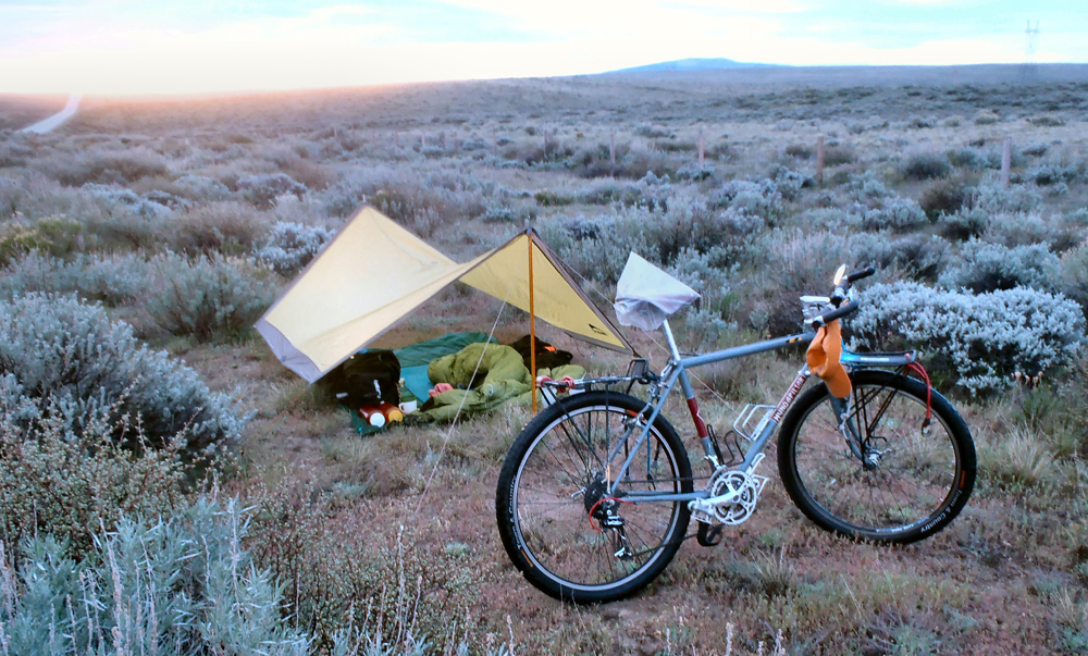
As the afternoon light started to fade I found a wonderful little campsite in a sagebrush meadow off the side of the roadway. I pitched the shelter, set up my camp and settled comfortably into the first evening of the trip. I got the evening’s meal going, had a little toddy, made a few notes and admired my surroundings. Darkness eventually settled in, and with the smell of rain in the breezes, I hunkered down for the night.
Day 2
Clouds still filled the skies when I woke before first light the next morning. It had rained during the night, but I had been dry and comfortable under the shelter, and I slept well. I went through my morning chores and was encouraged by the appearance of a wide band of sunlight at the eastern horizon. It looked like it was going to be a beautiful day.
I left camp and headed east into morning sunshine. I ran into a fellow bicycle tourist in the small town of Maybell, Colorado, which sat a few miles east of my campsite. He rolled up as I sipped a second cup of coffee at the general store. He was riding west from Boston and had spent the night in the wayside park adjacent to the store (a good overnight rest area!). He didn’t say much, but he did inform me that Maybell holds the Colorado record for the lowest recorded temperature … a minus 61!
I left Maybell heading east again along the Yampa River, then climbed out of the river bottom proper and onto a series of benches, toward Craig, Colorado. The riding was nearly effortless. A light tailwind continued to help me along, and the wide shoulder and gentle hills of the benches made it easy to put in the miles. Unfortunately, I had a blowout along the way and had to make repairs before I could carry on. It surprised me. I had thought to change tires before I left home, but decided I could get one more trip out of the old ones. It was a decision I would come to regret more than once during the trip ahead.
I made Craig in the early afternoon. I picked up a couple of new tubes at the ranch store, and was eating a six-inch tuna at the Subway when a fierce little rainstorm came through town. Good timing, I guess. The storm threw down a good amount of water in a short period of time, but the sun came back out bright and strong shortly thereafter.
I left U.S. 40 at Craig and began riding south on Route 13. I followed the Yampa River for a few miles, then broke off to follow a tributary called William’s Fork. I left that creek for a smaller one that I followed for the rest of the riding day. The road was peaceful and quite scenic as it followed the creek bed, climbing slowly and gently to the south. Around dusk I found decent campsite on a hillside above the road, at the mouth of a small side canyon, and settled in for another restful night.
Day 3
I awoke to frost on my gear and temps in the high 20s. It had been a chilly night, but I had slept well. The rising sun took its sweet time getting to my camp, but once it arrived things warmed up nicely. I broke camp, loaded up, and hit the road for the fourth day.
I continued my climb to the south, out of the Yampa River watershed and into the upper drainages of the White River. I crested the “gap” at about 7500′ and enjoyed an easy cruise down the other side into the town of Meeker, Colorado.
Meeker was a lovely town located on the north side of the White River. It sat a few miles upriver from the site of the infamous Meeker Massacre where, in 1879, nearly a dozen Indian agency workers were killed by disgruntled Utes. It was a tragic event and had the result of consigning all of the free-roaming Ute tribes in the region to reservations in Utah. A tragedy for everyone, really. I rolled into town mid-morning and bought a couple of excellent pastries in a shop on the town square. I sat in the shade of the square, enjoying my pastries, and wrote a postcard to my old Auntie. I gave my sweetie a call, too.
I left Meeker and the verdant farms and ranch lands along the river and began climbing again to the south, up and over the White River’s watershed and into the drainages of the Colorado River. I was still on Route 13, and I spent the next few hours slowly working my way along straight roads that passed through arid badlands and barren ridge tops. To me it was very pretty country. I fixed another flat at one point in the mid-afternoon, then rolled past bluffs and hogbacks to the east and the Roan Cliffs to the southwest.
I took a welcome break when got to the town of Rifle, with both I-70 and the Colorado River flowing in their own unique ways nearby, then meandered another 10 to 15 miles east on two-lane roads that ran parallel to both the freeway and the river. As I rode into the early evening hours the roads began to peter out, and I noticed a narrowing-down of the valley ahead into a canyon through which both the river and the freeway were being squeezed. It didn’t look so good. A perky couple jogging along the frontage road warned about dead-ends ahead and the unavoidable need to hit the freeway for a while. So off I went.
I put in a couple of stressful miles heading east on the freeway, then took a river access exit that put me across the river from the freeway. I found a surprisingly decent campsite with lots of flowers and birdsong, on the hillside above the river, and away from the worst of the highway racket. Given my camp’s proximity to the freeway, the river and a set of railroad tracks, I wouldn’t have expected to sleep as well as I did.
Day 4
I left my riverside camp the next morning and took a slight detour to check out a bike path that paralleled the freeway heading upriver. I’d seen it the evening before, but wasn’t overly optimistic about it. Sure enough, it dead-ended a half mile up the canyon. However, it did look a bit like a work in progress, so it might be worth a try the next time I pass through. Anything would have been an improvement over the few busy freeway miles I had to endure to get to Glenwood Springs.
I took the exit into Glenwood Springs and was immediately impressed. The modestly sized town at the confluence of the Roaring Fork and Colorado rivers had a great vibe and I quickly felt at home. No one seemed to be in any particular hurry as the work day began, and the town’s many trees and blooming flowers made that particular May morning especially nice.
Glenwood Springs began in the 1880’s as a rough-and-tumble center of regional commerce, and many attractive, older buildings remain in the town’s business district. It grew in importance over the years with mining interests, the railroad, and the development of the thermal springs all drawing settlers to the area. Various famous characters came through, too, including Teddy Roosevelt, who spent a summer there. The town is criss-crossed with bike paths and pedestrian walkways and is a popular destination for folks living in Denver, or so I was told. I could see why it would be.
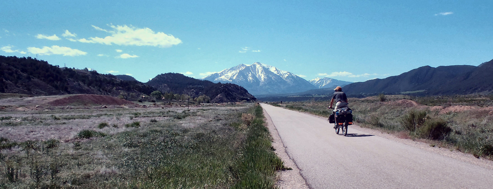
I cruised the downtown streets for a while, then connected with an excellent bike path that ran along the eastern edges of the Roaring Fork River. I had been told that the path would keep me off the busy, four-lane highway and take me upstream for more than 15 miles, through Carbondale and beyond. After the hubbub of the freeway it seemed the obvious way to go. So I took advantage of the path and the beautiful weather to pedal the pathway upriver, beyond the busy turnoff to Aspen, past Carbondale and into the canyon formed by the Crystal River, a tributary of the Roaring Fork. In the distance, to the south and east, I began to see the first of many glorious, snow-capped Colorado peaks.
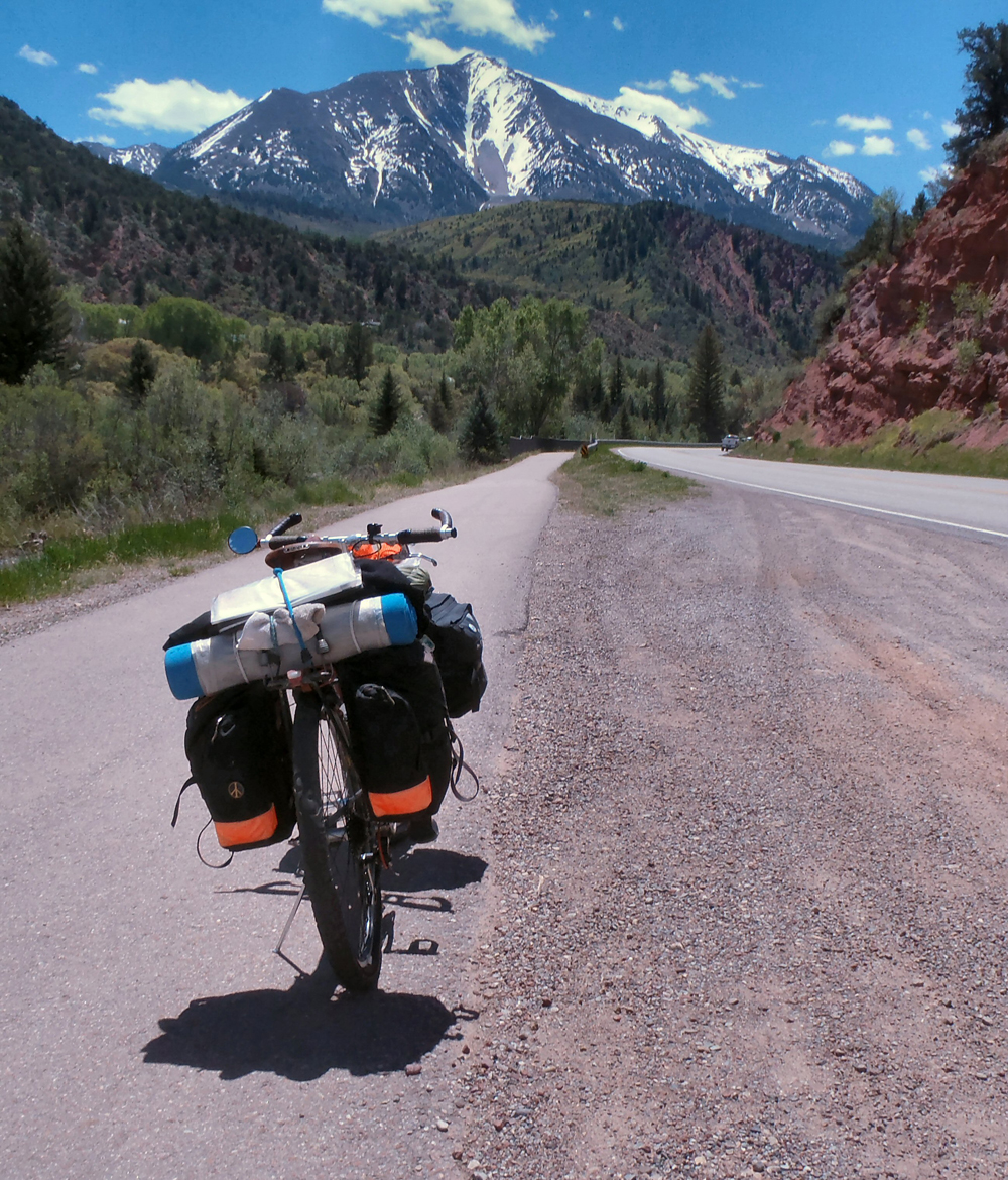
I lost the bicycle pathway at the Crystal River Resort, then spent the next few hours working my way up the river, passing through the charming community of Redstone and really picking up elevation in the process. The roads were quiet and smooth, but the wide shoulders I’d been enjoying the past few days seemed to have petered out there in the canyon. The road became steeper as the afternoon wore on, and I ground my way up and over McClure Pass (8763′) late in the afternoon, my first serious pass of the trip. I spent what was left of the day dropping down the other side of the pass and into the drainage of Muddy Creek. I found a high, open campsite off the road and above Paonia Reservoir and settled into yet another comfortable evening routine.
Day 5
I woke to temperatures in the upper 20s, but the sun warmed things up quickly, and I was heading down the canyon below the reservoir by 8:00 a.m. I was once again leaving the cooler high country behind me and dropping into the wider and warmer floodplains of the Gunnison and Uncompaghre Rivers, to the west. I stopped for a second, delicious creek-side breakfast at a cafe in the small town of Paonia (named, it seems, for a shortened version of the Latin name for the peony roots first brought to the area by one of the town’s original settlers), then carried on.
By mid-morning I was back in the low country again and heading west, through Hotchkiss and on to Delta, Colorado. The day was beautiful, but it had warmed considerably, and the roads had become pretty busy as I passed through Delta around mid-day. From Delta I picked up route 50 heading south towards Montrose and into the Uncompaghre River Valley. At this point I was back in civilization again and forced to deal with a lot of traffic flowing between Grand Junction to the north and Montrose to the south. I managed to find frontage-type roads here and there that allowed me to leave U.S. 50 occasionally, but they weren’t consistent. Although the day’s weather was perfect, and the surrounding agricultural lands lush and green, the constant roar of the highway made this stretch of my tour less than ideal. I spent the afternoon working my way up the river valley, arriving in Montrose at the end of the valley’s working day. I took a nice break in town to cool my heels and let everyone get home for supper, then carried on riding south.
The evening traffic was noticeably quieter as I left the wider river valley behind and continued my gentle climb upriver on U.S. 550 toward more beautiful, Colorado high country. As the sun settled lower in the west I realized that the country I was riding through was still fairly densely populated. Finding a decent roadside camp would be tough, so I bit the bullet and pulled into the Centennial RV Park, paid 26 bucks to a very nice lady, and set out my camp on a sweet piece of lawn away from a small cluster of big rigs in the more developed portions of the park. It was a wonderful, peaceful campsite and I slept like a log.
Day 6
I was up early the next morning and back on the road feeling rested and ready for what looked to be another beautiful day. The sky was clear and bright, the meadows were filled with spring flowers, and the southern horizons ahead were filled with the awe-inspiring, snow-capped peaks of the San Juan Mountains … serious mountains, for sure! I knew I’d be interacting with them during the days ahead, but I wasn’t overly concerned. After all, I’d be skirting the very highest regions of the mountains, and I knew that both my lowest gears and plenty of time would eventually get me to the top of any minor pass I encountered along the way.
After about an hour of easy morning pedaling through pinion and juniper country, I passed a large body of water called Ridgeway Reservoir, and an adjoining state park of the same name. Just beyond the park I came across an access to a developed bicycle/pedestrian path that led me along the river for several easy miles, all the way to the lovely town of Ridgeway, Colorado. The town sits with grand views of the surrounding peaks and is referred to as the Gateway to the San Juans. It’s a popular stop for travelers heading to Telluride and other points south. I took a nice break in town, then began what looked to be a long haul up the hill to the high pass beyond.
The climb from Ridgeway to Dallas Pass (about 9000′) was tough, and it took me a few hours to reach the summit. I stopped frequently to admire the views and, on one occasion, to shoot the breeze with a friendly Colorado trooper. The ride down off the pass on the other side was an easy cruise, and I hit the red rock canyon of the San Miguel River (a tributary of the Dolores River) in the later afternoon. I took a sit-down break at the general store in Placerville, a very small community a mile or so upriver. I chatted with a couple of motorcycle dudes who had trailer-ed their bikes from Denver to cruise the deliciously curvy canyons common to this part of the state. Nice guys, and just two of dozens of bikers who passed me during the next the next day or so.
From Placerville I headed back down river and fairly flew along. At one point the road left the San Miguel riverbed proper and made a short climb up and over into the drainage of two minor creeks that feed back into the San Miguel, further downriver. I had left the busy roads behind me and was, once again, back riding through quiet, ranching and agricultural lands. I rode through the small farming/ranching town or Norwood in the early evening. The town was quiet and had clearly shut down for the day, but I spent a pleasant 15 minutes there, by the side of the road, sharing stories and advice with an amiable fellow named Phil, who operated a surprisingly well-equipped bike shop there on the main street of town.
After another hour of riding through a mix of pasture and juniper scrub land, the sun dropped below the horizon, and I found myself scrambling into the scrub by the side of the road and into my sixth cozy camp of the trip.
Day 7
The sounds of early-morning traffic woke me from another excellent night’s sleep. After going through my morning routine I was back on the road and looking forward to another flawless May morning. I paused in the town of Naturita where I had a second breakfast and considered my situation. I had pretty much reached the southern-most point of my trip and would need to head back north in order to complete my trip loop. I knew from an earlier trip that I couldn’t count on much in the way of amenities between Naturita and Grand Junction, which I hoped to reach at the end of the following day, so I picked up a few necessities in town and headed back down the road.
The next thirty miles or so were something of a dream. The quiet, two-lane road followed the San Miguel River, and then the Dolores River, through shallow, red rock canyons filled with cottonwoods and flowering shrubs along the river banks. The well-surfaced road twisted and turned constantly, following the bends in the river flow … a treat for me and for the occasional groups of touring motorcyclists that passed me by.
I eventually came to the tiny community of Gateway, near the Utah border, where I took an extended break at the general store. Gateway is the home to a rather swanky resort that reportedly serves as a base for many outdoor activities, and I caught glimpses of it in the distance as I rode into town.
I left Gateway’s shade in the middle of the afternoon, heading north again, and spent the rest of my easy day slowly gaining back some of the elevation I’d lost. The nearly empty road climbed gently along a small creek in a shallow canyon that eventually opened up into a high, wide, green valley. There were meadows and pastures, and modest farms and ranchettes on both sides of the road. As the sun neared the crests of the western hills I realized that I had probably reached the highest and coolest parts of the drainage (a good place for sleeping!), so I searched out and found another roadside camp zone, and settled in for what would be still another restful night’s rest.
Day 8
I began another flawless Colorado morning with an unexpected stop just a mile down the road … my third flat of the trip. I made my repairs and was up and moving again fairly quickly. After a very few miles, I crossed the Unaweep Divide and began dropping northeast into Unaweep Canyon, beyond. The riding conditions were excellent. I was once again leaving cooler, higher, and greener plateau regions to re-enter arid landscapes that characterize much of both the western parts of Colorado and the eastern parts of Utah. As I rode I could see, in the distance, the green ribbon of the Gunnison River in dramatic contrast with the dry zones between and beyond.
I reached U.S. 50 around midday and jumped right into the steady traffic flowing between Delta and Montrose, to the south, and Grand Junction to the north. Grand Junction was a dozen miles further down the road, where the Gunnison River joins the Colorado River (the “junction” in Grand Junction). I was hoping to find a new tire and tube and a hearty meal before continuing north and back into quieter country.
Grand Junction was certainly the biggest city of the trip. With over 140,000 people living there I was sure to find all that I needed, and then some, but I was surprised and delighted to find that on that day the downtown district had been taken over by bicycles! It seems the Grand Junction Off-Road Mountain Bike Event was in full swing, with races and events and music occurring over multiple days, and cyclists had come from all over to enjoy the festivities. The downtown streets had been closed to traffic and were lined with vendors and manufacturer’s reps selling anything and everything related to two wheels. I had no trouble finding a replacement tire and tube, and I spent a very leisurely couple-of-hours making my repairs in the shade of a small city park. Some nice young fellows from Denver kept me company as I worked, and we shared stories about our recent two-wheeled adventures.
I loaded back up again, bid adieu to my Denver friends, and headed out into the neighborhoods north of town. I was searching for a route to the northeast, and I eventually ended up near Interstate 70, which passes along the northern edges of Grand Junction. I meandered along the frontage roads near the freeway all the way to the community of Fruita, where I stopped for a hearty meal and a cozy bed. I checked into the very comfortable, Balanced Rock Motel for a much-needed shower and good night’s sleep.
Day 9
The following morning I was up and out and on the road earlier than usual. I was heading north again, aiming for the small town of Rangely, and I knew I had a substantial climb ahead of me. But, the restful sleep I’d had, as well as my early start and another beautiful May day left me feeling optimistic about the road ahead. I left the frontage road and the sounds of the now-distant freeway in Loma, Colorado, and started up Highway 139.
The riding was pleasant that morning as I climbed gently, but steadily, out of the meadows and green fields of the Grand Valley. Mountains and ridges filled the northern horizon in front of me, but they didn’t seem so bad, compared to the snow-capped peaks I’d left behind. The wide valley narrowed as I climbed, and by late morning I found myself in a tight canyon following a modest creek. The road had been very quiet all morning and would remain so for most of the day, but it became steeper as climbed toward Douglas Pass, the high point for the day. The high canyon opened near the summit ridge, and I found myself switch-backing slowly through scattered conifer forests and mountain meadows. I reached the pass in the middle of the afternoon and paused to rest and check out the scenery. Far away to the south I could just make out the hazy green of the Grand and Gunnison Valleys and the snow-capped San Juans much further to the south.
I eventually dropped off the pass and onto the greener, north-side slopes of the ridge where I wound my way through lush, flowering meadows and groves of aspen along West Douglas Creek. I took my time as I descended, keeping my downhill speeds low so I could relish the high country sights while I could. The blue skies of the morning had, by this time, given way to dark clouds to the north, and I suspected I might experience rain for the first time since my first night on the road. I dawdled quite a bit, stopping often to let nasty-looking pulses of wet weather pass by in the distance. I stayed dry, but the highway itself was wet along several stretches. The canyon widened, and as I approached the mouth of the drainage I relished the classic, high-desert smells of sage and springtime that are especially fragrant after a rain.
I arrived in Rangely and passed through the peaceful town as the sun was settling onto a wide open western horizon. I crossed the White River on the east edge of town, climbed up and out of the river bottom, found a very reasonable campsite off in the sage north of the highway, and settled in for my last night on the road.
Day 10
The last day of my ride was delightful. It would be a short day, so I dawdled a bit over my breakfast before loading up the bike for the last time and heading back up the road. The morning traffic was light and seemed to be made up of oil and gas field service vehicles heading out for the day’s chores. I rolled along easily, enjoying both the wide-open scenery and the fine roadway. I passed through Dinosaur again, took another break at the Conoco station, then crossed the state line back into Utah. After a couple of hours of effortless riding (with still more accommodating tailwinds!) I arrived back in Vernal. After loading up and once again thanking the motel owner for keeping an eye on my truck, I headed west for home, another successful and memorable tour under my belt.
Note:
Western Colorado highways are generally excellent, though they do tend to go up and down a lot. The road surfaces are smooth, and wide shoulders are more common than not. Colorado drivers seem to be courteous and bicycle-conscious. I was never very far away from food sources, or water sources. Roadside historical sites were common, as were roadside trash cans. Roadside fences made finding off-road campsites more difficult to find than in my home state of Utah, but there was always some sort of off-the-road, out-of-sight option for me. The people of Colorado were extremely friendly, all of the time, and they made me feel very welcome.
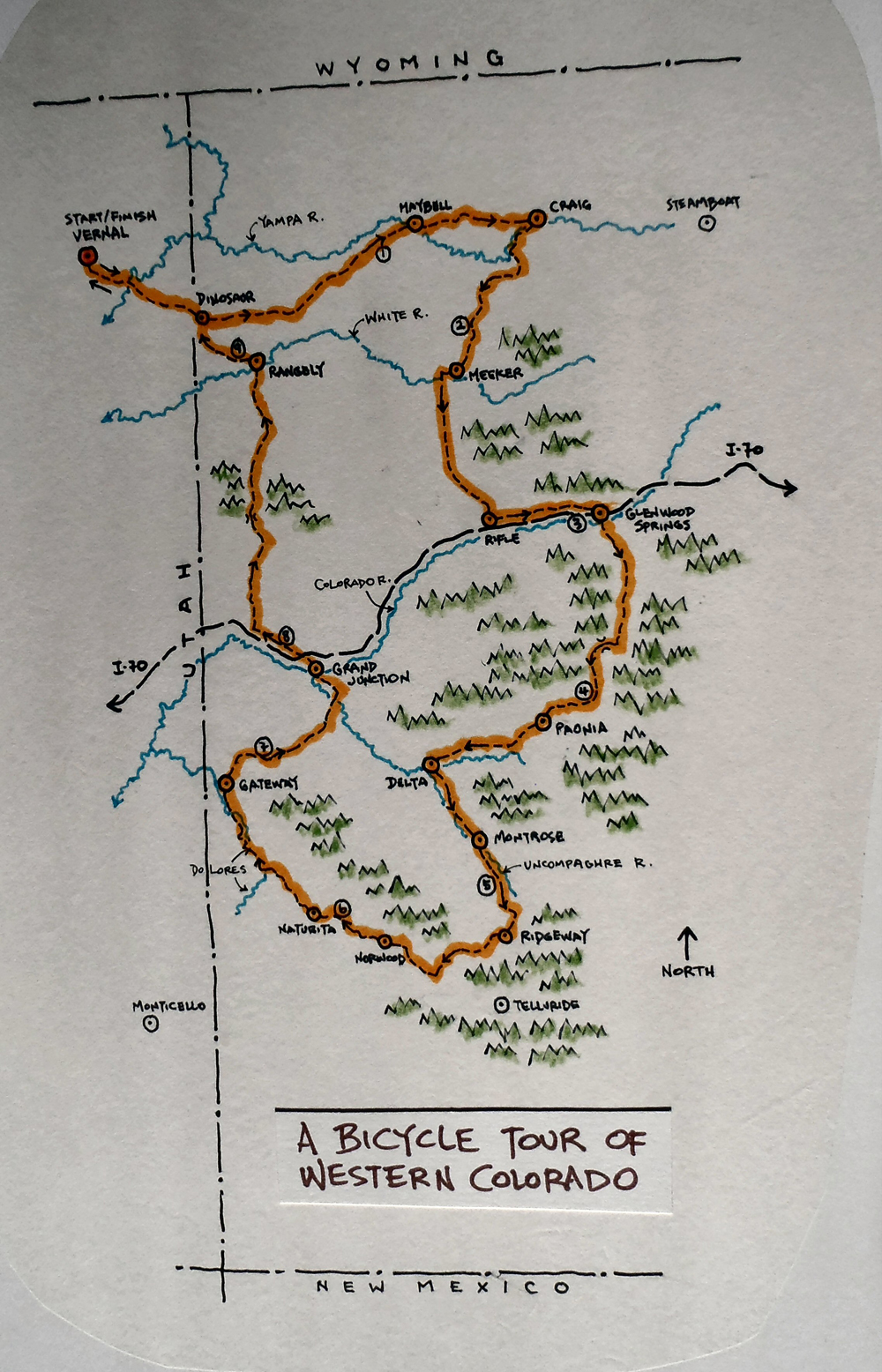
Roadside camp near Maybell, Colorado. A Bicycle Tour of Western Colorado. Photo by John RobersonOn the bike path south from Glenwood Springs. A Bicycle Tour of Western Colorado. Photo by John RobersonThe bike path near Redstone, Colorado. A Bicycle Tour of Western Colorado. Photo by John RobersonA map of John Roberson’s Bicycle Tour of Western Colorado. Map by John Roberson
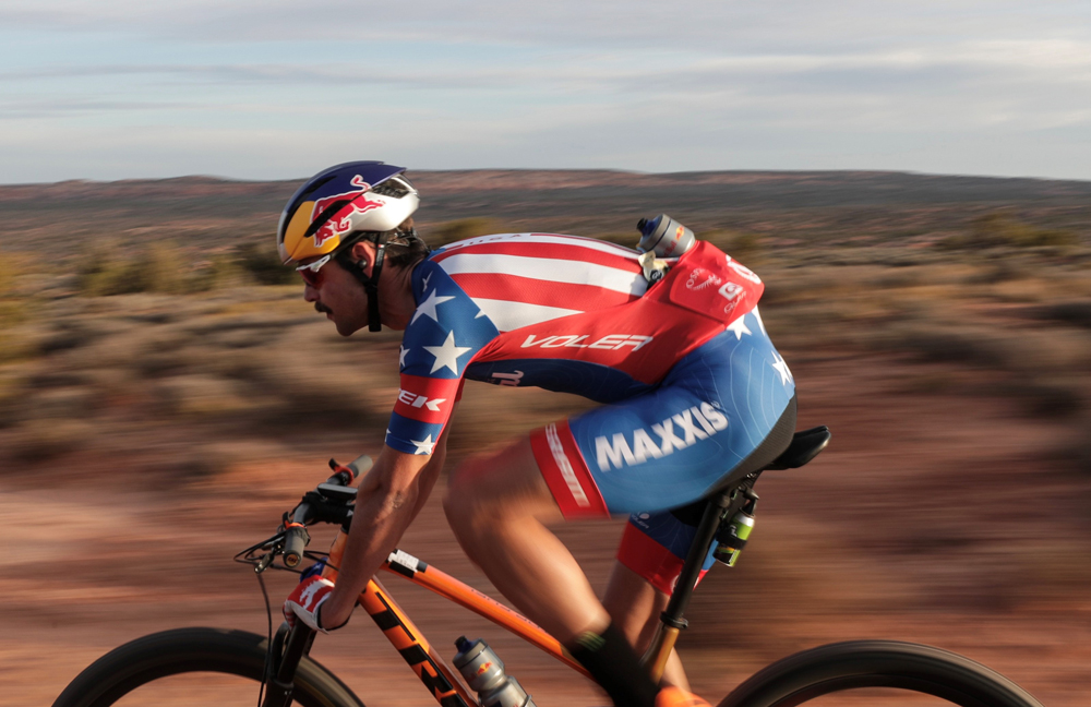
Payson McElveen rides his Orange Seal Trek Off Road Top Fuel on the White Rim Trail.
Fastest Known Time (FKT) Beat by 14 Minutes; New Challenge Issued to Community
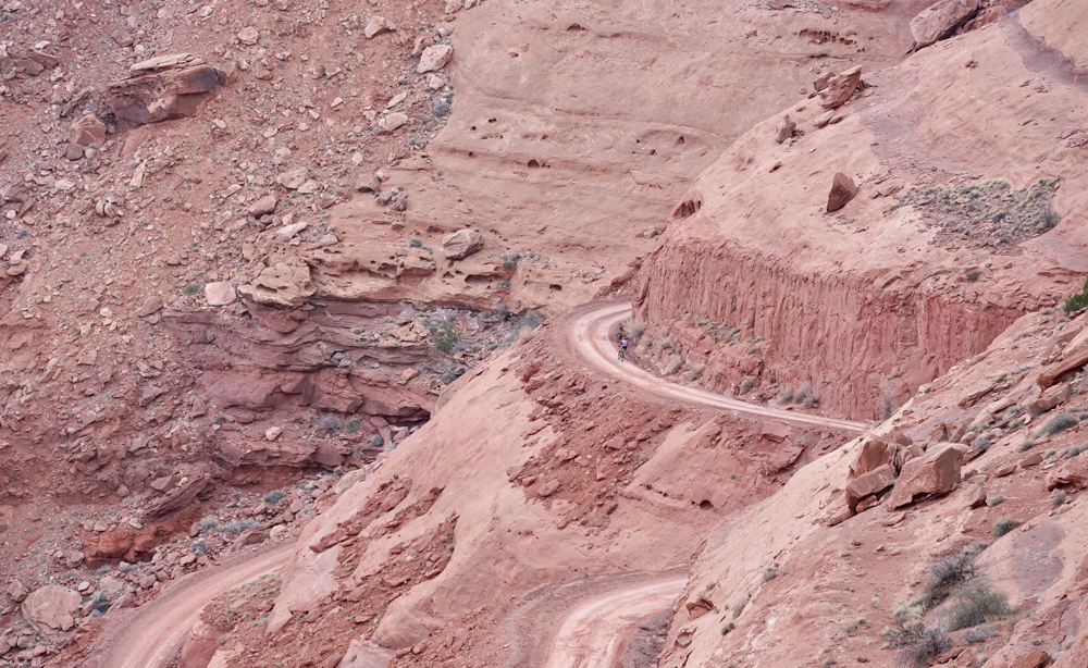
MOAB, UT (March 28, 2019) – After a fantastic season opener win at the Landrun 100, Payson McElveen decided to tackle one of the most iconic records in American cycling: the White Rim Trail. On Wednesday, March 27, 2019 at 7:39AM McElveen charged through the start line on his Orange Seal Off-road Trek Top Fuel and sprinted deep into Canyonlands National Park for a near six hour sufferfest in an effort to break Andy Dorais fastest known time of 5:59:34.
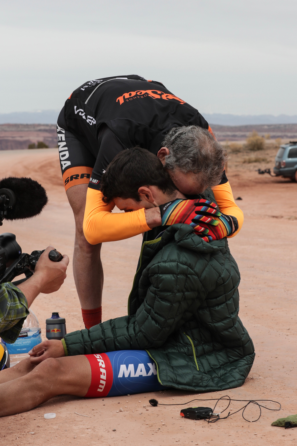
McElveen rolled across the finish line in an incredible 5:45:16.
What inspires a person to tackle such arduous feats of fitness?
PM: The only way to get better is to explore your boundaries, and I knew tackling this epic loop as fast I could would push me to my absolute limit. Also, as long as I can remember, the payoff of effort and struggle has brought incredible happiness to my life. If I’m in a beautiful place, I just naturally find myself wanting to see what’s around the next turn or over the next rise. Those places seems to call for us to give our full effort—it feels natural to celebrate these places by giving nothing but your very best.
Your father played a big role in your push today, how did it feel having him there?
PM: My dad (Mike McElveen) introduced me to the bike, and though he never pushed me to chase racing or goals, always supported my dreams. In the twenty years we’ve been riding together, there are just too many memories to keep track of. Directly and indirectly, the bike has shaped and guided my life. Both he and my mother Kathy have been adventurers most of their lives, and it’s permeated my family’s history. They are my greatest heroes, and remain the people I most want to be like. It was unfortunate that my mom couldn’t make it on this trip, but having my dad there was incredibly special, and gave all the inspiration I needed to give a true, full effort.
Walk through your preparation, how does one get ready for this?
PM: The training process for this FKT attempt in some ways has lasted my entire riding career, but my coach and I definitely dialed in specific training starting about four months ago. I did more 5+ hour rides this winter than the rest of my years riding a bike combined. I also was racing time a bit, as a nagging tricep tear added a challenging rehab element. That arm still isn’t at 100%, but thanks to diligent strength work at Red Bull’s High Performance Center and back home in Durango, it recovered just enough to get through all the miles of bumpy rocks on the course.
The mental side also posed a unique challenge. I’ve done plenty of long races, but when you’re going head-to-head with other athletes, the races ebb and flow and keep you constantly engaged. A solo time trial effort of this duration was something totally new for me, and required another level of focus. Letting up for even just a few minutes could’ve made the difference between success and failure.
Aside from the devilish post-ride calf cramps, what were your highs and lows from the endeavor? What’s vivid?
PM: A high was definitely getting to my first checkpoint 13 miles in and being over three minutes ahead. That set the tone, and was important for me mentally. Riding a few hundred yards with a herd of wild horses was memorable, too. I tried to harness some of their power and confidence in that heinous environment. I felt so good for the first four hours, unstoppable. I actually had to keep yelling at myself to slow down and adhere to our pacing strategy. The low was literally and figuratively hitting a wall in the last hour. The 2,200 foot climb out of the canyons broke me physically and almost mentally. I had to dig deeper than I ever have. I was using every mental strategy I’d learned, and the support of my team, dad, sponsors, film crew, and spectators that had shown up helped lift me to the finish. Rolling across the finish to the welcome party and sharing hugs after all that went in to this was an enormous highlight. Also drinking just about every type of cold beverage and laying the dirt for 20 minutes was up there, too.
On the scale of slowly peeling off a Band-Aid for 6 hours to absolute torture on two wheels, how did it feel?
PM: Because it’s so long, you have to pace it very carefully. The first 4 hours really weren’t too bad. I started falling apart in the last hour, and that was unequivocally the toughest hour I’ve had on a bike to date. A Band-Aid is child’s play. We get to peel those off pretty regularly as-is.
What’s your advice for someone looking to take a swing at your record? What’s up for grabs if they beat you?
PM: One of the goals of the project was to standardize an FKT loop. The way Andy routed his, by starting at the bottom of the last major climb, is undoubtedly a faster way to do it. However, I believe that way is logistically prohibitive for a lot of people. We wanted to start and end at the most commonly used parking lot. I hope this project might inspire more folks to get out and enjoy this beautiful place, whether it’s going for the FKT or enjoying it over the course of multiple days. If you’d like to go after my record, I’d recommend planning your ride when wind and surface conditions are the most favorable. Also definitely ride a full-suspension. Holy bumpiness. Also remember that if you’re pacing it correctly, the first 50 miles really shouldn’t feel very hard. Have a well-thought-out fueling strategy. I ate 300 calories per hour, which requires eating almost every 20-30 minutes. We’re having an official FKT trophy being made, so if you go beat my time using the same start and end point, I’ll ship it to you. Records are made to be broken, so I hope the trophy exchanges hands many times!
Where’s #VanLife taking you next?
PM: Luckily I have a bit of break now from racing! I think I may drive up in to the mountains of Durango and try to enjoy my backyard for a few days. That’s not something I get to do often enough. Following that, the van and I will be road tripping to Prescott, AZ for the Whiskey
Off-road at the end of April.
About Payson McElveen
Payson McElveen grew up in Austin, Texas and he’s the son of a mountain bike racer. He first started riding a bike at age four and began racing by 14. A natural on his bike from the beginning, he’s been a member of USA Cycling’s National Team since he was 17. When it was time to choose a college, it made sense that he picked Fort Lewis College, located in the mountain bike hub of Durango, Colorado.
In Durango, McElveen became a five-time national champion on the collegiate mountain bike circuit and juggled his academic schedule with a packed lineup of mountain bike races. He graduated in 2016 with a degree in exercise science and a minor in English and quickly set out to follow his dreams of becoming a professional mountain biker. “I want to use my bike as a vehicle to see the world and take advantage of all these amazing races that are happening,” he says.
So he did just that. In 2016, he won the Mongolia Bike Challenge, a six-stage race that Outside Magazine called the hardest mountain race on Earth. He had a breakout season in 2017, racking up major victories, including a win at the USA Cycling Marathon Mountain Bike National Championships, where his dad was also racing.
In addition to his bike racing, McElveen has also raised funds for the World Bicycle Relief, worked with development programs that train young cyclists, and he has plans to launch his own non-profit organization that gives back to cycling. A passionate van builder who lives out a customized van when he’s on the road, McElveen says he loves bike racing nearly any distance, but it’s the long, endurance races where he feels most at home. “I’ve come up with the majority of my most successful ideas during really long or hard rides,” McElveen says. “It strips everything else away and tells you what you’re made of.”
Payson McElveen on his record setting ride on the White Rim Trail.A shattered Payson McElveen at the end of the ride is greeted by his father.
Any way you look at it, cycling and walking are more dangerous than riding in an auto. But if more people would replace short car trips with active transportation, the rate of cycling injuries and fatalities would decrease. But the number of such casualties would go up. All in all, the public would be healthier, the streets less congested and the air cleaner.
With these assumptions, a study titled “Healthy mobility and road safety” in the United Kingdom suggests that if all car trips of one kilometer (about .62 mile) or less were replaced by walking or biking, the amount of bicycling in the British Isles would skyrocket an amazing 473 percent. The analysis by TRL of Wokingham, Berks, UK; which calls itself “a global centre for innovation in transport and mobility,” says it factored in some relevant issues such as mobility, age and access to a bicycle; but not others, such as terrain and the need to pick up large items not suitable for a bike.
Bisbee to Border and Back is an 18.75-mile loop that starts in Bisbee, Arizona heads toward the Mexican border, and then returns. There are no major climbs, but there are gradual changes in elevation, for a net elevation differential of 582 feet. My apologies for the short distance, but the international border is close enough to limit the distance that a cyclist can ride toward the south, without a passport. Longer rides are available by heading toward the northwest, or east. I will describe one of those in another edition. La Vuelta de Bisbee took advantage of roads in the Bisbee area for years. The race began in 1976, when Bisbee’s mines were closing, and the town needed an economic boost. Bike racing fit neatly into Bisbee’s off-beat culture. During its early years, the race attracted star riders, such as Greg Lemond, and future stars, who burned up the roads in their quest for Bisbee glory. Pro cyclists stopped coming when other, competing races appeared on the calendar. The race was always held in April, same as the now defunct Tour of Georgia, with the latter being more lucrative and prestigious. La Vuelta nonetheless continued into the 2010s, after going on hiatus for a couple of years, scaling back to two road races and two time trials. I was unable to find La Vuelta on this year’s race calendar, but perhaps it will return in the future? Bisbee to Border and Back follows a portion of the former Warren Time Trial.
A map of the ride from Bisbee to the Mexican Border and back. Map by Wayne Cottrell
Despite the distance, the route is filled with history and interest, as well as some fine high desert riding. The history begins at the ride’s staging point, Warren Ballpark, in Bisbee’s Warren district. Warren was Arizona’s first planned community, and there are numerous Arts & Crafts style houses. The community is located in southeastern Bisbee, away from the city’s historical district. Regarding that, Bisbee was founding as a copper, silver, and gold mining town during the 1880s. Mining was so successful that, by 1910, with a population of over 9,000, Bisbee was the largest U.S. city between San Francisco to the west and St. Louis to the east. (Today’s population of 5,575 is about 60% of that of 100 years ago). As for Warren Ballpark, minor league and high school baseball games are held here, in addition to high school football. The ballpark is infamous as the site of the 1917 deportation of 1,300 striking miners. An even larger posse of 2,000 captured the miners and held them at the ballpark, and then deported them to New Mexico, warning them to never return to Bisbee. Although a Presidential commission declared the action to be illegal and without authority, no one was ever convicted.
The posse is long gone, but perhaps it would be best to get going on the ride. Start by heading east along Ruppe Avenue, on the north side of the ballpark. Turn right adjacent the northeast corner of the ballpark, onto Arizona Street, and head south. Note that the starting elevation is 4,979 feet. Arizona Street leaves Bisbee within one-quarter mile, heading gradually downhill. You are now on Bisbee Junction Road. At mile 0.75, bear right to remain on Bisbee Junction. The Bisbee Municipal Airport is on the left at mile 2.5. This is a general aviation airport with no commercial service. At mile 4.1, stay to the right – you are now on Purdy Street. The road’s shoulder varies in width. Purdy curves to the right; you are now heading west. At mile 7.05, turn left to head south on Naco Highway, which has a good shoulder. After crossing a railroad track, the highway curves to the right – you are once again heading west, with the Mexican border immediately to the left. This is about as close as you can get!
At mile 8.7, the highway turns to the left – keep straight, which puts you on Towne Avenue. You are now fully in Naco, which is an unincorporated border community. The Mexican border town is also named Naco. There is an international port of entry here. Naco bears the distinction of being the only town in the continental U.S. (i.e., not counting Hawaii) to have been aerially bombed by a foreign force. It was in 1929, when the Escobar Rebellion came to Naco on the Mexican side. Don José Gonzalo Escobar, a general in the Mexican army, planned to overthrow the Mexican government. The rebels hired Irish soldier Patrick Murphy to drop bombs on government forces. His first two bombs were duds, but his third and ensuing bombs hit targets on the U.S. side of the border, destroying several buildings, and causing some road damage. Somewhat humorously, a crowd of several hundred had been gathering daily, some with picnic baskets, to watch the Mexican war from the comfort of the U.S. side. Several folks were hit with shrapnel and other fragments from Murphy’s wayward bombs. No Americans were killed, but there were a number of injuries. After several days of this, Murphy was shot down by Mexican forces, on the Mexican side. He lived, escaped, and fled to the U.S., where he was quickly captured. After being held for a few days, he was released without being charged. After being defeated, Escobar also fled to the U.S., where he sought and was awarded asylum. How is that for forgiveness! Adding to the humor, U.S. military forces reacted slowly. Despite being only 38 miles away, Fort Huachuca’s Buffalo soldiers finally arrived in Naco when the conflict was essentially over.
Back to the ride, Towne Avenue bends 90o to the right in Naco, to head north, away from the border. Turn left onto Newell Street to head west; Newell then bends 90o to the right, becoming Wilson Road. This is the lowest elevation of the ride (4,591 feet). You are now 9.6 miles into the ride, leaving Naco. The road crosses a cattle guard. The shoulder is narrow, but traffic volumes should be minimal. The next 2.8 miles are gradual uphill, across the high desert. At the end of Wilson – there is another cattle guard here — turn right onto Arizona State Highway 92 (AZ 92); you are now heading northeast, toward Bisbee. The highway has a good shoulder. Enter Bisbee at mile 14.15. You may be thinking that Bisbee is very large; it does sprawl, but the area is confined to a narrow strip between adjacent mountains, mines and quarries. The highway widens for a short segment near Naco Highway – the shoulder is lost for about 0.4 miles, but returns when the highway narrows. Pass School Terrace Road at mile 16.75 – this is the highest elevation of the ride (5,173 feet). AZ 92 takes you near Bisbee proper at mile 17.25, as it crosses under an elevated road. As you enter the traffic circle, stay to the right, and then immediately exit to the right, onto Bisbee Road. You are now heading southeast, toward Warren. Follow Bisbee as it passes through Warren, perhaps noticing some of the fine Arts & Crafts bungalows. Bisbee becomes Douglas Street at mile 18.6; Douglas promptly curves to the left, becoming Ruppe Avenue. Warren Ballpark will then be on the right, where the ride ends.
Starting & ending point coordinates: 31.410583oN 109.880242oW
For more Utah rides, see Road Biking Utah (Falcon Guides), written by avid cyclist Wayne Cottrell. Road Biking Utah features descriptions of 40 road bike rides in Utah. The ride lengths range from 14 to 106 miles, and the book’s coverage is statewide: from Wendover to Vernal, and from Bear Lake to St. George to Bluff. Each ride description features information about the suggested start-finish location, length, mileposts, terrain, traffic conditions and, most importantly, sights. The text is rich in detail about each route, including history, folklore, flora, fauna and, of course, scenery.
Wayne Cottrell is a former Utah resident who conducted extensive research while living here – and even after moving – to develop the content for the book.
If motorists object to adding bike lanes or parking – just tell them the more bicyclists, the safer the drivers are too. Yes, there’s a study to prove that cities with a higher percentage of bike riders and more bicycle infrastructure encounter a lower proportion of crashes involving cyclists, motorists and everybody else.
The title of the study asks the question: Why are Bike-Friendly Cities Safer for All Road Users? It was done at the University of Colorado and looked at data from 12 large American cities over 13 years. “Better safety outcomes are…associated with a greater prevalence of bike facilities – particularly protected and separated bike facilities,” the researchers conclude.
What makes it so? The study doesn’t pretend to know for sure. But through a lot of statistical analysis of all the crash data, the researchers conclude that the presence of infrastructure for cyclists promotes safety more than the number of people riding it. They speculate that just the presence of bike lanes makes motorists more alert and slows them down, and the slower the speed, the less likely the crash.
The authors also warn that their conclusions are not generalizable, as they only looked at large cities in this country and other factors may come into play elsewhere. Large cities may have more traffic calming measures, slower speeds and higher density of all users.


 Planners take note: E-bikes are here to stay. So you’d better take them into account when designing communities. Or so says a study from Norway, which may be ahead of the United States in e-bike use and planning. The Institute for Transportation Economics at the Norwegian Centre for Transportation Research looked at Norway’s four largest cities and advises that by integrating e-bike usage, “municipalities and regional development authorities can steer urban mobility to a more sustainable direction.”