
Introduction
By Christopher James — My initiation into the Pyrenees came nearly fifteen years ago during a week of guided cycling with Le Monastère in Limoux, in the Aude department. Each day revealed a different facet of the region’s terrain and geology, guided by a ride leader with an exceptional understanding of local weather patterns. A rainy morning in Limoux meant a short transfer east, allowing us to ride all the way to the Mediterranean. On another day, strong east winds prompted us to start at the coast and ride back toward Limoux. Other rides took us high into the mountains, tackling major cols such as the Col de Pailhaires, which rises to 2,001 meters.
I’ve returned many times since that first trip, and now my wife and I split our time between the Pacific Northwest and the central Pyrenees. What draws me back is the region’s wild nature—similar to riding in the American West, but with hundreds more route options, far less traffic, consistently respectful drivers, and dozens of varieties of cheese. Unlike the Alps, where a few famous exceptions aside—such as the Cols du Tourmalet and d’Aubisque—summits often feature restaurants and souvenir shops, the Pyrenees remain largely undeveloped at the top. The weather, too, adds to the character of the place, remaining changeable and unpredictable even within the same day.
After decades of bike commuting and urban cycling, today I follow the Cycle.Travel motto that “life is too short to cycle on busy roads”.[1] My criteria for a great day, or days, of riding are roads with:
-
- Great scenery,
- Little to no traffic,
- A bit of moss or grass in the center of the pavement, and
- Occasional intersecting and paralleling hiking trails.
Stretching from Haute‑Garonne in the west through Ariège and into Aude, the central to eastern Pyrenees quietly deliver everything a cyclist dreams of—and little of what one hopes to avoid. This is a landscape stitched together by hundreds of minor paved roads, adding up to thousands of kilometers of riding. Every village and hamlet, no matter how small, is reached by pavement—often a single ribbon of road barely wide enough for a farm tractor, which may be the only vehicle you encounter all morning. At roughly 42–43 degrees north, the region sits at the same latitude as Ashland, Oregon, or Boise, Idaho, yet feels distinctly its own.
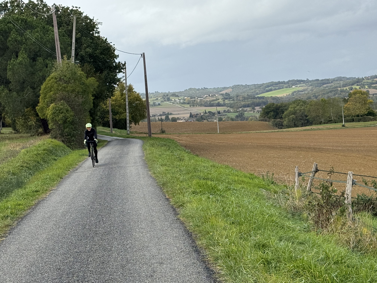
Much of the cycling spotlight here shines on the famous high passes—the Col du Tourmalet, the Col de Pailhaires—and rightly so. Crossing the Pyrenees by bike remains one of Europe’s great endurance journeys. But step away from the marquee climbs and a different kind of riding reveals itself. In the foothills and farmlands north of the massif, tranquility reigns. The terrain softens, the roads quiet down, and the scenery unfolds at a gentler, more contemplative pace.
Running west to east, the Pyrenees also trace a climatic shift. Atlantic moisture fades as you travel eastward, giving way to drier skies. In the Aude, the easternmost department covered here, a Mediterranean climate opens the door to year‑round riding. It all sounds nearly too good to be true—which naturally raises the question: what’s the catch?
As with cycling in the American West, scale and solitude define the experience. Many towns are small, services are limited, and a bit of foresight goes a long way. A sandwich from the local boulangerie, pockets filled with water, and a bike in good working order are all part of the rhythm here. On roads where an hour may pass between cars, self‑reliance becomes less a concern than a quiet pleasure.
Accommodations reflect the same understated character. Small, family‑run hotels, chambres d’hôtes, gîtes, and campgrounds are scattered throughout the region, many with only a handful of rooms. The result is an intimacy that suits solo travelers and couples especially well. Even when the Tour de France sweeps through—as it does each year—the race infrastructure stays largely in the larger towns, leaving the smaller villages and back roads blissfully unchanged.
Since this article focuses on France, metric units are used. You will want to make sure your GPS device settings are converted to metric before starting your rides.
Area History
The Pyrenees may rise as a formidable natural barrier, but their many passes—known locally as cols—have long made them a place of movement rather than division. For centuries, these openings have carried people, armies, and ideas back and forth between France and Spain. The Visigoths pushed the Romans out in the 5th century, followed by periods of Moorish control beginning in the 8th century. In the 12th century, the Cathars—a dissident Christian movement—left their mark by building a chain of dramatic hilltop fortresses, many of which still cling to rocky spurs today.[2] Some have been restored; others remain romantic ruins, rewarding a detour with sweeping views and a palpable sense of history.
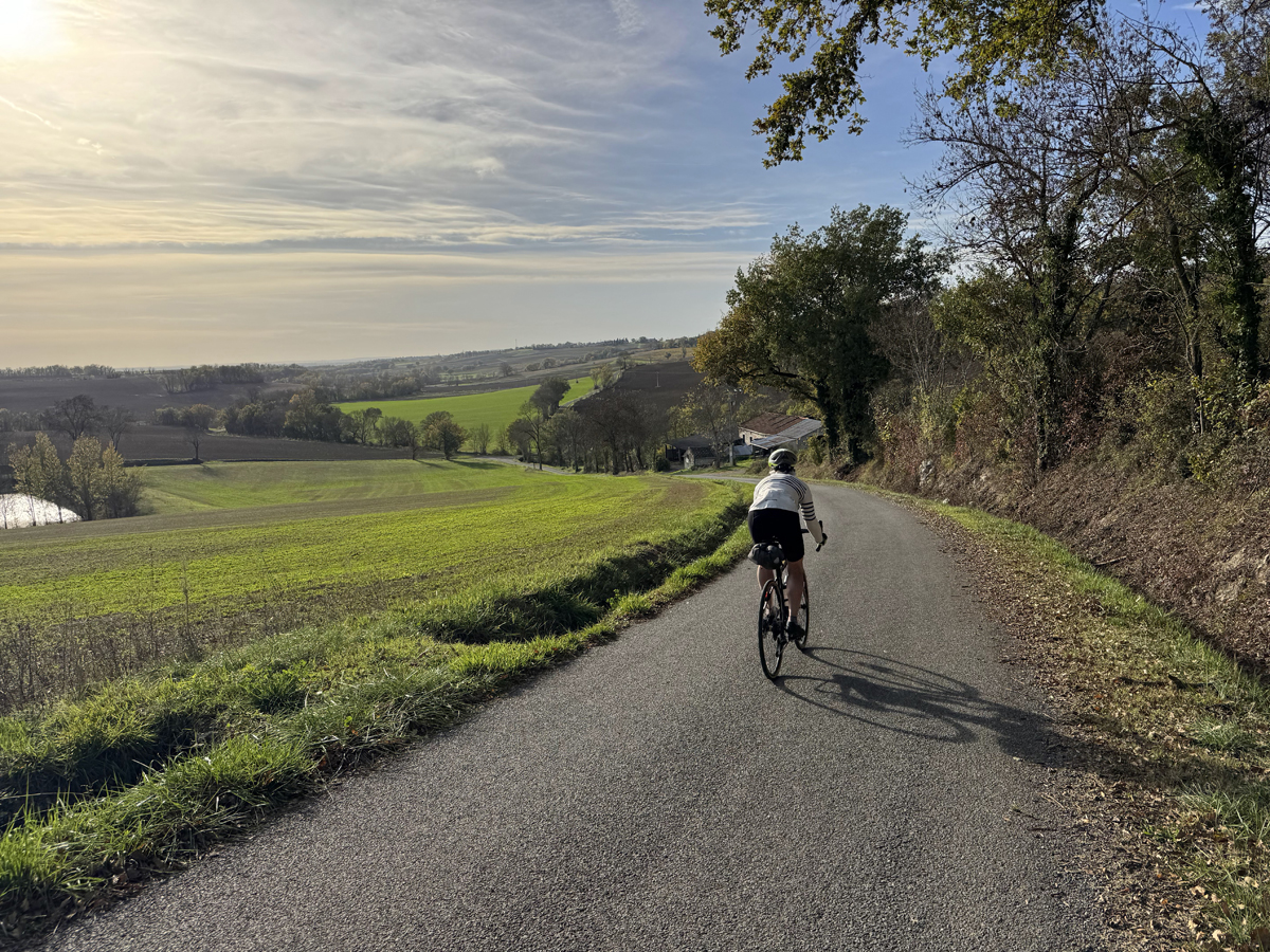
The mountains played a more somber role in the 20th century. During the Spanish Civil War, hundreds of thousands of Republicans fleeing Franco’s forces crossed these same passes into France in the winter of 1939, many ending up in internment camps.[3] During World War II, Spanish guerrilla fighters later returned to the mountains, working alongside French resistance groups in acts of remarkable courage. Quiet memorials scattered throughout the region honor both Spanish and French fighters who knew these roads and trails as lifelines.
That same sense of permeability extends to the land itself. Much of the Pyrenees is limestone, riddled with caves, sinkholes, and underground rivers. Some of these caverns hold prehistoric paintings more than 17,000 years old, none more famous than the Niaux cave near Tarascon‑sur‑Ariège.[4] Elsewhere, the landscape invites exploration in unexpected ways: you can float along Europe’s longest underground river at Labouiche near Foix, or ride straight through a natural grotto at Le Mas‑d’Azil—Europe’s only road to do so.
To the east, near Quillan in the Aude, rises Bugarach, the so‑called “upside‑down mountain.” Long rumored to possess mysterious powers, it briefly drew global attention in the late 1990s when believers claimed it would offer sanctuary during the much‑publicized 2012 apocalypse.[5] Today, the mountain has returned to quiet prominence, its myths lingering mostly as local color.
What ties all of this together—history, geology, myth—is access. Castles, caves, memorials, and mountain passes are not sealed behind highways or tour buses, but connected by an intricate web of narrow, lightly traveled roads. Many of them follow routes first worn by traders, shepherds, and refugees. Traveling through the central and eastern Pyrenees by bicycle is not just a way to move through the landscape—it is a way to read it, slowly and intimately, one climb, descent, and village at a time.
Getting There
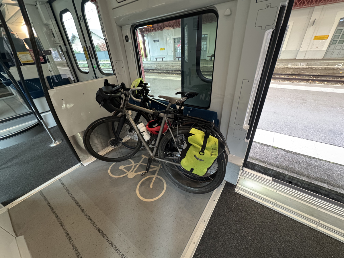
Most visitors fly into Toulouse, which has frequent flights to Paris and Amsterdam. You then take a train, or rent a car, to get to your destination. Table 1, later in the article, provides information on which towns are served by regional train service. Fully assembled bicycles are permitted on the regional SNCF trains if you book space ahead (free). There are restrictions during July and August weekends. Cardboard bicycle boxes are not allowed on any train.
Another possibility is to fly into Barcelona, which now has non-stop service to many US airports. Air Canada also flies non-stop from Montreal to Toulouse.
When To Go
With climate change, the Pyrenees weather has become even more difficult to predict. On a September 2025 traverse of the range, our group sweated in 32-35 C heat going up the Col d’Aubisque and Soulor. A few days later we nearly froze in 3.5 C drizzle on Col d’Agnès and we saw fresh snow above 2,000 meters. The best advice is to be flexible on your destination, and not to put too much confidence in any forecast more than 72 hours out. It reminds me somewhat of Winthrop, WA, where predicted big storms fizzled out, while another day unpredicted pop-up thunderstorms drenched us. Establishing a base for a week allows one to pick and choose between high, front, and low country depending on the weather.
For tranquility, you’ll have the best time if you choose to go in the spring and fall months. We enjoy 20 C days well into November many years, though short days factor into planning the day’s ride. At the lower elevations focused on here, spring comes earlier. After the wettest February on record, we saw temperatures above 20 C at the end of February 2026.
Most cols below 1000 meters elevation are open all year.
Avoid the months of July and August (a good recommendation for anywhere in France if you can). Toulouse temperatures can reach 40 C, and even the Pyreneen foothills have reached 35 C in recent years. Those months are also busy. Lodging of any type must be booked well in advance. Campgrounds also fill up.
Our favorite times to tour are in the fall, September into November, and also in April and May. Though of course spur of the moment trips can be done in any month, especially in the Aude in the winter, as it is warmer there.
Recommended Destinations
Cucugnan (Aude): Les Maitres de Mon Moulin is one of the best bakeries in the region. With a 17th century mill as centerpiece, and all organic breads. (https://lesmaitresdemonmoulin.com) Nearby are two Cathar castles, Château de Quéribus (€9 entry fee) and the Château de Peyrepertuse, and the Gorges de Galamus.
Niaux pre-historic caves, near Tarascon-sur-Ariège (Ariège): with a guide, you walk over a kilometer to view paintings that have been dated back 17,000 years. English-speaking guides available in summer months. Entry fee €14-17 (or family rate), (https://www.sites-touristiques-ariege.fr/grotte-de-niaux/)
Accommodations
While larger cities and towns have hotels, the best way to experience this area is to stay in either a gîte or a chambre d’hôte. The former is typically rented out by the week and guests are responsible for their own cooking. The latter is similar to an American or British B&B where breakfast is usually served, and dinner can be arranged ahead of time. Both allow one to live more like a local. These sites all link to such accommodations. Simply type in the name of the town (i.e., Limoux, Foix, Massat, etc.,) where you wish to stay to get a list of what’s available.
The English language version is accessed by clicking on the flag symbol at the upper right of the landing page.
This writer’s idea of “camping” now is to use his camping van. However, for those interested in touring and camping there are options ranging from rustic to places with swimming pools. Michelin publishes a French camping guide each year. These commercial sites (like Hipcamp in the US) also provide information on camping:
Wild camping is permitted in France, subject to permission from the landowner. There are restrictions, like no camping along the coast or at national monuments.[6]
Ride Recommendations
A base like Foix or Limoux offers ride dozens of loop ride options, with little to no repeats, making for great exploration of an area. With the exception of Bagnères-de-Luchon, each of the towns shown in the table offers rides in all types of areas: low country, farmlands, high country, or a mix of all of them. Bagnères rides focus more on higher mountain passes. Having a base also allows flexibility in your plans if the weather changes or rider preferences.
Using the regional train service further expands your options. Take advantage of the prevailing wind directions to ride the train one direction and then ride back, or vice versa. Or ride the train for a few stops in one direction, do a loop ride, and then take the train back to your base. Bicycles are free or regional trains, but book space ahead (ok to do even the same day). There are restrictions during July and August, especially on weekends (another reason to cycle in other months). Download the free SNCF app to your phone to accomplish your bookings, reserving space for a bike, and keeping an electronic copy of your ticket. Example fares: the one-way price between Toulouse and Foix (75 minutes, 85 km) costs around €12, though special €1 fares are offered on some off-season weekends. The one-way fare from Limoux to Carcassonne is often €1 to promote train travel over driving.
The IGN regional and local maps, available at area bookstores (“libraries”) and tobacco shops (“tabac”), work great with apps such as RideWithGPS and Cycle.Travel (best for point to point travel, though one can select loop rides). Many French riders also use Komoot and OpenRunner. Bikemap is yet another option. There is usually no reason to ride on a red color-coded road on a map. The IGN “top 100 tourisme et velo” maps are 1:100,000 scale (1 cm= 1km) with 40-meter contour intervals, while the IGN “top 25 randonee et plein air” maps are 1:25,000 scale (1 cm=250 m) with 10-meter contour intervals. I use the top 100 map first to plan a general route, then the top 25 map to find roads that are even less travelled or aren’t shown at all on the larger scaled map. Using contour lines, it’s easy to find whatever kind of route you want, following a stream for example, or climbing up a ridge for views and trying to follow that ridge as long as possible. Both map types also show all the hiking trails. You can then trace your mapped out route onto your favorite mapping app, and then upload that to your GPS device.[7]
Roads shown in white color are the best, and the commune (“town”) roads are even better. French road departments chip seal these roads, but a much finer grade of gravel is used than the coarse stuff many Western riders suffer through. Few potholes are found, but the roads are bumpy. A 28 or 32 mm tire width is recommended.
France has a large and expanding network of “voies vertes” (“greenways”). These are routed along old rail lines, canals and abandoned roads. The voies vertes can be useful to avoid busy roads or areas, or if one wants a flattish ride for a bit. The surfaces are mostly crushed stone and fine for road bike tires (28 or 32 mm). The site https://ww.af3v.org allows one to route plan, where one might combine a voie verte or section of one with other roads. For the region covered in this article, click on “Occitanie”.
The website Freewheeling France (https://www.freewheelingfrance.com/bike-routes-in-france/) is a rich resource for people interested in bike touring anywhere in France. The site also provides a list of bicycling friendly hotels.
Three-day loop tour ideas:
-
- Foix to Espéraza, Espéraza to Limoux, Limoux to Foix
- Foix to Carla-Bayle, Carla-Bayle to Saint-Girons, Saint-Girons to Foix
- Foix to Oust, Oust loop ride, Oust to Foix
Use the train to explore the region!
If you are based in Foix or Limoux initially, take the train from there to Bagnères-de-Luchon and do a multi-day tour back to your origin. For a shorter tour, take the train to Saint-Gaudens and return. Either of these destinations will be a 2.5-4 hour one way train ride. Off season weekends sometime have one-way train fares as low as €1. If you’re over 60, and plan to do a lot of travel in France, consider getting the SNCF discount card. That card provides a 30-40% discount on regional service, 20-25% on the high speed TGV, and discounts on food purchased on board.
Conclusion
Wherever—and whenever—you choose to ride, tranquility is the region’s constant companion. Your background noise shifts from car engines to braying animals, running creeks, and wind moving through the trees. You pause often, not out of necessity but inclination, to take in views across farmland toward the serrated line of the Pyrenees. Lunch becomes a quiet ritual on a sun‑warmed hillside. Your breathing slows and your perspective widens. Whatever weight you carried with you when you arrived has a way of loosening its grip, one unhurried kilometer at a time.
References:
[1] https://cycle.travel motto on landing page
[2] Cathar castles, Wikipedia entry, https://en.wikipedia.org/wiki/Cathar_castles
[3] Internment camps in France, https://en.wikipedia.org/wiki/Internment_camps_in_France
[4] Grotte de Niaux web site: https://www.sites-touristiques-ariege.fr/grotte-de-niaux/
[5] Bugarach entry Wikipedia, https://en.wikipedia.org/wiki/Bugarach
[6] See this link for the law and details: https://rural-camping.com/france/wild-camping.htm#:~:text=The%20principal%20rules,town%20and%20country%20planning%20law.
[7] I recommend against relying on your smartphone for directions. Cell service is, like the US West, very spotty once you get out of a town. If you must use a phone, download the course for offline use before you leave your house, and use a phone mount. I can’t tell you the number of times I’ve seen people get lost when they rely on their phone barking directions to them from their bike jersey pocket.