Tuesday, July 22, 2025
Home Blog Page 133

Five Great Utah Border Century Rides

0

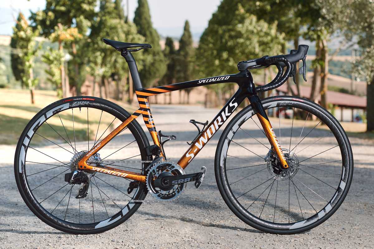
By David Collins — Ride 100 Miles or More in One Day – Entry Points in Utah. Rides Include Some Miles in Border State(s).

[Editor’s note: This article is the third part of a series, to see the first two, check out the 2019 March and July issues.]

Utah and her neighbor states are blessed with iconic geography and interesting diversions. Although these rides include stunning scenery, they often feature hidden gems and forgotten highways and byways – a cyclist’s dream – filled with unforgettable imagery, points of historical interest and quirky pit-stops.

Extended shoulder seasons are usually the best time of year to ride most of these routes, but depending on your skills and equipment, you might be able to ride nearly year-round. Be weather aware, riding conditions can swiftly change.

A scene from the Nevada ride. Photo by David Collins

Excursions and explorations are part of the fun of unsupported bicycle touring at your own pace. Mileage estimates are approximate and may vary depending on your tracking system and whims of the ride. Be sure to tell someone your plans and allow them to track your location using a smartphone or other device.

Solo or unsupported distance cycling often presents potentially dangerous situations related to terrain, weather, equipment, traffic, navigation and mental awareness. Even experienced cyclists must plan carefully and use wise judgment to successfully mitigate inherent risks of the sport or terminate a ride before it turns injurious or deadly. If you are new to the sport, or have never ridden a bicycle 100 miles in a single day, learn the ropes with a seasoned buddy or local riding club before giving one of these routes a go.

Make sure to check maps, plan your route and check local road conditions before you go. As with any ride, be aware of your surroundings and of roadway traffic.

Time to fill water bottles, stuff gear bags, click in and start pedaling Utah’s great border century rides.

Arizona

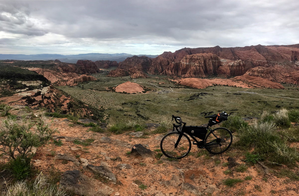
Mountains to Desert; Utah and Arizona (with a dash of Nevada at the end)

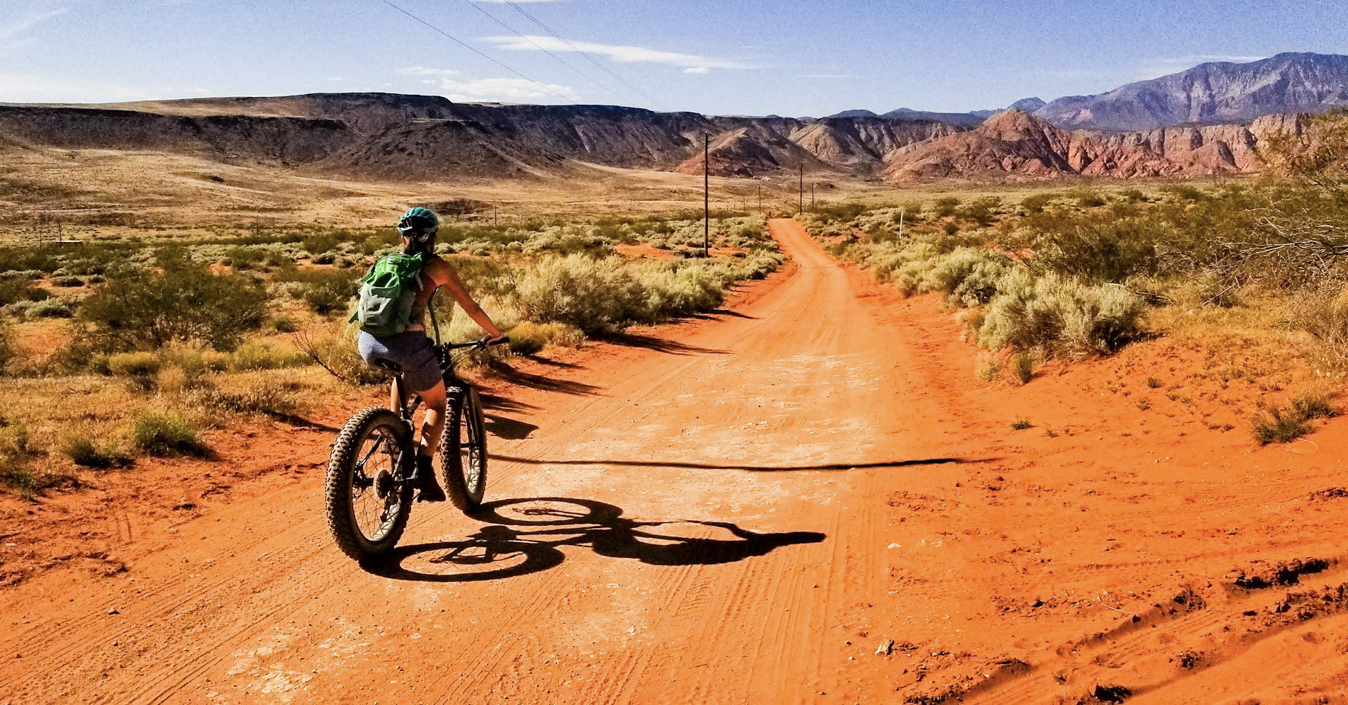
Route: Enterprise, UT; Veyo, UT; St. George, UT; Snow Canyon State Park, UT; Ivins ,UT, Shivwits, UT; Littlefield, AZ, Mesquite, NV. Begin in Enterprise, south on 18 through Veyo to St. George, west on W. Snow Canyon Parkway and north on Snow Canyon Drive to its terminus (through Snow Canyon State Park). Return the same way out of the park and ride through Ivins and turn West on W. Highway 91, South on Old Highway 91 through Littlefield AZ to Mesquite NV.

Rim view of Snow Canyon from the Arizona ride. Photo by David Collins

Terrain: Mountain passes, rural farmlands, remote Native American lands, long steady climbs and descents, small towns and villages.

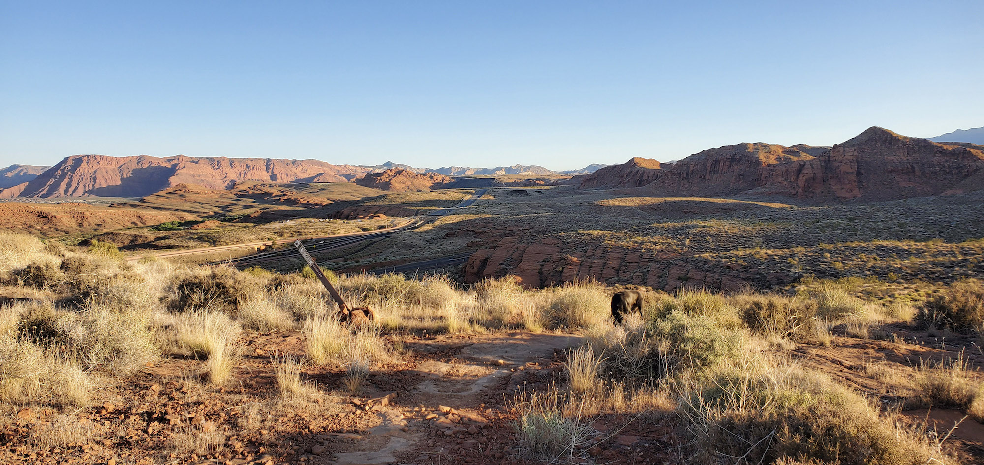
What to See: Just south of Enterprise you’ll see signs for the Mountain Meadows Massacre memorial site, be sure to take a few minutes to walk the short path up to the overlook and read about the 1857 tragedy; the rim of Snow Canyon, turn west at the road sign and take the short gravel road to the overlook; a stunning detour through Snow Canyon (including a memorable 1,000 ft. four mile climb); a show stopping curtain of red mountains, best viewed in the Shivwits Paiute Indian Reservation by turning around often during the long climb toward Arizona border; miles of Joshua trees and desert sagebrush throughout much of the long descent into Littlefield, Beaver Dam Mountains; dry wash beds of various creeks and rivers; Virgin River bottoms.

Selfies and Photo Ops: Mountain Meadows Massacre overlook; Snow Canyon from the rim and through the valley; Veyo Pies storefront; historic pioneer buildings and museum in Santa Clara (a brief detour you may want to explore if you are into regional history); Bulldog Pass sign; long road pointed northward toward the wall of red mountains in the Shivwits Paiute Indian Reservation; Scenic Joshua Tree Byway sign with miles of Joshua trees in the background; Beaver Dam Wash National Conservation Area; Virgin River bottoms overlook just outside of Mesquite.

Wildlife: Birds of prey, California condors, Mexican spotted owls, mountain lions, mule deer, fox, coyotes, badgers, porcupines, snakes, jackrabbits, raccoons, lizards, desert tortoise.

Best Post-Ride Eats: Check into CasaBlanca Resort and Casino, clean up and pay a visit to Katherine’s of CasaBlanca (will reopen May 15, 2020). USDA Dry Aged Prime beef from Stockyards in Chicago awaits, along with Florida stone crab flown in from the keys (when in season). Get things started with fresh Oysters Rockefeller. For the steak, get the strip. Wrap things up with Bananas Foster and a long night’s sleep in your nicely chilled room, a luxury after so many miles in the sun.

Still Have Legs, Lungs and Sunlight? Just past Shivwits, turn north on Gunlock Road and ride to Veyo and back (29 miles). A fabulous ride through sometimes lush farmland, past Gunlock reservoir and a lovely climb from the river bottoms up to another rural shelf and into Veyo. Be sure to stop by Veyo Pies again (surely you dropped in the first time through Veyo) and eat some of their world famous pie, I recommend the strawberry rhubarb. Pie and barbeque in a tiny roadside joint? The proprietors must have a spot or two of cycling in their souls.

Note: This ride begins in moderate mountain terrain and finishes in the desertscapes of northeastern Arizona, with and a handful of miles in Nevada. Pay careful attention to weather forecasts and be properly armed with sufficient hydration and nutrition. Also, be aware of flashfloods – water levels on local roadways can sometimes rise to dangerous levels in minutes of even seconds.

Nevada

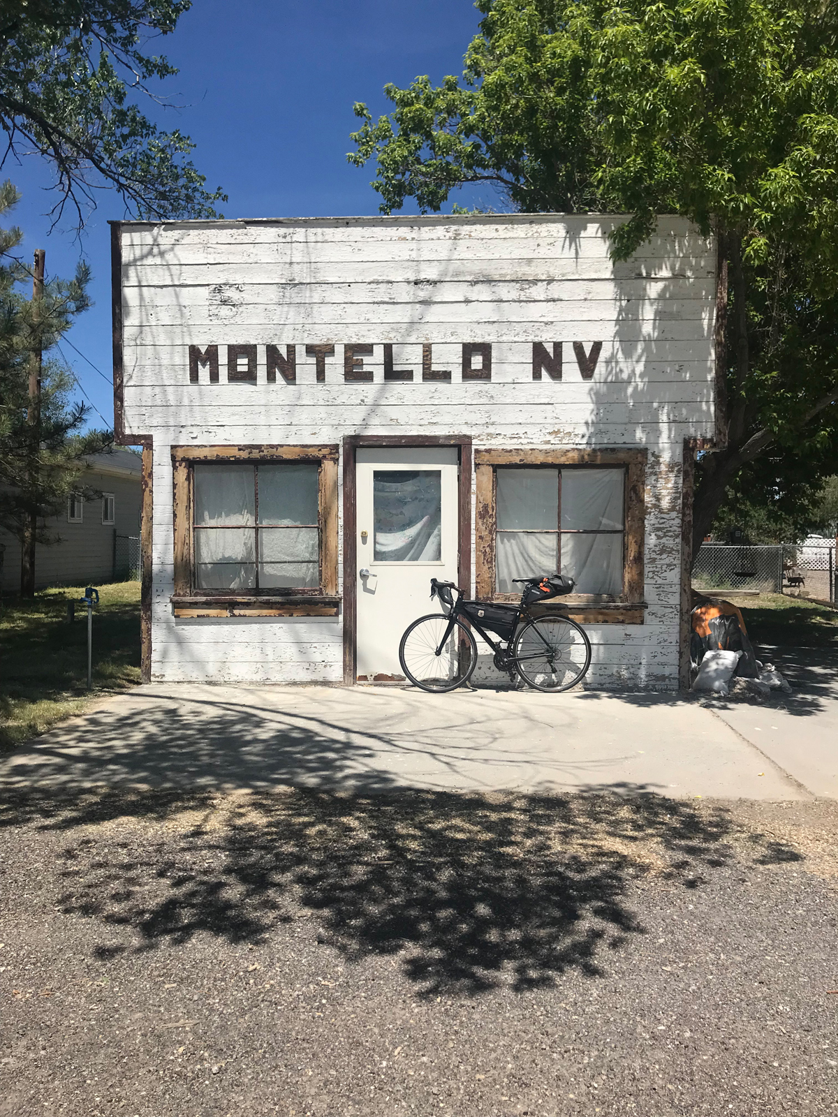
Go West! Utah and Nevada

Route: Snowville, UT to Montello, NV (one way). From Snowville, take N 18575 N (a gravel frontage road) west for a couple of miles until it joins the paved Highway 30. Ride west on Highway 30 until you reach Montello. 106 miles

A scene from the Nevada ride. Photo by David Collins

Terrain: Periodic patchwork of sage brush, grassland and cultivated farmland, rivers, creeks, expansive valleys lined by plateaus, risers, and alpine mountains.

What to See: Long stretches of road through valleys you’ll want to return to with a cinematographer to try and capture the essence of the place; open cattle ranges; alpine peaks on the horizon; northwest finger of the Great Salt Lake (including salt flats and watershed boundaries); skyline view of Antelope Island from the rarely seen or photographed west side; Pilot Peak (often snowcapped through much of the summer).

Selfies and Photo Ops: Next Services 102 miles sign; black metal silhouette of wolf howling on top of mountain butte; 27 Ranch gate; Coldwater Ranch gate; Welcome to Park Valley and nearby Park Valley Cemetery gate; Montello Rd. sign (a faded little wooden sign about a mile or two before town; Leenaz She Cave and bottle garden; several road-to-infinity backdrops along the way; old west façade whitewashed building with distinctive MONTELLO NV letters above the door.

Wildlife: Antelope, rabbits, coons, deer and elk, snakes and lizards, birds of prey, waterfowl, and buzzards.

Best Post-Ride Eats: Montello is charming but tiny and the kitchen in the bar never seems to be open, but there is one reliable food option: the Montello Gas and Grocery, serving soda pop, hot coffee, cold beer and snacks. Get some beef jerky, Frosted Flakes, cold milk and a loaf of white bread and mustard so you can wrap a few sticks of jerky dabbed with mustard to go with Tony the Tiger’s treat. Or, tough out 50 more miles to Wendover, Nevada where you’ll find all the casino food you can handle. If you do this ride in reverse and land in Snowville, there is a much better choice for dinner. Step into the Ranch House Diner, find your way back to a booth by the antique saddles, next to the fireplace and underneath the trophy elk head with a unique starboard antler. Then dive into The Trail Boss (a 16 oz rib eye – “hand cut, marinated and never frozen”). For a smaller serving try their Rattle Steak Sandwich and fixins – a tasty supper.

Still have Legs, Lungs and Sunlight? Fuel up and turn your wheels towards Wendover, about 50 miles down the road on the Utah border. After a nosh at one of the fern bars, check into a small-town casino, store your bike, take a hot shower and try your luck at the roulette wheel.

Notes:

This is a remote ride and cellular service is weak or nonexistent during the last 20-30 miles until you reach Montello. In addition to your normal tools and supplies, be sure to plan ahead by taking sufficient food and hydration since there are no refueling stops along the way.

Also, believe it or not, Montello has accommodations. The Pilot Motel features about a dozen clean rooms with AC and Free TV. Rooms can be booked through Montello Gas and Grocery. Call ahead though, you can’t check in past 7:00 PM on weekdays or 5:00 PM on weekends (hours may change based on whims of the proprietor). Why not stay overnight and turn your century ride into a back-to-backer by returning to Snowville the next day?

Colorado

Dinosaur Drive; Utah and Colorado

Route: Roosevelt UT; Vernal UT; Jensen UT; Dinosaur, CO; Rangely, CO. (with a detour through Dinosaur National Monument UT). From Roosevelt, east on Highway 191 to Vernal, east on Highway 40 to Jensen, north on S 9500 E to Quarry Entrance Road which takes you into Dinosaur National Monument (UT), take the seven-mile road in the park and return the way you came – back to Jensen. Continue east on Highway 40 to Dinosaur, CO, then south on Dinosaur Diamond Prehistoric Highway to Rangely CO. 101 miles.

Terrain: Low-grade risers and intermittent flats with arroyo undulations sprinkled throughout.

What to see: Rivers (Uintah, Green, Yampa, Rio Blanco); distant mountains (Uintas, Blue Mountain); Dinosaur National Monument north of Jensen. The seven-mile ride in the park is worth the effort and nominal entry fee and includes stunning views of dramatic cliffs, the Green River and easily accessible ancient Native American petroglyphs and pictographs; big western sky country; Rangely Auto Museum (seasonal hours); Chevron oil country including a few outbuildings littered across the empty valley between Dinosaur and Rangely, active oil pumps, drilling and wells; Rocky Mountain Cannabis store in Dinosaur (if that’s your thing).

Selfies and Photo Ops: Welcome to Roosevelt – Energy Hub of Utah sign on the east side of town; Musket Shot Springs overlook (between Jensen and the Colorado border); Split Mountain and ancient Native American petroglyphs and pictographs in Dinosaur National Monument; the giant dinosaur in the front yard of the town hall in Dinosaur; Rocky Mountain Cannabis sign in Dinosaur; several out buildings and abandoned structures throughout (think ghost town), Rangely School District bald eagle mural on the north side of the building; and Rio Blanco river crossings.

Wildlife: Bald eagles and other birds of prey, buzzards, ducks, geese, pelicans, elk, deer, fox, coyotes, trophy fish, black bears, mountain lions, badgers, porcupines, snakes, jackrabbits, raccoons, mountain goats, pica and other little grounders.

Best Post-Ride Eats: For such a small village, Rangely offers a surprising selection of eating options. After a long ride over the border though, it’s hard to beat the T-Bone Steak Ranchero at El Agave Mexican Restaurant. Ask them to add a few jumbo prawns to go with your hot tortillas, rice and beans that come with the steak and wash it all down with a cold drink from their full-service bar.

Still have Legs, Lungs and Sunlight? Turn north on Highway 191 in Vernal to Steinaker State Park where you can cool off in pristine blue waters and enjoy more sandstone and desert landscapes. (about 15 miles there and back).

Notes: The Welcome to Rangely sign brags: Way Outside of Ordinary. It’s true, it doesn’t take long to realize the ride continually evolves into a uniquely rugged and remote region after you leave Jensen. Bring extra hydration, sun protection and mechanical equipment. Also, consider scheduling your ride to overlap the annual multi-day Northern Ute 4th of July Pow Wow activities (east of Roosevelt at Fort Duchesne) where you’ll find folks from more than 15 states and Canada celebrating Native American cultures with dance, music, food and contests.

Idaho

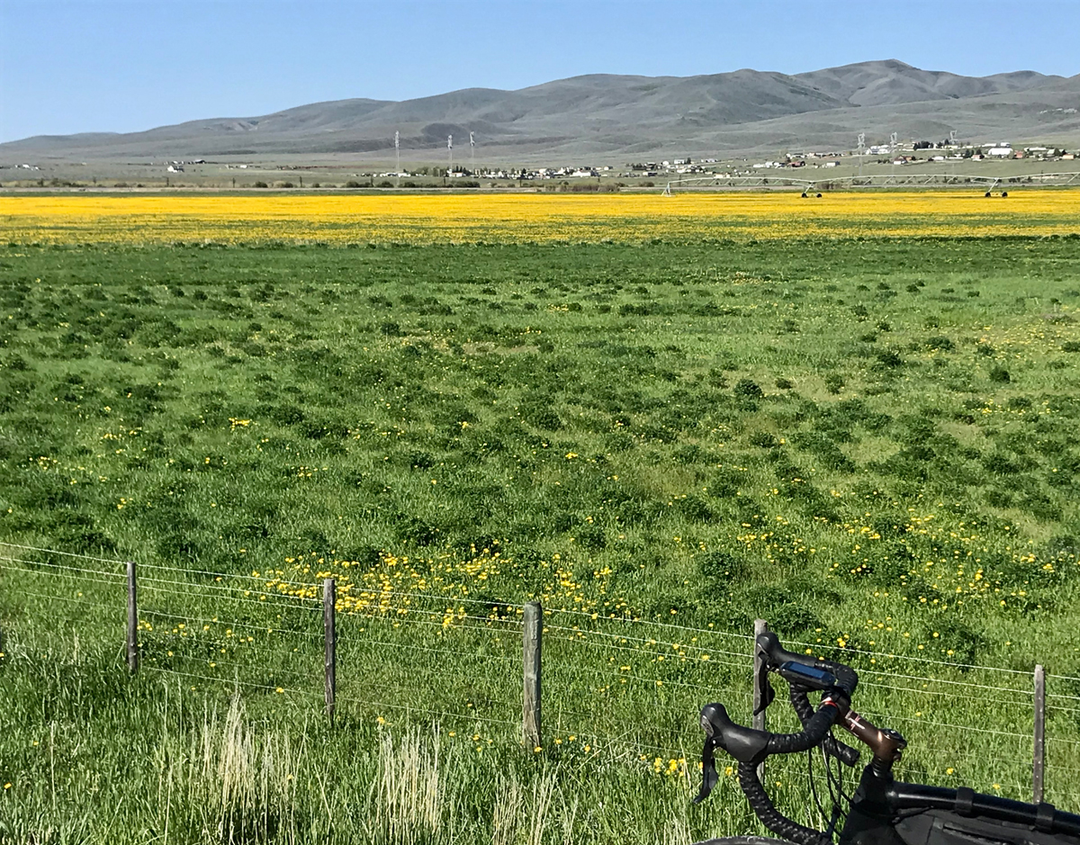
Plymouth to Pocatello; Utah and Idaho

Route: Plymouth UT; Malad City, ID; through southern Arbon Valley, ID; Pocatello ID. Begin in Plymouth, west on 20800 North Road, pass under Interstate 15, immediate north on Frontage Road, over the UT/ID state line, north on S. Old Highway 191 which turns into S. Main Street in Malad City. West on Idaho Highway 37/38 (which turns into W 2000 S). After riding over the mountain pass and descending into the next valley, turn north on N Arbon Valley Road which becomes Buist Road and then Arbon Valley Highway. Turn east on Mink Creek Road and ride through the mountain pass and into southern Pocatello – finally, north on Bannock Highway into Pocatello. Sound complicated? It’s really not. Take a look at a map and you’ll see it’s an easier route than it may seem from this description. 103 miles.

Terrain: Extended flats and long, low grade climbs through two mountain passes.

What to See: Rural farmlands; sagebrush foothills; mountain passes sometimes loaded with curious wildlife, historic pioneer landmarks and townships, open rangelands, memorable Arbon Valley (from their town website: “The Best Place on Earth”), you might be as surprised as I was to roll through such a picturesque valley that doesn’t seem to have been discovered yet by the hoi polloi. Stretches of winding roads through camping country (and ATV, snowmobiling and hunting and fishing country); historic section of old Pocatello and Idaho State University.

Selfies and Photo Ops: Welcome to Plymouth sign (with historic July 4th rodeo copy); faded Rope Trailers horse trailers mural on defunct building façade in downtown Malad City; road to infinity looking back into Malad City from the rising climb out of town on the west side of the valley; too many spots to mention in Arbon Valley but don’t miss the ghost town like outbuilding that’s barely standing in a drunken lean (on the east side of the road before the Mink Creek turn – can’t miss it); original art deco-ish Chief Theatre sign from 1938 in old Pocatello; the Idaho State University Greek pillars on Red Hill (a Pocatello landmark and I.S.U. icon).

Wildlife: Birds of prey, elk, deer, fox, coyotes, mountain lions, badgers, porcupines, snakes, jackrabbits, raccoons, mink, beavers and ranch dogs (well, they aren’t really wild but they seem to run extra free on parts of this route and are often keen to enthusiastically chase cyclists in anger – so be sure to brush up on your stray dog technique before you go).

Best Post-Ride Eats: A gas station? Although Pocatello is a city of more than 50,000 people, with all the food options you might expect, Cafe Tuscano is located in a gas station and is “pumping out” wonderful post ride bistro fare. Amazing Italian dishes with fresh ingredients and an impressive wine collection (go figure, there’s a terrific Indian restaurant in Logan, Utah built into a gas station too – maybe it’s an idea that’s catching on?). Start with the charcuterie board of meats and cheeses and move right into a well-prepared pan-seared striped sea bass plate with tasty sundried tomato and spinach risotto and roasted portabellas and a pimento green olive tapenade that would make a phone book taste good. Hard to believe such a food stop would be cyclist friendly – but they are indeed.

Still Have Legs, Lungs and Sunlight? Head north out of town on Highway 91 through Chubbuck and into Fort Hall, a township in the Native American reservation of the Shoshone-Bannock Tribes. Be sure to get one of the savory bison burgers at the gas station by the casino (24 miles there and back).

Note: This ride could be titled “Cowboy’s and Indian’s” since the route passes through pioneer and Native American points of interest. Look for historic landmark signs along the way.

Wyoming

The Big Bear Lake Loop; Utah and Wyoming (with a healthy clip of miles in Idaho)

Route: Garden City, UT; Cokeville, WY; Montpelier, ID; Paris, ID; Fish Haven, ID; Garden City, UT (one-way loop). Begin in Garden City, south on Highway 30, north on WY Highway 89, north on WY Highway 30 to Montpelier ID. Take south Highway 89 in Montpelier all the way back to Garden City, UT. 112 Miles

The vast Cokeville National Wildlife refuge from the Wyoming ride. Photo by David Collins

Terrain: Rural flats, two medium mountain passes, lakeside shorelines and historic settlements and villages.

What to See: Distant vistas and repeating mountain ranges layered on the horizon; rural farm towns; ranchlands; barns and out buildings; Bear Lake, a turquoise blue marble plopped down in the middle of a memorable valley, surrounded by alpine mountains; Cokeville National Wildlife Refuge; The Bank of Montpelier, the last standing bank verified to have been robbed by Butch Cassidy; Paris Tabernacle, a Romanesque Revival style red sandstone church built in the late 19th century by early settlers; national historic trails (Oregon Trail and California Trail); site of Pegleg Smith’s Trading Post; old McCauley’s Road, a section of current Highway 30.

Selfies and Photo Ops: Scenic miles along the western and southern shorelines of Bear Lake; Welcome to Cokeville sign on the southern end of town; the vast Cokeville National Wildlife Refuge; Pine Creek Ski Resort sign; entrances and exits of two remote mountain passes; Oregon and California Auto Tour Route signs; Paris Tabernacle, Butch Cassidy Museum in Montpelier; wetlands and ponds; Welcome to Paris sign.

Wildlife: Elk, deer, birds of prey (eagles, owls, hawks, Northern Harriers), Black Terns, Yellow-headed Blackbirds, White-faced Ibis, Black-necked Stilts, buzzards, fox, coyotes, beaver, trophy fish, black bears, badgers, jackrabbits, raccoons and other little grounders.

Best Post-Ride Eats: Cody’s Gastro Garage in Garden City. A converted mechanic’s garage (complete with a couple of hot rods on lifts inside the restaurant). Open year round and a great place to tuck into two or three pounds of wings. Be sure to get the raspberry chipotle sauce for the wings – the area is famous for mountain raspberry farms. BTW: the barbeque chicken quesadillas are the best I know of in Utah. You can’t believe the flavoring dance steps and innovative tortilla treatments they perform on the classic dish.

Still Have Legs, Lungs and Sunlight? It’s a bit of a stretch (and may require another day of riding) but it’s worth noting – you can turn north at the northern apex of the loop and be in Jackson Hole, WY in another 100 miles or so. Also, this ride is called the Big Bear Lake Loop; if you prefer a 50ish mile ride instead, hug the lake’s shoreline all the way around for the Little Bear Lake Loop.

Note: Some roads are closed during winter months and cell coverage may be spotty throughout the ride.

David Collins is a cycling enthusiast and amateur randonneur. Follow him on Instagram @rockypumpkin

Salt Lake Criterium Doubles Up for 2021 USA CRITS Series; Adds Second Day of Racing

0

SALT LAKE CITY, Utah (August 25, 2020) — The Salt Lake Criterium organizing committee announced today a new expanded racing weekend for 2021. The first of two criterium races will take place at the 2019 venue, the original Gateway location in downtown Salt Lake City on Saturday, July 17. The second race will be held on Sunday, July 18 on an exciting course in the city of Holladay, a vibrant suburb of Salt Lake City at the base of Mount Olympus on the east side of the Salt Lake Valley. These events will be sanctioned under USA Cycling and include amateur and professional fields. Both races will be part of the USA CRITS national series.

Salt Lake Criterium Logo

“Building on the success of last year’s inaugural event at the Gateway, we are excited to grow this into a crit racing weekend that will showcase more of Salt Lake City and its cycling fans,” said the race director, Eric Gardiner, “with back-to-back Saturday/Sunday USA CRITS races, we expect to attract an even larger number of pros competing for points and cash on the two very different courses.”

The organizing committee was saddened to cancel the 2020 event due to the COVID-19 pandemic but are doubling down on 2019’s event to continue growth. The criterium, with its fast, short laps, world class sprinters and professional teamwork, is one of the most exciting cycling disciplines to watch. The Committee will be planning for safely supporting the number of fans expected to watch in person, with scenarios dependent on the status of the pandemic in the next year. Both days will be streamed live on USACRITS.tv. The Salt Lake Criterium inaugural event in 2019 was highly successful with 319 amateur riders, 21 USA CRITS D1 professional teams, and over 5,000 fans that came down to The Gateway throughout the day.

Two rider break during the Women’s D1/Pro race at the Salt Lake Criterium, USA CRITS series held at the Gateway Mall (Photo by Dave Richards, daverphoto.com)
ButcherBox Cycling riders lead the pack past the fans during the Salt Lake Criterium, USA CRITS series held at the Gateway Mall (Photo by Dave Richards, daverphoto.com)
Veteran announcer Dave Towle has a quick word with Cory Williams and brother Justin (Legion of Los Angeles) after taking 3rd & 1st respectively at the Salt Lake Criterium, USA CRITS series held at the Gateway Mall (Photo by Dave Richards, daverphoto.com)

Pedal On – The Bicycle Art of Susan Adamé

0

Artist’s Statement

When my husband Tom and I are on scenic drives, I love taking photos out of the passenger side window. These quick shots have often become inspirations for some of my paintings. The fact that they lack detail can sometimes be an advantage when I later come to simplify a painting into essential elements. The reference for this painting, titled “Pedal On,” was taken on one of my favorite drives in Napa, California on the Silverado Trail.  Silverado Trail is one of the most popular routes for road cycling in the Napa Valley.

Pedal On – Artist: Susan Adamé. Title: Pedal On. Medium: Oil on Canvas, Size: 16×16

Background

Susan Adamé’s varied art career has included 23 years working in clay, during which time she opened and operated an art gallery for nine years. She spent ten years as a textile designer in SF with an overlapping ten years as a collage artist, before moving into painting. Her work has been carried by the San Francisco Museum of Modern Art Artist Gallery and was placed in many well-known locations, including Green’s Restaurant in San Francisco and the Alameda County Courthouse. Her collage work was commissioned for numerous medical institutions across the country as it was seen as positive and uplifting.

Susan’s involvement in the artwork has extended to volunteering in the Albany, California community for over 30 years, which included drafting the city public art ordinance while she was on the Albany Arts Committee. During her time on that City body, Susan met Amy Smolens, another volunteer in the community. Susan was greatly impressed with the completeness of Amy’s presentation to that Committee and her commitment to the installation of artistic bike racks in Albany.

Amy had everything worked out ahead including the design, locations for the racks, and the funding, so it was immediately approved. The Arts Committee approved 6 Dero “Bike Bike Racks” in 2012, and the program has grown so we now have 66 in our town of 1 square mile. During this difficult time in which we all are Sheltering in Place, a friend inspired her to give away her artwork as a way to help bring enjoyment to others. As she put it, “No strings attached – I am trading cheer for goodwill.”

As soon as Susan thought of giving away her only bike painting, Amy came to mind as the most deserving.

Amy had this to say about Pedal On, “When I first moved to Albany in 1986, Susan owned Adamé Ceramics, a lovely shop featuring local art, including her own. I bought a lamp and some beautiful ceramic platters & bowls…but I didn’t know her well until last week. It’s so generous of her to gift her paintings during Shelter in Place and I was honored to be one of her recipients. “Pedal On” now brightens up my living room, where I’m spending more time than I ever have!”

For more of Susan Adamé’s art, see: susanadameart.com

Circling Cabezon -A New Mexico Gravel Ride

1

By Don Scheese — In The Way to Rainy Mountain, N. Scott Momaday, a Native American writer of Kiowa ancestry, writes of returning to his ancestral homeland on the Great Plains. “A dark mist lay over the Black Hills, and the land was like iron. At the top of a ridge I caught sight of Devil’s Tower upthrust against the gray sky as if in the birth of time the core of the earth had broken through its crust and the motion of the world was begun. There are things in nature that engender an awful quiet in the heart of man; Devil’s Tower is one of them” (italics mine).

Cabezon at the start of the ride. Photo by Don Scheese

If you have ever driven highway U.S. 550 between Albuquerque and Durango, you could not help but have noticed off to the southwest a prominent volcanic peak rising from the high desert floor. That peak is Cabezon, Spanish for “Big Head,” and Cabezon is the Devil’s Tower of northwestern New Mexico. Towering almost 2000’ above the surrounding terrain, topping out at 7775’ above sea level, Cabezon is the tallest of fifty-some volcanic plugs protruding above the Rio Puerco valley, which in the 1800s was once a thriving Hispanic farming community. For thousands of years “Black Rock, “ as the Navajo refer to it, has functioned as a navigational landmark for travelers and residents.

I can see Cabezon from our house 40 miles distant, and have long been mesmerized by its hulking presence. So, one balmy spring day I headed out with the plan of paying homage to the peak by riding around it, figuring it would be around 30 miles of rolling desert gravel and dirt roads, through land owned by the BLM and private ranchers. Beautifully desolate country, where the Chihuahuan Desert meets the Colorado Plateau Province.

The drive to where I planned to start the ride took about an hour. I parked the car at the intersection of BLM roads 1113 and 1114, and headed off to the north/northwest in a counterclockwise direction, loaded with Camelbak, water bottles, spare tubes, and bars and fruit chews. A light northwesterly breeze kept the early morning temperatures nice and cool, and fair-weather cumulous clouds filled the sky.

What struck me at the start of the ride, and throughout the circumnavigation of Cabezon Peak, was the absolute quiet—no sound of motor vehicles or people talking, the sheer absence of human-caused noise. Except for the sound of my tires rolling across the smooth hard-packed dirt and gravel road, the only other sounds I could hear were the occasional chittering of a rock wren and the soft whoosh of wind across the desert landscape. I found this predominance of natural sound intoxicating.

Pipeline Road with the Sandia Mountains on the horizon, on the Cabezon gravel ride. Photo by Don Scheese

The start of the ride lay along a rolling spine separating Cabezon, but a few air miles distant, from the desert floor sloping eastward toward the Nacimiento Range. On either side of the road brown sandstone slabs protruded like the spines of a stegosaurus, the harder rimrock still in the process of weathering away, and it was great fun to ride this roller-coaster along the crest of the ridge. Eventually I topped out on the mesa top towards the junction of Pipeline Road, so named for the underground gas conduit connecting the oil fields of the San Juan Basin to the Albuquerque metro area and points southeast all the way to Texas. It was then an easy coast down to the dry crossing of the Rio Puerco, then uphill a bit to the outskirts of the village of San Luis. To the north a long low mesa formed the immediate horizon, atop which ran the Continental Divide National Scenic Trail—a geographical divide delineating major watersheds of the West.

A sharp turn to the southwest, on a wider, more gravelly road, followed, and Cabezon rose all the more impressively from the lower desert floor. The peak was formed when molten lava oozed out to the earth’s surface through older sedimentary layers that had accumulated hundreds of millions of years ago when this area was covered by an ancient sea, followed by hundreds of millions of years of erosion, slowly exposing the basalt volcanic columns.

The Navajo tell a different story of the peak’s genesis. According to their legend the sacred peak of Mt. Taylor to the southwest is the body of a giant slain by their heroic figures, the Twin War Gods. The head of the giant’s body rolled off and became Cabezon Peak, and the lava flows of the area are the congealed blood of the slain giant.

Now I was on a section of the Great Divide Bike Route, the 3000-some mile track from Jasper, Canada, to Antelope Wells on the New Mexico-Mexico border. But only briefly, as I took the road less traveled by at the next junction, past the ghost town of Cabezon and across the Rio Puerco again, choked with tamarisk and dry as a bone, one of countless “seasonal rivers” in the arid Southwest. Then it was a long gradual trundle up to the top of the next divide, where I found myself sandwiched between volcanic necks: the brown-layered Cerro Cuate to the west, the Shiprock-like form of Cerro Chato to the south, and immediately due east, the Gibraltar of northwestern New Mexico, Cabezon Peak.

On the edge of Cabezon Wilderness Study Area. Photo by Don Scheese

A BLM sign indicated that I was on the western edge of the Cabezon Wilderness Study Area, an 8000-acre preserve of sorts encompassing the immediate area around the peak. A spur road headed off towards the peak and I followed it to the base of Cabezon where a trail register and a few fire rings dotted the ground. The peak looked impregnable, but a brochure in the register mentioned there was a route to the top, a 2.5 mile roundtrip hike and climb of almost 2000 feet. Another time, perhaps ….

Cerro Chato. Photo by Don Scheese

After refueling for a bit, I continued south, the road plunging down into the Abra de los Cerros (the Cove of the Hills), revealing fine views of a number of volcanic necks throughout the Rio Puerco valley, jutting like goosenecks above the desert floor. Past Cerro Chato—past Cerro de Santa Clara—past Cerro de Guadalupe…to the bottom of the drainage, where I took a hard left eastward at another road junction to begin the long steady climb up Canon del Camino. I passed more cow-burnt landscape dotted with juniper and pinyon pines, with some of the latter robustly thriving, while others stood desiccated and needle-less, weather-worn limbs glistening like the bones in an ossuary. The dead pines were apparently the victims of the Mega-Drought the Southwest is currently suffering from. Why do some survive and others not? The Darwinian struggle and the mystery of existence, survival, and death….

Cerro Cuate on the Cabezon gravel ride. Photo by Don Scheese

A lone vulture floated low over the terrain, making me think of Edward Abbey, who frequently expressed a wish to be reincarnated as a vulture. “Howdy Ed,” I said aloud, breaking the silence. In his most famous work, Desert Solitaire, Abbey tried to articulate the allure of the desert by writing, “The desert wears a veil of mystery. Motionless and silent it evokes in us an elusive hint of something unknown, unknowable, about to be revealed. There is something about the desert that the human sensibility cannot assimilate, or so far has not been assimilated.”

The pyramid-like hill of Cerro Cochino, and the long dark form of juniper-covered Mesa Prieta, loomed immediately to my right as I dropped into my lowest gears and huffed and puffed my way up the steep inclines. Back on top, arriving at the junction where I had begun the ride, 24 miles and 1400’ of ascent later, I could see to the distant south the high dark profile of the Sandias … my Home Mt Range. Turtle Mountain, according to the local Puebloan tribes. How satisfying are Long Views, Distant Horizons, I thought. For 25 years I lived in exile in the Midwest, where a ‘long view’ was but a few miles off….to hell with a ‘prairie perspective,’ I decided—much better, much more inspirational, are the far-off vistas of the American West.

It is a Cyclist’s Truism that the earlier you ride in the day, the lighter the wind, the fewer the vehicles, and the more enjoyable the experience will be. During the entire 24-mile loop I met with only one vehicle, an Hispanic rancher in a battered Nissan pickup who motioned to me in passing if I needed any agua. No gracias, I said.

I had been gone only a few hours, but somehow the ride through the backcountry of Cabezon had seemed much longer, deliciously longer—as if I had experienced a different sense of time while cycling through the solitary silence. Desert Time.

And above it all loomed the dark hulking shape of Cabezon, engendering an awful quiet in the hearts of all who pass by.

Don “Seldom Seen” Scheese lives and rides in New Mexico, always in search of new adventurous routes, especially on gravel roads.

Advocacy Alert: Support New MTB Trail Networks in the Pine Valley Ranger District

1

TASU (formerly DMBTA) with the help of Fezzari Bicycles in partnership with Greater Zion has been working with The Pine Valley Ranger District to create two amazing new trail networks. The environmental assessment is out for public comment and we need your support.

Photo courtesy Trail Alliance of Southern Utah

Below is a brief summery of the project, feel free to use any of this in your comments.

  • 60 miles of purpose built mountain bike trails at higher elevations and cooler temperatures up to 7,000 feet elevation
  • New XC race course designed to meet NICA requirements with parking for large crowds
  • Designed with multiple access points to allow use of the network even during an event
  • 23 miles of directional downhill trails built for a variety of skill levels
  • Designed with riding loops as well as shuttle options
  • There will be a 10+ mile true enduro downhill with “a”and “b” lines, and a 1.8 mile jump line

Submitting Comments

SUBMIT COMMENTS BY SEPTEMBER 18, 2020. The best method for submitting comments is through the public participation portal on the project webpage:

https://www.fs.usda.gov/project/?project=58618

To submit comments using the web form on the project webpage select “Comment on Project” under “Get Connected” on the right side of the project’s webpage, and scroll down to the submission form.

Written comments may also be submitted by mail or hand delivered to Nicholas Glidden, Pine Valley District Ranger, 196 E. Tabernacle Street, Suite 38, St. George, UT 84770.

Spring Hollow MTB Trail Network
Grass Valley MTB Trail Network

Boise GreenBike to Suspend Service on September 30, 2020

0

Seeks Necessary Title Sponsorship to Fund Plan 2021 Return

Boise GreenBike will hit the pause button on the bike share program at the end of September but plans to revive and improve the service in the spring of 2021.

About a year ago, Valley Regional Transit’s bike share program started making plans to transition to a new vendor and bring in electric-assist bikes to replace the aging pedal-only bikes. The program had faced many challenges with out-dated technology, and a vendor who would no longer support third-party operators like Boise GreenBike.

Photo courtesy Boise GreenBike.

Through the Request for Proposal process, Drop Mobility, a Canadian-based bike share provider, was selected last fall to supply the next generation of bike share to Boise. Feeling the program had always been too small, VRT chose to try and grow the system from the 127 bikes in operation today, to 300 or more over the next few years. Naturally, expanding the number of bikes was going to cost more to operate.

Boise GreenBike has always been an enterprise program of Valley Regional Transit. As such, it has relied on ride and membership revenue and sponsorship to cover the cost of operations. Sponsorships, and most importantly, the title sponsorships, account for 75% of the operating budget. VRT approached the existing title sponsors with the expansion proposal and was turned down, leaving Boise GreenBike with a massive hole in its budget. The City of Boise stepped in with a one-time grant to keep the program operational through the end of the fiscal year, September 30.

Photo courtesy Boise GreenBike.

VRT had been actively pursuing new title sponsors when the coronavirus pandemic hit, creating significant headwinds as businesses lost the capacity for or interest in becoming sponsors. VRT is still working to recruit one or more title sponsors so it can continue with plans to launch the new, more extensive and all-electric system in the spring of 2021. For now, however, the city will be without a bike share for a few months. Failing to find new title sponsors will mean the end of bike share in Boise.

What happens with existing memberships?

Boise GreenBike will be reaching out to all members, especially those with credit in their accounts. Those riders will have the option of riding off their credits or accepting credit in the new system when it launches. Boise GreenBike will not be providing cash refunds.
More than ninety percent of Boise GreenBike riders are “Pay as You Go” members. For them, it is a simple matter of riding their balance down to zero. If they ride more than their balance, the additional time will be charged at the usual prorated $5 per hour.

For long-term members, those with Monthly, Student, Annual, and Premium memberships, the new bike share system will honor the remaining value they have in their accounts. Members will also be offered generous terms in the new system to get them to return as sustaining customers. In the meantime, the auto-renew on these long-term accounts has been turned off, so members won’t be charged for benefits they won’t be able to use. Also, effective immediately, the system will not allow any new long-term memberships. New riders will have only the “Pay as You Go” membership option.

What happens to the existing bikes?

The bikes are still perfectly serviceable, but the controllers will be shut off and removed since the hardware will become useless on October 1. VRT is developing plans for a second life for these bikes. They may be repurposed for community bike libraries, similar to a program established last year with Interfaith Sanctuary. The bikes might also be auctioned off.

What happens with the racks and station hubs?

The bike racks and station hubs will stay in place, as the next iteration of bike share will be able to use them. The only other change is that all of the payment kiosks will be removed. The kiosks were turned off with the start of the pandemic to eliminate the risks associated with people using touchscreens.

Members should direct questions about their membership status to the Help Desk at 208-345-7433, or email help@boise.greenbike.com.

Stokes Nature Center Hosts the first Wild Miles Virtual Race

0

LOGAN, Utah (August 19, 2020) — The Allen and Alice Stokes Nature Center announced its first ever virtual race, Wild Miles, to encourage people to get outside and get active during the uncertainty of 2020.

Wild Miles will begin on September 16, the birthday of founder Allen Stokes and run to October 25, the birthday of founder Alice Stokes. Participants will be challenged to go 105 miles (Alice’s age this year) in those 39 days. They can bike, hike, run, swim, walk, or any other way of moving to accomplish those miles, but just get outside and enjoy nature while supporting Stokes Nature Center and its mission to make nature education and outdoor exploration possible for all people.

“We at Stokes have been working to create opportunities to keep people outside and engaging with nature, especially over the past few months. We know that nature supports mental and physical health for all people and this was just one more way for us to encourage healthy activity for all people. We feel this distance is challenging, but achievable and with support from our staff, everyone that signs up can reach their goal. Especially these days, with so many organized events being cancelled, this is a great way to not let your training go to waste, but rather still achieve something significant and help make a difference for our community,” says the Executive Director, Kendra Penry.

Photo courtesy Stokes Nature Center

This event will offer two ways for people to participate: you can register for $60, which includes a custom medal when you finish 105 miles and a virtual swag bag. Or you can earn a free entry by fundraising to support Stokes Nature Center. Fundraisers are asked to fundraise at least $105, but will also earn a unique Wild Miles t-shirt for their efforts, in addition to earning additional swag along the way to fundraising milestones.

“Stokes Nature Center has always been committed to making nature education and outdoor exploration possible for all people, and this means we keep our programs either free or low-cost. Like many non-profits and small businesses, the pandemic has severely limited our revenues, but this is a chance for people to not only do something fun, but also help us continue to serve our entire community. We believe that all people can learn to appreciate and be better stewards of the natural world with the right knowledge and tools, and this event will help us carry on with that work so that we as well as future generations can all enjoy our great outdoors in Utah,” continued Penry.

Photo courtesy Stokes Nature Center

For those unsure of their ability to reach 105 miles, SNC is offering two supported, drop-in events. There will not be an official start or finish line, but there will be aid stations available. These include a bike ride around Bear Lake on October 3 with three fully stocked aid stations sponsored by Gnarly and Honey Stinger and a mobile bike repair service sponsored by Joy Ride Bicycles, the official sponsor of this event. In addition, there will be a supported hike/run/mountain bike ride on October 17 on the River Trail in Logan, UT, with an aid station right in front of the nature center that participants are supporting. Those wanting to participate in the supported events but not do the full race will be able to by paying a drop-in fee of $10 for each activity.

Registration is available at http://logannature.org/wildmiles where you will also find the mileage log for self-reporting your distance.

Bicycle Portrait: World Champion Anna van der Breggen’s Specialized Tarmac

0

Anna van der Breggen is a Dutch professional road bicycle racer, who currently rides for Team Boels–Dolmans. She is the reigning Olympic champion, having won the women’s road race at the 2016 Olympic games in Rio de Janeiro. She also won the World Championships in 2018, and is a two-time winner of the Giro Femminile (2015, 2017).

Anna van der Breggen (NED) Specialized Tarmac – Team bikes supported by SRAM in 2020 – July 30, 2020. Photo by Sean Robinson/velofocus.com

Advocacy Alert: Help Save Red Cliffs Desert Reserve Trails for Mountain Biking

0

Hey Utah Mountain Bikers —

Hi, it’s Uncle Knux. Come on in, there’s beer in the cooler and we’ll have some refreshments when this is all over, but first we need to chat.

[Editor’s Note: For more information, see https://savepioneerpark.org]

You see, as a mountain biker, you need open space to enjoy your sport, to get your shred on, to pedal till your lungs scream, whatever your chosen cycling poison is, you need space, wide open space. In Utah, that means you need public lands. Currently, we have lots of open space, lots of public lands. Unfortunately, many of our elected officials are hell bent on following California’s lead and doing everything they can to encourage suburban sprawl. You know, the stuff of endless road construction, houses instead of space and malls. You all know we need our malls.

Photo courtesy Lukas Brinkerhoff

I know all of you riders in Northern Utah love coming down south. And why wouldn’t you? We have killer trails and we have lots of open space. A good chunk of those trails are protected and made possible because they fall within reserves. All the trails in Santa Clara? Those are located in the Santa Clara River Reserve. Care to shred the Claw? Yup, the Bear Claw Poppy trail and all of its off shoots exists because it sits in the protected Bear Claw Poppy Reserve. What about all those trails through the iconic red rocks of St. George and Washington? Again, that space has only been preserved because it is a National Conservation Area, the Red Cliffs Desert Reserve.

Photo courtesy Lukas Brinkerhoff

The Red Cliffs Desert Reserve (RCDR) has a lot of trails in it. Those most loved by mountain bikers are Prospector, Church Rocks, Paradise, City Creek, Broken Mesa and Icehouse. One of the best parts of the RCDR is its continuous nature. One can jump on Prospector and heading Southwest ride only dirt through Grapevine, Powerline, T-Bone, Pioneer Hills, City Creek and in Paradise. It’s actually our favorite way to end the popular Turkey Farm Loop.

Photo courtesy Lukas Brinkerhoff

The Reserve has been under attack pretty much from its inception. The desire to develop everything (see above about endless sprawl) is strong in Washington County. Our elected officials are giddy about turning this place into the next Salt Lake Valley or even worse, Los Angeles (they are pretty much following the LA County play book to a tee, see Lake Powell Pipeline). And I get it, there’s money to be made. Can you imagine what a view lot on Church Rocks would sell for? I think you get it.

Unfortunately, all that money that could be made is really just trading our biggest asset, our open space and iconic red desert, for McMansions and pavement.

Erik Peterson sang in Mischief Brew’s Love and Rage, “And the greatest of all historical shams is believing you cannot do something you can.”

Photo courtesy Lukas Brinkerhoff

We are currently amid a fight to save the Red Cliffs Desert Reserve. County Officials, UDOT and our Congressman are hell bent on pushing a road through the Reserve. This road, known as the Northern Corridor, would start at the top of Washington Parkway and push right into our trails. It would become the bottom of Broken Mesa/Icehouse, eliminate Powerline and T-bone and end back at Red Cliffs Parkway just above Pioneer Park by Pioneer Hills Trailhead.

[Editor’s Note: For more information, see https://savepioneerpark.org]

It’s easy to look at these instances and feel like it’s impossible to win. Not only do those we oppose seem to have all the power, but there’s that ever present bureaucratic inertia (if UDOT doesn’t build roads, it doesn’t have a reason to exist) we have to contend with, but history is on our side.

You see, this isn’t the first time the Northern Corridor has been pushed. No, this fight has been going on for almost 20 years. And every single time, the people have spoken, and the road has been kept out of the Reserve.

You know you are winning when those you oppose begin trying to circumvent the public process. Congressman Stewart has introduced a bill that would do just that. Instead of allowing the road to go through a NEPA process including public comments and protests, it would be pushed through as a legislative move.

Now, mountain bikers, this is where you come in. You might be thinking that this doesn’t affect you, but this is your land. The Northern Corridor isn’t dissecting land owned by the county or a city or even private individuals (while there are private inholdings that could benefit from this road), it’s your land. You have a right to speak up and be part of the process that will ultimately determine if this road happens or not. You are a public landowner and it’s time to stand up for that land and oppose those who would give it away far too cheaply.

So, what can you do? It’s actually a pretty easy process. It’s simply commenting to the BLM, signing some petitions and putting numbers behind the message that we do not want a road through our desert. Fire up the internet box and go to savepioneerpark.org. The front page includes a link to a To Do List. Go there and follow the steps. Easy peasy.

[Editor’s Note: For more information, see https://savepioneerpark.org]

This fight won’t be over when we stop this road once again. Attacks on our open space, our public lands are going to continue. We have to make sure that we stay vigilant and active to ensure our voices are heard when it comes to our state. If we don’t, there’s a chance we will lose all these amazing places. Access to our land stops when it becomes privately held.

Alright, I see you’re getting antsy. The cooler is right over there, grab a beer and a cookie, just don’t forget to act.

Thanks, Uncle Knux.

Grow Cycling Foundation Promotes Diversity and Inclusion in Cycling

0

LOS ANGELES, California (August 13, 2020) — The brainchild of Eliot Jackson and Katie Holden, Grow Cycling Foundation serves to promote education, access and opportunities that advance diversity and inclusion in cycling.

Grow Cycling Foundation was created in light of the 2020 George Floyd protests and the resurgence of the Black Lives Matter movement. In recognition that the cycling world is not immune to a culture of exclusivity and racism, the founders felt a need to help focus the call to action within their own community.

Grow Cycling Foundation was established to create new avenues for inclusive community building and career development in the cycling industry as well as to empower existing programs working to tear down the barriers to entry in cycling for marginalized communities. With ears on the ground in these communities, Grow Cycling Foundation serves to provide the education, access, and opportunities that directly address the barriers they face. To sustainably and inclusively grow the industry, authentic foundations of diversity must be built from within.

Investing in areas that create sustainable paths for cycling as a lifelong passion, Grow Cycling Foundation leverages four overlapping pillars: Education, Opportunity, Community & Access, to create solutions that provide entry points at various steps of a cyclist’s journey.

With a dynamic, five-year plan in place, the first initiative of Grow Cycling Foundation is to build a pumptrack in Los Angeles, CA. Grow aims to inspire career paths and involve the local community by using this space for world-class events, community building and programs that teach various cycling industry skills.

For more information, visit https://growcyclingfoundation.org or follow @growcyclingfoundation on Facebook and Instagram.

“Stay Safe, Stay Active” Street Closures Provide a Possible Vision of the Future of Roads

0

On April 23, 2020 Salt Lake City Mayor Erin Mendenhall announced the first of several “Stay Safe, Stay Active street closures with the announcement of the closure of 500 North between Redwood Road and 800 West. With the announcement, Salt Lake City joined a growing number of cities throughout the country that have begun reimagining their relationship with streets.

Across the country cities of all sizes have closed streets to vehicle traffic and opened safe access to pedestrians and cyclists. The simple act of putting up signs and barricades can provide significant recreation space for families on bicycles, joggers looking for extra space, and people who have mobility issues – whose needs are all too often forgotten.

Signs closing streets except to local traffic as part of SLC Mayor Erin Mendenhall's "Stay Safe, Stay Active" plan during the Covid-19 pandemic. Photo by Turner Bitton
Signs closing streets except to local traffic as part of SLC Mayor Erin Mendenhall’s “Stay Safe, Stay Active” plan during the Covid-19 pandemic. Photo by Turner Bitton

With up to 80% of habitable land in a city paved over for streets, every inch of recreation space become crucial at a time when physical distancing is so important. To promote the public health, cities have reimagined the community’s relationship with its streets. Residents, it seems, are all too happy to take advantage of the safe, pedestrian-centered changes by utilizing the open spaces.

With bicycle sales experiencing a significant boom since the onset of COVID-19, streets are becoming a new adventure for cyclists without a history on city streets. The urgency of reclaiming streets has grown as maintaining physical distancing during the COVID-19 crisis has proven difficult to some residents. This is especially true in dense areas where playgrounds and other public gathering places have closed due to health precautions. As summer approached, and trails, bike paths, and sidewalks grew busier, Salt Lake City took action to provide additional outdoor spaces for residents to get out onto the street and enjoy physical activity.

To determine the least disruptive and community-friendly closures, Salt Lake City conducted a weeklong survey. During the week that the survey was active, over 6,200 people completed the survey weighing in on the proposed closures.

In addition to survey data, the city used geographic equity, connections to parks and trails, hospital/emergency routes, transit routes, and traffic patterns in determining the best routes for closure.

At the time of the street closure announcement, Salt Lake City Transportation Director Jon Larsen released a statement explaining the care that the city was taking in opening streets, “These are challenging times and we are aware of the strain that the current situation is placing on people’s physical and mental health. Opening up more space to walk and bike is one way we are trying to help people stay healthy and safe… Similar initiatives to this have been successfully implemented in cities throughout the world, and we’re excited to make this happen in Salt Lake City.”

Since the initial closure in April, Salt Lake City announced several other neighorhood street closures, which altogether, represented roughly 8 miles of closures within city limits. However, as of June 30th, Salt Lake City began reopening some of the streets that were closed previously and normal operation has resumed.

As with all changes, the closure of streets hasn’t been without controversy and some residents have expressed frustration that vehicles are unnecessarily restricted by the closures. Still, many residents have expressed optimism about the future of initiatives like “Stay Safe, Stay Active.”

Taylor Anderson from the newly launched Sweet Streets Initiative, a new Salt Lake City transportation advocacy group, shares that optimism. “I think particularly during this pandemic we’ve seen just how inadequate our sidewalks — and even some trails — are in just about every neighborhood. The Stay Safe, Stay Active streets showed what can be accomplished when we view streets as public spaces for everyone and not just people traveling by car. About 80% of the public space in our city consists of roads, so it’s time for Salt Lake City to join others in permanently reallocating street space for all people.”

The lessons learned, he argues, will provide a pathway forward for doing just that. “We saw that we can make changes to our streets and the sky won’t fall. There won’t be paralyzing gridlock. When given the space, people will get into the streets we all pay for and use it. I hope and expect that the city collected valuable data during this unprecedented time to see how these streets were used when they were temporarily altered to help make changes moving forward.”

Others see significant opportunity to use street closures as a mechanism for stimulating an awakening economy. As states and cities begin to reopen, many restaurants and businesses see closed streets as an opportunity to better utilize urban space to thread the needle of public health and economics.

On June 13th, Salt Lake City Mayor Erin Mendenhall signed an executive order allowing restaurants and businesses to apply for special permitting to reopen in outdoor spaces so long as they provide a 6-foot pathway for pedestrians and foot traffic.

It remains to be seen what kind of cultural change will occur when whatever form of normalcy returns post-COVID. However, one thing seems to be apparent – residents will have dramatically reimagined their relationship with the streets in cities across the country.

A cyclist on the now dismantled 900 S Safe Street closure. Photo by Dave Iltis

[Editor’s Note: the following streets were closed in Salt Lake City as part of this program, although a number have since reopened: 900 South between 300 East and 700 East, 600 East between South Temple and 900 South, Wasatch Drive between Crestview Drive and 1300 South, Stratford Avenue between 1300 East and 2000 East, 4th Avenue between A Street and N Street, 200 West between 600 North and North Temple, Emery Street between 300 South and Hayes Avenue, 800 East between 700 South and 1700 South, Kensington Avenue between 700 East and 1400 East, and between 1500 East and 1600 East.]


2020 IRONMAN 70.3 North American Championship in St. George Cancelled

0

In a news release dated August 10, 2020, the organizers of the 2020 IRONMAN 70.3 North American Championship in St. George announced that the event was being cancelled due to the ongoing COVID-19 pandemic.

The text of the release is as follows:

When we postponed the IRONMAN North American Championship St. George triathlon from its original date of May 2, 2020 to September 19, 2020, we felt confident we would still be able to deliver an exceptional event at the later date.

Unfortunately, based on further conversations with and direction from local authorities, including medical, health and safety leaders in relation to the COVID-19 pandemic, and in the best interest of our IRONMAN community and the local communities, the IRONMAN North American Championship St. George cannot take place in 2020. In what has been a continually evolving and challenging time globally, we recognize that this may come as a disappointment, but assure you that our commitment to our athletes and the success of our sport is stronger than ever. Our partnership with St. George remains strong and we are scheduled to hold six races from 2021-2025. These races will include the IRONMAN 70.3 World Championship in 2021, two IRONMAN North American Championships and three IRONMAN 70.3 North American Championships. All registered athletes of the 2020 IRONMAN North American Championship St. George triathlon will be receiving an email with further information.

We thank our athletes for their commitment and look forward to providing them with an exceptional race experience in the future.

Park City Point 2 Point Releases a Virtual Ride for 2020

0

PARK CITY, Utah (August 10, 2020) —  The Park City Point 2 Point released a virtual challenge.  The primary event, originally scheduled for Sept. 3rd, was cancelled due to the unknown potential restrictions  the ongoing pandemic. Race organizer, Jay Burke, “we released this activity as an outlet for some late summer fun on your bike – it isn’t being pushed out as a race, just something to encourage P2P fans to get out and ride – stay healthy.”  Ride it when you can, by yourself, or with a small group. When you do ride, have fun!

Evelyn Dong topped the women’s field at the 2019 Park City Point-2-Point.. Photo by Chris See.

Two options for Participation.Option one, ride the entire course in one outing.Option two split the ride into 3 parts. Option one will need to be ridden any time by Sept. 5th. Option two also needs to be ridden by September 5th, however, you only have 8 days after you ride the first leg to complete the other 2 segments (which should give you 4 weekend days to complete the ride). 

There is also also achallenge for out-of-state riders, or those of you not able/willing to travel to Park City. Find a course in your area that is 75 miles (or more), climbs over 10,000′, and is over 50% dirt (preferably singletrack). It can be a contiguous course, or it can be a loop you ride multiple times (life is too short for riding in circles – so try to find an enjoyable long route).

Everyone completing gets a commemorative sticker mailed to them, and you’ll be eligible for the Point 2 Point opportunity drawing.  There are additional ways to gain extra drawing tickets too!  All the details can be found on the webpage: https://thepcpp.com/2020-p2p-virtual-challenge

Cycling West and Cycling Utah’s Summer 2020 Issue is Now Available!

0

Cycling West and Cycling Utah Magazine’s Summer 2020 Issue is now available as a free download (12 MB download). Pick up a copy at your favorite Utah, Idaho, Wyoming, Nevada, Montana, Colorado, Arizona, New Mexico and Northern California bike shop or other location.

Download the Magazine Now!

Cycling West Summer 2020 Cover Photo: Lisa Hazel mountain biking the trails on Molas Pass near Silverton, Colorado. Photo by Dave Iltis

Contents

  • Poor and Black ‘Invisible Cyclists’ Need to be Part of Post-Pandemic Transport Planning Too — page 3
  • INVEST in America Act Could Help Bicycle Infrastructure — page 4
  • Report: Wyoming Dead Last for Bicycle, Pedestrian Safety — page 5
  • Tips for Time Trialing and Conquering STRAVA — page 6
  • Switchblade Poetry — page 7
  • The Athlete’s Kitchen: Food, Anxiety and Athletes: A Troublesome Trio — page 8
  • Interview with Professional Mountain Biker Payson McElveen — page 9
  • Interview with Professional BMX Rider Hayden Raymond  — page 10
  • Custer Gallatin National Forest May Limit Mountain Bike Trail Access — page 10
  • Survey Indicates Women Cycle Less Than Men — page 10
  • GreenBike Memberships for Essential Workers — page 10
  • Erik Lopez Offers Tips for Commuter Cyclists  — page 11
  • Riding Through the Staircase – The Grand Century — page 12
  • How to Ride a Bike (as told from the notes on my phone) — page 13
  • Calendar Notes for Summer 2020 — page 16
  • Hydraulic Brakes Require Preventative Maintenance — page 22
  • Coastal Cruz – The Bicycle Art of Mindy Larson — page 23

Utah High School Cycling League To Race 2020 Season as Scheduled

2

In an email sent to students, parents, and other members of the NICA community in Utah, the Board of Director’s of the Utah High School Cycling League announced that the 2020 season would proceed as scheduled.

The text of the email is as follows:

Dear Utah High School Cycling League Community,

With much thought and consideration, the Board of Directors and league staff decided to continue the 2020 Race Season as scheduled. The decision to begin racing was not taken lightly. We will conduct our races with strict adherence to the restrictions and guidelines published by the Utah Department of Health and under the requirements and permission of county health departments.

An important part of the decision to have a race season is based on strengthening the physical and emotional health of our student-athletes. Our races provide a positive environment that encourages and challenges each of our riders. The benefits of being outside, doing physical activity, learning to be a team member, and competing, even against oneself, is important to youth development.

This will not be a normal race season. We understand the risks involved by racing during the current pandemic. We are all in this together, but it is up to each individual to follow the COVID-19 precautions as specified by the league. Masks must be worn, and all other stated precautions must be complied with at our events. We will not hesitate to sanction anyone who chooses to do otherwise at our permitted venues. Head coaches will also have the latitude to sanction team members if the coach feels their behavior jeopardizes the team and the ability to hold practices and attend races. We will continually monitor the critical coronavirus metrics across the state and the communities where we race. We reserve the right to cancel the race season at any time if we believe we cannot conduct races safely.

The Utah League is proud to be the largest NICA league and as such we are a leader in the national mountain biking community. We need to set the example. It is going to take extra work and vigilance by our whole community this year to provide a meaningful race season for our wonderful student athletes.

Sincerely,

Jim Wedge
President, Board of Directors

Dallen Atack
League Director

The league also posted policies for how they plan to mitigate the continued spread of COVID-19.